This file has been started to present some of the information we have accumulated on the pool in order to stimulate students to raise further questions and devise problems that can be investigated at the pool. It is also intended to be part of a cumulative digital legacy that those examining the pool can pass on to future students.
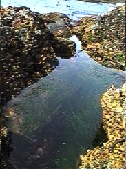
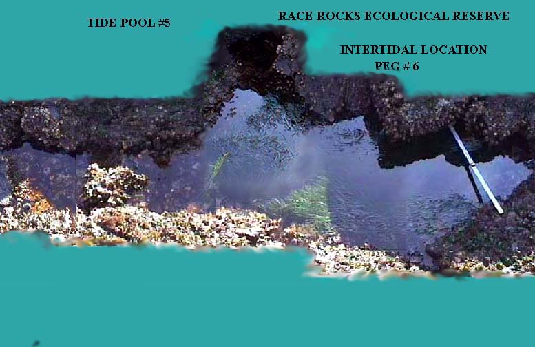
Pool 5 with a compass bearing of 210 degrees from Peg 6 is only cut off from the open ocean at a very low tide so it has a number of invertebrates that need cooler water to survive. Some anemone and purple urchins and several snail species inhabit this pool.
The following is a student lab done on an analysis of this pool:
TIDE POOL LABORATORY
BY: SARA PAVAN, ROCIO GIL, ANA MARIA VEGA, MARIUXI ZAMBRANO
Introduction
THE INTERTIDALZone: It is an area occupied by a great number of individuals and species. It is sufficiently inundated by tides and waves that provide plant nutrients, Oxygen and plankton. It is the zone where tide pools form.The intertidal zone of Race Rocks is very rich of tide pools. They are conventionally numbered for the purpose of identification. The tide pool that was studied for this lab is pool #5.
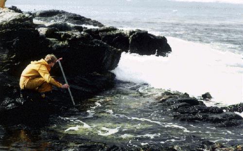
POOL NUMBER 5: It is a very low pool but very high in biodiversity. It is located in an area very open to the swells of the sea.
STRUCTURE OF THE LAB
BIOTIC FACTORS: measurement of horizontal and vertical distribution.
ABIOTIC FACTORS: temperature and salinity.
AIM OF THE LAB: TO STUDY THE HIGH BIODIVERSITY IN THE LOW POOL.
PROCEDURE AND ANALYSIS.
In the middle of the tide pool and at point#1.1 temperature and salinity were measured. The table shows the data collected.
| salinity-parts per thousand | temperature °Celsius | |
| middle-surface | 27.5 parts | 9° |
| middle-8 centimetres | 28.5 | 9° |
middle- 48 centimetres 9° 30
point 1- 8 centimetres 9° 28.5
point 1- 28.5 centimetres 9° 29
The above results were obtained in the morning and comparing with the results given by other groups at 4:00 pm, we can see that the temperature increased one degree.
The data collection process has caused some problems, as big swells came regularly every three minutes from 9:22 to 9:28, a smaller swell came at 9:31 and an even smaller one came at 9:36. At these times we had to clear a pool, this slowed down the process quite a bit.
The following species were found in the following points.
In point 2 Balanus was found at 20 cm. of depth to the surface. It was found also in point 3 at 23 cm. of depth to the surface.Two Anthopleura elegantissima were found at 25 cm. of deph. Two Purple Sea Urchins were found at the point of 1 metre of length, covered by rocks. Two cabezons were present as well as mussels. Fucus distichus algae were covering the left part of the pool.
Some of the species were weighed the same day that were collected.Then they were dried and weighed again, with the aim of obtaining the biomass. The next table shows the results obtained
Species Weight before dry Weight after dry Biomass
Corallina 14.1 g 4.8 g 34 %
Fucus 20.1 g 1.3 g 6.5 %
Green algae 8.7 g 0.6 g 0.6 %
Phylospadix (surf grass) -10.5 g 2.3 g 21.9 %
To get the Biomass results we multiplied the dry weight for 100 and divided by normal weight.
To get more data about pool 5, we measured the amount of plankton of each sample of water. The results were that there was less plankton in the surface than in the bottom due to the constant exchange of oxygen produced by the waves
Measurements of the pool 5.
1.Aea: 34546.95 cm2
2.Length: 1449.65 cm.
To obtain these measurements, refer to this file on using NIH IMAGE
Obviously, the level of oxygen in pool 5 must be really high due to the huge diversity of animals and plants found. As we know, the plants produce oxygen and the animals consume it while producing carbon dioxide, which provokes an interaction increasing and decreasing the level of ph and oxygen depending on whether sunlight is present for photosynthesis or not.
OUR EVALUATION.
From the beginning of the lab, we had some problems to take the samples due to the high tide that made the collecting of samples a lot more difficult. A more accurate study of the pool, could have been done by measuring the levels of ph and oxygen. Team work was effective, the effort came from everyone in the group and we succeeded in computer work by obtaining excellent pictures and measurements of the pool.

