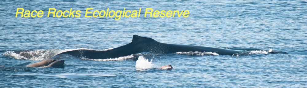
The end of term exam in the first year environmental systems class is always held at Race Rocks. These images were taken as the students worked at the various stations on the island in mid-May of 2000.
Daily Archives: Monday,May 15, 2000
Zooplankton (macro) at Race Rocks
In mid May 2000, this video was taken of some of the varieties of zooplankton found by diving on an ebb tide at the end of the docks on the North side of Race Rocks.
Maps and compliance concerns of MPAs
Posted on May 15, 2000 –
Maps and compliance concerns
Marc Pakenham, a community advisor for Canada’s Department of Fisheries and Oceans (DFO), said the maps used to plan the Race Rocks Pilot MPA, off the nation’s west coast, have held different meanings for different people. “They’re a visualization of what’s being set aside, from one perspective, and what’s being taken away, from another perspective,” he said.
Negotiations on the boundary of the Race Rocks Pilot MPA — a no-take zone for commercial and most sport fishing — were not easy. Ironically, difficulties arose over the government’s attempt to define a relatively linear boundary line so as to ease compliance for fishermen; with a linear boundary, the government reasoned, fishermen would be able to tell more readily whether they were inside or outside the MPA. Fishermen, however, saw the linear boundary as an attempt to expand the MPA beyond the bounds of a 1980 declaration by the British Columbia provincial government that had already established Race Rocks as an “ecological reserve”. The 1980 boundary was much more amoeba-like in shape and based on inexact bathymetric data, roughly approximating a 20-fathom (36.6 meter) contour.
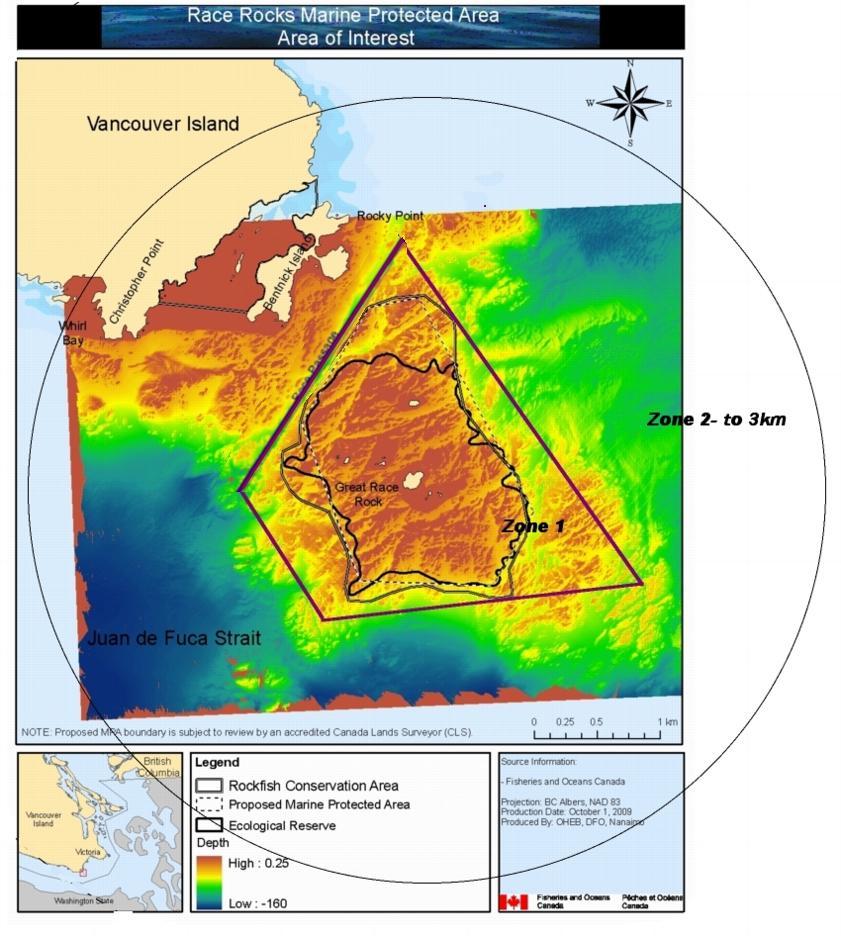
This proposal was not accepted by the fishermen
“The fishermen said they were willing to agree to a no-take zone following the 1980 boundary — because Race Rocks represented an important, biodiverse area — but that they wouldn’t agree to anything bigger,” said Pakenham. The government and other stakeholders agreed to this, despite the compliance challenges posed by a serpentine boundary. “The fact that the MPA is supported by the various stakeholders goes a long way toward ensuring better compliance,” said Pakenham.
Compliance is a major issue for Race Rocks due to its small size. Consisting of exposed rocks surrounded by strong currents and upwellings, the Race Rocks Pilot MPA is smaller than one square mile (2.6 sq. km) in area. If a fishing boat crosses the boundary by 100 meters, it is already well into the no-take zone. Pakenham said he counted on the recent de-scrambling of satellite signals from the US-operated global positioning system (GPS) to aid fishermen in knowing exactly when they are in the protected area. “Mapping is only as good as people’s understanding of where they are,” he said.
See this post on Proposals for: Future Modification of the boundaries of the Race Rocks MPA
Callorhinus ursinus : Northern fur seal- The Race Rocks Taxonomy
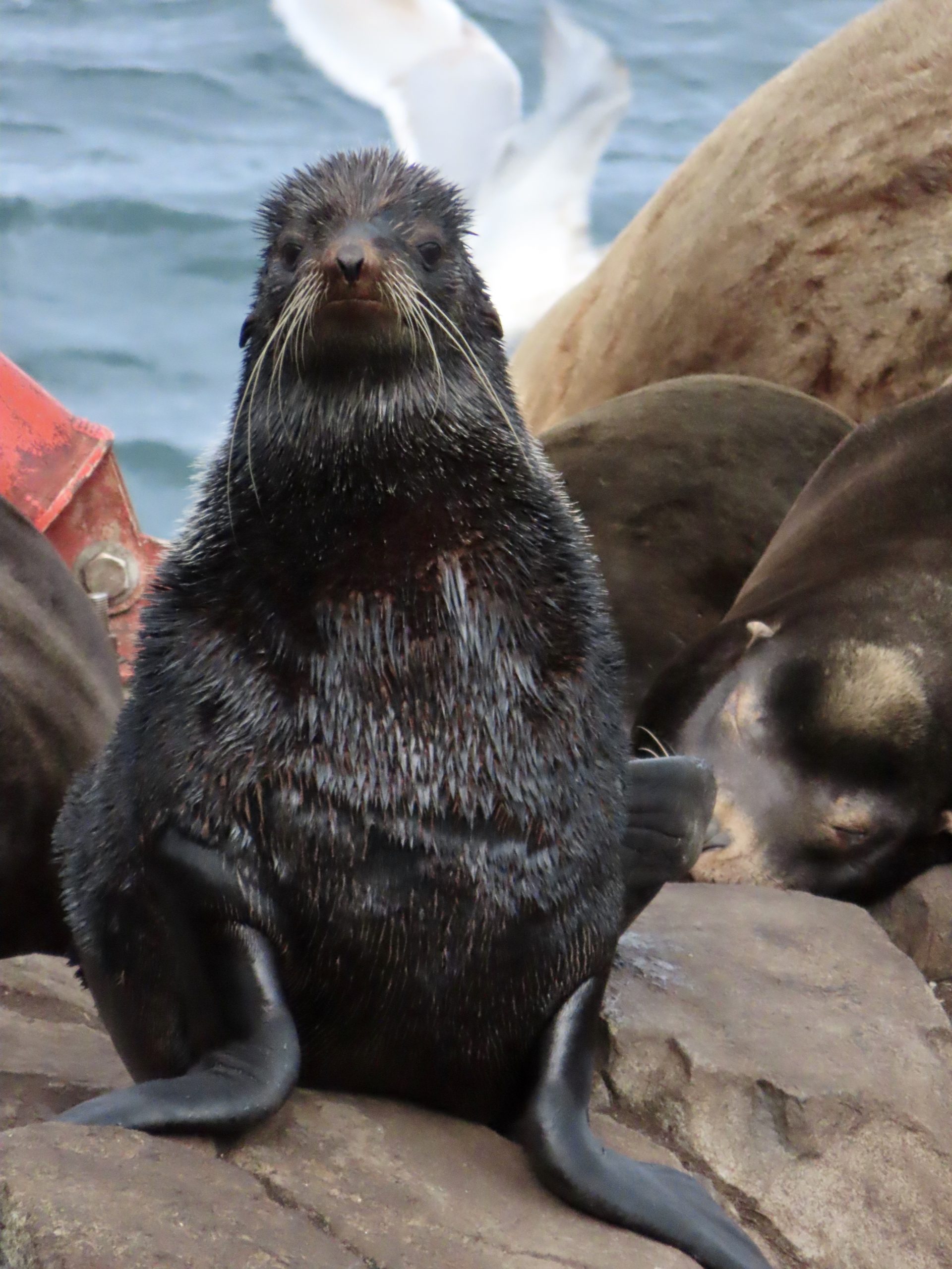
second observation after over 40 years . Observed by Ecoguardian Kendra Luclow in January, 2024
-
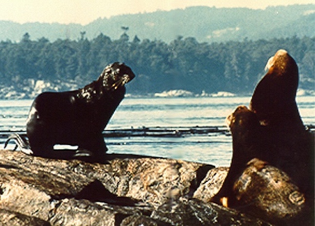
- This picture was taken in 1980 by Trev and Flo Anderson, lightkeepers at Race Rocks. They reported that “Frosty” was a winter resident for the 8 years leading up to their departure from the station in 1982.
-
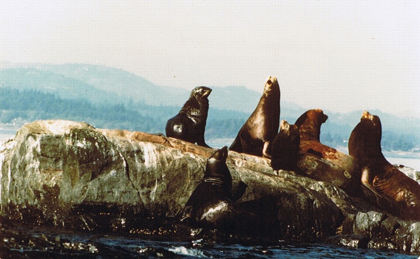
- A photo by the Anderson’s from September, 1978 with “Frosty” an the left. This gives a good size comparison with the Californian Sea lions.
Domain Eukarya
Kingdom Animalia
Phylum Chordata
Subphylum Veretebrata
Class Mammalia
Order Carnivora
Clade Pinnipedia
Family Otaridae
Genus Callorhinus
Species ursinus
Common Name: Northern Fur Seal