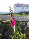
Spotted: Turkish Marsh Gladiolus!

Weather:

  • Visibility: 5 miles
  • Wind: 12 knots
  • Sky: Overcast in the morning, clearer skies in the second half of the day
  • Water: Calm

Boats/Visitors:

Greg came again on Tuesday to bring us more water, we get a few hundred litres per load so our main water tank is over half full again. There has been a steady trickle of tour/whale watching boats, approximately 10-15 per day.

Ecological:

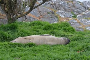
The two moulting elephant seals are still here, and they appear to be in less pain and are doing well.

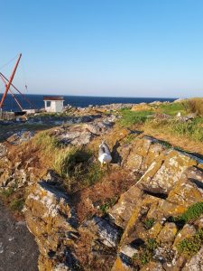
The seagulls continue to get more and more aggressive, we’ve noticed that their eggs go missing. Yesterday, near the main path to the jetty there was a nest containing one egg and a territorial pair of gulls. Today, they are off the nest and the egg is missing.

Near desalination building we found a great example of what appears to be Gladiolus Imbricatus in bloom. According to a previous log post by Garry Fletcher: “Originally from south-eastern Europe/Turkey, it was introduced in the garden of an early lightkeeper and has been growing unattended here for over 50 years.”

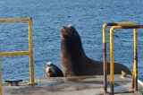
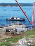
While doing our daily seawater salinity and temperature sample, we were able to get a great picture of two sea lions on the jetty that were basking in the evening sun.

Wind, Fog, and Eggs!

Weather: 

  • Visibility varied today. This evening visibility is excellent, 10-13 miles. This afternoon we were surrounded by fog and could not see even nearby north rock (less than 1 mile).
  • Wind this evening is blowing 30-40 knots. This morning was calmer, 12 knots.
  • Sky clear. This was interrupted mid afternoon by thick fog.
  • Water white capping and breaking into spindrift.

Boats/Visitors: 

  • Today was fairly quiet, with only a few whale watching boats in the morning which seemed to mostly keep a good distance. Greg visited this afternoon to deliver water as we are still waiting for the new desalinator. A former student visited as well.
  • The swiftsure international sailing race passed Race Rocks on Saturday, so we have been seeing the boats trickle back towards Victoria over the past couple of days.
  • Yesterday we spotted a rental boat from Pedder Bay Marina attempt to pass through the channel between our main island and the south islands.
  • Lately whale watching boats have been present viewing the elephant seals and sea lions. Many have appeared to be well within the 100m distance from sea lions required by DFO.

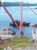
Whale watching boat disturbs sea lions on jetty

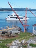
Whale watching boat approaches sea lions on rocks

Ecological: 

  • Two evenings past we noticed the first seagull eggs of the season. We noticed that one nest was missing its egg the next morning. The seagulls have become quite aggressive towards us but only if we get too close to their nest by accident.
  • There are still four elephant seals on the island, two moulting, the juvenile male from this past spring, and an older female.
  • The sea lions have remained on the SE side of the island, although fewer than what we were seeing before surrounding our jetty. They have been enjoying surfing the waves periodically.
  • Another oyster catcher nest spotted on the SW side.
  • We have been finding dead seagulls presumably killed by the bald eagles that have been hanging around. They especially like to sit on top of camera three.

Seagull guarding its egg and nest.

Other: 

  • Except for in the occasional presence of fog, we have been able to operate the island completely with solar on clear days.
  • We were in need of batteries so missed a few days of salinity/temperature data collection.

Oil cleanup near Island impossible much of the year TC May 2019

I was involved as an intervenor  in the NEB reconsideration Hearings in the fall of 2018. We presented the wind data from Race Rocks which confirms much of the information in this newspaper article. Note Race Rocks is also  mentioned below:

From The Times Colonist -Island Voices: May 26 2017 

Oil cleanup near Island impossible much of the year

If an oil spill occurred in the Juan de Fuca Strait, a cleanup would be impossible or severely limited 198 days of the year, according to Christianne Wilhelmson, executive director of the Georgia Strait Alliance

If you are wondering whether our coast is ready for an oil spill, you might like to know that responding to one at the mouth of the Juan de Fuca Strait, near Port Renfrew, would be impossible or severely limited 198 days of the year.
As part of the National Energy Board’s re-review of the Trans Mountain pipeline expansion, Georgia Strait Alliance examined the physical limits of booms, which are foundational pieces of equipment to contain and deflect spilled oil. We compared their limits to wind, wave and currents along the tanker route, and found that responding to a spill on our coast is likely to result in a significant amount of oil being left in our marine environment.

Most of the booms used to respond to spills along the tanker route are meant for protected water areas, such as harbours. They aren’t built to withstand the currents we find along the route, with 87 per cent of them failing at about 1.5 knots (2.8 km/h). Even the most effective high-current booms on our coast fail at four knots. Meanwhile, in some locations, such as Race Rocks on the southern tip of Vancouver Island, currents can exceed seven knots.
Strong wind and waves carry oil over or under booms, sometimes even breaking them. In the heaviest weather, booms can’t be deployed. Wind and waves surpass boom capabilities for days, sometimes weeks, at a time during the fall and winter at the mouth of the Juan de Fuca Strait. If an oil spill were to happen during one of these periods, our coast would likely be awash in oil.
When the tug Nathan E. Stewart sank in Heiltsuk Nation territory in the northern part of the province in 2016, weather conditions suspended spill cleanup for 11 of 40 days of recovery efforts recovered 1,400 litres of oily water and waste, leaving 110,000 litres of fuel and lubricant in the surrounding waters. The spill contaminated shellfish harvesting areas, forcing the Heiltsuk to halt food and commercial harvests, as well as cultural practices.
Unfortunately, this level of failure is common. The International Tanker Owners Pollution Federation estimates that 10 to 15 per cent of spilled oil is recovered, with the weather limits of spill equipment being a major factor. Spills are complex and difficult to manage — and their repercussions last for decades. We’re 30 years on from the Exxon Valdez disaster in Alaska, which saw the loss of thousands of local jobs and the functional extinction of a pod of orcas, and oil is still being found on beaches in Prince William Sound.
An outcome such as this isn’t one that the people who live and work in the Salish Sea area should have to navigate. The federal government can say no to the expansion of the Trans Mountain pipeline and protect our coast from the risk of a future spill.
The government’s rationale for the pipeline expansion is unravelling: The NEB acknowledges there would be devastating impacts to southern resident orcas; Alberta’s carbon tax and oil-production cap are on the chopping block with the election of Premier Jason Kenney; and oil-spill response is nowhere near being “world-class.” The NEB recommends reviewing nearly every aspect of how we respond to spills — from response resources to the methods we use for spill response to including Indigenous and municipal governments in planning.
The federal government continues to claim that this project is in the national interest, while evidence and research suggest otherwise. The economic case for fossil fuels is unravelling, as the benefits of government revenues and jobs decline, while the impacts of their production on climate change and the natural world continues to climb.
It is time for Prime Minister Justin Trudeau to acknowledge that the government’s case for Trans Mountain is crumbling and move on from this project that puts our coast at risk.

Christianne Wilhelmson is the executive director of Georgia Strait Alliance, a regional marine conservation organization and intervener in the National Energy Board process.

Jumping Into the Deep End

Weather 

Visibility: 5-10 miles

Wind: Less than one knot

Sky: Overcast with lots of fog

Water: Calm


Boats/Visitors: 

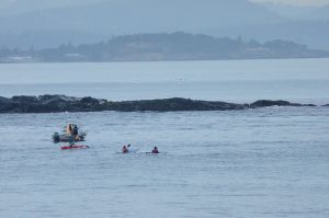
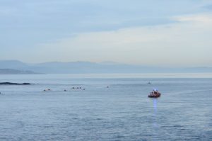
This morning students from the college took a dive into the deep end and swam from our jetty back to Pearson’s dock. Along with the swimmers, early this morning we greeted their coach, a team of Pearson staff supporting them in multiple vessels, as well as a team of kayakers to accompany them and a military college vessel.

We have observed very few whale watching boats over the past few days. It has been very foggy.

Over the past few days we have had groups of students visit with their families and a couple of outside groups as well.

Swimmers, safety boat, and accompanying kayakers.

Quite a few kayakers started their journey to rack rocks at 05:30 this morning, just in time to be greeted by the sea lions waking up.


Ecological: 

The two families of geese are still on Race Rocks, with the older gaggle starting to learn how to swim! The nest outside our door appears to have been abandoned after the seagulls cracked the eggs last week.

The elephant seals are starting to leave, only 4 were counted these past couple of days, two moulting. The larger elephant seal with one cloudy eye is gone.

Fewer sea lions lately, but with a lot of visitors it seems that most of them moved to the SE side of the island, away from the busy jetty. As well, there has been some very loud DND blasting.

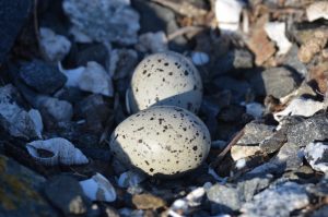
We spotted an oyster catcher nest on the NE side of the main residence. Currently there are two eggs but one appears to be cracked.

Oyster catcher nest nestled in the rocks.


Still haven’t seen any seagull eggs, although they continue to seem less and less afraid of us as they build their nests.

Census Report:

115 seagulls

9 sea lions

7 geese, 12 goslings

2 seals

4 oyster catchers

Nesting Gulls and Geese

Weather

  • Visibility: 10 miles
  • Wind: 15 knots NE
  • Sky: Partly Cloudy, quite a bit of sunshine
  • Water: Rippled, mostly calm.

Boats/Visitors

  • We are expecting a delivery of fresh water from Guy and Greg at the college to pump into our tank today, as the desalinator is still broken.
  • Fewer whale watching boats over the past couple of days.
  • Yesterday morning Laura and her first year marine science classes visited for their final field exam.

Ecological

  • A few eagles perching on the south islands, north rocks, and the webcam
  • There is a pair of geese nesting beside our basement door that have been trying to lay eggs, but it looks like something (maybe the seagulls?) is getting the eggs even before we have a chance to addle them. We have been finding cracked open eggs on our doorstep.
  • The seagulls are starting to establish nests and become more aggressive towards us when we go outside. We haven’t spotted any eggs yet.
  • There are now two elephant seals moulting, but they are looking a bit better since it rained.

    The young elephant seal from this spring is still here too.

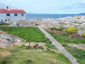
From our kitchen window: One of two families of geese currently living on Race Rocks.

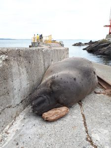
One of the elephant seals found a comfy spot to take a nap as researchers came and went with equipment on the jetty.

New Eco-Guardians, Many Visitors, and Catastrophic Moults

We’re Mara and Kai, the new Eco-Guardians. We’re very excited to be on Race Rocks. It’s been a busy few days (we arrived Monday), but lots has been done so far. Now that we are settling in, we’ll be sure to log post more frequently and with pictures!

Weather:

Visibility: 20 miles

Wind: 30 knots S

Sky: Overcast

Water: Waves up to half a metre, whitecaps

Boats/Visitors:

Over the last few days there has been traffic: visitors including people working on costal radar, the weather station, seismic monitoring, and guests of Pearson College. The costal radar antenna had to be shipped back to its manufacturer to be recalibrate, and is now working as intended.

Some whale watching boats have been getting close, well inside of 100m of the animals. They usually make more distance if they can see us. Lots of traffic today specifically, well over twenty visits by whale watching.

Maintenance:

The desalinator is still broken so we are conserving water, and our drinking water is being brought from Pearson College. Earlier this week they brought a fire hose to pump clean water into the tank when we get low. A new four wheeled cart was brought to facilitate safer diesel fuel transfers between the shed by the jetty and the generator room.

Ecological:

One elephant seal has been on land near the boat ramp for days now. It seems to be undergoing catastrophic moulting, a process in which they shed all of their fur as well as the underlaying skin. They appear to be sick, but we’ve been assured it’s normal.

Yesterday’s Census:

9 elephant seals: youngest one is still here on our lawn, two moulting

About 30 sea lions

2 families of geese with 6 goslings per

5 additional pairs of geese (one laid eggs today that we had to collect and addle)

About 200 seagulls- they are starting to build nests and are becoming more aggressive

About 20 pigeon guillemots

A handful of oyster catchers

A hub of research activity at Race Rocks today.

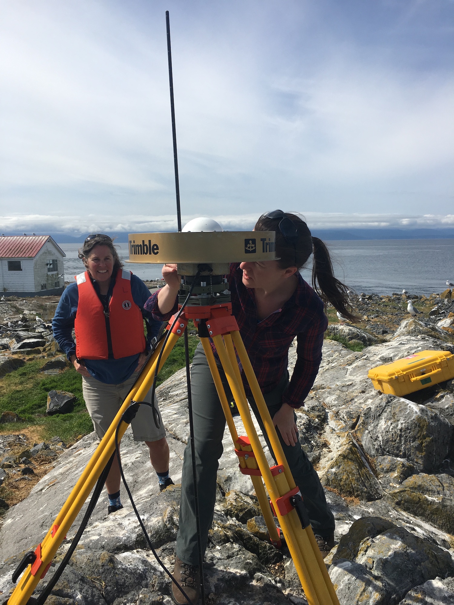
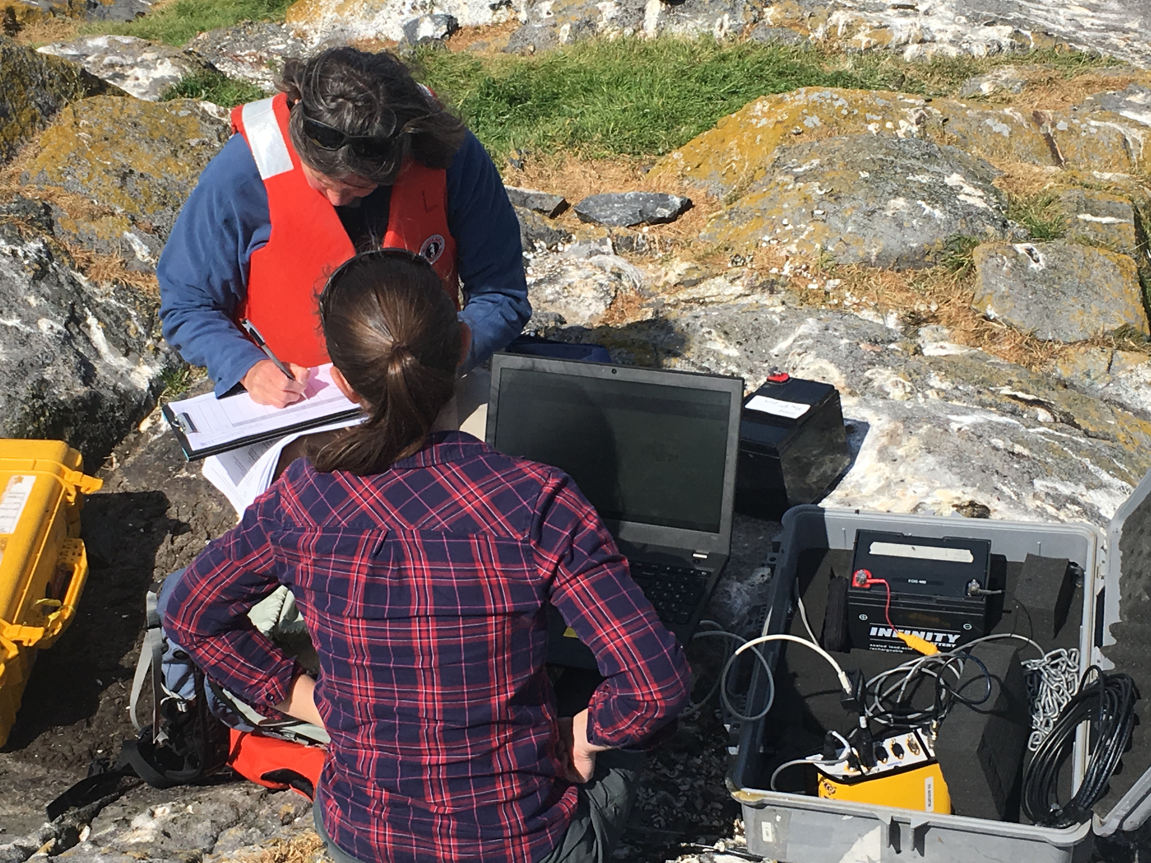
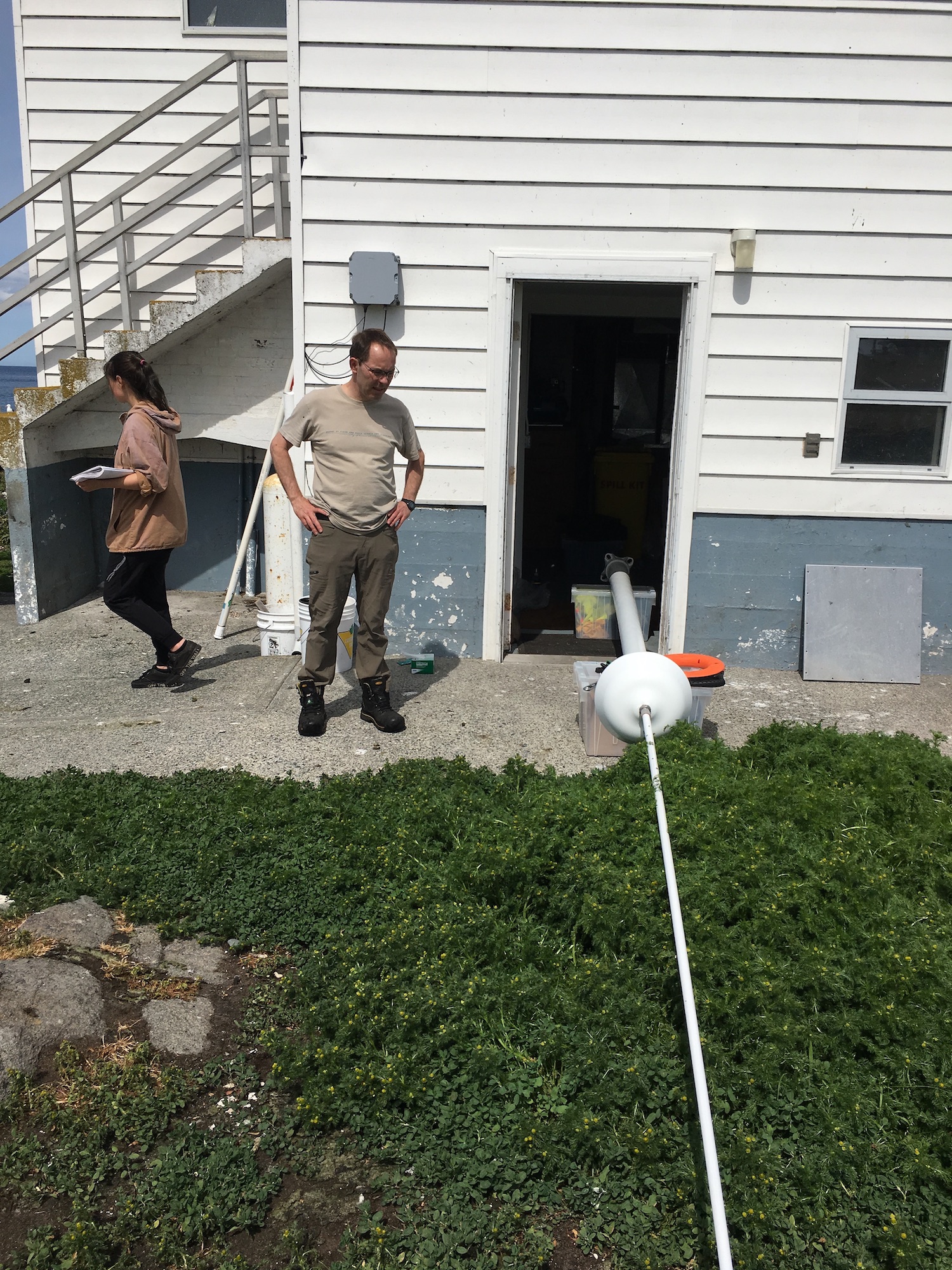
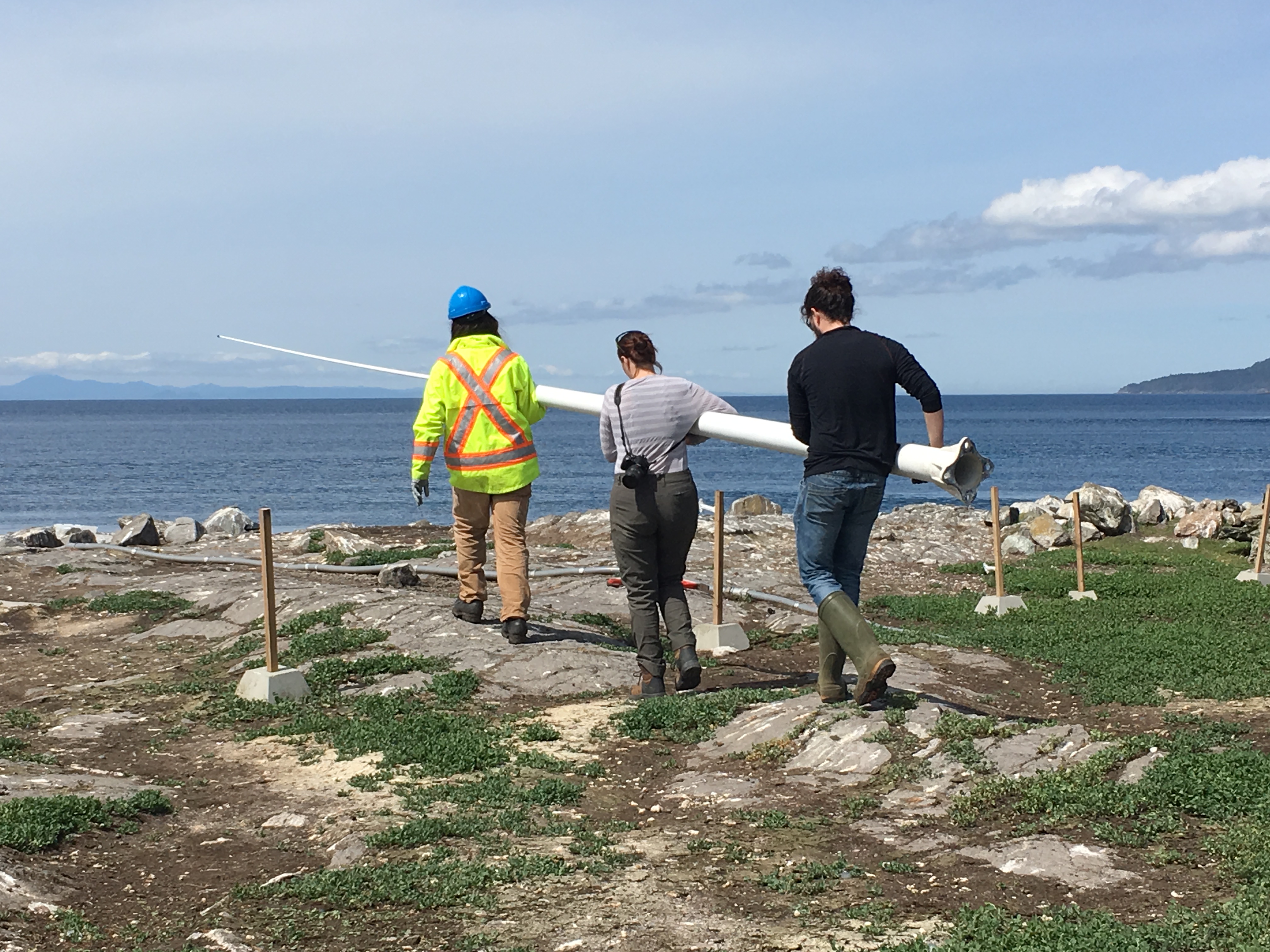
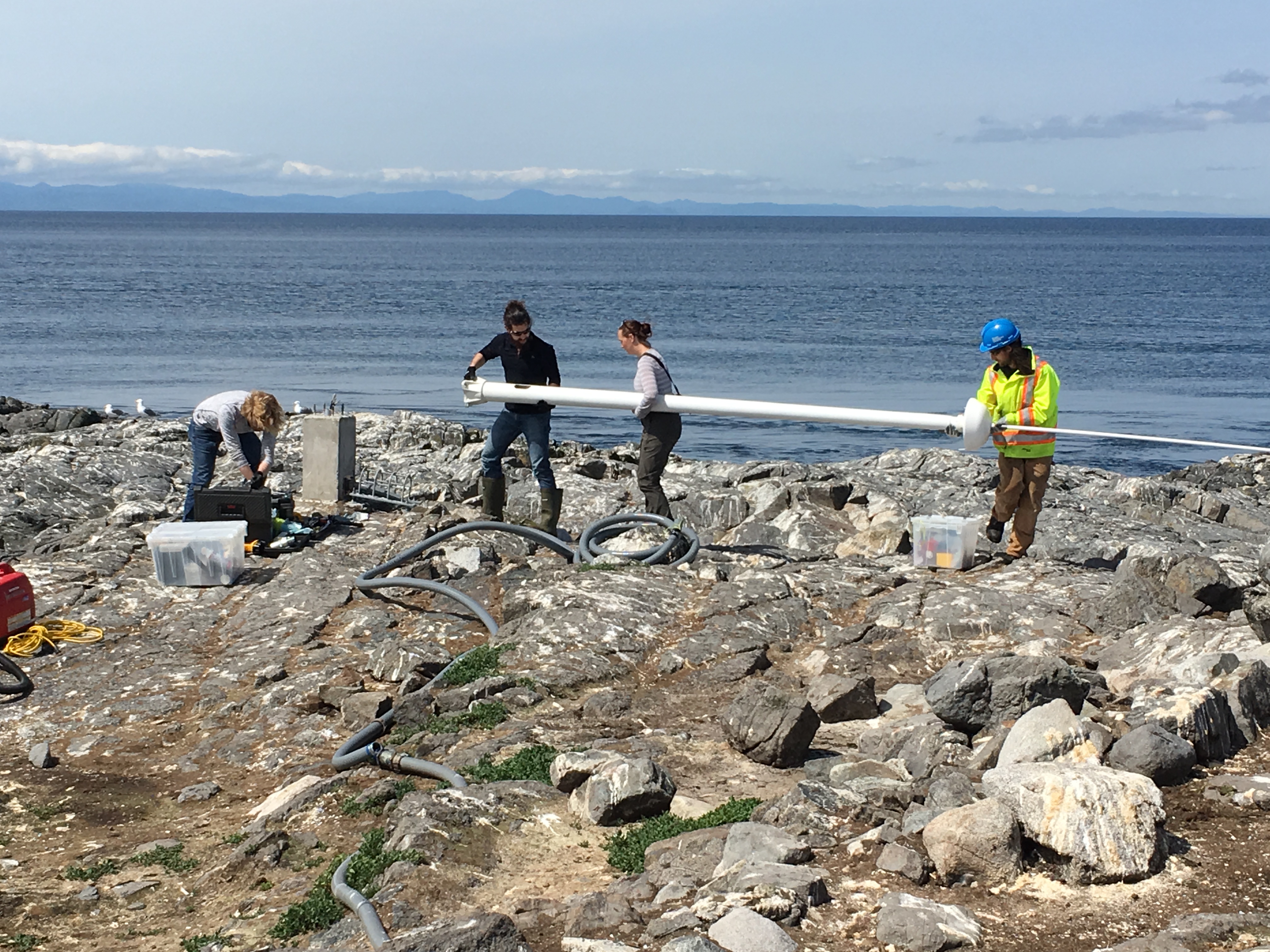
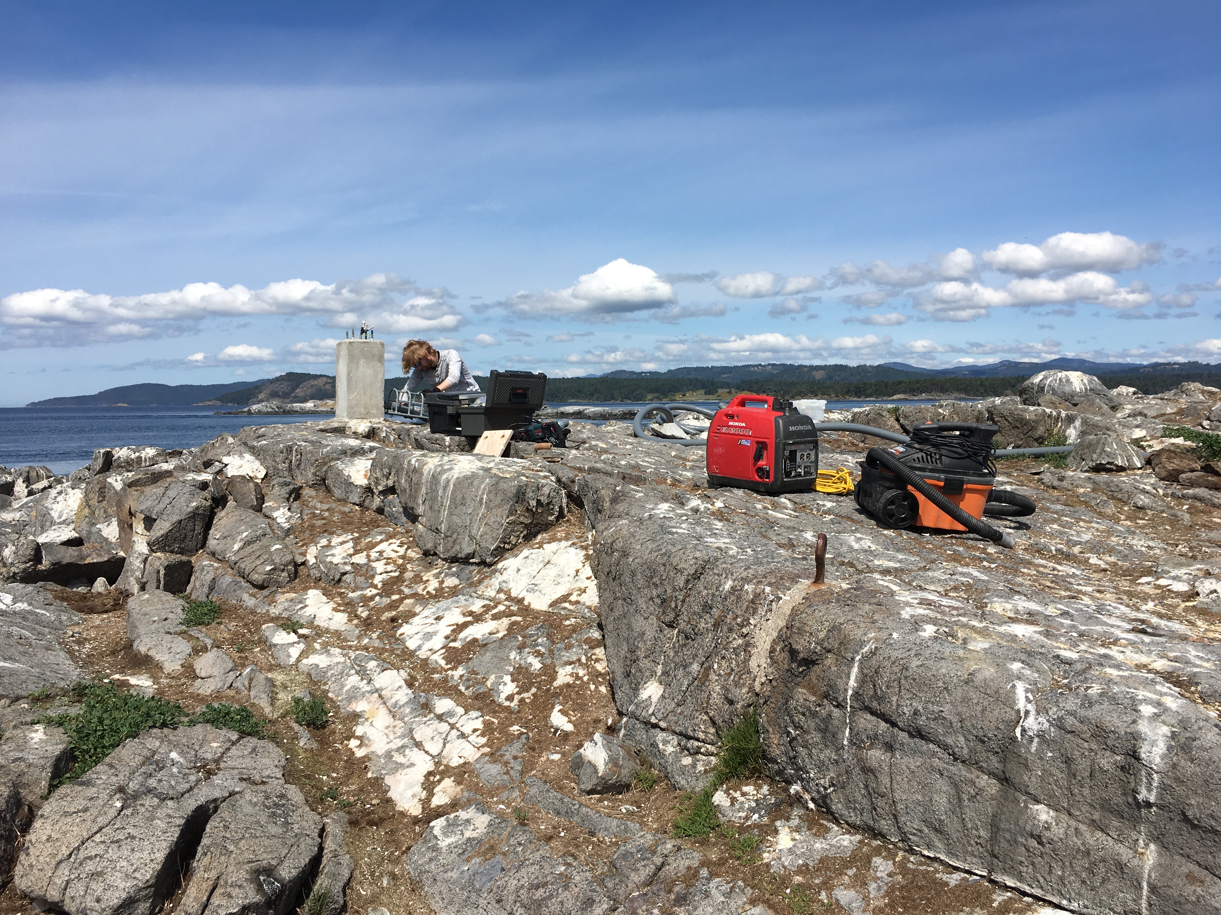
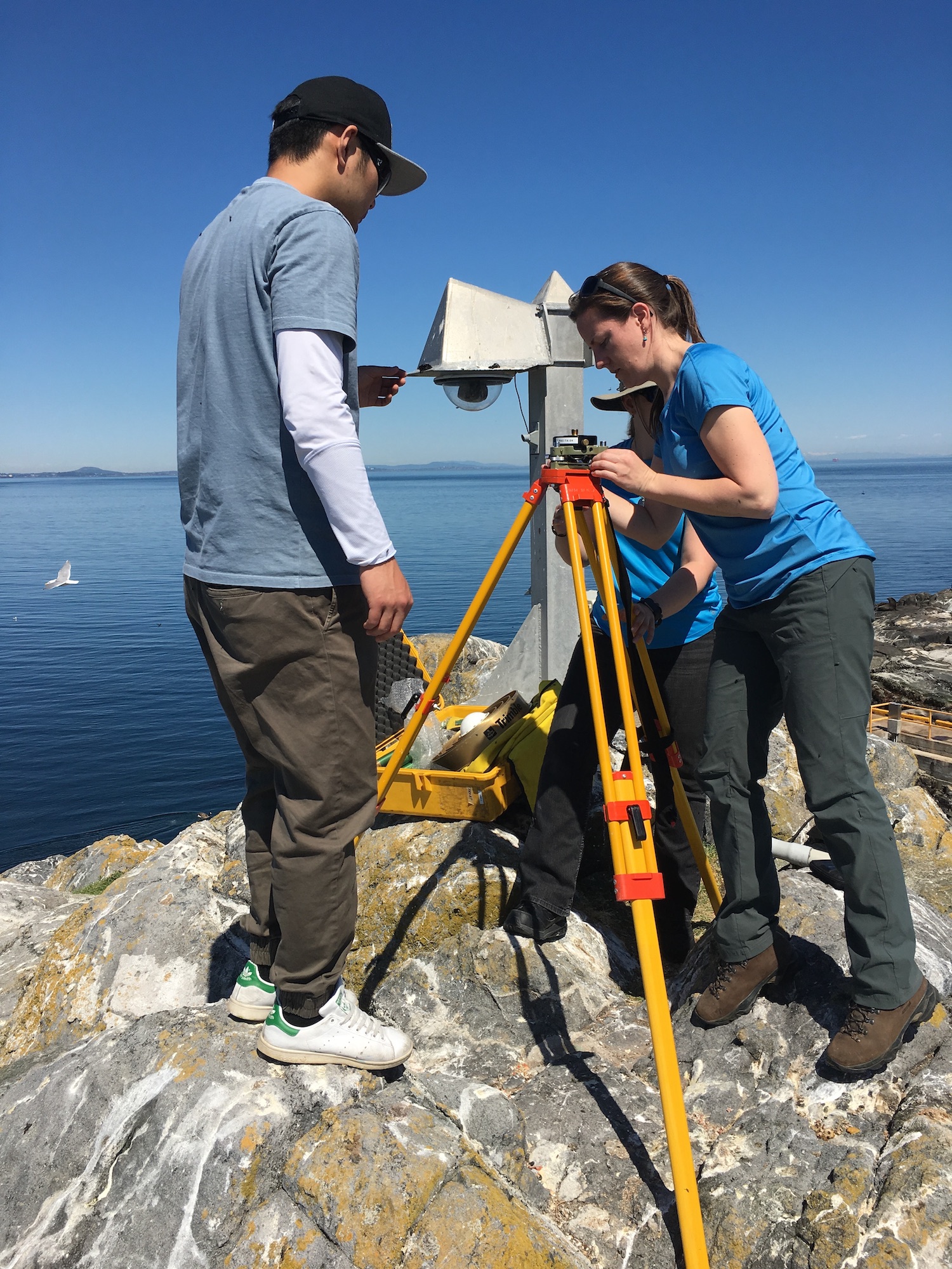
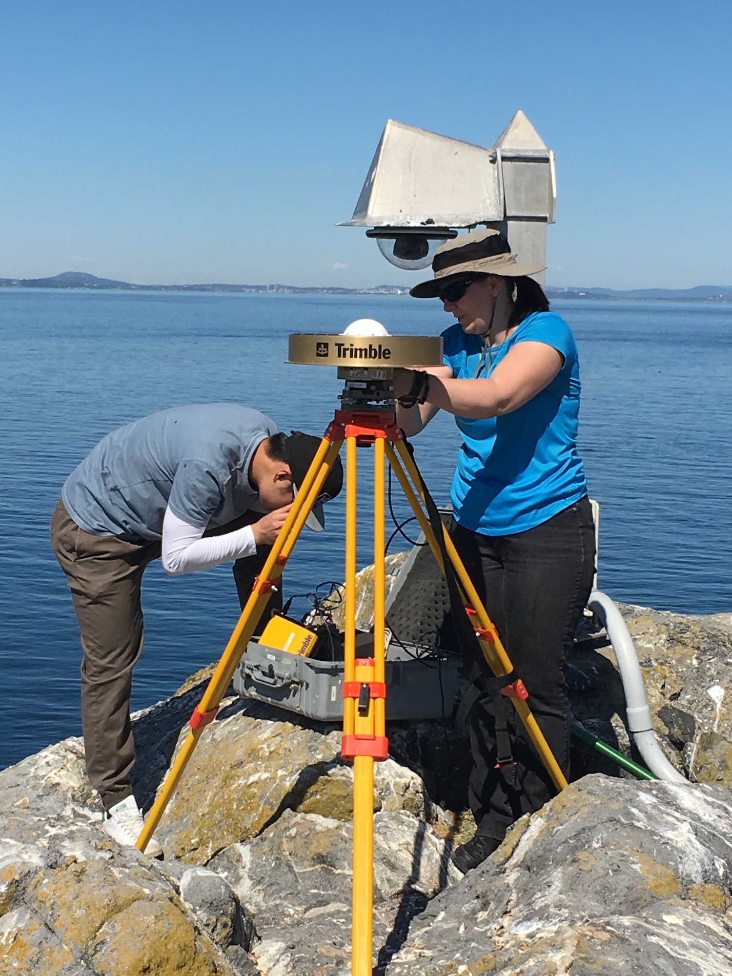
A lot of activity was going on today in the reserve.  Guy drove out myself and Laura Verhegge and several others to attend to equipment  at Race Rocks. Already there was a crew with Kevin of Oceans Network Canada who were reinstalling the CODAR sea surface monitor. This was last commented on in a log on  September 28 Also accompanying us was Ed Weibe, of the UVic School of Earth and Ocean Sciences — EOS 110 Labs Vancouver Island School-Based Weather Station Network http://victoriaweather.ca , who monitors the  Davis weather station for our weather page on this site and the UVic Schools  Weather program.  He was there to change the humidity sensor and check on the equipment.  Lucinda Leonard was along to take down the GPS earthquake monitoring equipment after its successful deployment for the past week.  (See the May 10 log)


The other activity going on was the installation of a CODAR  monitor by the crew with Kevin from Oceans Network Canada.

Barn Swallows

Weather

  • Visibility: 15 Miles
  • Wind: 5-15 SW
  • Sky: Overcast
  • Water: Flat

Boats/Visitors

  • had a little tour from the college come by this morning
  • the day before there were a couple of people from UVIC setting up equipment to monitor earthquake activity

Maintenance

  • The blue water tank at the side of the house is being cleaned out and filled at the college and will be transported here to fill up our freshwater tank until we get a new desalinator put in place

Ecological

  • Maybe 15 stellers and 30 Californias around, the numbers have gone down
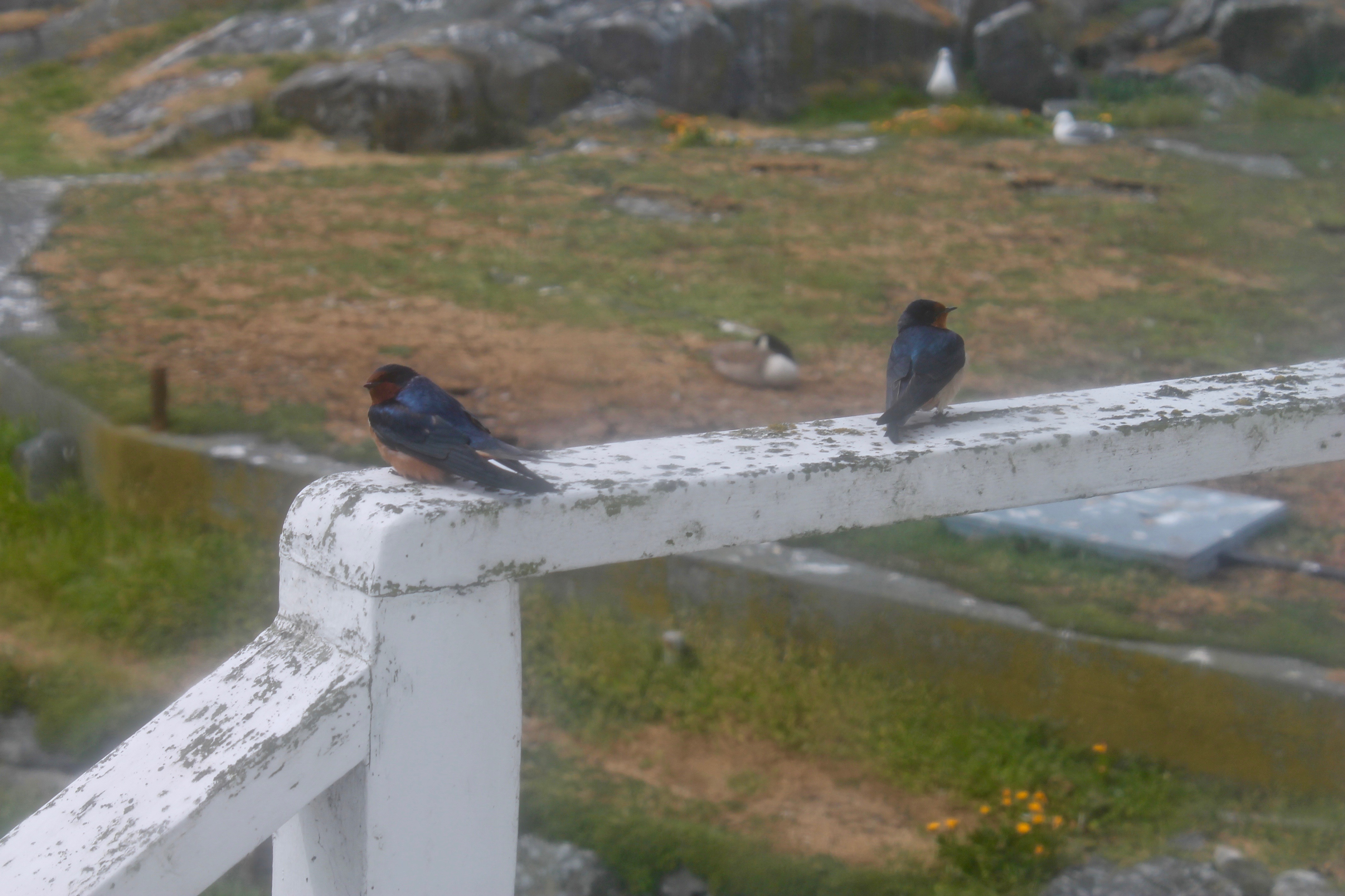
  • two adorable little barn swallows have been hanging around the house
  • 11 elephants, the numbers will be dropping soon as everyone has finished molting and will need to go hunting soon
  • a couple of hundred pigeon guillemots around today
  • about 8 oystercatchers who should be setting up their nests soon
  • still around 16 geese and at least 14 goslings, three nests hatched
  • a few hundred seagulls buildings their nests
  • the cormorants and harbour seals are sticking to the outer rocks
  • two bald eagles out on north rock today

Other

  • was stuck in a fog bank yesterday and it has been very cloudy today so I will run the generator a bit
  • I leave on Tuesday and our new eco-guardians Mara and Kai will be taking over for the summer

Barn Swallows on the deck railing

GPS Survey for Earthquake Hazard Assessment on Southern Vancouver Island

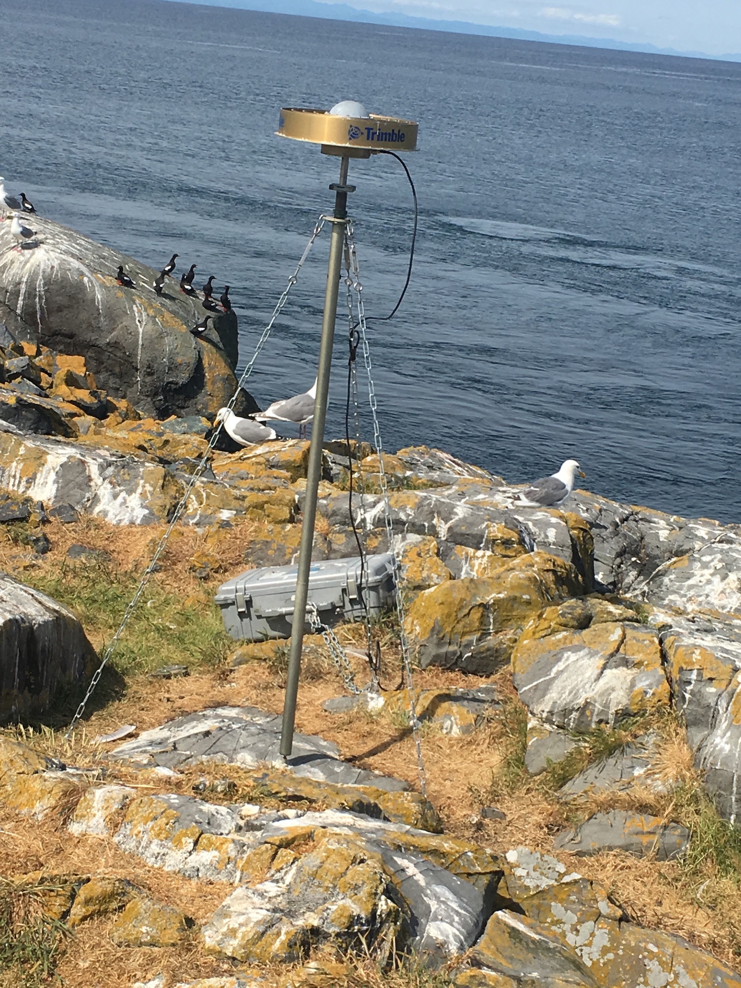
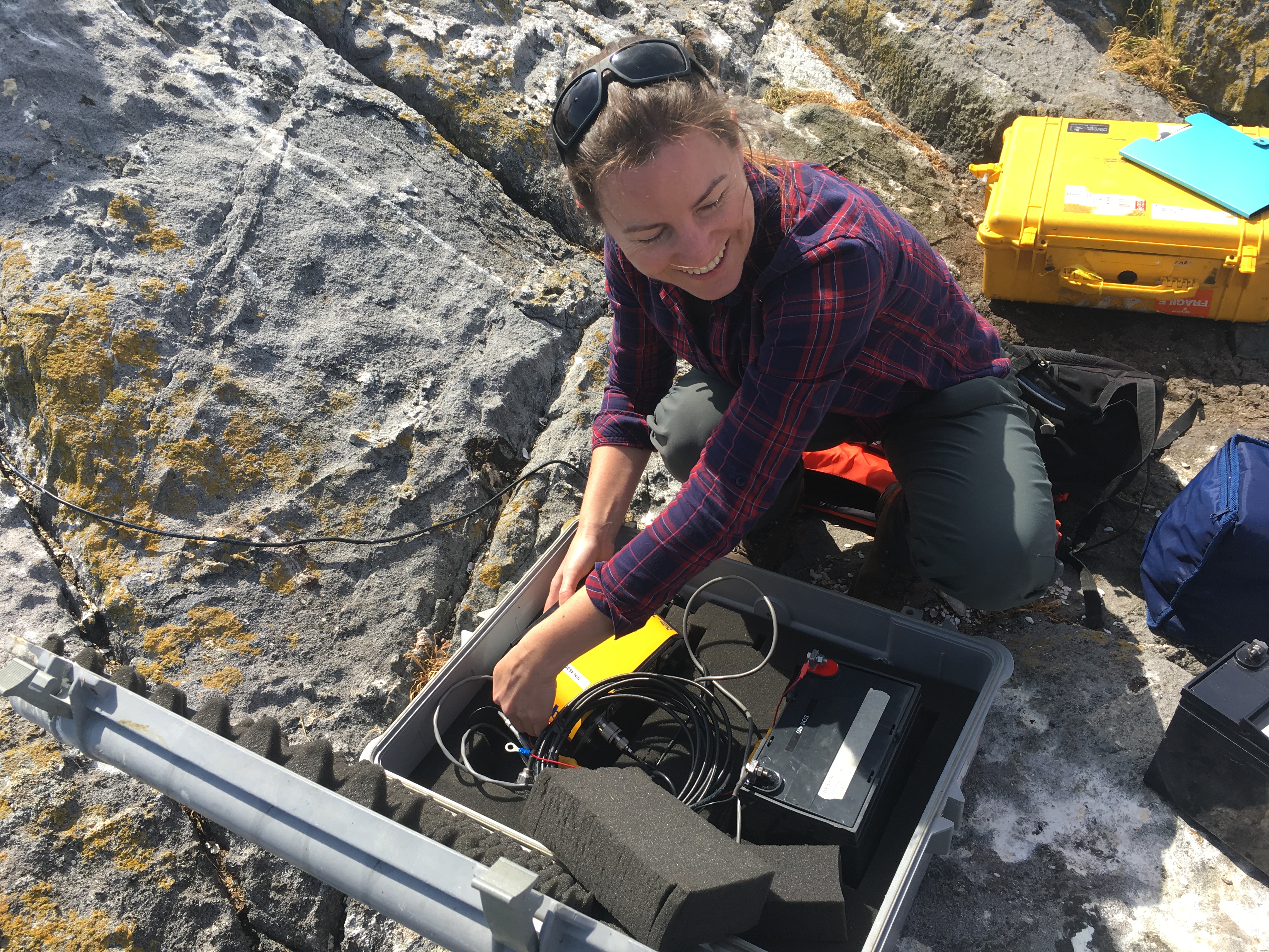
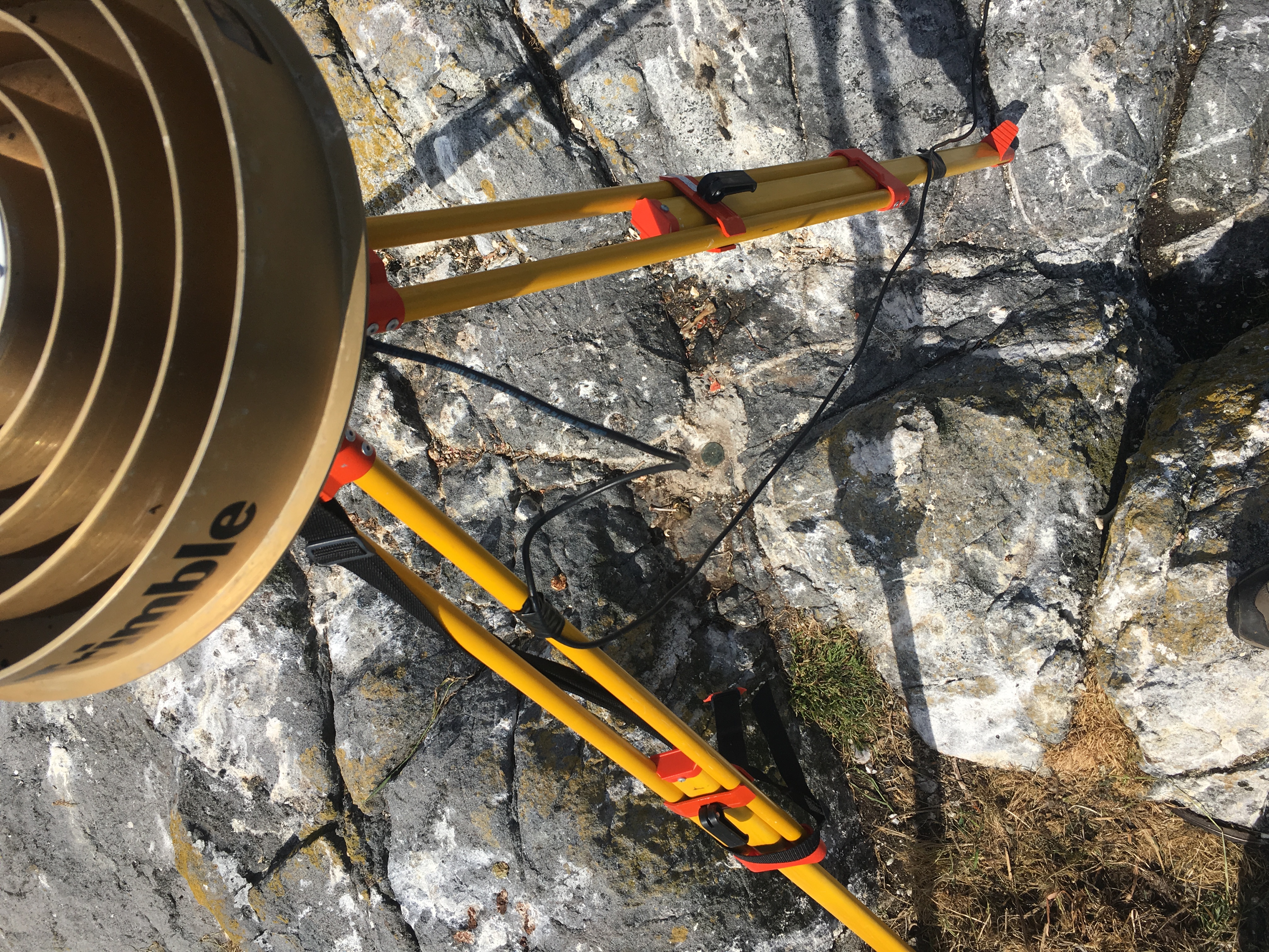
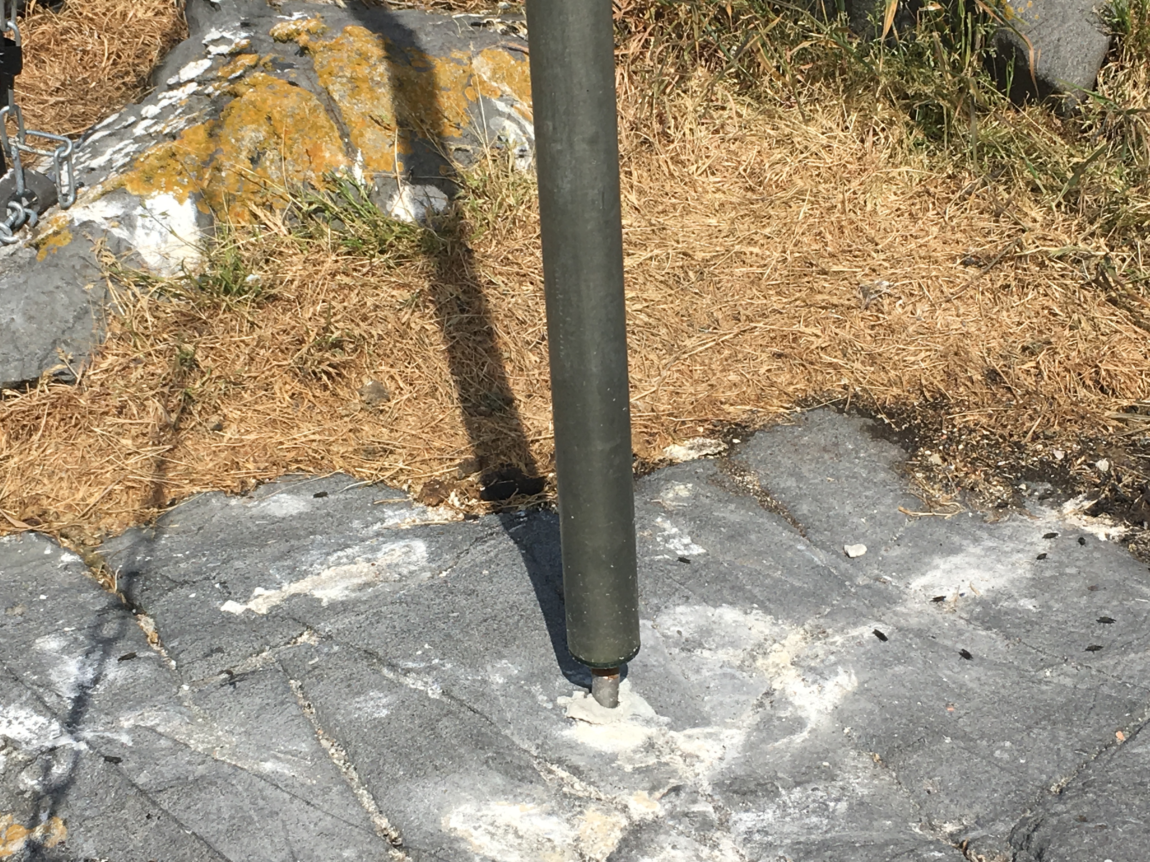
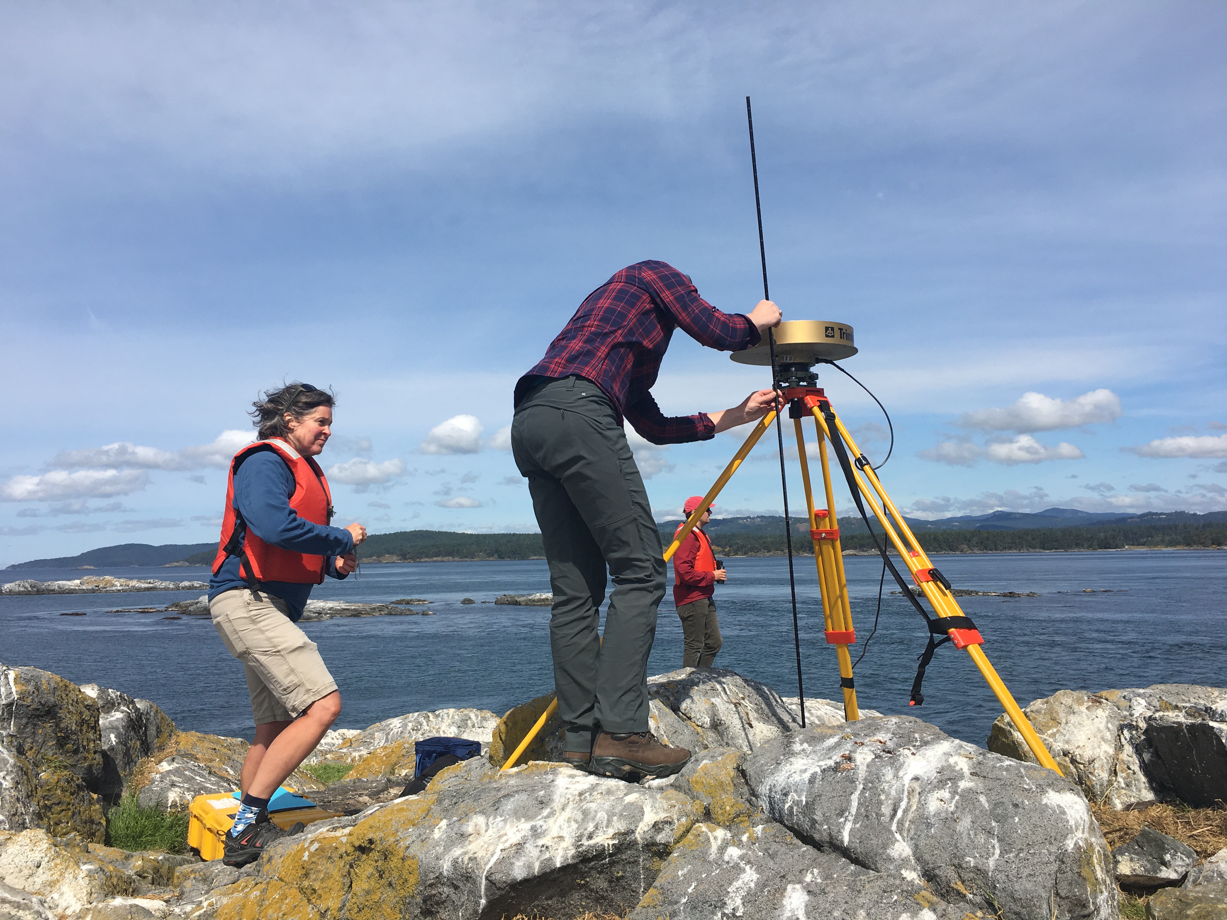
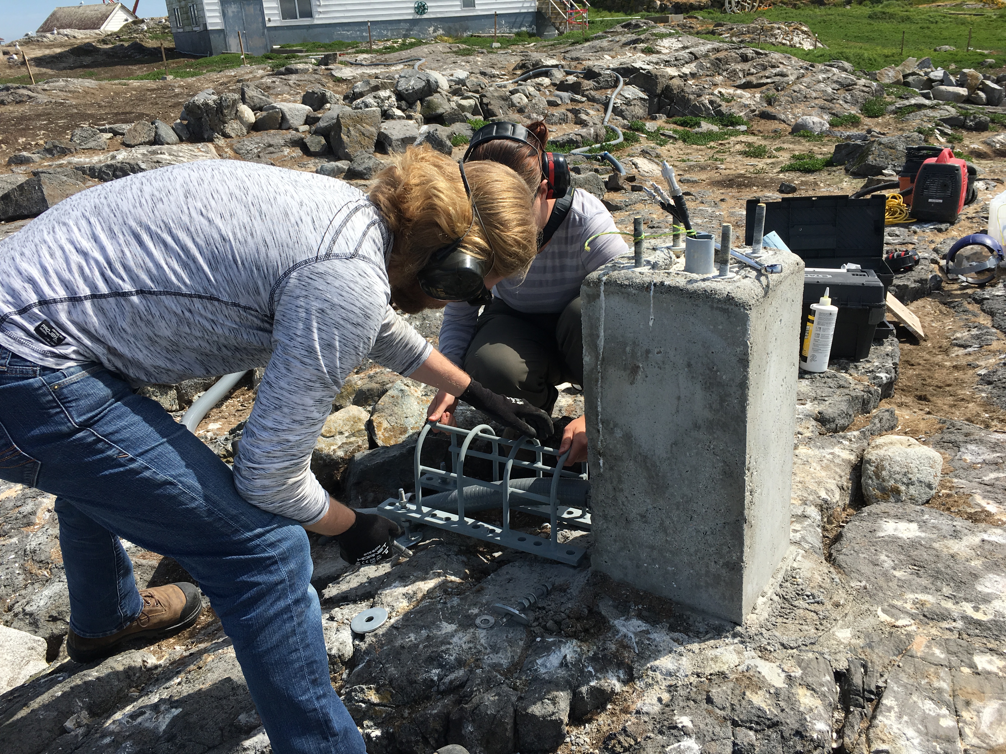
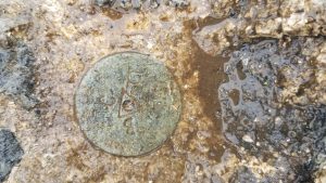
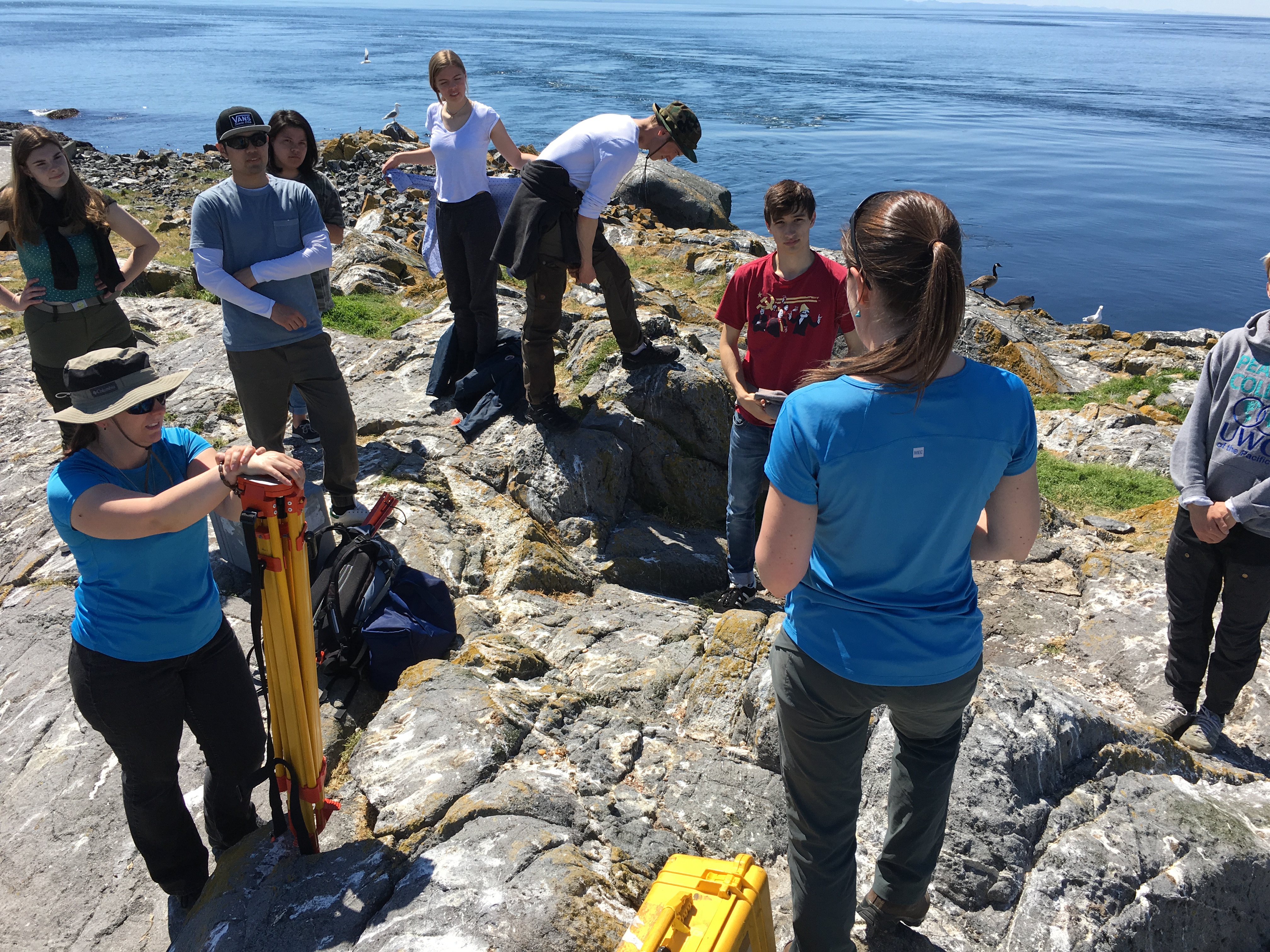
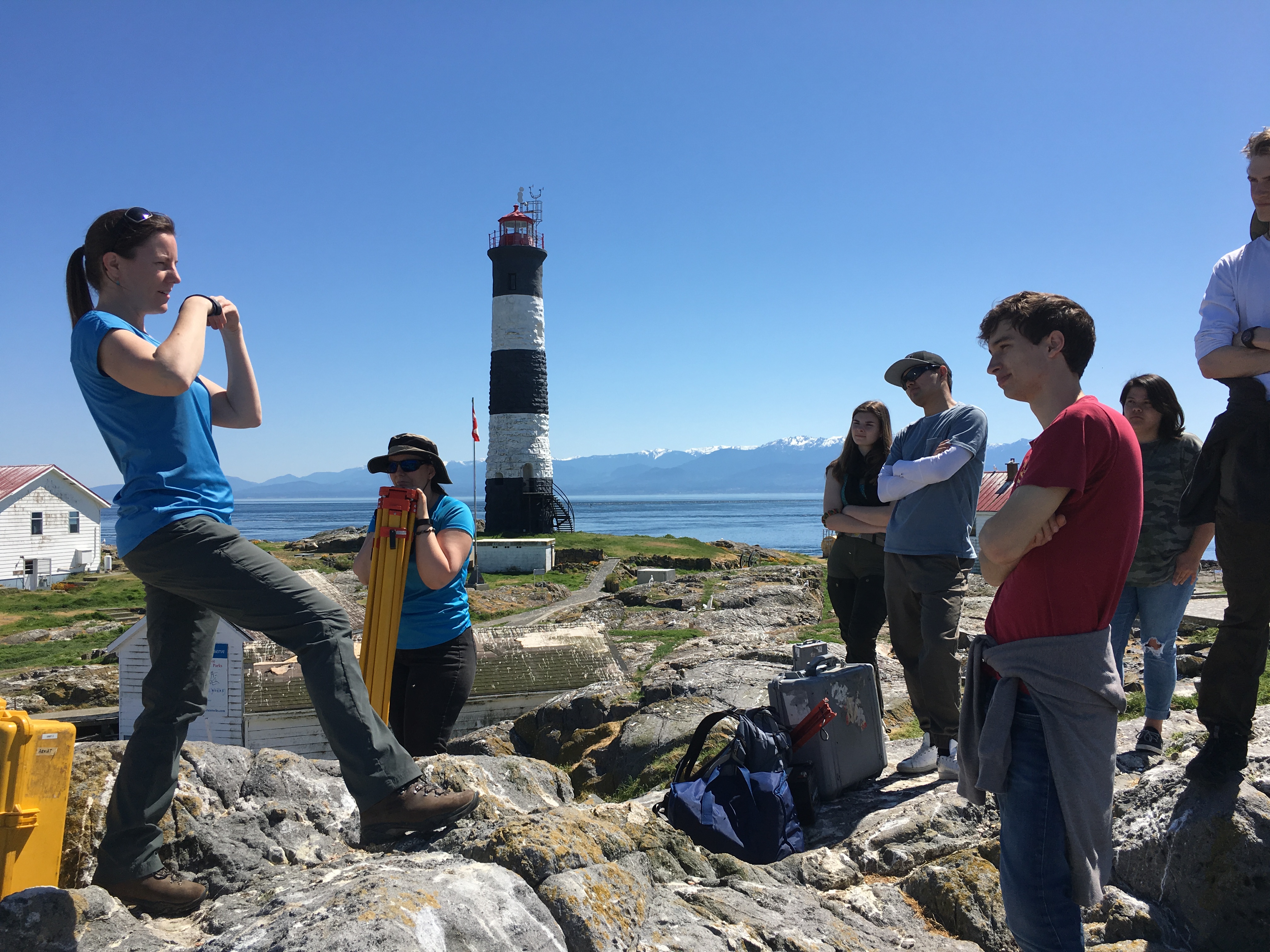
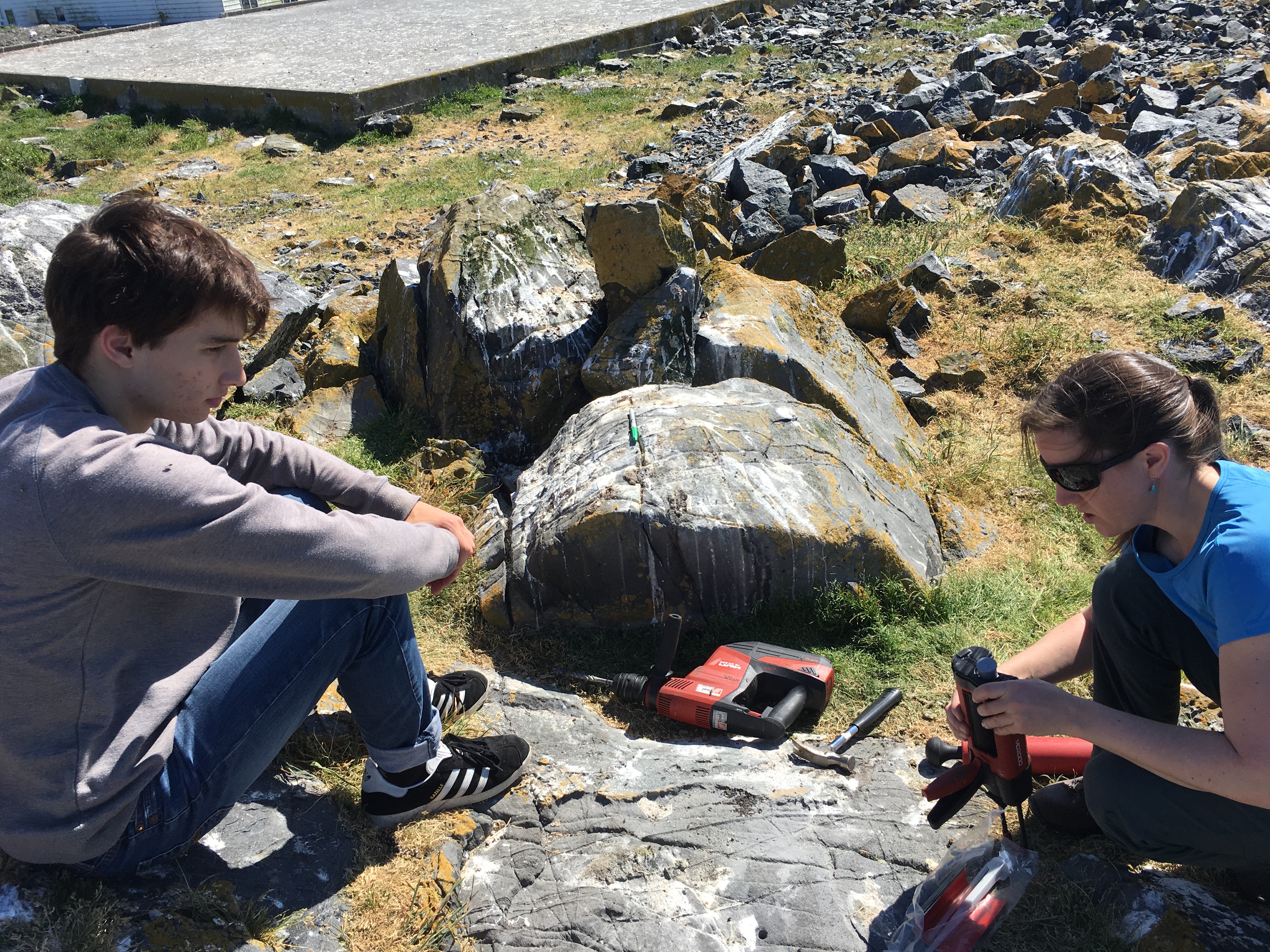
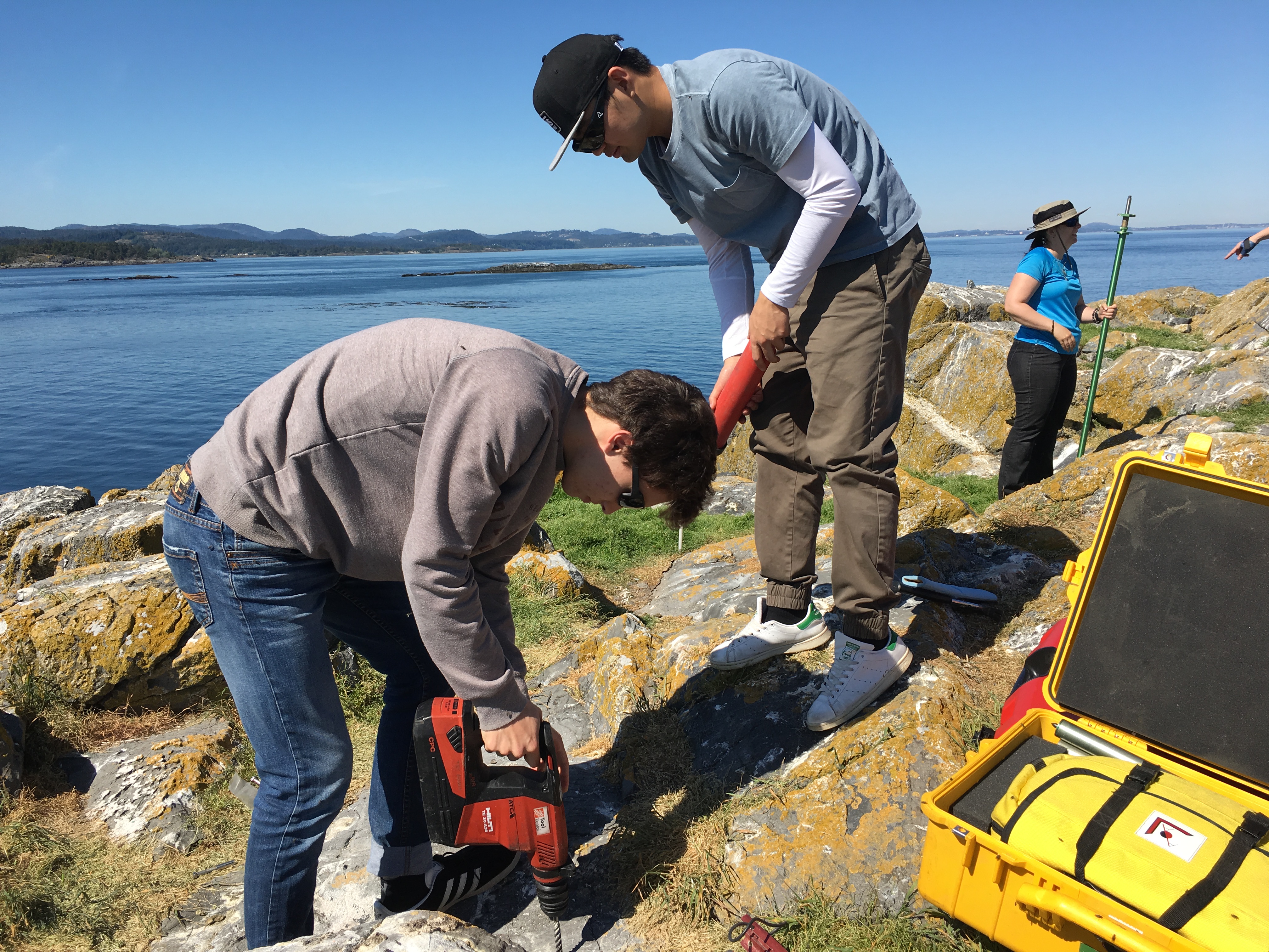
I accompanied Lucinda Leonard and two students from UVIc  Megan Caston and Yijie Zhu – they are both working towards Masters degrees in Geophysics, working on earthquakes and faults to Race Rocks along with 6 students from Pearson College for the installation of two GPS stations. Many years ago , perhaps as early as 1991, this plug had been installed a meter in front of the Camera 5 location , and it had not been rechecked since.  Laas was able to get this picture of it to verify that it was still there .

gps marker

The following is the research proposal by Lucinda Leonard, Assistant Professor (Geophysics) School of Earth and Ocean Sciences, University of Victoria PO Box 1700 STN CSC, Victoria, British Columbia, Canada V8W 2Y2

GPS Survey for Earthquake Hazard Assessment on Southern Vancouver Island

Participants: Lucinda Leonard, Assistant Professor, School of Earth and Ocean Sciences, University of Victoria
Julie Elliott, Assistant Professor, Purdue University
Yan Jiang, Research Scientist, Natural Resources Canada, and Adjunct Professor, University of Victoria 2-3 students will also take part in the fieldwork.

Objectives:

(1) To quantify seismic hazard of crustal faults on southern Vancouver Island. (2) To improve understanding of crustal deformation in subduction zone forearcs.

Scope of fieldwork:

The research project will establish and survey a relatively dense network of high-precision Global Positioning System (GPS) sites across fault zones on southeastern Vancouver Island that may host significant earthquakes. The 2018 survey will involve temporary instrument deployments at a number of pre-existing survey markers as well as new markers emplaced in bedrock. We anticipate future deployments every 1-2 years over the next 5-10 years.

Rationale:

Southeastern Vancouver Island is a region of high seismic hazard due to its location above the Cascadia subduction zone – the region is susceptible to damage from: earthquakes on the Cascadia megathrust fault offshore (magnitude ~9; similar to the devastating 2011 tsunamigenic Japan earthquake), deep earthquakes beneath the Salish Sea and Puget Sound (up to magnitude ~7; e.g., 2001 earthquake in Nisqually, Washington, that caused minor damage in Victoria), and earthquakes on poorly-understood shallow crustal faults (up to magnitude ~7.5; similar to the 2011 damaging earthquake in Christchurch, New Zealand). Crustal earthquakes, although smaller in magnitude than megathrust events, may produce strong shaking in urban areas due to their shallow source and possible close proximity. Modelling of a scenario crustal earthquake beneath the City of Victoria estimates extensive damage to 64% of building stock, 75% of the water pipeline system, and 90% of the sewer pipeline system in the city (VC Structural Dynamics Ltd., 2016).

Crustal faults remain poorly understood in the region, although recent progress includes the identification of surface-rupturing Holocene earthquakes on the Leech River fault (Morell et al., 2017) and its likely offshore equivalent, the Devil’s Mountain fault (Barrie and Greene, 2018). Fault mapping and trenching are important to determine the maximum magnitude of past and future earthquakes on individual fault strands, but these methods cannot provide accurate estimates of slip rates on fault zones, as required for input into seismic hazard assessments. GPS surveying can be used to track the relative motion of survey markers over time; a sufficiently dense GPS network can be further used to identify the location of active faults and to quantify their slip rates (e.g., Marechal et al., 2015). The existing network of continuous GPS stations on southeastern Vancouver Island is inadequate for this purpose, e.g., there are only three stations within 20 km of the active Leech River fault zone. Campaign-style deployments, repeated every 1-2 years over a time-span of 5-10 years, will provide the greater density of survey locations needed to assess strain build-up on fault zones. Several sites were established in 1991 and re-surveyed in 1996 (Henton, 2000; Mazzotti et al. 2003) – we propose to re-occupy these sites, where possible, and to establish a denser network of campaign GPS sites for temporary deployments (2-4 days at each site).

1

Methodology
Site locations:
Site requirements: accurate GPS positioning (to within 1 mm) requires the GPS antenna to have a good view of the sky in order to maximize the satellite signals received. It also requires a marker to be emplaced in a stable substrate, ideally bedrock. Thus bedrock hilltops provide optimum site locations. In this region, many optimal locations are located within parks.

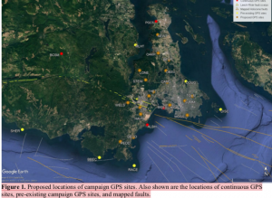
Proposed deployments include 5 pre-existing sites, in addition to ~16 new sites, at an average of ~3 km spacing perpendicular to the Leech River fault zone and adjacent faults offshore (Figure 1; Table 1). The greater number of sites to the north of the fault zone reflects greater accessibility over a larger land area in this region.

Figure 1. Proposed locations of campaign GPS sites. Also shown are the locations of continuous GPS sites, pre-existing campaign GPS sites, and mapped faults.

Table 1. Locations of existing and proposed GPS campaign sites available by contacting the research proponenet

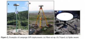
For a continuous period of 2-4 days at each site (maximum of once per year), a 1.7-m high mast with GPS antenna will be set up over an existing or new marker in the bedrock at each site, attached by cable to a receiver in a locked box on the ground. During deployment, the mast will be secured to the anchors using chains (Fig. 2a). At sites not conducive to the mast set-up, a tripod (Fig. 2b) or spike mount (Fig. 2c) will be used instead. New sites will be established by using epoxy to fix stainless steel marker pins into the bedrock. These will penetrate 6 inches into the rock, with a diameter of 0.5 inches, to lie flush with the ground surface. For mast sites, three stainless steel anchor bolts will also be bolted into the rock to a depth of ~2 inches, each attached to a 2-inch diameter stainless steel ring flush to the ground, at a distance of ~0.5 m from the central marker.

Approximate schedule for 2018 fieldwork:

The fieldwork will be carried out in August 2018, with each site being surveyed for 2-4 days. The proposed schedule is shown in Table 2 below, although actual dates may differ.

Table 2. Approximate schedule for fieldwork in August 2018 Approx. Dates Tasks

Aug 1 Aug 2 Aug 3 Aug 4 Aug 5 Aug 6 Aug 7 Aug 10

Aug 11 Aug 12 Aug 13 Aug 14 Aug 15 Aug 16 Aug 17 Aug 18

Team 1: Deploy PBHY, HIGH, SHER
Team 1: Deploy MLHT, TOLM, check others, babysit TOLM
Team 1: Stay at TOLM, check others
Team 1: Babysit TOLM, Demob PBHY, HIGH, TOLM (after 5 pm) Team 1: Demob MLHT, Deploy HAVN
Team 1: Check HAVN
Team 1: Demob HAVN after 5 pm
Team 1: Paperwork; deploy BEAR, STEW
Team 2: Deploy BBEC, DEVO, MILL
Team 1: Deploy OAKH, DOUG, check BEAR, STEW, babysit DOUG Team 2: Deploy PEDD, check BBEC,DEVO, MILL
Team 1: Babysit DOUG, check STEW, OAKH, BEAR
Team 2: Check DEVO, PEDD, BBEC, MILL
Team 1: Demob STEW, BEAR, Babysit DOUG then demob after 5 pm Team 2: Demob BBEC, DEVO, MILL
Team 1: Demob OAKH, Deploy THET, DISC (by boat)
Team 2: Demob PEDD, deploy LONE, CAMO
Team 1: Deploy WELS, MOSS, SUMM
Team 2: Deploy OBSV, check LONE, CAMO
Team 1: Check WELS, THET, MOSS, SUMM
Team 2: Check LONE, CAMO, OBSV
Team 1: Demob DISC (boat), THET
Team 2: Demob LONE, CAMO
Team 1/2: Demobilize WELS, MOSS, SUMM, OBSV

4

Plans for on-site security, site control and general safety?

The deployment of passive GPS equipment poses little risk to the public. Flagging will be placed on the equipment to mitigate any potential tripping hazards. Signs will be posted at all sites, with the following text (correct dates to be inserted): “Surveying for earthquake hazard study in progress from August 3-6 – please do not disturb. For more information, please contact Lucinda Leonard, School of Earth and Ocean Sciences, University of Victoria: 778-676-9621 or lleonard@uvic.ca”. At locations that are popular with the public, sites will be manned during daylight hours. Sites that see less pedestrian traffic will be visited 1-2 times per day during the deployment.

Data processing and analysis:

Geodetic data will be processed using standard routines to determine precise daily average locations for each site. Positional time series will be analyzed to provide site motions (direction and rate of motion) in a North America reference frame. Analysis of relative motion between sites will enable determination of strain across fault zones and improve seismic hazard assessment for southern Vancouver Island.

References:

Barrie, V., and H. G. Greene (2018), The Devils Mountain Fault zone: an active Cascadia upper plate zone of deformation, Pacific Northwest of North America, Sedimentary Geology, v. 364, p. 228-241, doi: 10.1016/j.sedgeo.2017.12.018.

Henton, J.A. (2000), GPS studies of crustal deformation in the northern Cascadia subduction zone. Ph.D. thesis, Univ. Victoria, Victoria B.C., Canada, 169p.

Marechal, A., S. Mazzotti, J.L. Elliott, J.T. Freymueller, and M. Schmidt (2015), Indentor-corner tectonics in the Yakutat-St. Elias collision constrained by GPS, Journal of Geophysical Research, v. 120, p. 3897-3908, doi: 10.1002/2014JB011842.

Mazzotti, S., H. Dragert, J. Henton, M. Schmidt, R. Hyndman, T. James, Y. Lu, and M. Craymer (2003), Current tectonics of northern Cascadia from a decade of GPS measurements. J. Geophys. Res. 108(B12):2554.

Morell, K. D., C. Regalla, L. J. Leonard, C. Amos, and V. Levson (2017), Quaternary rupture of a crustal fault beneath Victoria, British Columbia, Canada, GSA Today, v. 27, no. 3.

VC Structural Dynamics Ltd. (2016), Citywide seismic vulnerability assessment of the City of Victoria, Report prepared for the corporation of the City of Victoria, Victoria, BC, Canada, 43p, available online at: http://www.victoria.ca/assets/Departments/Emergency~Preparedness/Documents/Citywide- Seismic-Vulnerabilities-Assessment.pdf

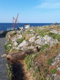
See the follow-up  when the instrument was removed on the May 15 log

Polygonum aviculare: prostrate knotweed – The Race Rocks Taxonomy

knotweed

Polygonum aviculare

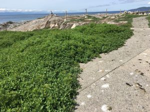
I noticed a particularly thriving population of the invasive prostrate knotweed this spring . It is typically successful in heavily compacted areas and adjacent to the sidewalks. Also it is probably not  favoured by Canada geese, as with most of the successful invasive species on the island. See also: https://racerocks.ca/polygonum-aviculare-prostrate-knotweed-the-race-rocks-taxonomy/
Kingdom: Plantae
Clade: Angiosperms
Clade: Eudicots
Order: Caryophyllales
Family: Polygonaceae
Genus: Polygonum
Species:
P. aviculare
Binomial name
Polygonum aviculare
taxonomyiconReturn to the Race Rocks Taxonomy
and Image File
pearsonlogo2_f2The Race Rocks taxonomy is a collaborative venture originally started with the Biology and Environmental Systems students of Lester Pearson College UWC. It now also has contributions added by Faculty, Staff, Volunteers and Observers on the remote control webcams.