The vessel traffic lanes in the Strait of Juan de Fuca which go past Race Rocks are very close to the Ecological Reserve. I have put together this page as a resource to see just how prevalent the ship traffic is already, without the addition of 1000 more tankers a year.
As Intervenors in the National Energy Board Kinder Morgan Trans Mountain Hearings, the Board of Friends of Ecological Reserves has published their submissions at http://ecoreserves.bc.ca/category/issues/oil-spill-threat/
A post I did on June 6 2004 titled Friday Night Vessel Scramble in the Strait of Juan de Fuca made me start thinking about the incredible
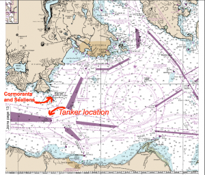
A map showing the location of the tanker lanes, within 3-5 nautical miles of Race Rocks. (NOAA) The dark purple bands are where the traffic is supposed to be. outbound on the Canadian side, Inbound on the American side.
risk to our Ecological Reserve posed by the current level of tanker traffic past Race Rocks (many already carrying Dilbit), as well as the projected increase in vessel and tanker traffic over the next few years . I have included a number of references in the Oil Spill Risks Category which point to this projected increase.
You can also see the ships out there right now and historical aspects of ship traffic past Race Rocks currently using the links on this page.
On this page we will portray some of the images of vessels with aspects of Race Rocks included in order to emphasize the real threat for the reserve and its unique Biodiversity in the event of a catastrophic accident posed by this increase.
Ed. Note on tankers in the Strait: According to the WCMR Corp, they are mandated to be there for cleanup within 72 hours of a spill after clearing it with the Incident Control Centre That is, if the spill is up to 10,000 tonnes. Race Rocks is in the “Enhanced Response Area”
A tanker passes by south of Race Rocks. Nov. 7, 2014. Photo by Nick Townley
</td
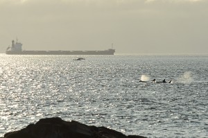 Orcas beyond south island with halibut sports fishing boats and the Captain George, a 229mx 32m bulk carrier heading to Itaquai Brazil, in the background. Feb 15, 2015-Alex Fletcher photo. |
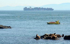 A whale watching boat gets up close to a group of sea lions on the South Islands. In the background a large container ship, the 334mx43m CMA CGM Cendrillon, passes within 4km of Race Rocks on its way to Seattle. Feb 4, photo by Nick Townley |
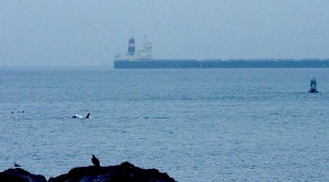 Killer whale and Eagle with bulk carrier in the background. January 13, 2015-Alex Fletcher photo. |
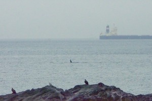 Killer whale and 2 eagles with bulk carrier in the background. January 13, 2015-Alex Fletcher photo. |
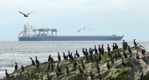 A large bulk carrier near the Ecological Reserve– Dec 12, 2014 –photo by Alex Fletcher |
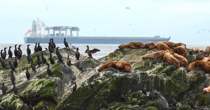 The same vessel near the Ecological Reserve –Dec 12, 2014–photo by Alex Fletcher |
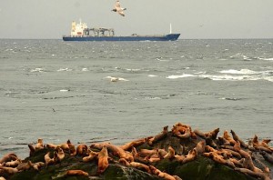 Bulk Carrier and sealions of Race Rocks Ecological Reserve:. Photo by Nick Townley |
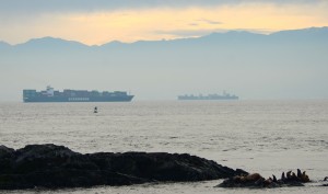 Two cargo ships pass near each other several kilometres southeast of Race Rocks. The Singaporean ship Evergreen Unific, 285m long, is using the outbound lane on its way to Tokyo. The Panamanian ship MSC Nerissa, 294 m, is using the inbound lane towards Vancouver. November 19, 2014. Photo by Nick Townley |
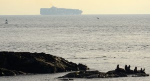 The 335m long cargo ship CMA CGM Bianca, registered in Malta, passes a few kilometres southeast of Race Rocks on its way to Seattle. Nov. 18, 2014. Photo by Nick Townley |
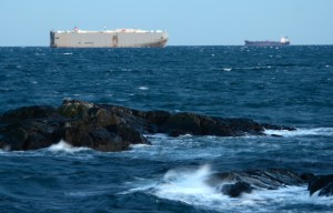 The car carrier Seven Seas Highway in the outbound lane and another cargo ship inbound in the Strait of Juan de Fuca pass within a few kilometres southeast of Race Rocks Ecological Reserve. Nov. 12, 2014. Photo by Nick Townley |
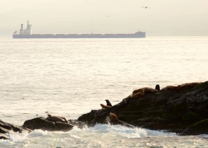 The bulk carrier “Angel Nobility”, (deadweight 206,000t , 300m x 50m, registered in Greece in 2013, passes by the south side of Race Rocks. Nov. 7, 2014. Photo by Nick Townley |
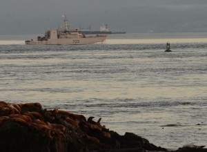 HMCS Edmonton, a coastal defence vessel from the Canadian Navy, passes just south of the bouy marking Rosedale Rock. Nov. 7, 2014. Photo by Nick Townley |
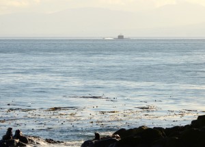 A submarine motors by the south of Race Rocks. Nov. 7, 2014. Photo by Nick Townley |
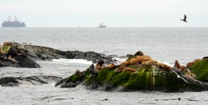 A self loading self dumping log barge is towed towards the west past the reserve. Where is this floating forest from? Where is it going? Nov 5,2014, photo by Nick Townley. |
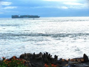 A container ship transits within a few kms of the island. Rosedale Reef marker can be seen less than 2km from the ship on the outbound vessel traffic lane. ( Oct 29, 2014) photo: G.Fletcher |
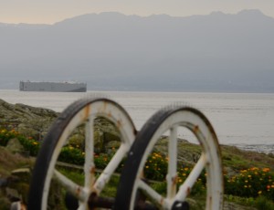 Roro Oct 12 , 2014 photo: A Stewart |
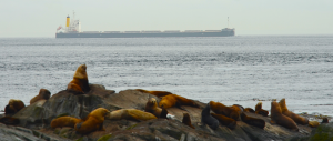 Frontier leader Bulk Carrier–81,383t DWT. 225m x 32m. built 2013, Japanese owned, registered in the Marshall Islands. Bulk tankers such as this can carry up to 120,000 metric tons of crude oil. Photo by Anne Stewart, Sept 24 2014. |
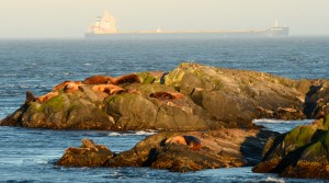 Seals and Sea Lions in the foreground, this ship, the Sea Proteus is a 229 metre bulk carrier registered in the Marshall Islands. Sept 7, 2014 photo by A.Stewart |
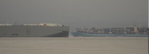 Roro and Maersk-Oct 12,2014- photo by A.Stewart |
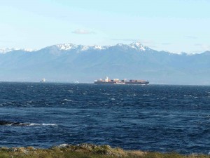 June 6, 2014 photo by C. Edwards-The Singapore Express, a container ship 66793t deadweight, 294mx32m registered in Hong Kong, built in 2000, and the Atlantic Bridge- bulk carrier (tanker), Japanese owned but registered in Panama, built in 2005, 177,106 tons DWT and measuring 280m x 45m in tandem in the Strait of Juan de Fuca– just south of Race Rocks |
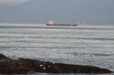 an Oil/Chemical tanker, the BW Jaguar on its way to Mexico. March 26, 2021. It sails under the flag of Singapore with a carrying capacity of 49999 t DWT and with a draught of 12 metres, length 183 m. width 32 m. A tug followed but left the tanker before reaching Race Rocks.. photo by ecoguardian Rod King. |
— |
Ryan Murphy, when he was Ecoguardian recorded with his photographs, many of the ships passing Race Rocks.
See calculations of Wind Speed in the Strait of Juan de Fuca which prevent the deployment of oil-spill clean up equipment ;
https://racerocks.ca/race-rocks-lightstation-weather-conditions-environment-canada-problems-for-oil-spill-cleanup/


