ACOUSTICAL BATHYMETRY OF RACE ROCKS
|
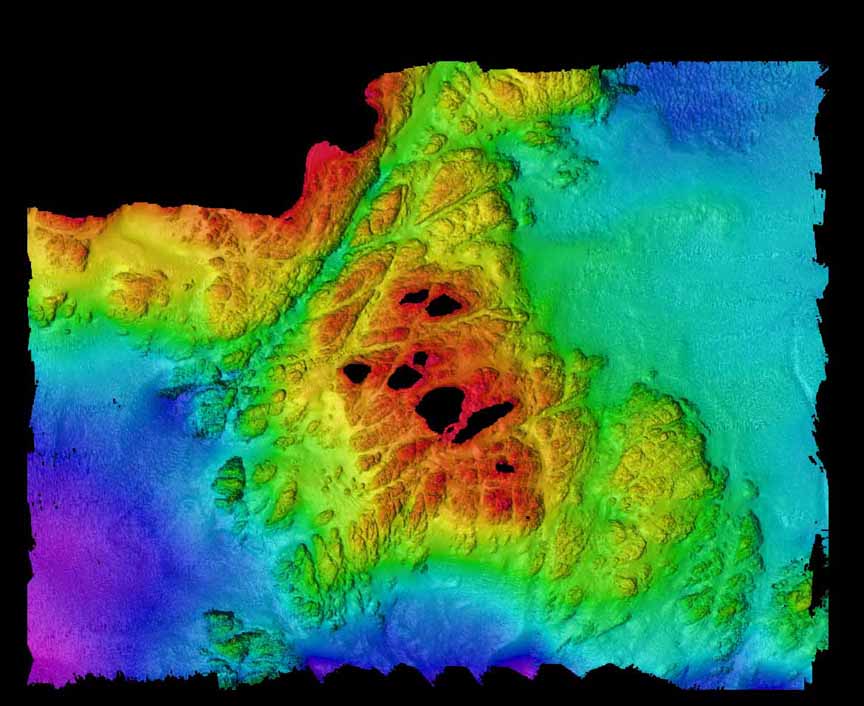
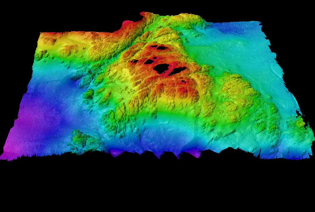
 In February 1999 the hydrographic survey boat from The Institute of Ocean Sciences in Sidney, B.C. has done an acoustical bathymetry program which has mapped the seafloor around Race Rocks to a depth of 100 meters. The project is under the direction of James Galloway. This project will eventually involve two other components as well, grab samples at 40 locations underwater and underwater towed video to a depth of 20 meters. More detail will follow on this page as the project progresses, but the initial two images of bathymetry from different perspectives are presented here. In February 1999 the hydrographic survey boat from The Institute of Ocean Sciences in Sidney, B.C. has done an acoustical bathymetry program which has mapped the seafloor around Race Rocks to a depth of 100 meters. The project is under the direction of James Galloway. This project will eventually involve two other components as well, grab samples at 40 locations underwater and underwater towed video to a depth of 20 meters. More detail will follow on this page as the project progresses, but the initial two images of bathymetry from different perspectives are presented here.
Our thanks to the following who have made this project possible and have shared their results immediately with us.Doug Cartwright Hydrographer
Canadian Hydrographic Service
Pacific RegionAlso thanks to Lt.Mike Brissette at DND for final stages of work on these images.and to James L Galloway , PEng
Canadian Hydrographic Service, Head, Sonar Systems Institute of Ocean Sciences
9860 West Saanich Road
Sidney BC |
 Note: In this view, the black area is either where land is located, or it represents the margins of the survey . Note: In this view, the black area is either where land is located, or it represents the margins of the survey .
(2d capture of entire area from south – 1 x magnification ). Bentick Island appears at the top of the picture. Great Race Rocks, where the light station is located is the large island in the center of the picture. Shoreline margins are not yet accurate. The present boundaries of the Ecological reserve are more or less the outer limits of the red area at 36 meters.
.  The second image is a view from the South looking Northward. Colors toward the blue scale are representing depths of almost 100 meters. The second image is a view from the South looking Northward. Colors toward the blue scale are representing depths of almost 100 meters.
( 3d capture of entire area from south : 1x magnification -3 x vertical exaggeration)
We hope to add further interpretation to the pictures , but at this stage they represent a significant step as the first layer of information on the seabed.
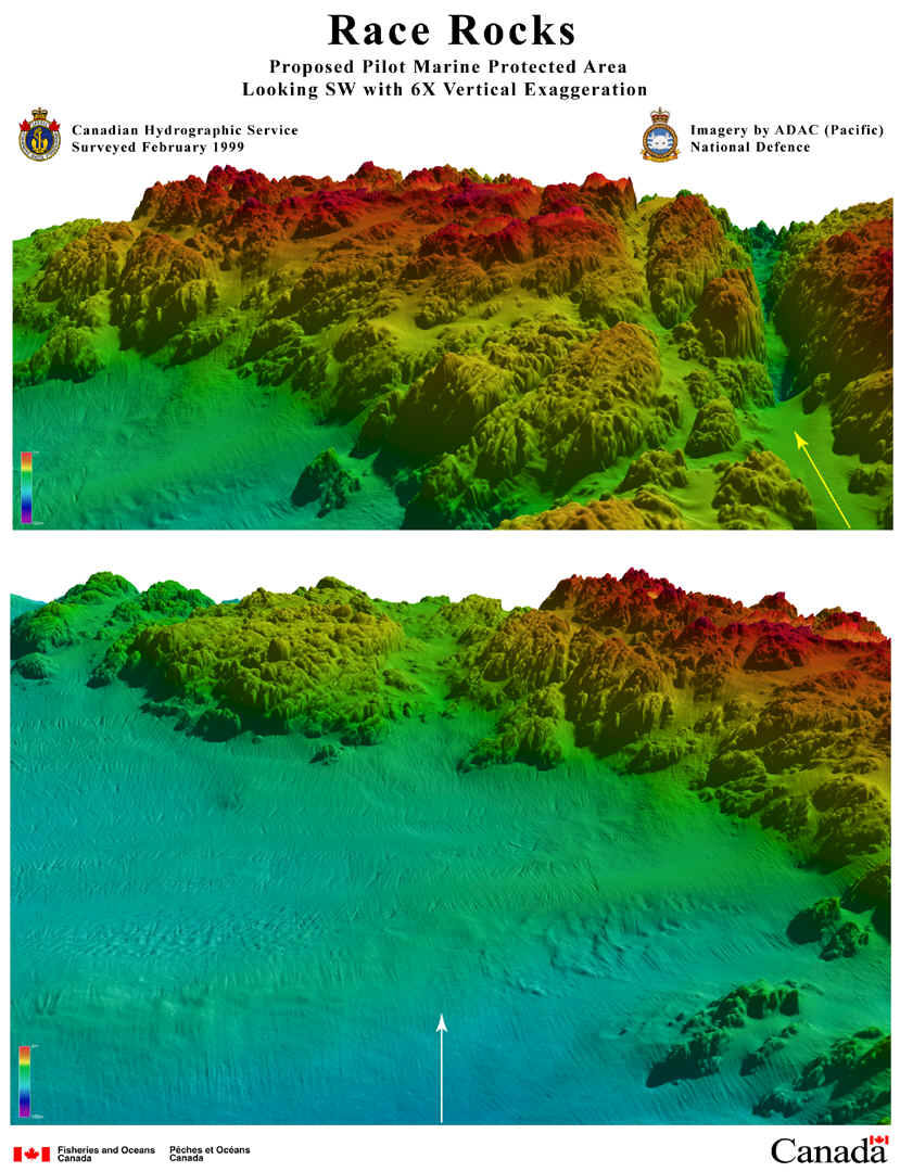
 These projections represent three dimensional views looking toward Race Rocks from the North West underwater direction. These projections represent three dimensional views looking toward Race Rocks from the North West underwater direction.
|

