A hub of research activity at Race Rocks today.

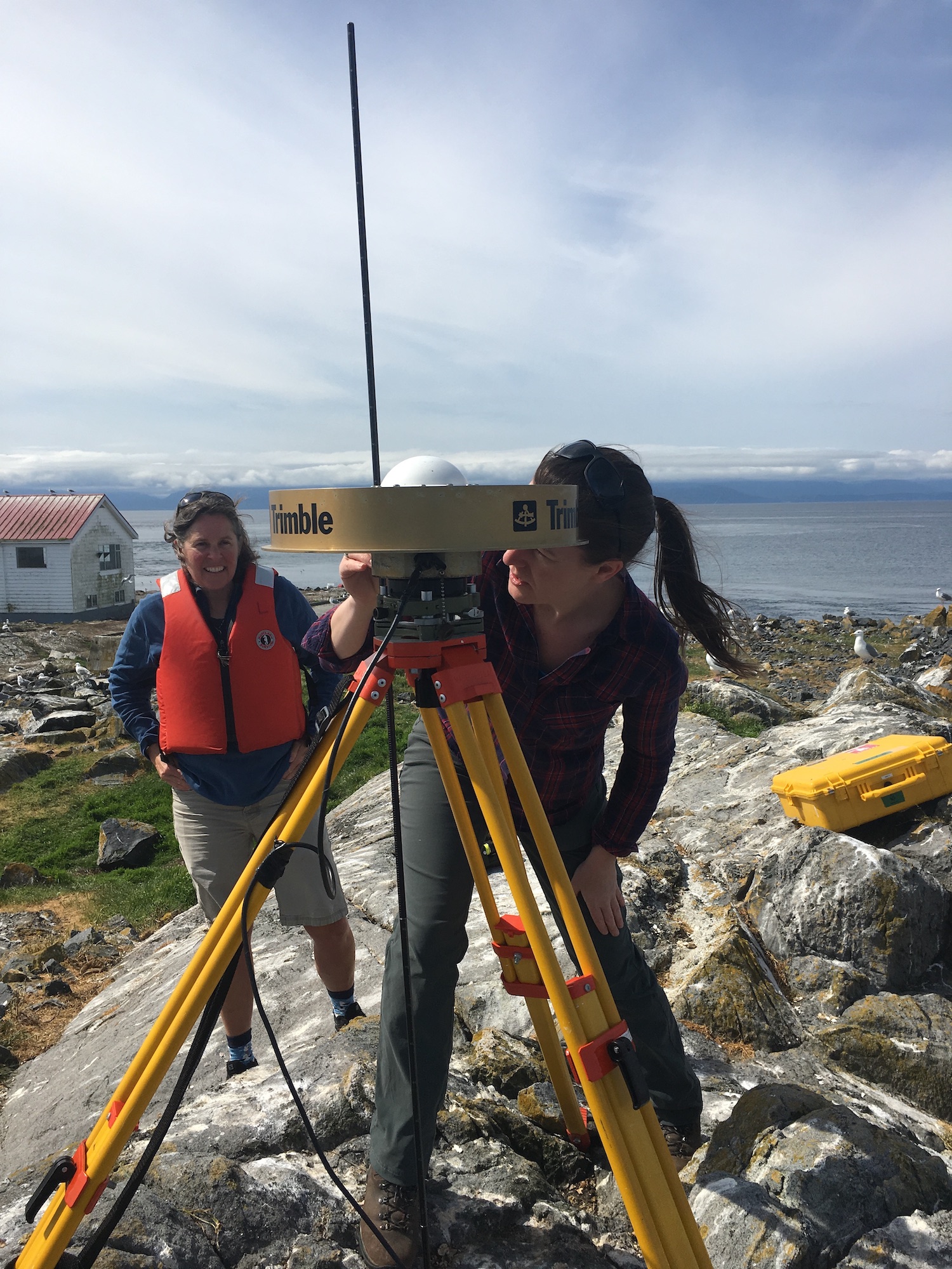
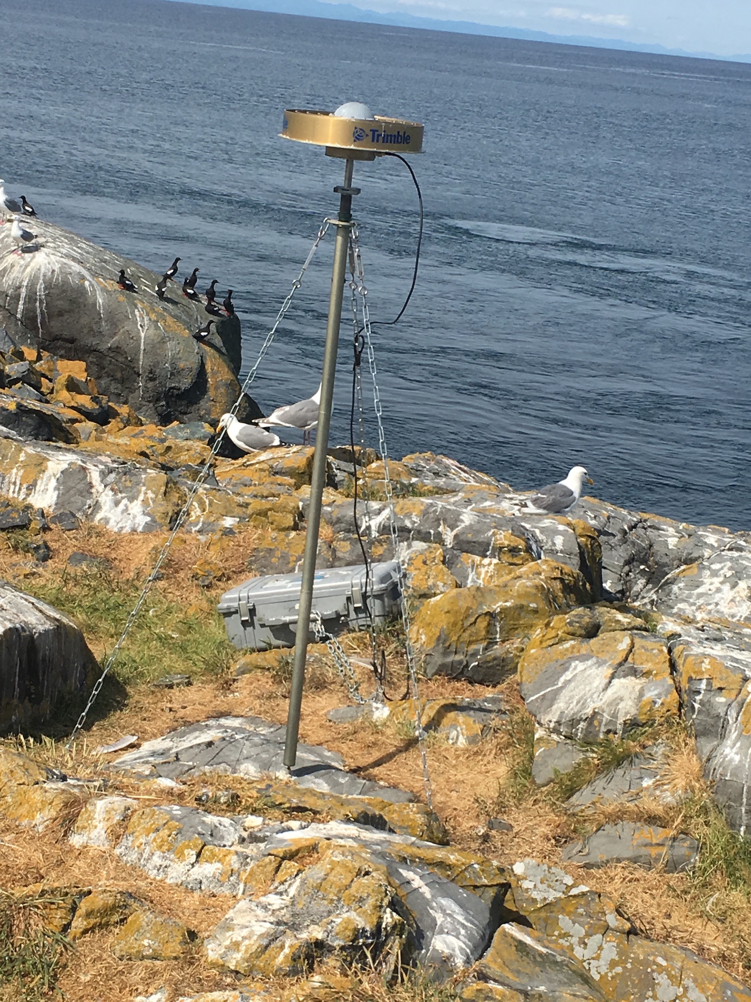
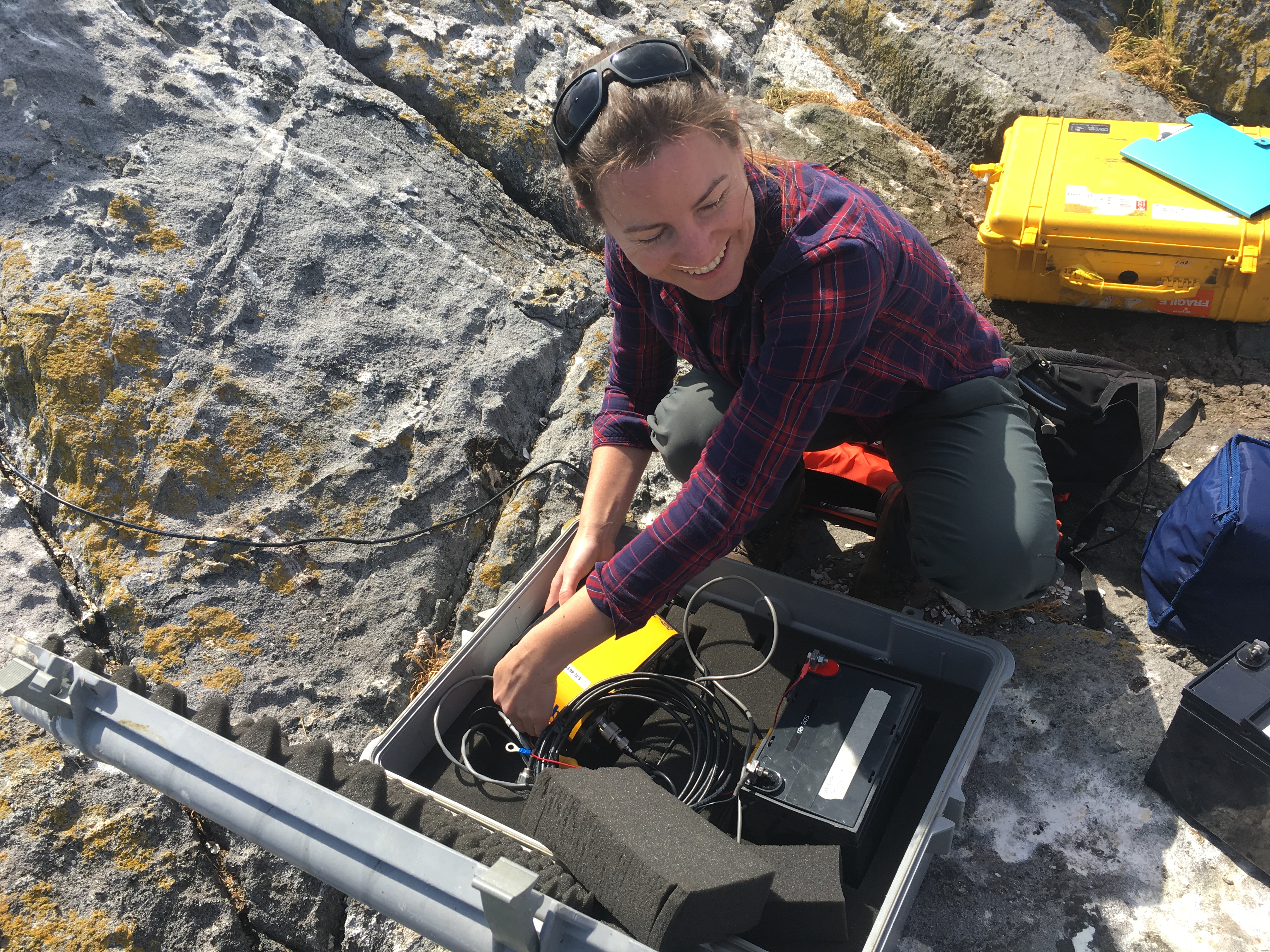
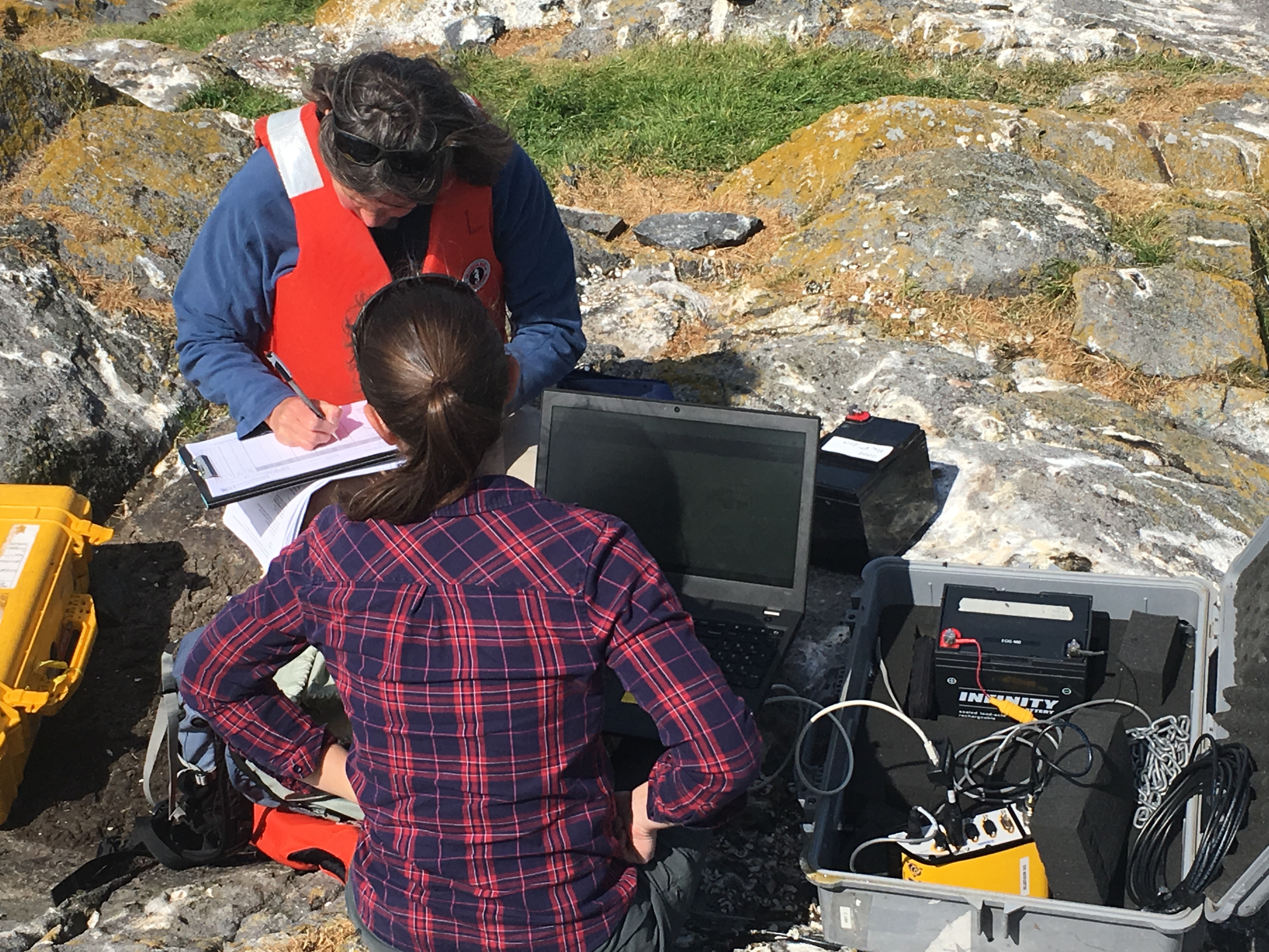
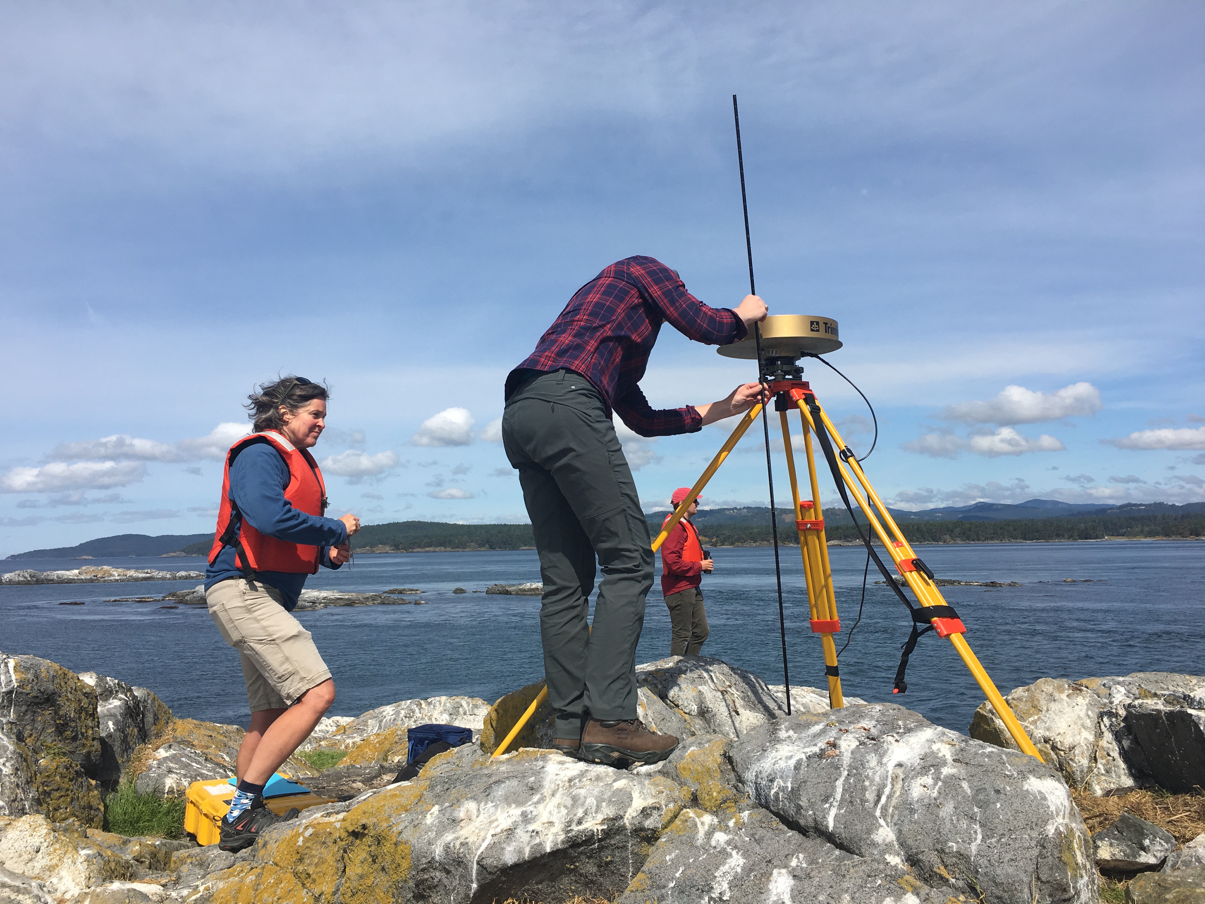
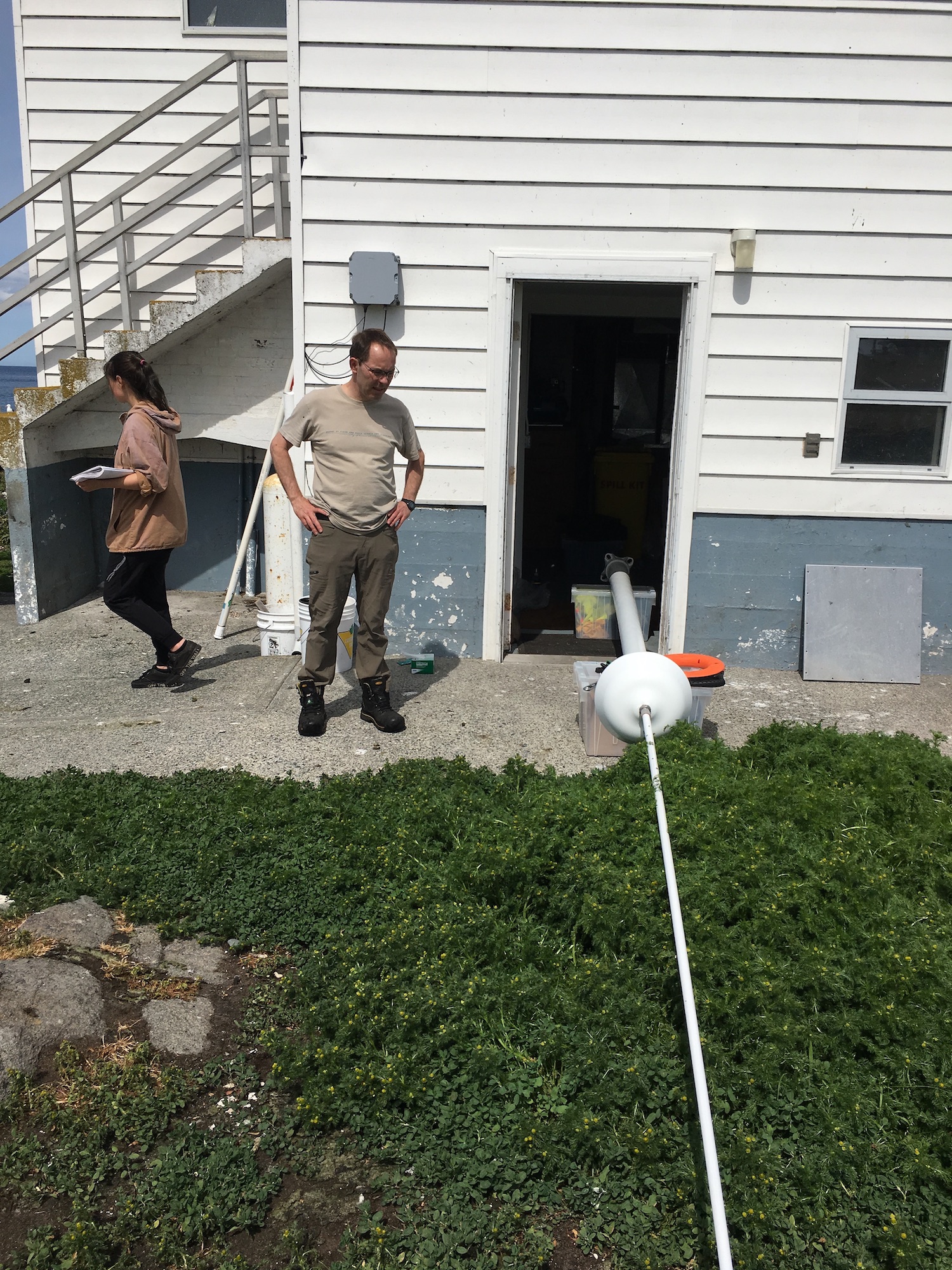
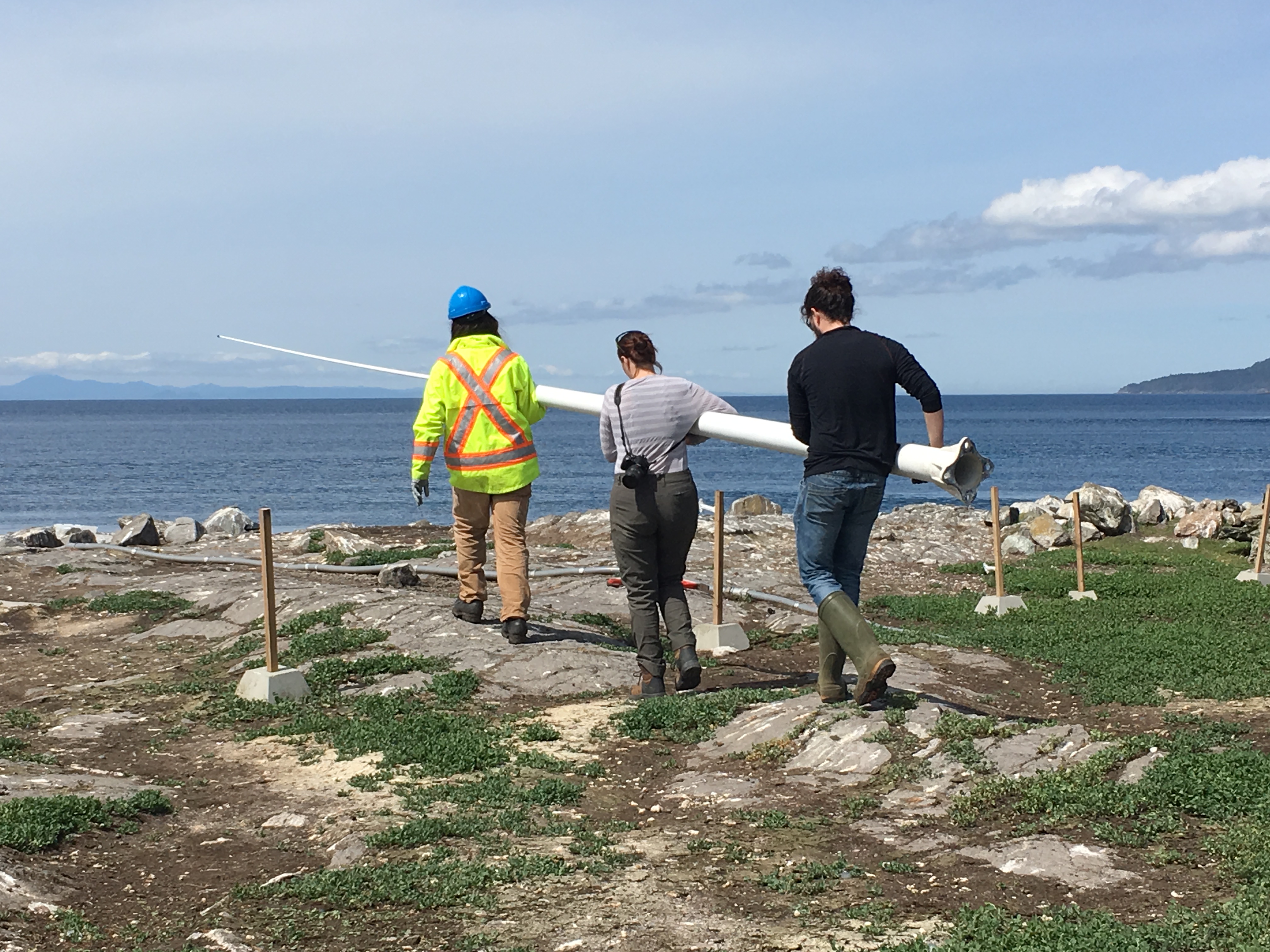
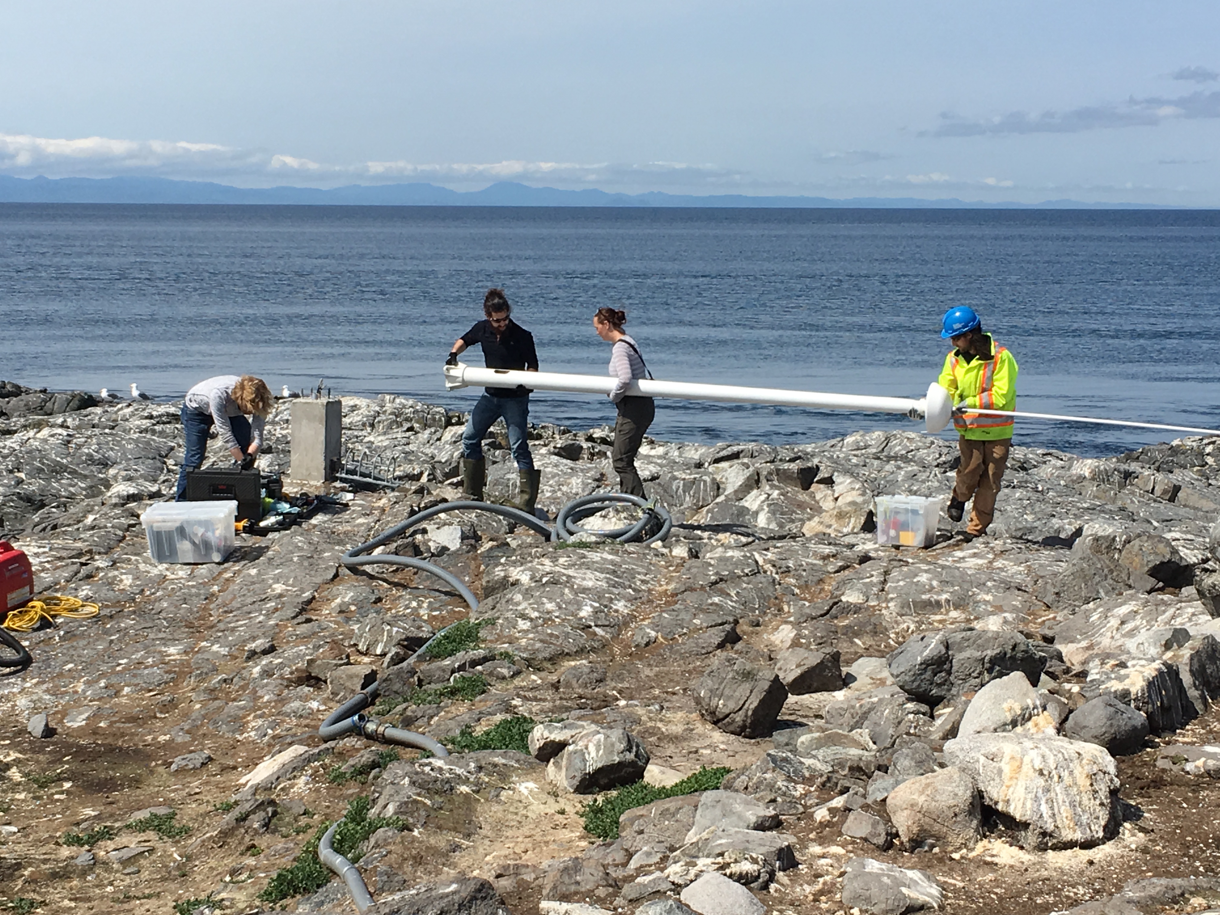
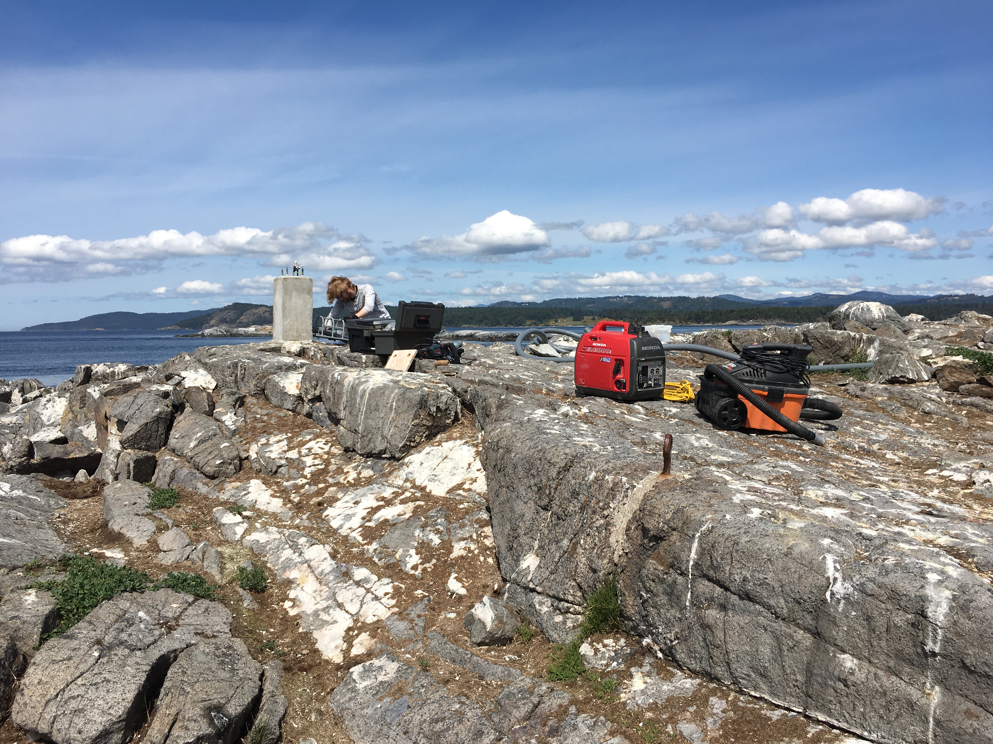
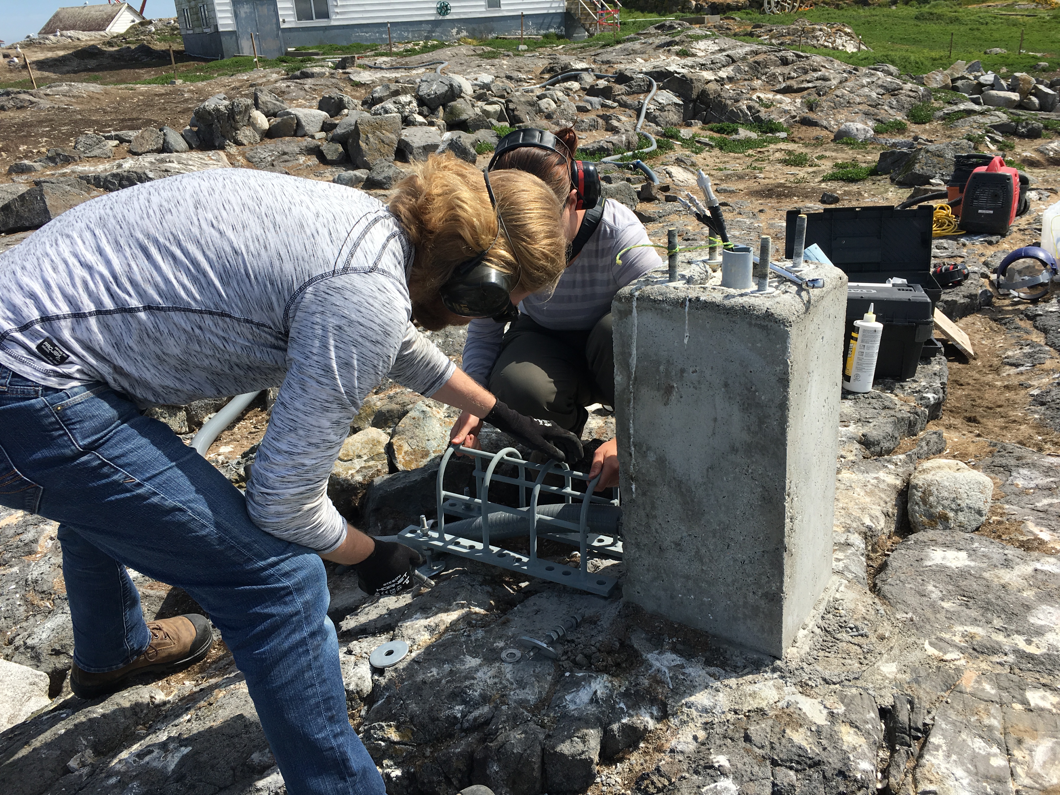
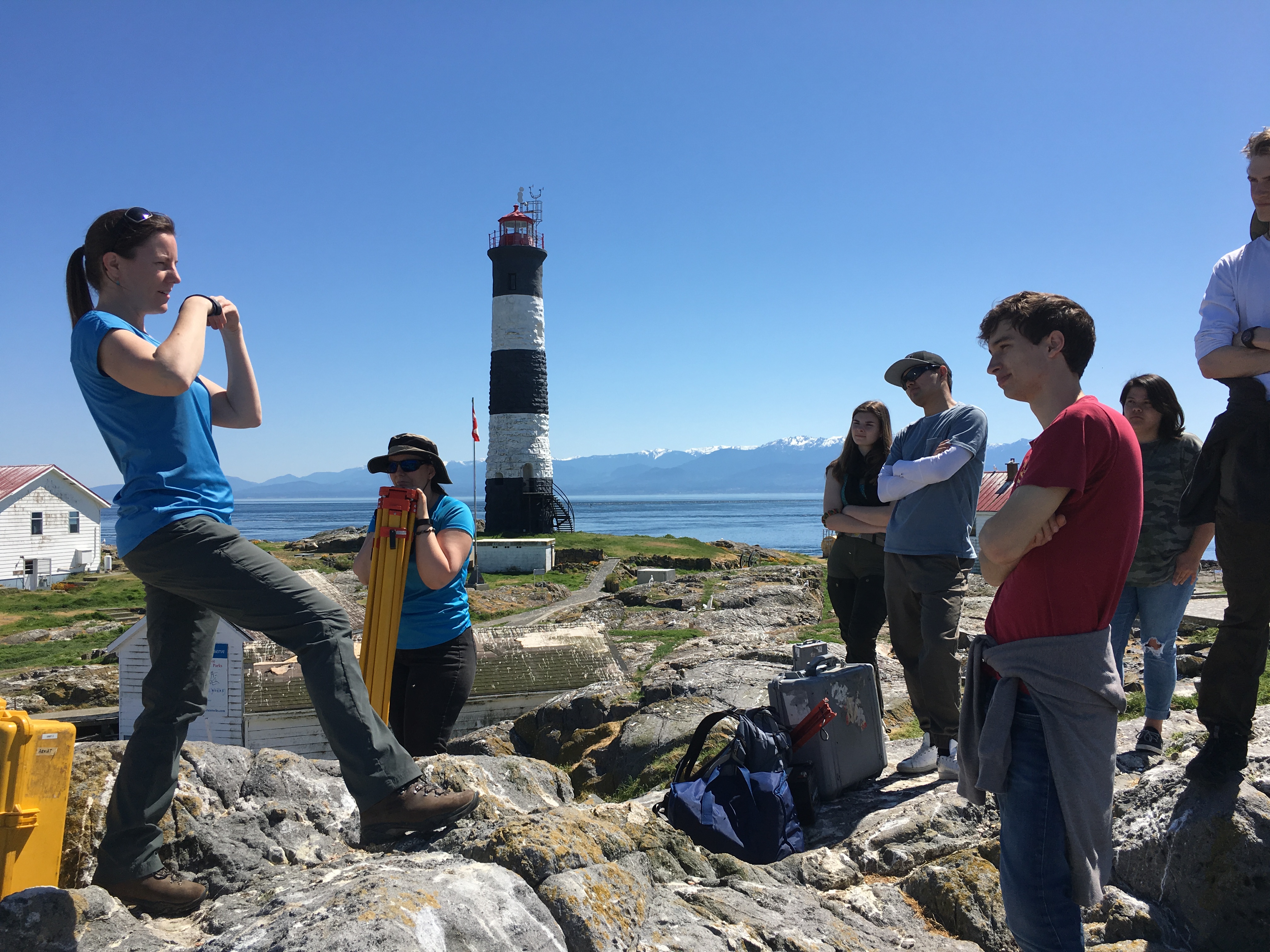
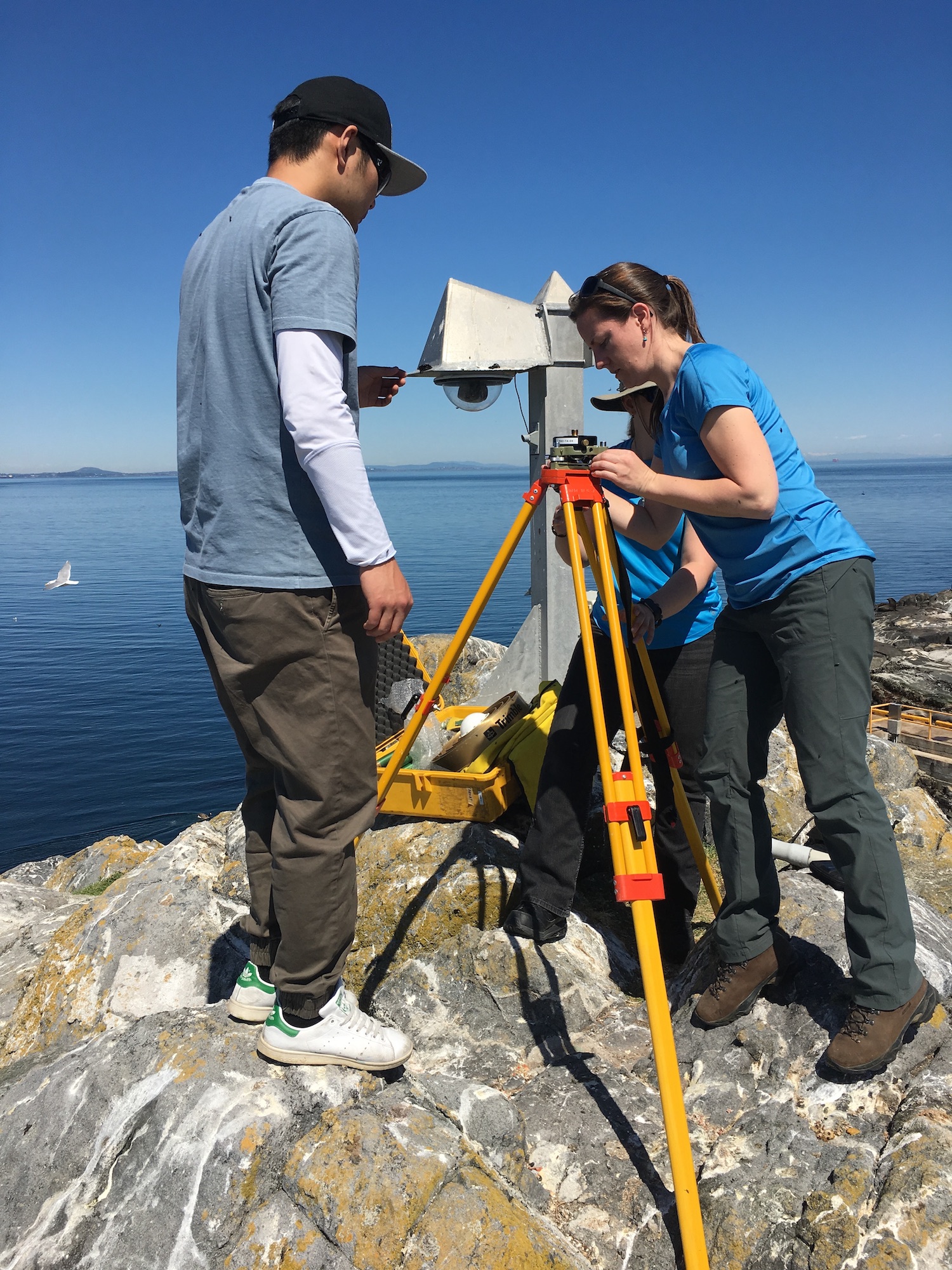
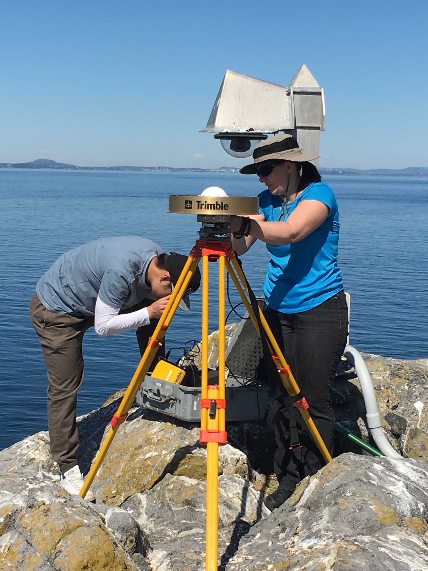
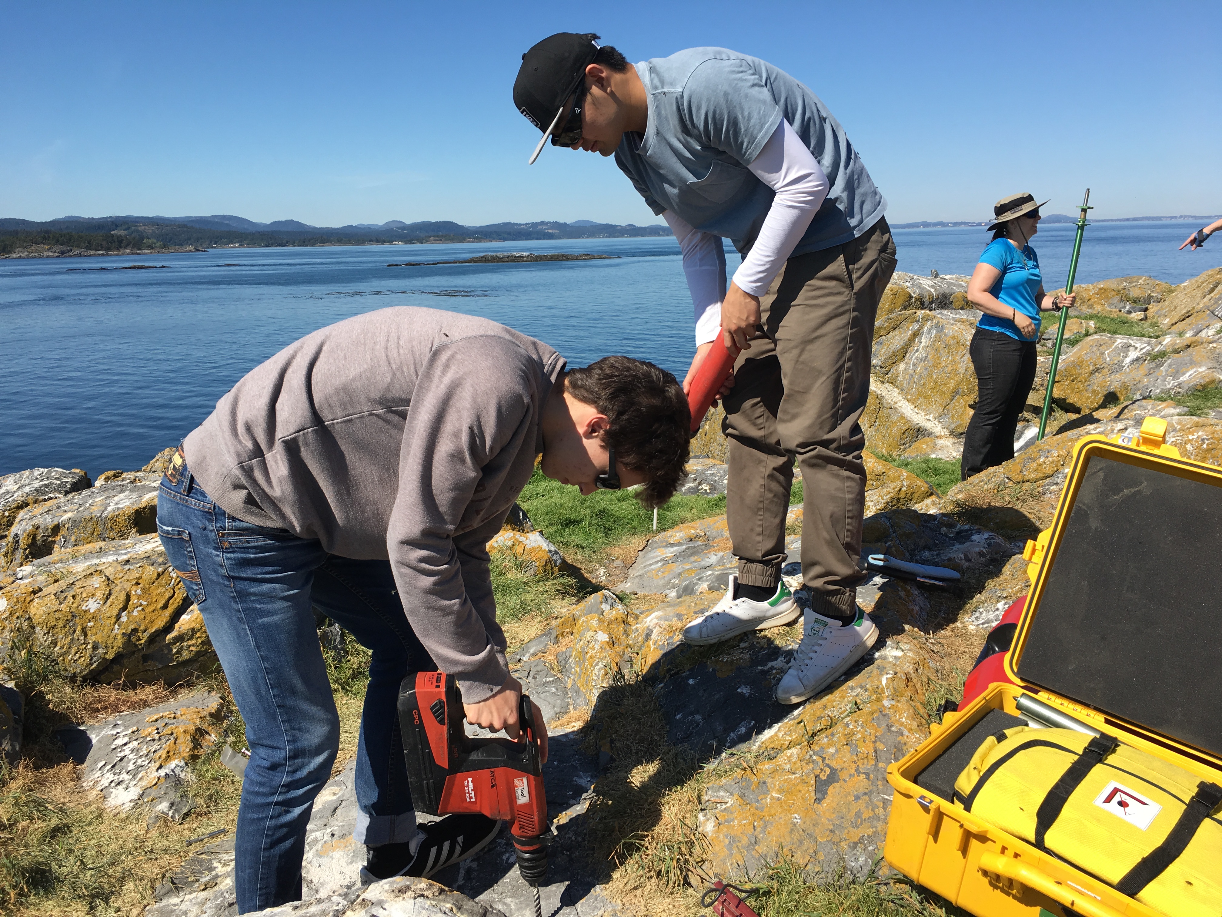
A lot of activity was going on today in the reserve.  Guy drove out myself and Laura Verhegge and several others to attend to equipment  at Race Rocks. Already there was a crew with Kevin of Oceans Network Canada who were reinstalling the CODAR sea surface monitor. This was last commented on in a log on  September 28 Also accompanying us was Ed Weibe, of the UVic School of Earth and Ocean Sciences — EOS 110 Labs Vancouver Island School-Based Weather Station Network http://victoriaweather.ca , who monitors the  Davis weather station for our weather page on this site and the UVic Schools  Weather program.  He was there to change the humidity sensor and check on the equipment.  Lucinda Leonard was along to take down the GPS earthquake monitoring equipment after its successful deployment for the past week.  (See the May 10 log)


The other activity going on was the installation of a CODAR  monitor by the crew with Kevin from Oceans Network Canada.

GPS Survey for Earthquake Hazard Assessment on Southern Vancouver Island

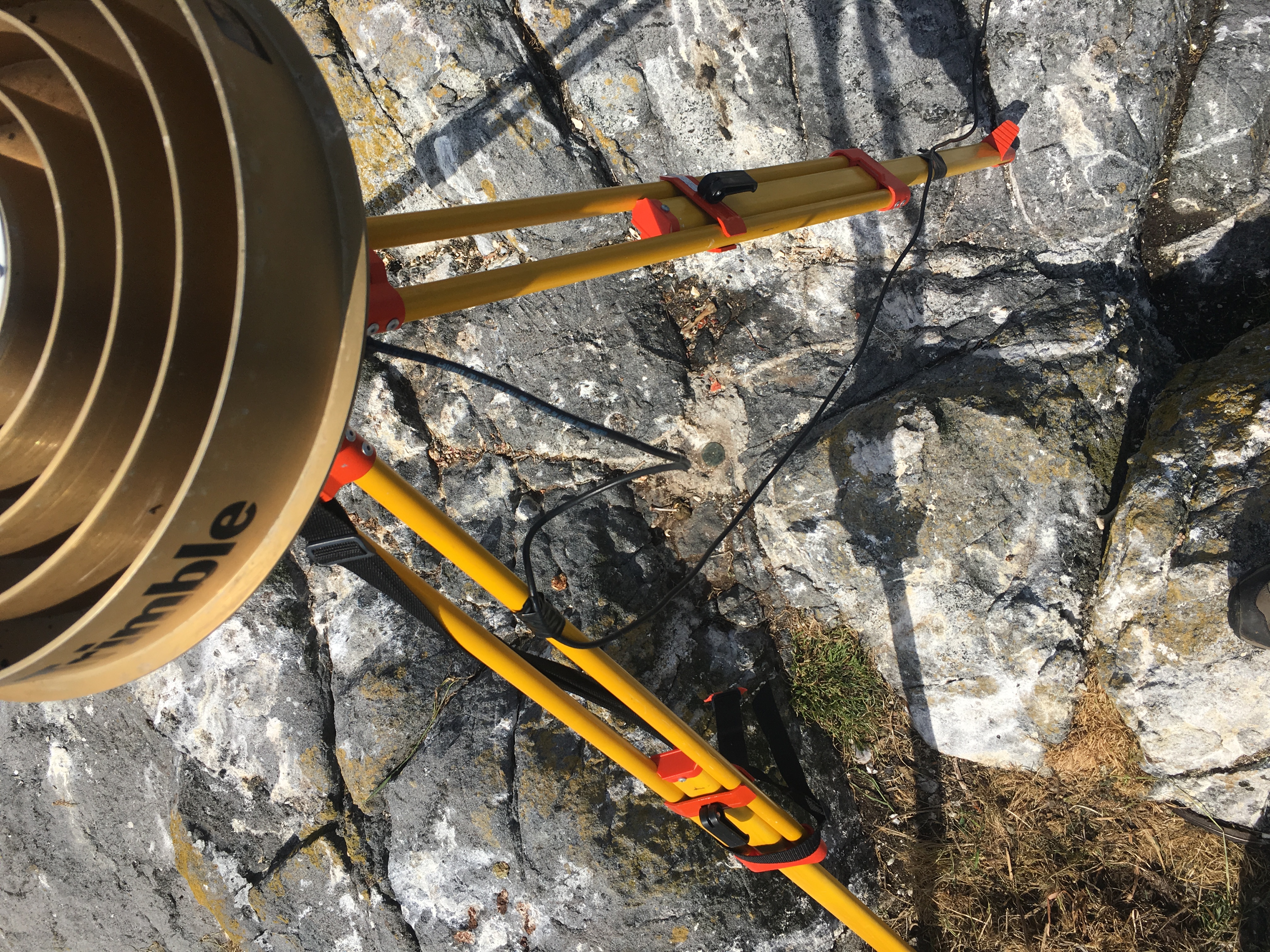
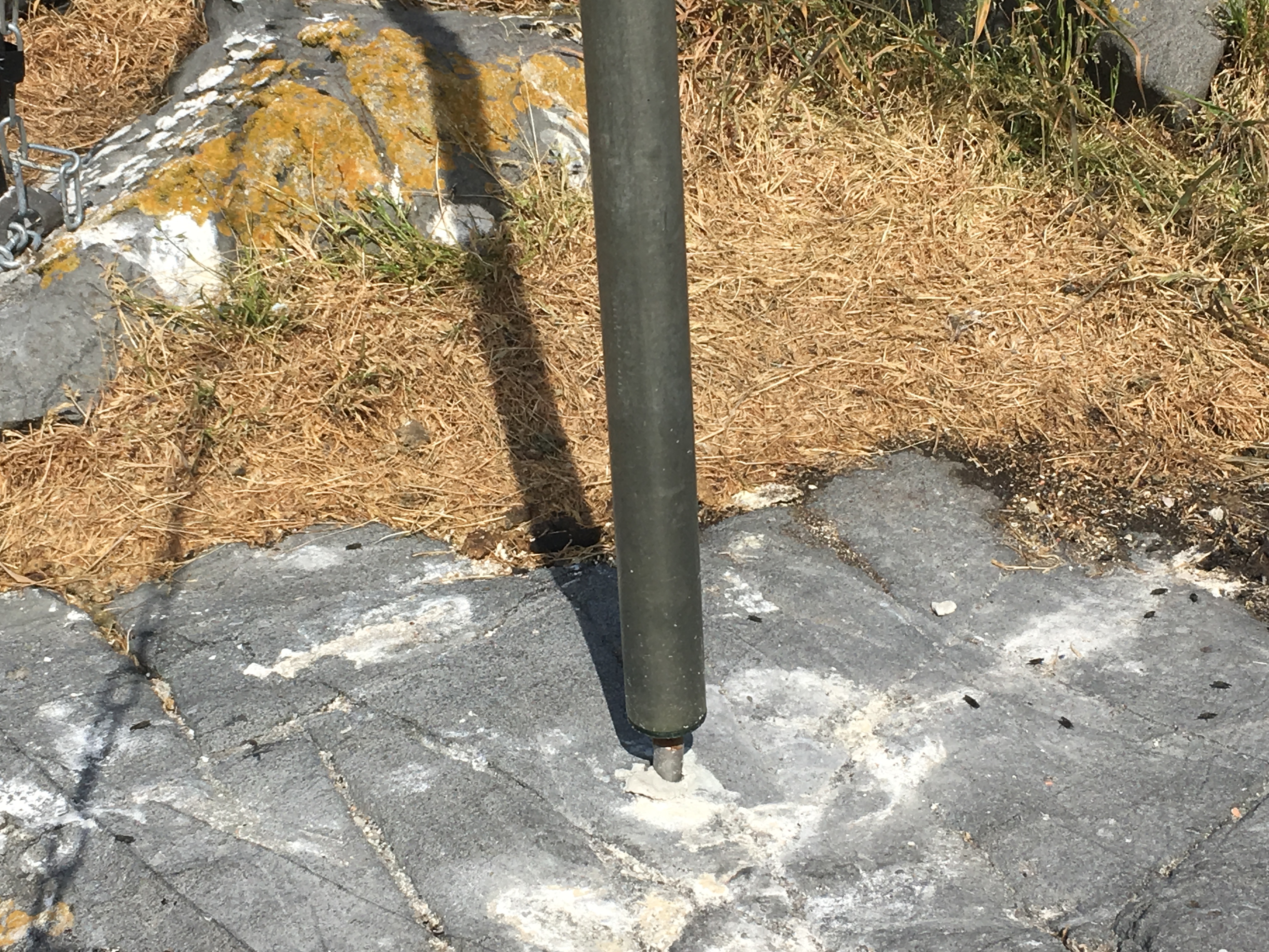
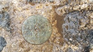
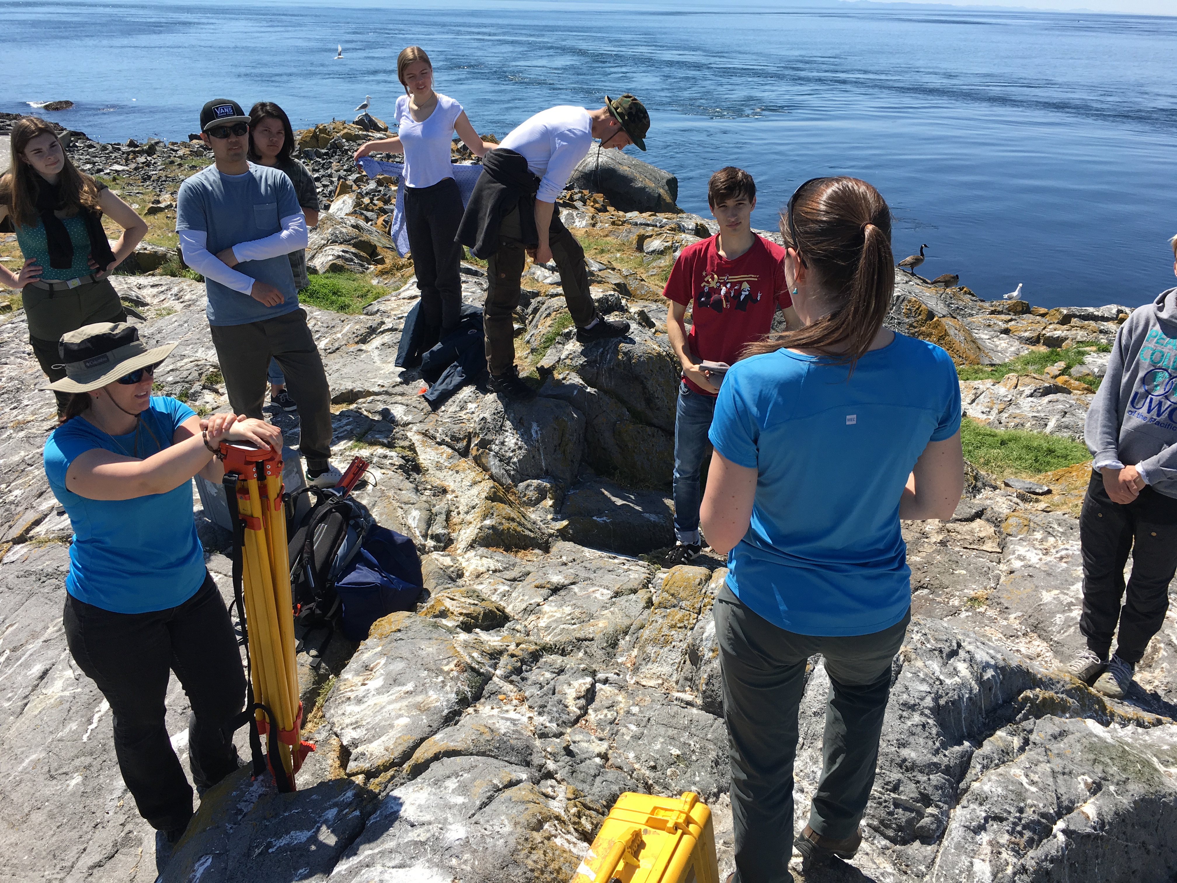
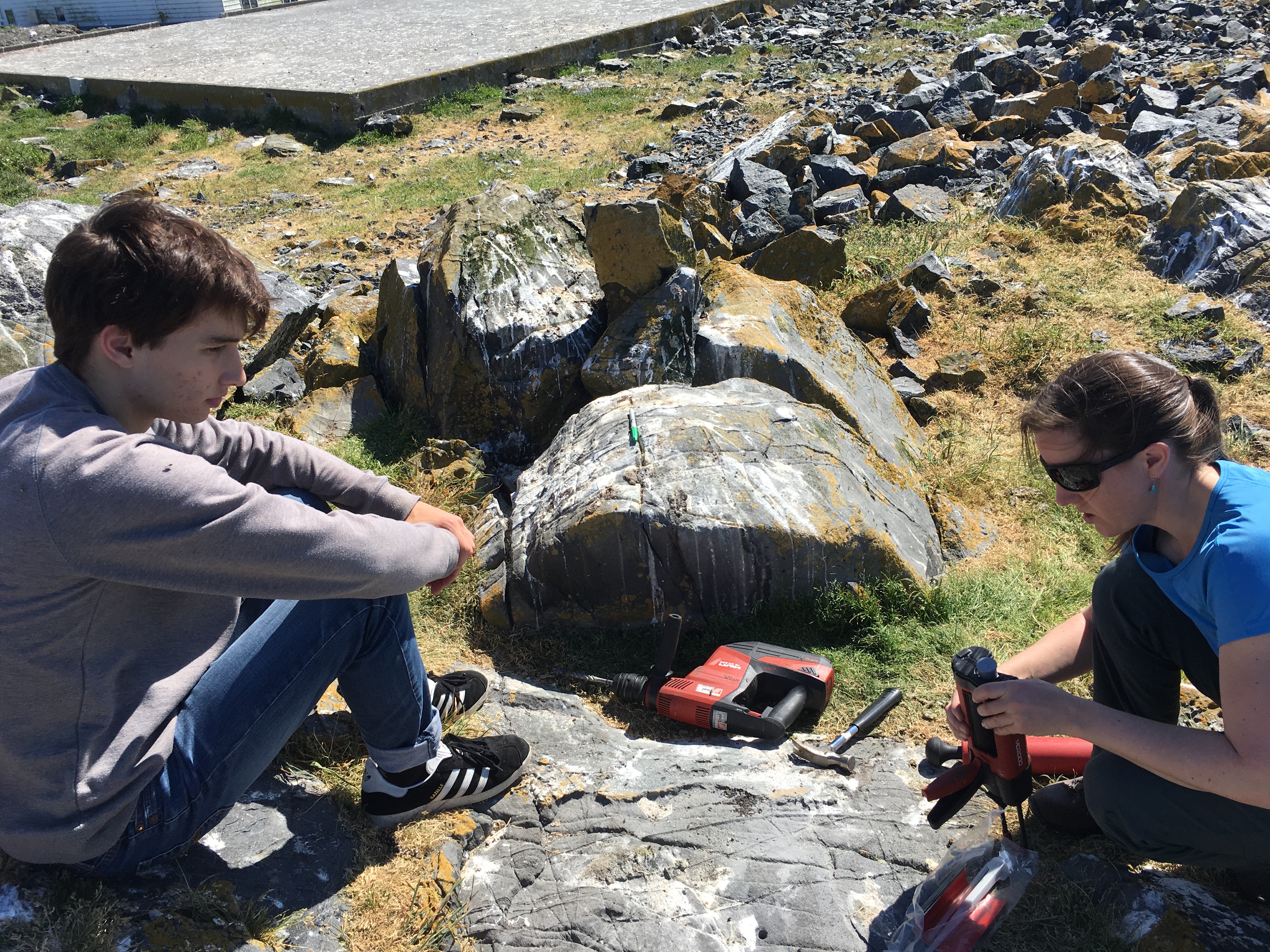
I accompanied Lucinda Leonard and two students from UVIc  Megan Caston and Yijie Zhu – they are both working towards Masters degrees in Geophysics, working on earthquakes and faults to Race Rocks along with 6 students from Pearson College for the installation of two GPS stations. Many years ago , perhaps as early as 1991, this plug had been installed a meter in front of the Camera 5 location , and it had not been rechecked since.  Laas was able to get this picture of it to verify that it was still there .

gps marker

The following is the research proposal by Lucinda Leonard, Assistant Professor (Geophysics) School of Earth and Ocean Sciences, University of Victoria PO Box 1700 STN CSC, Victoria, British Columbia, Canada V8W 2Y2

GPS Survey for Earthquake Hazard Assessment on Southern Vancouver Island

Participants: Lucinda Leonard, Assistant Professor, School of Earth and Ocean Sciences, University of Victoria
Julie Elliott, Assistant Professor, Purdue University
Yan Jiang, Research Scientist, Natural Resources Canada, and Adjunct Professor, University of Victoria 2-3 students will also take part in the fieldwork.

Objectives:

(1) To quantify seismic hazard of crustal faults on southern Vancouver Island. (2) To improve understanding of crustal deformation in subduction zone forearcs.

Scope of fieldwork:

The research project will establish and survey a relatively dense network of high-precision Global Positioning System (GPS) sites across fault zones on southeastern Vancouver Island that may host significant earthquakes. The 2018 survey will involve temporary instrument deployments at a number of pre-existing survey markers as well as new markers emplaced in bedrock. We anticipate future deployments every 1-2 years over the next 5-10 years.

Rationale:

Southeastern Vancouver Island is a region of high seismic hazard due to its location above the Cascadia subduction zone – the region is susceptible to damage from: earthquakes on the Cascadia megathrust fault offshore (magnitude ~9; similar to the devastating 2011 tsunamigenic Japan earthquake), deep earthquakes beneath the Salish Sea and Puget Sound (up to magnitude ~7; e.g., 2001 earthquake in Nisqually, Washington, that caused minor damage in Victoria), and earthquakes on poorly-understood shallow crustal faults (up to magnitude ~7.5; similar to the 2011 damaging earthquake in Christchurch, New Zealand). Crustal earthquakes, although smaller in magnitude than megathrust events, may produce strong shaking in urban areas due to their shallow source and possible close proximity. Modelling of a scenario crustal earthquake beneath the City of Victoria estimates extensive damage to 64% of building stock, 75% of the water pipeline system, and 90% of the sewer pipeline system in the city (VC Structural Dynamics Ltd., 2016).

Crustal faults remain poorly understood in the region, although recent progress includes the identification of surface-rupturing Holocene earthquakes on the Leech River fault (Morell et al., 2017) and its likely offshore equivalent, the Devil’s Mountain fault (Barrie and Greene, 2018). Fault mapping and trenching are important to determine the maximum magnitude of past and future earthquakes on individual fault strands, but these methods cannot provide accurate estimates of slip rates on fault zones, as required for input into seismic hazard assessments. GPS surveying can be used to track the relative motion of survey markers over time; a sufficiently dense GPS network can be further used to identify the location of active faults and to quantify their slip rates (e.g., Marechal et al., 2015). The existing network of continuous GPS stations on southeastern Vancouver Island is inadequate for this purpose, e.g., there are only three stations within 20 km of the active Leech River fault zone. Campaign-style deployments, repeated every 1-2 years over a time-span of 5-10 years, will provide the greater density of survey locations needed to assess strain build-up on fault zones. Several sites were established in 1991 and re-surveyed in 1996 (Henton, 2000; Mazzotti et al. 2003) – we propose to re-occupy these sites, where possible, and to establish a denser network of campaign GPS sites for temporary deployments (2-4 days at each site).

1

Methodology
Site locations:
Site requirements: accurate GPS positioning (to within 1 mm) requires the GPS antenna to have a good view of the sky in order to maximize the satellite signals received. It also requires a marker to be emplaced in a stable substrate, ideally bedrock. Thus bedrock hilltops provide optimum site locations. In this region, many optimal locations are located within parks.

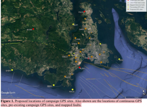
Proposed deployments include 5 pre-existing sites, in addition to ~16 new sites, at an average of ~3 km spacing perpendicular to the Leech River fault zone and adjacent faults offshore (Figure 1; Table 1). The greater number of sites to the north of the fault zone reflects greater accessibility over a larger land area in this region.

Figure 1. Proposed locations of campaign GPS sites. Also shown are the locations of continuous GPS sites, pre-existing campaign GPS sites, and mapped faults.

Table 1. Locations of existing and proposed GPS campaign sites available by contacting the research proponenet

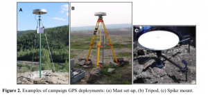
For a continuous period of 2-4 days at each site (maximum of once per year), a 1.7-m high mast with GPS antenna will be set up over an existing or new marker in the bedrock at each site, attached by cable to a receiver in a locked box on the ground. During deployment, the mast will be secured to the anchors using chains (Fig. 2a). At sites not conducive to the mast set-up, a tripod (Fig. 2b) or spike mount (Fig. 2c) will be used instead. New sites will be established by using epoxy to fix stainless steel marker pins into the bedrock. These will penetrate 6 inches into the rock, with a diameter of 0.5 inches, to lie flush with the ground surface. For mast sites, three stainless steel anchor bolts will also be bolted into the rock to a depth of ~2 inches, each attached to a 2-inch diameter stainless steel ring flush to the ground, at a distance of ~0.5 m from the central marker.

Approximate schedule for 2018 fieldwork:

The fieldwork will be carried out in August 2018, with each site being surveyed for 2-4 days. The proposed schedule is shown in Table 2 below, although actual dates may differ.

Table 2. Approximate schedule for fieldwork in August 2018 Approx. Dates Tasks

Aug 1 Aug 2 Aug 3 Aug 4 Aug 5 Aug 6 Aug 7 Aug 10

Aug 11 Aug 12 Aug 13 Aug 14 Aug 15 Aug 16 Aug 17 Aug 18

Team 1: Deploy PBHY, HIGH, SHER
Team 1: Deploy MLHT, TOLM, check others, babysit TOLM
Team 1: Stay at TOLM, check others
Team 1: Babysit TOLM, Demob PBHY, HIGH, TOLM (after 5 pm) Team 1: Demob MLHT, Deploy HAVN
Team 1: Check HAVN
Team 1: Demob HAVN after 5 pm
Team 1: Paperwork; deploy BEAR, STEW
Team 2: Deploy BBEC, DEVO, MILL
Team 1: Deploy OAKH, DOUG, check BEAR, STEW, babysit DOUG Team 2: Deploy PEDD, check BBEC,DEVO, MILL
Team 1: Babysit DOUG, check STEW, OAKH, BEAR
Team 2: Check DEVO, PEDD, BBEC, MILL
Team 1: Demob STEW, BEAR, Babysit DOUG then demob after 5 pm Team 2: Demob BBEC, DEVO, MILL
Team 1: Demob OAKH, Deploy THET, DISC (by boat)
Team 2: Demob PEDD, deploy LONE, CAMO
Team 1: Deploy WELS, MOSS, SUMM
Team 2: Deploy OBSV, check LONE, CAMO
Team 1: Check WELS, THET, MOSS, SUMM
Team 2: Check LONE, CAMO, OBSV
Team 1: Demob DISC (boat), THET
Team 2: Demob LONE, CAMO
Team 1/2: Demobilize WELS, MOSS, SUMM, OBSV

4

Plans for on-site security, site control and general safety?

The deployment of passive GPS equipment poses little risk to the public. Flagging will be placed on the equipment to mitigate any potential tripping hazards. Signs will be posted at all sites, with the following text (correct dates to be inserted): “Surveying for earthquake hazard study in progress from August 3-6 – please do not disturb. For more information, please contact Lucinda Leonard, School of Earth and Ocean Sciences, University of Victoria: 778-676-9621 or lleonard@uvic.ca”. At locations that are popular with the public, sites will be manned during daylight hours. Sites that see less pedestrian traffic will be visited 1-2 times per day during the deployment.

Data processing and analysis:

Geodetic data will be processed using standard routines to determine precise daily average locations for each site. Positional time series will be analyzed to provide site motions (direction and rate of motion) in a North America reference frame. Analysis of relative motion between sites will enable determination of strain across fault zones and improve seismic hazard assessment for southern Vancouver Island.

References:

Barrie, V., and H. G. Greene (2018), The Devils Mountain Fault zone: an active Cascadia upper plate zone of deformation, Pacific Northwest of North America, Sedimentary Geology, v. 364, p. 228-241, doi: 10.1016/j.sedgeo.2017.12.018.

Henton, J.A. (2000), GPS studies of crustal deformation in the northern Cascadia subduction zone. Ph.D. thesis, Univ. Victoria, Victoria B.C., Canada, 169p.

Marechal, A., S. Mazzotti, J.L. Elliott, J.T. Freymueller, and M. Schmidt (2015), Indentor-corner tectonics in the Yakutat-St. Elias collision constrained by GPS, Journal of Geophysical Research, v. 120, p. 3897-3908, doi: 10.1002/2014JB011842.

Mazzotti, S., H. Dragert, J. Henton, M. Schmidt, R. Hyndman, T. James, Y. Lu, and M. Craymer (2003), Current tectonics of northern Cascadia from a decade of GPS measurements. J. Geophys. Res. 108(B12):2554.

Morell, K. D., C. Regalla, L. J. Leonard, C. Amos, and V. Levson (2017), Quaternary rupture of a crustal fault beneath Victoria, British Columbia, Canada, GSA Today, v. 27, no. 3.

VC Structural Dynamics Ltd. (2016), Citywide seismic vulnerability assessment of the City of Victoria, Report prepared for the corporation of the City of Victoria, Victoria, BC, Canada, 43p, available online at: http://www.victoria.ca/assets/Departments/Emergency~Preparedness/Documents/Citywide- Seismic-Vulnerabilities-Assessment.pdf

See the follow-up  when the instrument was removed on the May 15 log

Polygonum aviculare: prostrate knotweed – The Race Rocks Taxonomy

knotweed

Polygonum aviculare

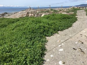
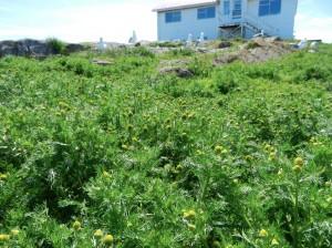
I noticed a particularly thriving population of the invasive prostrate knotweed this spring . It is typically successful in heavily compacted areas and adjacent to the sidewalks. Also it is probably not  favoured by Canada geese, as with most of the successful invasive species on the island. See also: https://racerocks.ca/polygonum-aviculare-prostrate-knotweed-the-race-rocks-taxonomy/

Kingdom: Plantae
Clade: Angiosperms
Clade: Eudicots
Order: Caryophyllales
Family: Polygonaceae
Genus: Polygonum
Species:
P. aviculare
Binomial name
Polygonum aviculare
taxonomyiconReturn to the Race Rocks Taxonomy
and Image File
pearsonlogo2_f2The Race Rocks taxonomy is a collaborative venture originally started with the Biology and Environmental Systems students of Lester Pearson College UWC. It now also has contributions added by Faculty, Staff, Volunteers and Observers on the remote control webcams.


Matricaria discoidea : pineapple weed, The Race Rocks taxonomy

The observation below was made in 2013/06/05 …

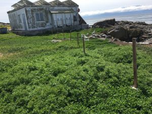
Several large areas where the grass was matted and smothered by the sealions hauling out last fall, now have a prolific growth of this newly arrived plant, Matricaria discoidea, or pineappleweed. These are the tallest growing samples of that plant I have seen. Another plant in the same areas is the fiddleneck, Amsinckia menziesii

This year the same situation appears in the areas trampled by the sealions last fall. This post  shows how comfortable it is for the elephant seals.

Kingdom: Plantae
Clade: Tracheophytes
Clade: Angiosperms
Clade: Eudicots
Clade: Asterids
Order: Asterales
Family: Asteraceae
Genus: Matricaria
Species: M. discoidea

taxonomyiconReturn to the Race Rocks Taxonomy
and Image File
pearsonlogo2_f2The Race Rocks taxonomy is a collaborative venture originally started with the Biology and Environmental Systems students of Lester Pearson College UWC. It now also has contributions added by Faculty, Staff, Volunteers and Observers on the remote control webcams.


Nautichthys oculofasciatus (Sailfin Sculpin): The Race Rocks taxonomy


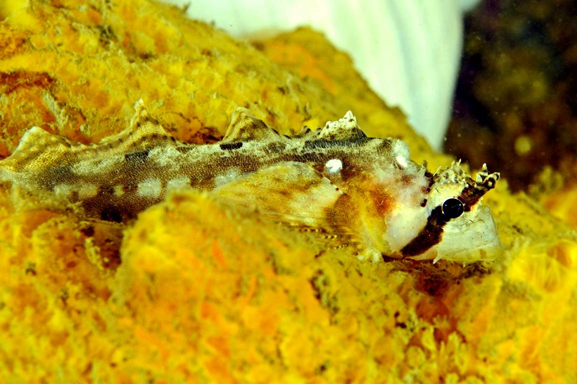
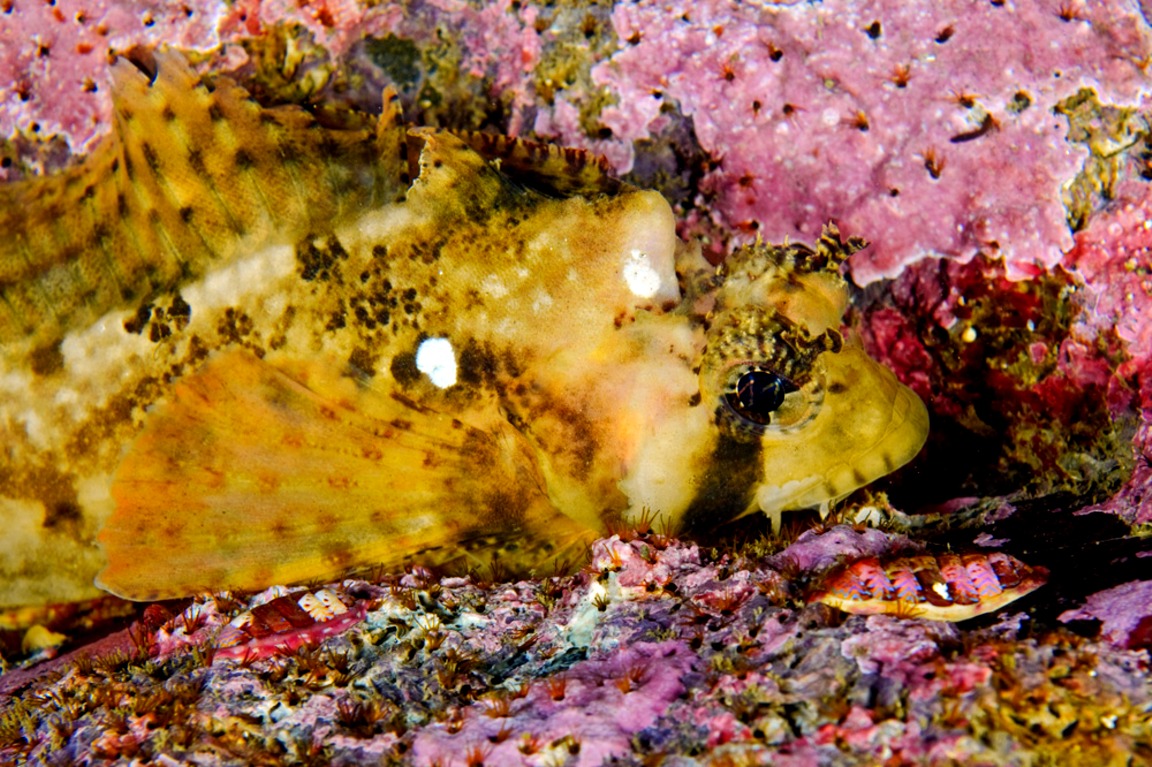
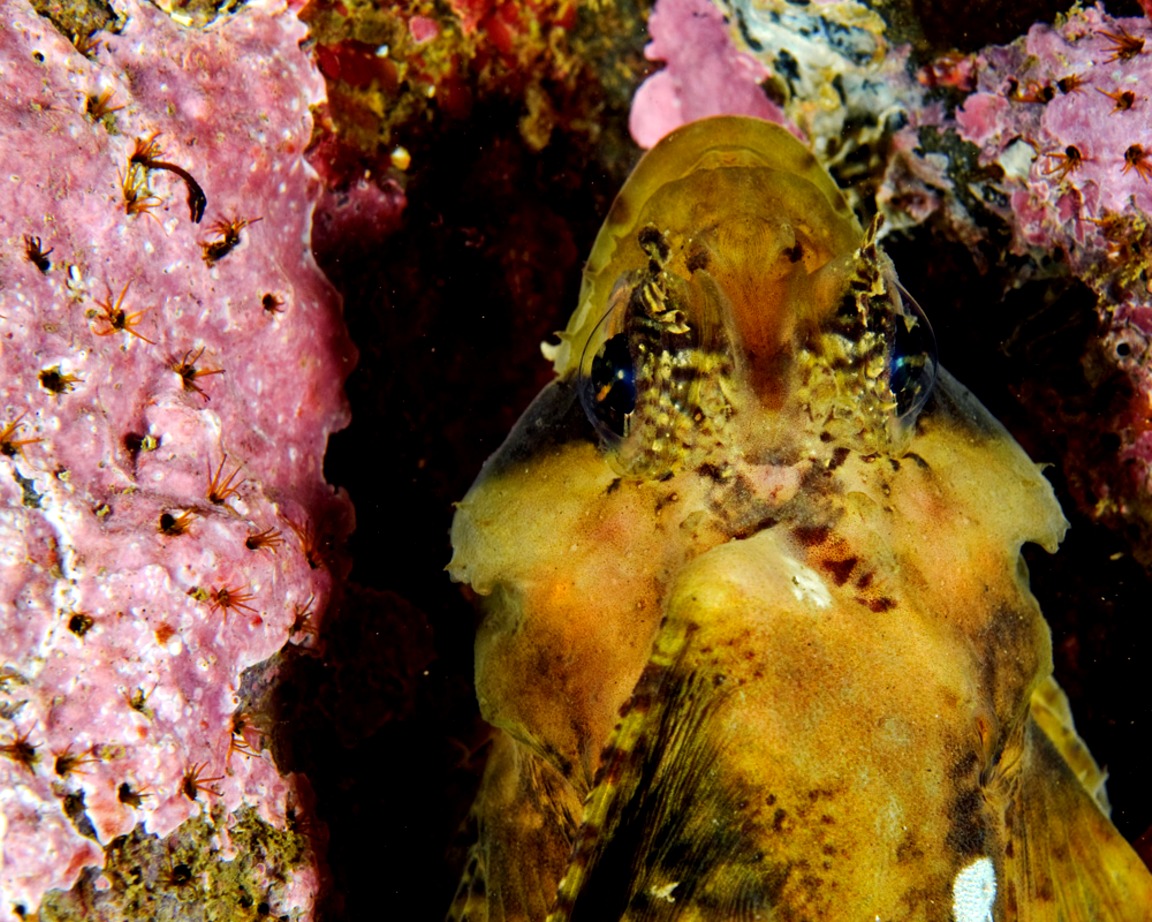
Sailfin Sculpin , Nauticthys oculofasciatus
(Aprox 20cm in length) Ryan took these pictures on a night dive in April, 2010.


Domain Eukarya
Kingdom Animalia
Phylum Chordata
Sub-PhylumVertebrata
Class Scorpaeniformes
Order hemitripteridae
Family Cottidae
Genus Nauticthys
Species oculofasciatus Girard 1858
Common Name:Sailfin Sculin


taxonomyiconReturn to the Race Rocks Taxonomy
and Image File
pearsonlogo2_f2The Race Rocks taxonomy is a collaborative venture originally started with the Biology and Environmental Systems students of Lester Pearson College UWC. It now also has contributions added by Faculty, Staff, Volunteers and Observers on the remote control webcams. March 15 2010 – Ryan Murphy

Update on Tagged Elephant Seal Cow

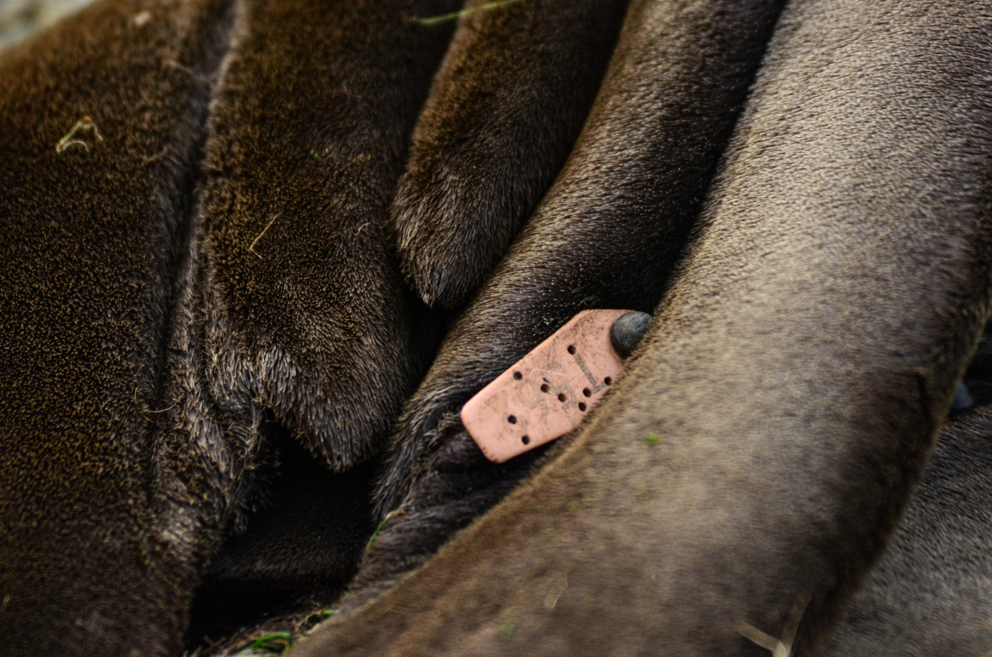
T 562 pink

Recently I sent this email to the folks who are in charge of the tagged elephant seal program in the US .” This year we have had three pups born The tag (on this website) for pups born here over the last few years is https://www.racerocks.ca/tag/pup/ This year the first pup belonging to one of your tagged females, pink tag T562 is doing very well. One other one is ok but the last born one has been mauled by one of the mothers and has died. It would be interesting for us to know when this tagged mother was born so that we know her age and origin

***********************************************************************************************

NOTE : The following link is connected to all the posts on this log relating to tagged elphant seals we have recorded at Race Rocks Ecological Reserve over the past 19 years

https://www.racerocks.ca/tag/tagged/

Today we received this information from Garrett Duncan, Farallon Program Biologist at Point Blue Conservation Science. www.pointblue.org  :

The cow you re-sighted with a Pink tag T562 was born on the SE Farallon Island during the 2010-2011 breeding season and hasn’t been seen since. It’s mother’s name in our database was Peggy and she was likely born in the 1998-1999 breeding season in a colony further to the south, Piedras Blancas. She frequented the island every year between 1999 and 2011.


NEB, Trans Mountain Reconsideration Hearings

The Friends of Ecological Reserves Board Members Mike Fenger and Garry Fletcher have worked since late September in serving as Intervenors In the NEB, Trans Mountain Reconsideration Hearings. Their aim was to attempt to ensure some level of protection for the shorelines of our 19 Ecological Reserves on southern Vancouver Island including Race Rocks and other sensitive ecosystems in the event of a catastrophic spill of diluted bitumen in the Salish Sea and Juan de Fuca waterways because of the projected increase of marine transport of oil from Western Canada.

You can access our Opening Statement and Direct Evidence at this link:

https://apps.neb-one.gc.ca/REGDOCS/Item/Filing/A96487

We wish to acknowledge the work of Louise Beinhauer of L.B WordWorks in editing and assisting us to put together our Direct Evidence and Information Requests to the Federal agencies for the National Energy Board Reconsideration Hearings for the Trans Mountain Pipeline Project .

The Opening Statement is presented in this post below.

Garry Fletcher and Mike Fenger on behalf of the Board of Friends of Ecological Reserves
______________________________________________________________________-

Friends of Ecological Reserves
Direct Evidence Report
Contents

EXECUTIVE SUMMARY

The Friends of Ecological Reserves (FER) is a small non-government organization (NGO), that through volunteer efforts, supports Ecological Reserves (ERs) and BC Parks staff who manage ERs. FER was formed 34 years ago with goals to maintain and enhance ERs so that they meet their intended legislated purposes as defined under the Ecological Reserves Act of BC2. Those purposes are to serve as natural area benchmarks for research, education, and monitoring for the benefit of British Columbians, government agencies, scientists and First Nations while protecting high value ecosystems and species.

There are 19 marine ERs along the shipping route that the tankers and escort tugs follow. These ERs, as well as the areas between them, will be affected by the TMX project and the 600+ per cent increase in diluted bitumen (dilbit) transportation in coastal waters. It was stated in the earlier hearings that dilbit export will continue for the next 30 years, likely to the year 2048+. Long-term monitoring in ERs should be continued and supported to help inform pre-oil spill baseline conditions.

When the Trans Mountain Pipeline Expansion (TMX) is completed, there will be 40 loaded Aframax tankers and their escort tugs per month traversing the Salish Sea and the Strait of Juan de Fuca and 40 empty Aframax tanks coming to the Westridge Terminal. This means their will be 160 tankers and escort tugs per month (1920/year) related to the TMX project. There is an expectation that shipping through Vancouver as well as through the US ports in Puget Sound, will also increase. The probability of an oil spill over the life of the project is not nil.

The Board of Friends of Ecological Reserves was an intervenor in the 2014-2016 NEB Kinder Morgan/TMX Hearings. Our Evidence and links to reports, Information Requests and dialogue with the Agencies and TMX are included in Table 1-1 at the end of this opening statement. At that time, we focused entirely on the marine ecosystems and mitigation measures. We are pleased that these reconsideration hearing were mandated by the Federal Court of Appeal (FCA) as many of the earlier information requests, in our estimation were not adequately addressed.

We were not successful in influencing the NEB Board members at that initial hearing, to adopt any of the dozen Board of FER proposed mitigation measures. Now that the Federal Court of Appeal (FCA) has ruled that the marine waters are in scope for the TMX project, we hope for a different outcome from this new NEB Reconsideration Hearings Board.

Permit Conditions to Establish Financial Obligation and Improve Long-term Collaboration on Marine Research and Monitoring on TMX and Oil Exporters

We seek the inclusion of TMX permit condition to establish a financial obligation on TMX to support long-term research and monitoring to improve understanding of dilbit in the marine environment. TMX and the oil exporters who use the pipeline, bring risk over the life of their project. A long-term obligation to fund environmental research, improvements in spill modeling, toxicity, monitoring and recovery/restoration options is a legitimate cost of doing business and we believe this should be a new permit condition.

1 http://ecoreserves.bc.ca
2 http://www.bclaws.ca/civix/document/id/complete/statreg/96103_01

December 5, 2018 i

Friends of Ecological Reserves Contents Direct Evidence Report

We do not support the current model for marine research as it has largely placed a financial burden on the Federal Agencies/Universities and the Canadian public. With changes in governments and budgeting cycles, it is, over the long term, an unstable unpredictable funding model. TMX does support research now but it is discretionary. TMX selects the topic, scope, budget duration of research, vets the findings and decides whether the findings are proprietary. Our concept for long term research and monitoring is to help understand how to make incremental improvements in practices.

We seek from NEB, support for TMX permit conditions to create a formal and multi-stake holder collaboration (a forum) on long term research and monitoring of marine ecosystems along the lines of the Habitat Conservation Trust Foundation (HCTF).3 A Marine Conservation Trust Foundation (MCTF) would have an oversight board with members from Federal, Provincial, State, First Nation governments, TMX, and the Non-governmental Organizations (NGO) communities. This forum would have no single agency control the research and monitoring agenda and there would be no discretion on disclosure or vetting of findings. We hope for a future where research priorities are mutually agreed on between stakeholders, and participation in marine projects are proposal driven and awarded against strategic priorities. We provided an organization chart for such a research and monitoring forum in our original Evidence Report filed on May 28, 2015 page 90.

Western Canadian Oil Producers expect an increase in netbacks of approximately $73.5 billion over the first 20 years of the Project’s operations as was stated in their evidence. A Marine Conservation Trust Foundation of $500 million Endowment as a permit condition is an insurance policy taken out on behalf of the public for research and monitoring. A $500 million Endowment is 6/100th of 1% of the netbacks that the Western Oil Producers identified that they stand to gain over the first 20 years of the project. This would produce a program with a similar budget scope to HCTF and similar in size to what Alaskans spent post-spill annually, 25 years after the Exxon Valdez oil spill. (March 24, 1989).4

Permit Conditions for Mitigation Measures

We commend Federal Court of Appeal for its decision to quash the TMX permit so that the marine concerns can be more fully addressed. Canadians now own the TMX project and current practices of all Federal Agencies are in scope and under review, as well as new evidence from TMX and intervenors.

The NEB’s first and second information requests of Federal Agencies and TMX, compelled greater disclosure, greater transparency on government policy to a degree not possible without this reconsideration hearing. Significant new evidence has been filed on species at risk and shipping impacts in general, and an array of mitigation options have been provided.

We reviewed the evidence and conclude that TMX can today mitigate some of its environmental impact through a change in its current shipping practices. The new evidence on noise in the marine environment by Aframax tankers and the escort tugs is now better understood and TMX can choose to include ship contract clauses that TMX vessels do not exceed 7 knots when in SRKW critical habitat. This reduced speed mitigates acoustic noise, Green House Gas (GHG) emissions and lowers

3 https://hctf.ca/ Funded by a surcharge on hunting and fishing licenses. Allocates funding to fish and wildlife project province wide. HCTF manages of 10 million/year program.
4 http://www.evostc.state.ak.us/ Exxon Valdez Oil Spill Trust Council

————————-

the probability of marine mammal strikes and is easy to implement. The NEB could establish a slower ship speed permit condition on TMX so when the 600% increase in oil shipments begin shipping, a speed of 7 knots would be imposed on TMX contracted vessels.

The Federal Agencies, Transport Canada (TC), Canadian Coastguard (CCG), the Pacific Pilots Association and Canadian Pilots Association can work together to change current shipping practices through regulation and enforcement measures that mandate slower ship speeds. Such conditions would apply to all shipping, and would require consequences for non compliance. We support such Agencies coordination for mitigation measures that address cumulative effects of all shipping. We do not support voluntary measures as a long term approach to managing species at risk.

Although the Board of FER focuses on the integrity of ERs and species within these areas, the health of marine ecosystems is of concern since all species including humans are impacted by Green House Gas emissions – emissions such as those associated with shipping dilbit. We learned from the recent International Panel on Climate Change5 that GHG continue to be a driver of climate change, so any mitigation helps to dampen the impacts of the effects of an ever-increasing fleet of ships in Canadian waters. We conclude there is more evidence needed from TMX, as there have been changes in regulations which affect GHG emissions from Aframax tankers and cleaner fuel standards are coming into effect.

Shipping Lane Changes (Lateral Displacement)

The evidence that changes in shipping lanes (lateral displacement) and the trials recently completed by Transport Canada (TC), demonstrate that these are proven mitigation strategies for noise reduction. Lateral displacement away from shore has added benefits. First, if any ship has a malfunction, this would occur further from shore and allow a greater response time for rescue tugs or other vessels to provide assistance and prevent a grounding and oil spill. Second, lateral displacement away from shore would also provide a greater window of opportunity for Response Organizations (RO) to begin at sea oil recovery before the oil spill can fully spread, which would reduce length of shoreline likely to be affected.

Change in shipping lanes has been the focus on noise reduction for the Southern Resident Killer Whales (SRKW), but it can also mitigate against damage to environmentally sensitive ecosystems such as ERs. TMX tankers and all shipping currently transits within 1 to 2 km of Trial Island ER, Oak Bay Island ERs and Race Rocks ER as shown in Figure 1-1 and 1-2.

5 https://www.ipcc.ch/

This report said we have 12 years to change our practices before exceeding the 1.5 degree limit warming is exceeded.

—————–

Figure 0-1: Image of Dilbit Tanker and Escort Tug Passing Oak Bay Islands ER


Figure 0-2: Image of Bulk Carrier Passing Race Rocks ER

There are approximately 400,000 residents in 13 Municipalities on the Saanich Peninsula and along the shores to Sooke. Figure 1-3 below shows current shipping lanes lead all ships to the Brotchie Ledge Pilot drop off area at point F. A lateral displacement towards the demarcation line between the Canadian and American boundary is precautionary and in keeping with that direction in Canada’s Oceans Act. Such a route would move all shipping in Canadian waters away from populated areas and sensitive ecosystems.

iv
————————–

Figure 0-3: Lateral Displacement of Current shipping Lanes

Lateral displacement of shipping lanes in these hearings has only been contemplated for Southern Resident Killer Whales. However where possible, it will benefit many other fragile ecosystems such as of estuaries, eel grass beds, forage fish spawning areas, marine bird breeding, foraging, migrating and overwintering habitat, marine mammal haul-out and pupping colonies, scattered throughout the region, that merit more attention and planning for protection. It is a mitigation strategy that needs to be more fully implemented and coordinated between the Federal Agencies.

Better Descriptions and Information on the Location of High Use Areas as Well as Critical Habitat

We reviewed the evidence provided on species listed under the Species at Risk Act (SARA) (Topic 2). We also reviewed the evidence provided on marine birds (Topic 4) at the same time. We conclude there is a need for better long term baseline monitoring, research and disclosure of the occurrence and population fluctuations of this natural capital. Reviewing the agencies’ evidence, we find there is a need for a more accurate description and location of high use areas as well as critical habitat. Federal Agencies lack knowledge about the toxicity of dilbit and impacts on SARA-listed as well as other species, and do not have clear recovery plans even in the absence of a dilbit or any other oil spill.

We reviewed the spill response plans of Western Canada Marine Response Corporation (WCMRC)6 and failed to find any response strategies on their website to protect sensitive areas such as the habitat of species at risk in ERs and other ecologically sensitive areas. If the NEB does place permit conditions and establish a Marine Conservation Trust Foundation (MCTF), then it is more likely that

6 http://wcmrc.com/
—————————————————

Agencies and First Nations and NGOs together will be able to provide more consistent environmental baselines.

Adopt the Economic Exclusion Zone (EEZ)

Southern Resident Killer Whales (Topic 3) and their the survivability has been researched extensively since the last NEB report was written. Since these marine mammals are an important component of the marine ecosystems around southern British Columbia’s 19 Ecological Reserves, we examined the evidence and came to the conclusion that critical habitat of SRKW whales extends beyond the 12 nautical miles imposed as the limits of these hearings. SRKW habitat goes well out to the 200 nautical mile area off southwestern Vancouver Island and dilbit tankers traverse waters listed as critical habitat.

We supported the motion to expand the area covered by these hearing to include the EEZ. We seek additional clarification of the rationale for exclusion of the EEZ from the NEB panel and the Federal Agencies, and hope to get understanding of this rationale within the time frame of this hearing. We do not see any great burden on TMX or the Federal Government from inclusion of the EEZ should it be accepted. We do see legal challenges from its omission, and delays that could have been avoided.

Marine Oil Spills (Topic) 5 and Marine Safety, Navigation, and Disturbance (Topic 6)

We believe a fundamental principle for this project is that the risk-bringer “TMX” and Oil Producers who use the pipeline for export, bear long term responsibility to learn how to manage their product when spilled into the natural environment. There is much room to learn how to better model an oil spill, predict and plan recovery, describe where and how to restore or enhance alternate habitats since if damaged, some marine ecosystems may not fully recover. We have concluded that the Federal Agencies should not carry this load largely alone. The NEB can and should change the role of TMX with regard to long-term research, monitoring and restoration. It needs to shift from voluntary and discretionary as it is now, to mandatory and formally structured.

The WCMRC certificate expires on September 1, 2020 at a time when the TMX project is expected to be fully built and the 600% increase in dilbit transport becomes a reality. Western Canada Marine Resources Corporate is a subsidiary of KM, the parent company who sold the pipeline to the Canadian government. We conclude in our review of their spill plans and their equipment on hand, that they are unprepared for a major dilbit spill. We also find WCMRC does not know where important and sensitive environmental values are located and have no response strategies for them. WCMRC likely meets the 23-year old TC Response Organization (RO) standards for readiness for a spill up to 10,000 tons. However, an Aframax tanker holds over 100,000 tonnes and therefore WCMRC would only need to have capacity for recovery of 10% of a TMX Aframax tanker. This level of performance is inadequate. Canada wishes to claims it has a world class response program. The US requires a RO to have capacity to deal with 100% discharge of any tanker’s contents. Dilbit is also different from other oils as it emulsifies relatively quickly so a speedy response with adequate equipment needs to be part of future RO requirements.

vi

—————————————

The over confidence of TC, CCG and WCMRC does not align with their performance as was noted in the independent evaluations completed after spills from the Marathassa and sinking of the Nathan E. Stewart.

The 23-year old TC RO standards that govern the WCMRC certificate, also means that a RO does not need to respond to a marine oil spill if wind speeds are greater than 28 km/hour or Beaufort scale Force 4 28 Km/hour winds. In our oil spill response gap assessment, this occurs at least 40% of the time. It is questionable to state that Canada has a world class system when this means no deployment of spill response 40% of the time. We find the TC and the WCMRC are communicating overly optimistic claims on how well they have the public interest covered, and they are too confident to state they have the situation in hand in the event of a spill and know what to do, when there is evidence to the contrary. The RO standards need to be revised WCMRC’s spill response capacity needs to be increased in light of the TMX project.

After a review of the spill response and timing windows, we find that Vancouver Fraser Port Authority (VFPA) is zoned for a 6-hour response time while Southern Vancouver Island has an 18 to 72-hour response time. We found from the evidence filed, that the likelihood of ship collision or grounding is greater along the Gulf Islands, Saanich Peninsula and Strait of Juan de Fuca. It is unclear why the RO standards of TC for Southern Vancouver Island Zone, are significantly lower. In real terms, it means the RO does not need to have the equipment on hand for a rapid response at the same rate or speed as it does for the VFPA area. We believe these arrangements reflect long working relationships between regulatory agencies and are out of step with the need to protect environmental values. We believe that TC, CCG and the pilots associations understand the business of shipping but not the business of environmental protection and how they can really mitigate environmental impacts. We conclude that TC needs to change RO standards before the TMX project is operational. We conclude that NEB can and should make this a Permit Condition so that shipments cannot begin until the infrastructure for a Spill Response for a full Aframax tanker are in place, and until the response times on Southern Vancouver Island match those of VFPA area.

We seek support from the NEB for appointment of an independent advisor to audit and report on the current capacity of WCMRC and TC, and address the TMX project risks and make recommendations for changes in the 1993 RO standards. Such an advisor is enabled in the regulations that TC has for the management of ROs.

National Parks and/or National Marine Conservation Areas

Canada’s two National Parks, (Pacific Rim National Park Reserve (PRNPR) and the Gulf Islands National Park Reserve (GINPR) are located where they could experience maximum exposure in the event of a marine catastrophe involving TMX tankers carrying dilbit. This was identified as Topic 7 in the agency responses. The Board of the Friends of Ecological Reserves is concerned that the protection of critical habitat of fragile ecosystems and SARA-listed protected species is not understood, as the agencies do not appear to know where the critical habitats are and have not contemplated what to do in the event of a dilbit spill.

We question whether Parks Canada has been involved with Transport Canada, the Coast Guard and other agencies in considerations of the strategy in marine parks for protection of species at risk. We are uncertain if Parks has sought support from other agencies through regulation, such as no fishing or no harvesting within these so called ‘protected areas’. There may be no differences in

————————————-management in the marine environment inside and outside of areas designated as Marine Parks. It is unclear why, if there is no difference in management, how the claim of ‘protected area’ meets any public expectation that this is a protected area. In addition there are proposed and new areas shown for protection. At a time when there is a desperate need for marine protection, and benefits of marine protection and harvesting restrictions are known to mitigate impacts of overfishing, we were not able to find any timing on establishment of the new protected areas.

Race Rocks ER has been considered for over two decades to be worthy of status as a marine protected area. The Province of BC knew the values at Race Rocks decades ago when it received ER status. There has been interest in adding additional protection to Race Rocks by the Federal government but after two decades of talk, nothing has been achieved. The current talk of an Oceans Protection Plan, lacks credibility as there have been few protected area established and clearly few no ‘harvest policies’ have been in place.

Human and Ecosystem Health (Topic 8)

Human and ecosystem health must, in all cases, be a major consideration in the transport of a highly toxic substance through the waterways of Canada’s Pacific Coast. Whether the work force involved in the transport of dilbit or the populations of coastal areas where impact will be felt, are aware of the dangers of a spill of such a toxic substance is a major concern for us living here. We are concerned, not only for the consequences of the immediate effects, but the implications for long- term damage to health. We examined the implications of a lack of information on the levels of toxicity, and ask for clarification from the agencies, on policies related to this problem. We are also concerned about the toxicity of dispersants, as it is unclear if used for an oil spill, they will not produce greater harm since adding two toxic substances may not be better for humans and other species.

Mitigation Accommodation, and Monitoring Measures Proposed by Indigenous Groups (Topic 9)

We have not commented on this topic since we believe aboriginal people, who have been systematically marginalized for the sake of generating far-away profits, are best qualified to speak for themselves. The recognition of their traditional wisdom and rights in this process must be given careful attention. Wishing to gain from First Nations insights is part of the vision in the proposed Marine Conservation Trust Foundation, we have proposed they are so needed to help guide research and set monitoring priorities.

Conclusions

Though NEB is mandated to only issue permit conditions on a TMX certificate, there is a need to communicate to Cabinet the findings with regard to the Federal Agencies role, and other practical mitigating measures that apply to all shipping and protection and recovery of environmental values. Change in shipping lanes through lateral displacement, changes in tanker speed, closure of areas to motorized vessels, closure of areas to fishing and harvesting to allow for stock recovery, increased enforcement on existing regulations are all needed. The NEB is in a unique position to provide to the Government of Canada, some observation on mitigation that can be taken for all shipping and for RO standards. We hope this happens.

viii

———————————————–

The Board of FER is mostly a group of conservation biologists and citizens who seek information thresholds for species and ecosystems. Without this understanding, species and ecosystems are on the road to extinction. We note there have been many legal arguments and we present information needed to make common sense of environmental issues that may or may not be protected by current laws and regulations.

Current law and regulation are human constructs as is our economic system. There are however, real thresholds in nature which, when crossed, mean environmental productivity and biological diversity and redundancy of natural ecosystems, begin to collapse or in the case of SKRW, become extirpated. We have been watching in slow motion, the decline and collapse of natural ecosystems. Arguments of law and economics have no standing in managing ecosystem sustainability. Ecosystems, species and food webs respond to the laws of nature not the constructs of law and economics, which are human constructs.

Humans have the capability to drive the environmental systems into irreversible decline by balancing decisions for development against the imperatives of natural thresholds. This need to know, strengthens the Board of FER’s case for funded research to learn about ecological thresholds from those who may be pushing systems over their limits. Humans are highly adaptive and if we do not achieve our economic aspirations and maximum return to investors, we will not become endangered, we will recover or simply get a lower return on our investment. Ecosystems on the other hand, may be resilient to a point, but when thresholds are crossed, there is no road to recovery for many species. The TMX project and the risk of a major oil spill it poses, by any reasonable measure, presents a real and persistent threat to marine species along the tanker route. There may be no road to recovery from a mass ecosystem poisoning. The TMX project is a very high risk project for marine species in British Columbia.

We believe Aboriginal people understand the need to support the natural environment as we all depend on it. Sustainability of the natural environment means that the sustaining of environmental measures are not a constraint on economic aspirations. Economic aspirations can be a constraint on environmental sustainability. We hope for a change in the status quo.

——————————————Table 1: Evidence Filed by the Board of Friends of Ecological Reserves to NEB’s Earlier Hearings 2015 and 2016

Exhibit No.

Evidence

Date filed

C33-11

C33-11 – Board of Friends of Ecological Reserves – Final response to Motion for adequate response on Gov of Canada (A71853)

CS33-10

C33-10 – Board of the Friends of Ecological Reserves – Motion to Government of Canada for adequate responses from Board of Friends of Ecological Reserves (A71454)

CS33-09

C33-09 – Board of Friends of Ecological Reserves – IR to G of BC from Board of Friends of Ecological Reserves (A70810)

C33-08

C33-08 – Board of Friends of Ecological Reserves – IR to Government of Canada and Government of BC (A70801)

C33-07

C33-07 – Board of Friends of Ecological Reserves Notice to Provide Oral Summary Argument (A70798)

C33-06

C33-06 – Board for Friends of Ecological Reserves final evidence reports KM-TMX (A70395)

C33-05

C33-05 – Board of Friends of Ecological Reserves – Motion for adequacy IR2 (A66957)

CS33-04

C33-04 – Board of the Friends of Ecological Reserves Information Request No. 2 (A65404)

CS33-03

C33-03 – Board of Friends of Ecological Reserves – Letter of Support BC Gov motion Dec 5 from FER (A64999)

CS33-02

C33-02 – Board of Friends of Ecological Reserves – Motion to compel Trans Mountain to provide full and adequate responses to IR (A61539)

CS33-01

C33-01 – Board of Friends of Ecological Reserves – Information Request to KM on TMX by Friends of Ecological Reserves (A60256)

CS33-0

C33-0 – Board of the Friends of Ecological Reserves – Application To Participate (A57279)

You can access the complete 160 page Opening Statement and Direct Evidence at this link:

https://apps.neb-one.gc.ca/REGDOCS/Item/Filing/A96487

the internal version on FER website is here: Direct Evidence Report-Friends of Ecological Reserves Final-Dec-5-2018:


The effects of Vessel Underwater Noise on whales

Currently Mike Fenger and I are representing the Board of the Friends of Ecological Reserves as Intervenors in the New round of Reconsideration Hearings  of the National Energy Board on the Trans Mountain Pipeline Proposal . You can follow this process with its daily updates from participants at https://apps.neb-one.gc.ca/REGDOCS/Item/View/3614457

Since one of the aspects ordered by the Review Panel is the state of the Southern resident Killer whales one of the most disturbing piece of evidence of their plight comes  I have come across is contained in this audio clip:

This audio clip comes from the following image posted in the NEB records:

A95280-effects-of-uw-noise-and-what-mariners-can-do-A6J6G4


Pam sees 6-spot the harbour seal

Pam Birley of Leistershire  England has regularly photographed this harbour seal which she named 6-spot , since 2008.. Their lifespan is 25-30 years.

CODAR installation for Race Rocks

Juan de Fuca _CODAR_backgrounder

Today Guy drove me out to Race Rocks with Kevin Bartlett, Marine Equipment, Specialist with Ocean Networks Canada. They had installed equipment earlier in the year but had ro change the frequency of broadcasting before it is operational. Kevin was making repairs, one being fixing the conduit at the base of the tower which had been disturbed by sealions. When this equipment is fully operational it will give acurate current vectors for the eastern entrance of the Strait of Juan de Fuca.


Sample from a similar station now  in operation:

 see animation here


It was has been noticeable this year that instead of hauling out on the neighbouring islets of the Race Rocks Archipelago, the sealions are hauled out entirely on the main island of Great Race Rock. They have heavily impacted the vegetated areas .