Summary Report: Race Rocks Public Advisory Board Meeting #3
Purpose
The purpose of this report is to provide a summary of observations and recommendations in support of the RRPAB moving forward.
Issues and Observations
The RRPAB is a representative group of stakeholders who have been providing advice on the designation process.
Many of these stakeholders have been involved with Race Rocks for many years, including the failed attempt to obtain designation about ten years ago.
This history has led several board members to become impatient with the current process and they have begun to question the benefits of continued investment in the designation process.
Some members have been questioning the wisdom of the significant financial investments (DFO) to date to achieve the MPA designation under the Oceans Act.
All members agree that MPA designation would add a greater margin of protection as well as a vehicle for funding management of the MPA.
Recent correspondence between members indicates that the Pearson College, Shaw Ocean Discovery Centre and the RR Eco-Reserve (RaceRocks.com) have significant interest in Race Rocks as a platform for programming. In at least one case there are significant financial pressures on continued programming.
DFO has established a separate, parallel consultation process with First Nations, as they are legally required to do so. These are moving more slowly than several board members would like. Also, only three of the four identified First Nations that hold an interest in Race Rocks are participating in the parallel process. This has been identified as a significant risk that might delay/derail the designation process and steps are being taken to address this risk.
Some board members have expressed concern that the DFO staff who are leading / managing the designation process have changed often and believe this has delayed progress toward designation.
Based upon previous experience, DFO is reluctant to set a definitive timeline for completion of the designation process, as they can not control the level of involvement of all interested parties. This is causing frustration for some members.
Recommended Consultation Objectives Moving Forward
Given that a definitive timeline for the designation process can not be established at this time, it is suggested that the following objectives be considered for the RRPAB moving forward.
|
Objectives |
Outcomes |
Outputs |
Status |
| To review progress to date. | Board is up-to-date and supportive of actions and progress to dateMembers see how they have influenced progress to dateMembers understand how the progress to date supports future steps in the designation process and their role in it | Power Point presentation outlining the current situation and way forward.An overview of the OAR (includes SECOA, EOAR, and Cultural Overview) structure and status of developmentInformative text to be placed on the website (maybe the minutes of the meeting and the presentation) | Full review conducted during meeting #3. Members were provided with an overview of the process, as defined by the Oceans Act, and where Race Rocks is within that processThe Mtg #3 evaluation indicates that the Board is up-to-date |
| Review the status of the Board TOR approval process | The role of the Board within the designation process is clarified.Members know that DFO staff have taken the TORs to senior management for approval and they will be finalized soon.Members know that staff have heard and are attempting to integrate their ideas into the TORs.
Confirm the roles of the Board in the designation process. |
TORs are signed off by the PAB and DFO. | A full report on status will be provided during meeting #4 |
| To provide an overview of the designation process moving forward, from the current situation to gazetting of the final regulations. | Members have an opportunity to question and discuss major milestones and the timeline involved in the designation processMembers are supportive of the proposed approach. | Graphic summary (“wiring diagram”) of designation process and brief summary, in order that members can communicate the process to their constituents / members.
|
Presentation made during meeting #3Minute minutes and attachment provide future referenceRequest for “wire diagram” is pending
From #3 evaluations, clarity of process with PAB is not clear
|
| To provide an update on the status of consultations with First Nations. | Members understand the status of consultations with First Nations.Members have an opportunity to question and discuss the current approach. | Summary of current situation and way forward for involving First Nations | Summary of current situation and way forward for involving First Nations |
| To provide an update on the status of the Overview and Assessment Report and its components and seek input as warranted. | An understanding of the Overview and Assessment Report, its function and components.An understanding of how Board input is incorporated into the Report (conservation objective, compatible/non-compatible activities, significance of the protected ecological features, and local and traditional ecological knowledge, SECOA).Receiving input from Board on any concerns regarding the OAR process, board input, how information is being gathered, next steps. | Update on Overview and Assessment Report.List of Board-suggested inputs to the supporting documentation.List of Board concerns / issues with the structure of the proposed documentation.
|
Update on Overview and Assessment Report.List of Board-suggested inputs to the supporting documentation.
List of Board concerns / issues with the structure of the proposed documentation (i.e. SECOA).
|
| To review and obtain input on next steps for the MPA designation process. | A full and common understanding of the MPA designation process and timelines.Ownership, support and advocacy for the designation process. | Document the differences between the current (provincial) designation process and the MPA process, including the pros and cons, the approach to transitioning between the two and any concerns held by the Board.Document any Board questions/concerns regarding the designation process and timelines.Establish major milestones and timeline for designation process.
A simple graphic outlining the major milestones and associated timeline.
|
Full status report provided during meeting #3 |
| To obtain input into the first order conservation objective for the Race Rocks MPA, including, vision, conservation objectives compatible and non-compatible activities | A full and common understanding of the CO processOwnership of approach by Board.Resulting CO is reflective of stakeholder values and interests
Determine whether objective is supported unanimously or not, plus list any concerns and which members dissent Discuss objectives that are not supported unanimously so that all participants are aware of the pros and cons |
Establish a list of any follow-up information or explanations required by members.Brainstormed (= draft) list of options for first order conservation objective.Review list to determine compatible and non-compatible activities associated with objective
|
Values summaries have been generated by some groupsDFO has developed preliminary conservation objectives, which were well received by the PABMore discussions required leading to definitive advice |
Assessment of Meeting Outcomes
1. Sample
Board Members – 6
DFO Project Team – 1
2. Meeting Initiation
|
VS |
S |
NS |
D |
|
| Introductions |
3 |
2 |
0 |
1 |
| Statement of meeting purpose |
0 |
2 |
1 |
0 |
| Review and approval of previous minutes |
0 |
2 |
1 |
0 |
| Review and approval of agenda |
0 |
2 |
3 |
2 |
3. Overview of MPA Designation Process
| Very Satisfied |
1 |
| Satisfied |
2 |
| Not Satisfied |
2 |
| Disappointed |
2 |
4. Review of Documents and Instruments
| Very Satisfied |
1 |
| Satisfied |
3 |
| Not Satisfied |
2 |
| Disappointed |
1 |
5. Opportunity to Ask Questions
| Very Satisfied |
1 |
| Satisfied |
3 |
| Not Satisfied |
2 |
| Disappointed |
1 |
6. Opportunity to Discuss Issues
| Very Satisfied |
0 |
| Satisfied |
1 |
| Not Satisfied |
5 |
| Disappointed |
1 |
7. Opportunity to Plan Next 6-8 Months
| Very Satisfied |
0 |
| Satisfied |
1 |
| Not Satisfied |
5 |
| Disappointed |
1 |
8. Opportunity to Provide Feedback and Input
| Very Satisfied |
0 |
| Satisfied |
0 |
| Not Satisfied |
4 |
| Disappointed |
3 |
9. Detail and Format of Presentations
| Very Satisfied |
0 |
| Satisfied |
4 |
| Not Satisfied |
1 |
| Disappointed |
2 |
10. Opportunity to Develop Advice
| Very Satisfied |
0 |
| Satisfied |
1 |
| Not Satisfied |
2 |
| Disappointed |
4 |
11. Awareness and Understanding
| None | Limited | Some | Good | |
| Role of the Board in designation process. |
1 |
1 |
5 |
|
| How the progress to date supports future steps in the designation process. |
1 |
3 |
3 |
|
| Current status and approach for First Nations consultation. |
4 |
1 |
1 |
1 |
| Current status and content of the overview and assessment report. |
4 |
2 |
1 |
|
| The purpose of the overview and assessment report. |
1 |
3 |
1 |
2 |
12. Facilitator Helped Achieve Meeting Objectives
| Much Better |
2 |
| Better |
4 |
| Same |
1 |
| Worse |
0 |
13. Useful aspects of a Facilitated Session
1. Unbiased
2. Allowed participation of DFO staff
3. Agenda and key messages written on flip charts
4. Keeping the meeting moving
5. Yes, allowed DFO to more fully participate and there were strong feelings about process and issues that were helped by having a third party present.
6. Staying on task and on time
+++
7. No personal agenda
8. Good time management
9. Defusing tension and redirecting
10. Lowering the “volume”
+++
11. Competent and capable in role
12. Periodic check ins to assess how meeting was going
13.redefining the role of DFO staff in the process
14. Facilitation could be improved
1. Arrange for information request follow-up
2. Pay more attention to the issues important to the board
3. Was not familiar with TOR
4. Kevin needed facilitator help sooner when fielding questions
5. Accommodate the interests of members not just DFO
+++
6. Did not go over ground rules
7. There were some side conversations with DFO in which it appears some decisions where made about the agenda and whether Gary would be able share what he had learned. That information needs to have been shared. Reinforces the impression that this is an tick box exercise for DFO and it does not matter what participants contribute.
8. Seek advice from advisors in future meetings
+++
9. Had to be asked to step in to manage comments
10. Better agenda design
15. Meeting Pace
| Too Slow |
4 |
| Just Right |
3 |
| Too Fast |
0 |
16. Able to Exchange views and Build Working Relationships
| Very Satisfied |
0 |
| Satisfied |
5 |
| Not Satisfied |
2 |
| Disappointed |
0 |
17. Held at Pearson College
| Very Satisfied |
4 |
| Satisfied |
3 |
| Not Satisfied |
0 |
| Disappointed |
0 |
18. Why Dissatisfied – Nil
19. Time of Day
| Very Satisfied |
1 |
| Satisfied |
5 |
| Not Satisfied |
1 |
| Disappointed |
0 |
20. Why Dissatisfied
1. Adjourned too early
21 Food and Refreshments
| Very Satisfied |
4 |
| Satisfied |
3 |
| Not Satisfied |
0 |
| Disappointed |
0 |
22. Why Disappointed – Nil
23. Most Important Aspects of Meeting
1. Trying to get DFO to be responsive
2. Working on values identification
3. See letter e-mailed*
4. Understanding that the members of advisory group who have done this process for a decade know so much more than the DFO AND that the DFO staff have not looked at the results of the previous advisory group.
5. Having DFO participate as participants
+++
6. Get DFO to listen
7. That some (no all) of the original advisory group are not convinced DFO is willing to offer anything towards management in the future and a reluctance to rubber stamp something meaningless
8. The use of motions for clear advice / decisions
+++
9. Need First Nations input
10.Kate did a great job of the draft objectives and if they can be integrated with the MPA objectives from 2000 this is an incremental improvement.
11. Having local DFO staff supplemented by Regional staff. Better feed back to DFO management.
24. Least Important Aspects of Meeting
1. Obvious regurgitation
2. Designation process details
3. See letter –mailed*
4. Was the presentations by DFO because they did not link to the enormous advances that has already been made. DFO is missing an enormous opportunity and need to study the oucomes of the last process and then build then outline their process and internal process and then get every one to help them through.
5. Too much time spent on DFO updates
+++
6. That DFO and the facilitator’s need to leave exactly at 3:oo. Ferries appreciated but someone should have stayed out of respect and to learn what was of burning importance.
7. Too much time spent on DFO process
+++
8. DFOs need to control the agenda.
25. Extent to Which RRPAB Influenced Progress
| Significantly |
0 |
| Somewhat |
0 |
| A little bit |
3 |
| Not at all |
3 |
26. Closing Comments
1. Need real DFO input, not a cookie cutter
2. Dialogue on management objectives
3. See comments in e-mail*
4. DFO seriously needs to do a review and go and study the Race Rocks web site and the past history. This will go along way to improving the role. Great to have Kate their need a replacement ASAP and they too must do their homework. The process is unnecessarily prolonged given the amount of information that already exists. The funds budgeted for the completion of the process need to influenced by the advisory group. It is likely that this process could be finished in 1 or 2 workshops.
5. Solicit more advice from advisors
* Included with the author’s permission:
April 6, 2010
Richard: Well done!, thanks ..
Maybe some modification is needed on point 5. Be aware that the management plan published by BC Parks in 2001 needs very little modification, and research on gaps is already included, so there should be no delay attributed to management plan, a small modification by those who know what is going on should be adequate.
HYPERLINK “http://www.env.gov.bc.ca/bcparks/planning/mgmtplns/race_rocks/racerock.html” \o “blocked::http://www.env.gov.bc.ca/bcparks/planning/mgmtplns/race_rocks/racerock.html” http://www.env.gov.bc.ca/bcparks/planning/mgmtplns/race_rocks/racerock.html
The science gaps require a commitment from governments to designate funds to thoroughly research the gaps. One of the reasons for MPAs as well as Ecological reserves is to serve as benchmarks for the environment and to provide educational opportunities.
I also want to see all those at the table who have influence, Transport being one area that has not been involved but yet is essential to solve the problem of overhead airspace. We have consistently asked for representation and accountability from that sector
A further issue that I never mentioned is the need to consider this as one of the first in a network of MPAs.. The marine ecological reserve system provides as good place to start, and I know that is a major goal of parks, FER , CPAWS and others as well. Refusal to acknowledge openly that this is one of the goals of RR MPA is to further reduce the interest and support of the rest of the conservation and ecologically sustainable use community. It seems to me that DFO considers this is a one off, and that’s not a good plan.
Garry April 5, 2010
Richard
In response to your questionnaire, I don’t believe in anonymity when criticism is involved so here is my comment to the last part.
It seems that the DFO has a problem with how to handle a group of people who already have a lot of expertise in the area, and who are in general agreement of a fairly clear vision of what needs to be done. I would go so far as to say much more than the DFO staff. The continuing changing of DFO personnel at our meetings means we are always facing a re-invention of the wheel atmosphere. The most recent appointment will only be there for a few months. How many times do they have to be told that all the resources are available on the racerocks.com website, as it is clear they are either not aware or purposely ignoring them? The lack of transparency in the real goals, intentions and unwillingness to discuss the value added that DFO can bring to the table is deplorable. I also really didn’t appreciate the lack of willingness on the part of the DFO reps to deal with the issues of the finances of the process over the last 11 years. The inability to stick with our original timetable, where we were to be finished by now is unacceptable. The goodwill of volunteers is being stretched too far. Perhaps given that DFO has frittered away a budget of almost half a million dollars in the last 11 years , with nothing done at Race Rocks to ensure its ecological sustainability is enough reason to cut the bureaucratic rubber-stamping process , bring out someone from head office who can make some real decisions and just get on with it. . An indication from DFO that they are willing to have another meeting right away to get to the bottom of the real issues might indicate to us that they are serious. So now they suggest in MAY!
The continuing absence of First Nations representation and the omission of the Esquimalt council in existing negotiations, let alone the expenditure of $170,000 for nothing that has gone towards conservation of ecosystem of Race Rocks in the past 11 years makes it clear to many of us that no one is willing to really deal with the problem up front. Keep in mind we were promised an MOU from the First Nations by last December. The inability of DFO to effectively handle the First Nations issues was made clearly evident to us when they indicated in the September meeting that they had met with First Nations and a ceremony was held to allow DFO to use the name Xwayen as part of the MPA. This was clearly done 11 years ago, we never used the name without permission, it was given to us to use for the reserve by an elder of the Beecher Bay band. A burning ceremony was also conducted there to allow the MPA to go forward. It seems that some people have selective memory about these things. Do a thorough analysis of the record to find out the full extent of the mess that DFO has made of what seemed in 1999 to be a simple exercise.
In our September meeting we asked that some effort be made to include a Science representative. The rep from UVIC has only been able to attend once and no substitute has been named. We have therefore not had any representation of what science needs to be done to fill the GAPS in knowledge required to justify this as a MPA. We also asked that the Department of Transport would be involved as there are many issues under their control.. also no action on that….and now the added expense of a consultant to conduct their meeting and do research on the process.
There is ambiguity in #11 about the “Overview and assessment report” as far as I am concerned no assessment report has been dealt with yet. If overview meant the DFO presentation, given in the first two meetings if it wasn’t overview? We don’t need any more overview, just get on with it.
Since some people find it hard to get through all the documents on the RRAB web page that are relevant. At least view this one and note the date! HYPERLINK “http://www.racerocks.com/racerock/admin/proposal/fedpropos.htm” http://www.racerocks.com/racerock/admin/proposal/fedpropos.htm
Garry Fletcher
PAGE
PAGE 10
Delaney and Associates Inc.
..durable solutions in a complicated world..
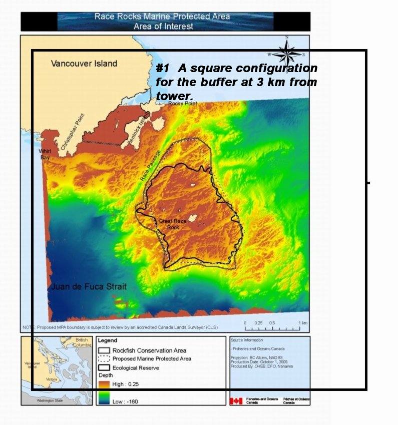
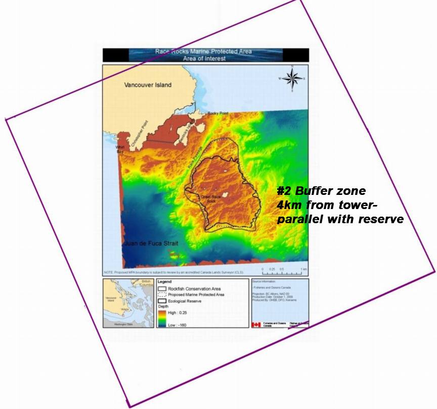
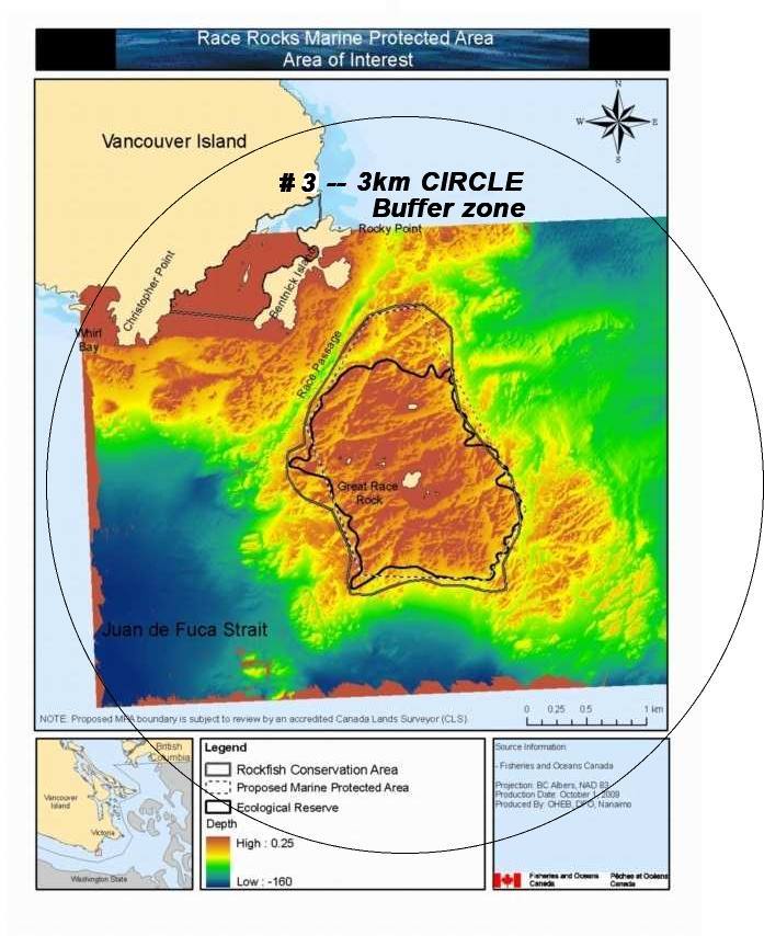
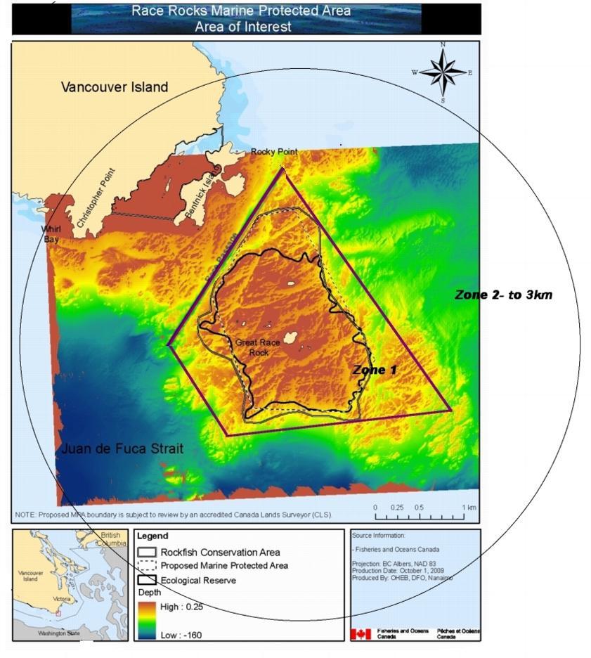

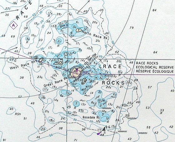
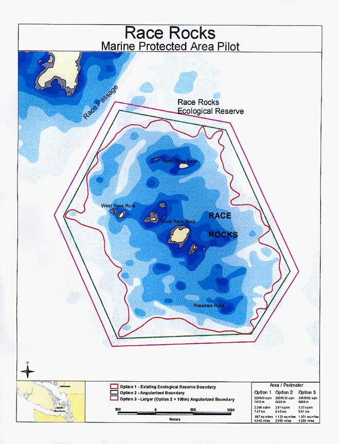
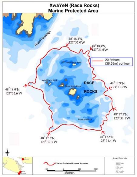
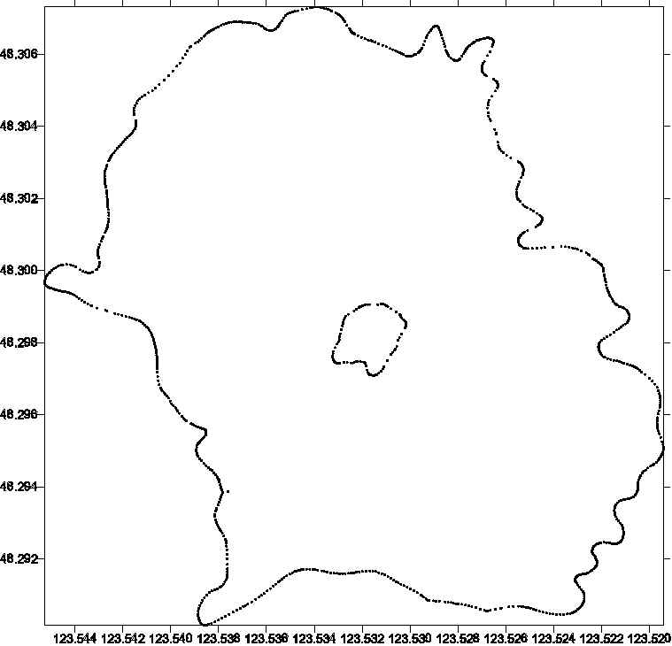
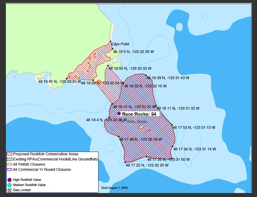
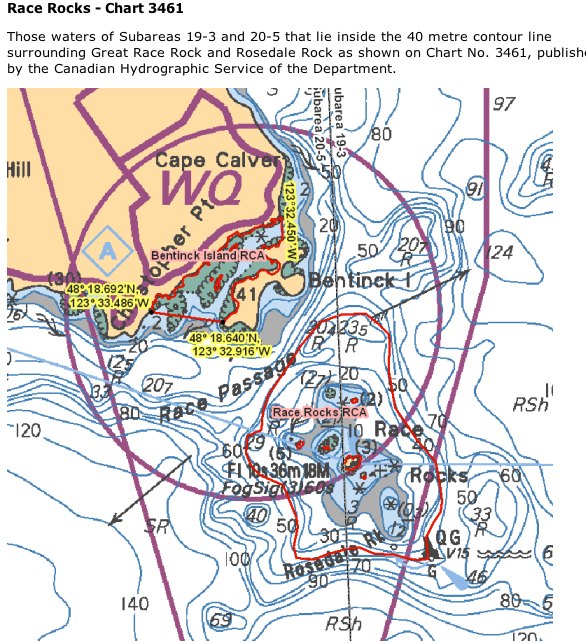
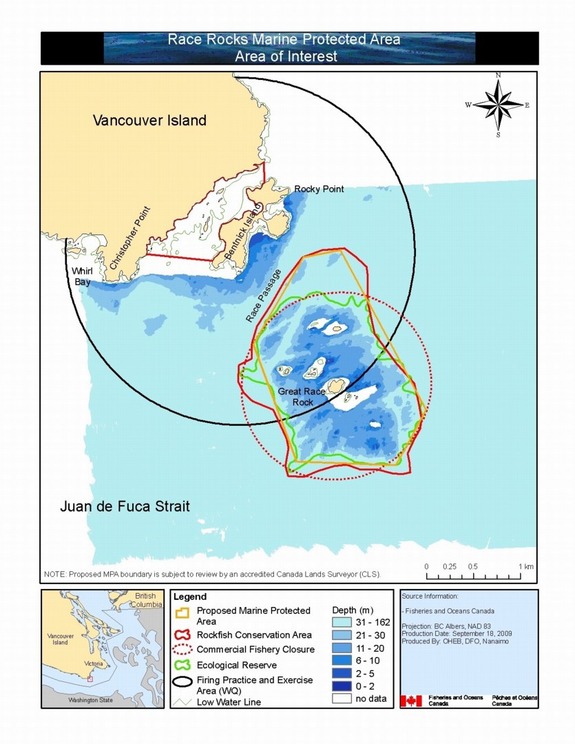
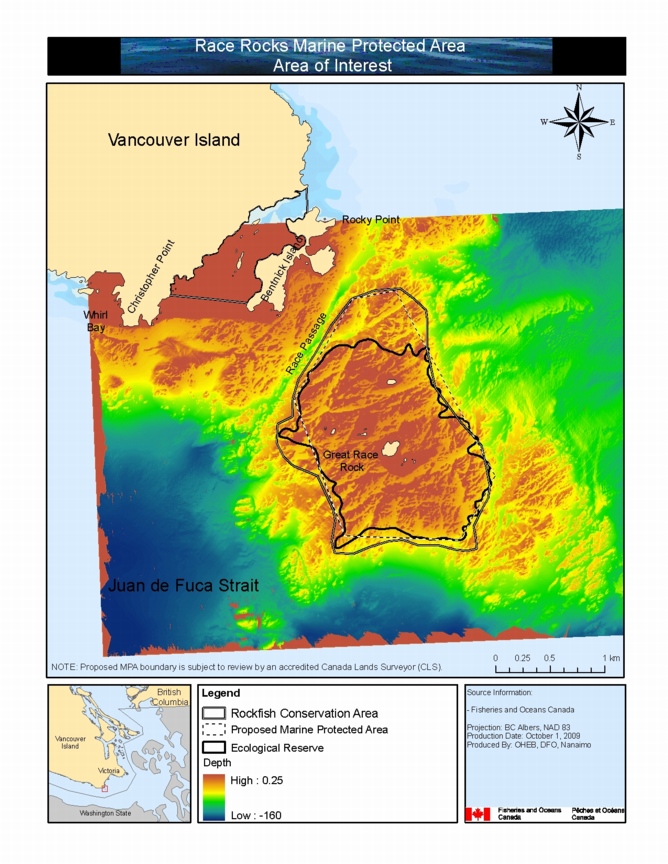
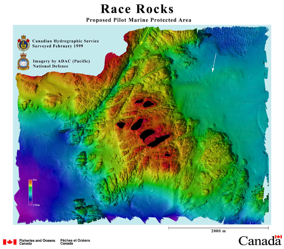
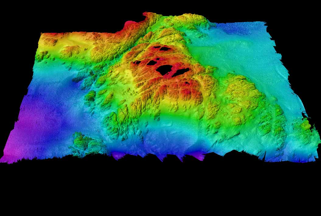
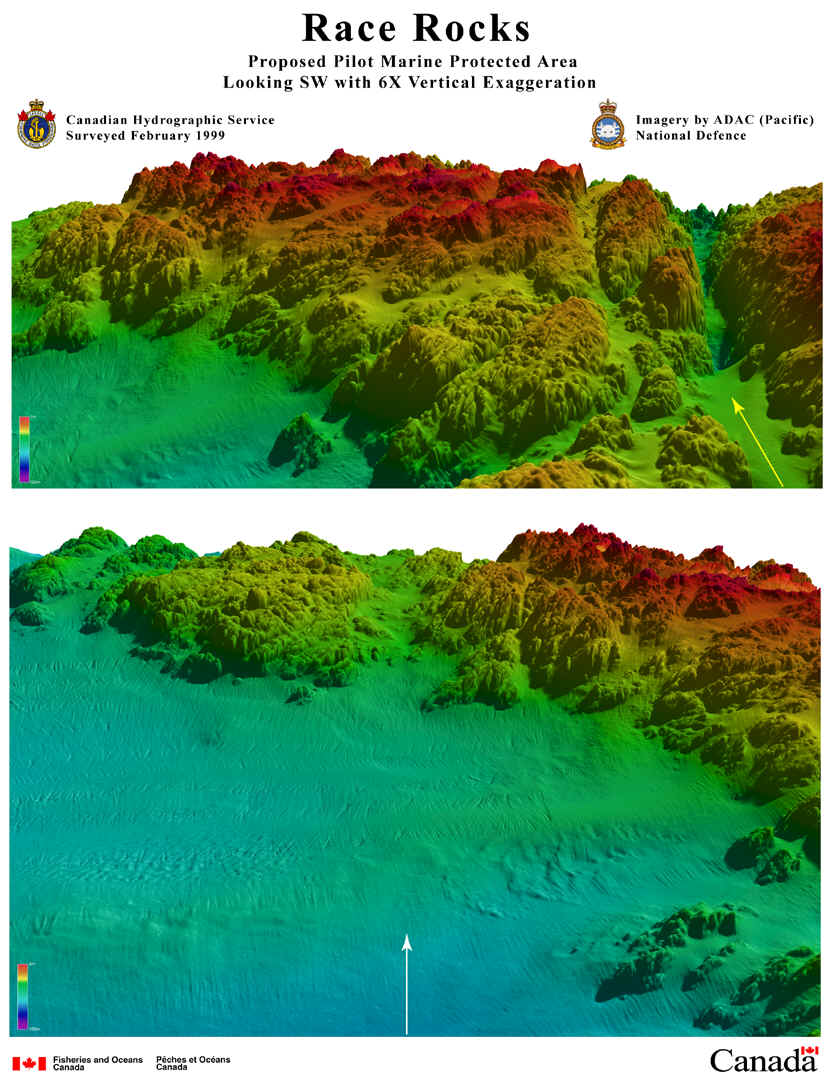
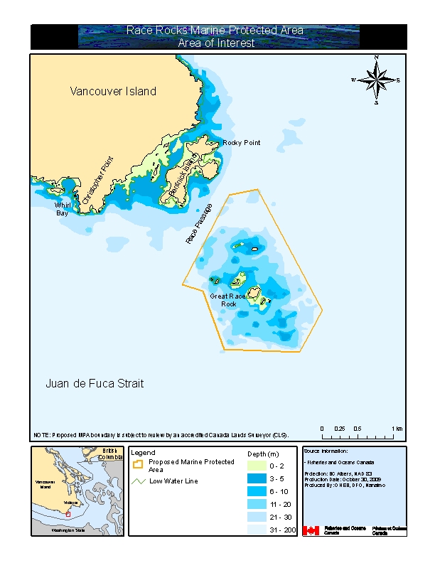 Proposed boundary areas
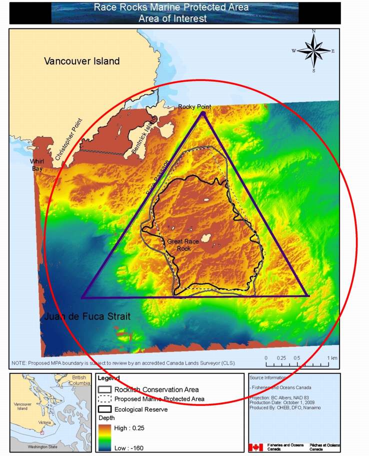
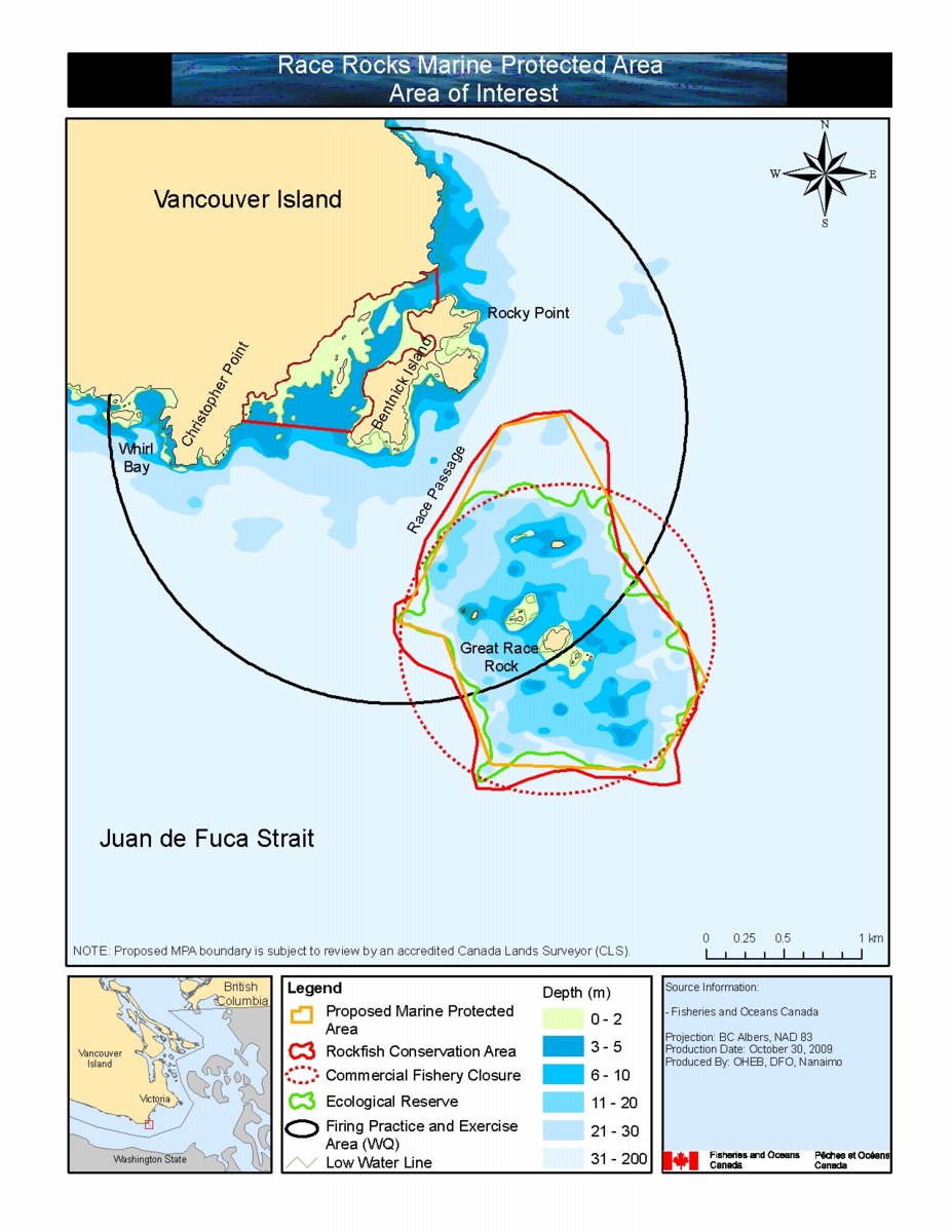 Proposed boundary areas detail
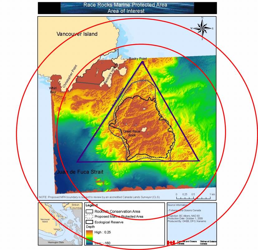