The First Nations of the North West Coast- Coast Salish; Connections to the environment, involvement in conservation.

The First Nations of the North West Coast-
Coast Salish; Connections to the environment, involvement in conservation. With a Case Study of
First Nations involvement in the development of the
Race Rocks Marine Protected Area off Vancouver Island .
Sarah C. Fletcher, April 17, 2000
INTRODUCTION:

COAST SALISH AND THE ENVIRONMENT:
a) Aboriginal rights and land claims in British Columbia
b) Fisheries and Resource use
c) Coast Salish ties to the environment
d) Land Management and Ties to the Environment: The 13 moons system
e) The Bamberton Town Development Project as a model for environmental management in British Columbia
CONCLUSION:First Nations involvement in conservation and decision making:

BIBLIOGRAPHY

INTRODUCTION:

Among the First Nations of the North West Coast there are 13 different language families, making up 13 ‘nations’. The Coast Salish are part of the Salishan language family, forming a cultural continuum from the north end of the Strait of Georgia to the southern end of Puget Sound, covering coastal regions of British Columbia and Washington, including parts of Vancouver island. Within this large group there are a number of bands; some more closely related (linguistically) than others. Western archeologists believe that the First Nations of the North West Coast have occupied the region as of c.9000BC. The various bands argue that they have been living in that region, interacting with their environment, from time immemorial.

The Social Organization of the First Nations of the North West Coast, including the Coast Salish peoples, allowed for the combination of a clan system with a social class system. The institution of the Potlatch can be seen as being what mediated this combination. The Potlatch is a feast system found among the societies of the North West Coast based on reciprocity. Although the chief of a lineage or village organized a potlatch, it was only with the whole community working together that it could be a success. It permitted the creation of an economy that was intrinsically linked to social status, based on the concept of redistributive exchange among lineages, clans, and villages; with the lineage being the principle productive unit in the society. Although the institution of the potlatch is weaker today than it was before contact, it is still in existence. With the revival of First Nations cultural practices, the potlatch is being used to demonstrate, to the provincial and federal governments, the unity and power of various groups on the North West Coast. It is being used to support the rights of First Nations to self-determination and self-government. The potlatch system, being based on the accumulation and redistribution of surplus resources and handcrafted goods, could only have developed in a lush environment with many resources. The rich environment of the Northwest coast, including the expansive marine resources can be seen as being what permitted much of the development of North West Coast society. The various bands and nations of the area, including the Coast Salish, recognized their dependence on the environment and as such, many aspects of their lives and culture were tied to the environment. This tie to the environment still exists today and has become an important factor in land claims issues, environmental conservation, and in other attempts made by the First Nations to redefine their relationship with the state after the era of colonialism

COAST SALISH AND THE ENVIRONMENT:

The Northwest Coast is recognized as a land of abundance, a land rich in marine resources and a diversity of plant and animal species. Increasingly, it is also recognized as a landscape, which to a large extent was managed and maintained by the First Nations peoples who have lived in the region for generations…

(e.g. Turner and Peacock in Press, Anderson 1996)

a)Aboriginal Rights and Land Claims in British Columbia

In 1982 aboriginal rights were recognized and affirmed in section 35(1) of the Constitution Act. Recent court decisions have clarified the issue of aboriginal rights in BC, redefining the legal relationship between the provincial government and the First Nations in the province.

In the Delgamuukw Decision, 1993, the court of appeal held that blanket extinguishment of aboriginal rights did not occur prior to 1871 and therefore, aboriginal rights continue to exist today. Native peoples in BC never ceded their rights to land as according to the Royal Proclamation. This argument wasn’t accepted until a year ago.(Previously the government had argued that the Proclamation didn’t apply to BC as it wasn’t a British colony in 1763 when the Proclamation was accepted.) The NDP government in British Columbia has recently agreed to negotiate compensation for land claims, creating new types of relations with First Nations by giving them some rights to government, land management, and resources, as well as others.

The Van der Peet, N.T.C, and Smokehouse decisions, were all cases involving fishing restrictions which led to the evolution of tests to determine aboriginal rights.1 Aboriginal rights include the rights to engage in traditional activities (fishing, hunting etc. for sustenance, social, spiritual, and ceremonial purposes), and these may be modernized. They are rights, which are vital to the distinctive culture of aboriginal society and are dependent on patterns of historical occupancy and use of land. Included in these rights and a central motivation for First Nations involvement in conservation, is the right to teach the younger generations the cultural practices, which are intrinsically tied to the land. In order for a right to be recognized the provincial and federal courts have determined that it had to be integral to the distinctive culture of the society prior to contact. As a result, before any action occurs on crown land, the province now has to determine if there are aboriginal rights that exist in the area and if the proposed action will infringe on the rights. This policy is now in effect at all times and applies generally to all ministries and officers of the crown overseeing decisions on crown land.2

Sharma, Parnesh, Aboriginal Fishing Rights: Laws, Courts, Politics, Fernwood Publishing, Hailfax Nova Scotia, 1998.
2 Aboriginal Affairs, province of BC. Crown Land Act. And aboriginal rights Policy Framework 1999.

On December 11th 1997, the Supreme Court of Canada issued its landmark decision on the claim to aboriginal title and self government made by the hereditary chiefs of the Gitskan and Wet’suwet’en Nations.(Granting them title and aspects of self government.) This set the stage for redefining the relationship of the First Nations in BC with the state. As a result, all land claims in BC are now comprehensive; referring to land rights, resource rights and rights to cultural traditions as well as political autonomy.

b) Fisheries and Resource use

The fishing industry in Canada is a multibillion dollar business, with an estimated worth of close to $3 billion. In BC the commercial fishery sector is the fourth largest primary industry, with an estimated worth in excess of $1 billion. It is one industry in which aboriginal peoples are economically active. Many native communities along the coast are fishing communities, and with the recognition of native rights in BC they have recently become more vocal in refusing to have their rights ignored. The failure of Canadian Courts to recognize aboriginal fishing rights is a reflection of the colonialist and imperialist ideals that are still prevalent in many aspects of government.3

Fish was an integral part of aboriginal life along the coastal and inland waters of BC. Not only was it a valuable form of food, but it was also revered in song and dance, forming the economic and cultural lifeline of many bands.

“Fishing has been of such importance that it is at the very roots of our cultures; our lives have revolved around the yearly arrival of the rivers’ bounty. And so we cannot speak of fishery without talking of our cultures, because in many ways they are one and the same.”

-Gitskan-Carrier Tribal Council, in Pearse 1982:177.

Taking this into account demonstrates that the restrictions placed on First Nations fisheries had a huge impact on the traditional lifestyles of many communities. In 1990, the Sparrow decision finally recognized aboriginal fishing rights.4 During the course of the trial of Mr. Sparrow, a member of the Musqueam Indian band, (charged with fishing with a net that was too large), the British Columbia Court of Appeal found that existing aboriginal rights had not been extinguished.

3 Sharma, Parnesh Aboriginal Fishing Rights: Laws, Courts, Politics, Fernwood Publishing, Hailfax Nova Scotia, 1998.
4
Thom, Brian, Aboriginal rights and Title after Delgamuukw; an anthropological perspective, McGill Universtiy, 1998

As such it was determined that aboriginal food fishery was entitled to constitutional protection, and that protection, with the exception of conservation measures, gave aboriginal fisheries first priority over the interests of other users. This included commercial fisheries. The decision was then appealed, but was upheld in the Supreme Court of Canada. This was an important victory for native peoples in the recognition of aboriginal rights, however these rights are still limited.5 However, for a Canadian Court to declare that the economic interests of a major industry were less deserving than those of aboriginal peoples was previously unheard of. Before the Sparrow decision, aboriginal peoples had no legal rights to fish for food or for any other reason. (i.e. Ceremonial, economic etc.)

.

Although they now have these rights in theory, in practice they are still overshadowed by commercial fisheries and government bureaucracy. First Nations can now be seen as having more rights over their marine resources, however, their access to other natural resources remains restricted be government policy. In many ways, this is in direct opposition to the cultural and traditional base of the North West Coast societies, whose history and heritage have left them with strong ties to their land and to the environment.

c) Coast Salish ties to the environment

Traditionally, the various bands and tribes within the Coast Salish language group lived in a seasonal round; with large, central, permanent villages in the winter, and temporary summer campsites. For the First Nations on the Coast of British Columbia and Washington, the ocean was the central source of food extraction. In their food production nothing was wasted. Families had a wide variety of food resources. Surplus food was exchanged with affinal relations for wealth items needed in the Potlatch. Maintaining family relations was therefore of high priority, with extended family being as important as the nuclear family. The local group was also of great importance in the social organization of the Salish bands. Members of a local group didn’t have affinal or cosanguinal ties, however they do consider themselves to be the descendants of a common ancestor. Above all else, the local group served to connect the people to their land. Membership to a local group gave individuals the right to use names, (associated with status in the institution of the Potlatch) and to tell stories that connected them to their ancestors. The Salish peoples relied on their environment for survival. As such, they developed a very special relationship to their land, with their traditions and oral history linking them into the environmental and seasonal cycle of their territories.


5 Section 1 of the charter of rights and freedoms allows for the infringement of constitutionally guaranteed rights if it can be justified according to a test and section 33 allows legislative action to override charterguarantees. This allows for the limitation and control of aboriginal rights.


Transformation stories were an important way in which the Coast Salish made sense of their world and connected themselves to their environment. The stories form a conceptual bond between members of a local group.6 The Coast Salish peoples include plants, animals, rocks, and places in their reckoning of kin. This provides some insight into the cultural importance of the current political struggles over rights to resources and land. The social organization of the native societies of the North West Coast operate on the basis of reciprocity. The Salish believe that these obligations of reciprocity extend from obligations to kin and community, to the environment in which they live. This can be understood when the oral histories and transformation stories of the Coast Salish Nations are taken into account. They believe that their ancestors, spoken of in stories, were transformed into the natural features present in the environment and surrounding their ancestral villages. This aided in creating the special relationship to nature, animals, and the environment, which is still prevalent in Salishan traditions today.

6 Thom, Brian, Coast Salish Transformation Stories: Kinship, Place and Aboriginal Rights and Title in Canada, Department of Anthropology, McGill University, 1998.

Non-human ancestors, such as elements in the environment, are seen as part of the community and make up an important aspect of personal identity. Places are connected to people through kinship. They are seen as having a sense of community, history, and spiritual power. Ties to the land, as demonstrated in stories, are integral to the culture of the natives of the North West Coast. In the Sparrow case, 1990, Judge Lamer overturned the previous ruling (McCeachern) which had judged that oral histories were not permissible as evidence in land claim negotiations. As such, stories and oral histories can now be used as evidence for rights and title to land.7

Stories provide the Coast Salish peoples with the right to engage with the non-human world in various economic pursuits, tempered with the obligations and respect required, by the ancestors, towards non-human kin. From this flows the necessity for aboriginal peoples to be involved at all levels of the resource management process. The right to have a meaningful say in how natural resources are managed gives the First Nations a great deal of leverage in present negotiations.8


7 Thom, Brian, Connecting Humans to non-humans through kinship and place, draft 1997.
8 Thom, Brian Transformation stories: Kinship, Place and Aboriginal Rights and Title in Canada, Department of Anthropology, McGill University 1998.


d)Land Management and Ties to the Environment: The 13 moons system9

The 13 moons system is a strategy that was developed by the Coast Salish people for survival. It focuses on cycles, allowing the harvesting of resources at specified times and guiding the social and ceremonial aspects of life. Religion and ritual guide the movements through the seasons, while the stories associated with each moon serve as connections between religion and resource management. The system of the 13 moons makes ecology and religion inseparable.10

As an example of the 13 moons system, Sis’et the elder moon is the most important time of year ceremonially. It is a time for character building, focusing on family and interpersonal relationships. It occurs around January and is also the time of year that conservation practices are taught to younger generations. It is a time when families are gathered together, children learn how to work, taught by their elders.11 Whereas education in the Western system emphasizes individuality, the 13 moons system has a strong community focus. Each of the moons is associated with stories, certain types of weather, economic and cultural activities.

The Coast Salish bands of today believe that the social problems that many reserves are currently experiencing are because they lost control of the family institutions by losing control of their connections to the moons. The loss of the principles guiding the 13 moon system has led to dislocated culture and spiritual beliefs. As a results many elders are now trying to re-instill the values taught in the 13 moons into their communities, with the system now being taught in the elementary schools on the reserves. Children are seen as the most precious resource in Coast Salish communities. Many of the rituals and ceremonies guided by the moons reflect this.12 Respect for land is one of the over-riding principles emphasized in the system, accompanied with the idea of “taking only what is needed” creating a base for sustainable resource management.


9 See Appendix I —Seasons and the Moons
10 Paul, Philip Kevin, The re-emergence of the Sannich Indian Map, (report DFO misc.) 1995.

11Claxton, Earl, The Sannich Year, Sannich Indian school board District #63, 1993.

12 “As an example, the children of a community are the ones who carry the first salmon catch of the year up the beach. This ties together the importance of children and the environment. The children then put back the salmon bones [into the ocean] and thank the salmon, emphasizing the cycle.”- Taken from audio recording of Tom Sampson, Elder of the Brentwood First Nations speaking about the 13 moons


The Coast Salish First Nations believe in the hereditary right to land and traditions, determined by hereditary names, which are connected to their history and myths of creation. The 13 moon system guides their interaction with their environment; it stresses the importance of ancestors and leads the Coast Salish to see themselves as the youngest of all creation, as students who must learn from their environment. It also recognizes that as ‘children’, they still have a lot to learn from their environment. By looking at the 13 moon system, which links places, and the environment to ancestors and cultural traditions, the full complexity of land claims issues are brought forward. As well, the principles guiding the recent involvement of several bands of Coast Salish in marine conservation efforts are illuminated.

e)The Bamberton Town Development Project as a model for environmental management in British Columbia

“People who are dependant on local resources for their livelihood are often able to assess the true costs and benefits of development better than any evaluator coming from the outside.” -Berkes (1993)

On August 14th 1994, the South Island Development Corporation submitted a letter to the environmental assessment project office, stating their intention to seek project approval for the Bamberton Town Development Project . This included plans to redevelop the former Bamberton cement plant and surrounding privately owned lands; leading to the creation of a fully integrated new town, 32 km north of Victoria. This was the first project to fall under the auspices of the Environmental Assessment Act of British Columbia (Bill 29). The act requires that the potential impacts of proposed development projects be assessed, including the environmental, economic, social, cultural, and health effects on First Nations peoples traditionally residing in the development area. 13 It has been suggested that research on First Nations traditional land use be carried out under four frames of reference: Taxonomic (species identification), spatial (distribution of species), temporal (seasonal variation in species distribution and abundance), and social perspectives.14 The social frame of reference includes the way Indigenous peoples perceive, use, allocate, transfer, and manage their natural resources. Traditional knowledge cannot be used in isolation from the social and political structure in which it is embedded.15

The Environmental Assessment Office of BC recognizes that First-Nations will have to play a critical role in the decision making processes involving land use. They are using principles of recognition, cooperation, and respect to achieve the goal of building a more meaningful relationship with the provinces native peoples. Under the guidance of the Environmental Assessment Office a Comprehensive Heritage Impact Assessment Project was carried out on the Bamberton Town Development proposal, involving the west side of the Sannich inlet. This is the traditional territory of the Sannich, Malahat and Cowichan First Nations, all members of the Coast Salishan language group. The process included a year-long consultation between the proponent of the project (the South Island Development Corporation), the project consulting team, the Environmental Affairs Office, and the six First Nations who had interests in the area. The direct involvement of the First Nations in the management of the project was intended to provide a management plan for the future protection and preservation of the First Nations cultural, spiritual, and ceremonial interests associated with the Bamberton lands and surrounding area.

13 Aboriginal Affairs, Province of British Columbia, Crown Land: Activities and Aboriginal rights, 1998. (gov. doc.)

14Taken from the Report of the First Nations Cultural Heritage Impact Assessment and Consultation; Component- Bamberton Town development project- First Nations Cultural Heritage Study.

15Johannes (1993:35) Bamberton Town Development Advisory Committee

The First Nations management committee involved in the project was composed of elected chief councilors of the six local First Nations with primary interests in the area. These included the Malahat, Tsartlip, Pauquachin, Tseycum, and Tsawout bands, as well as the Cowichan tribes. The management committee structure that evolved was the first to provide a meaningful process for direct First Nations involvement in the co-management of a project that had the potential to affect their lands. The process of the study also provided a means of communication between all interest groups. The meetings of the management committee were open to all interested members of the First Nation communities, and as such, they provided an open forum for discussion of all the issues and concerns involved.

Many aspects were included in the First Nations cultural heritage study in the Bamberton Town Development assessment. There was a compilation of the aboriginal use of the area (based on documentary and oral research), traditional use areas inventory, archeological resources inventory, ethno-botanical surveys, and an examination of spiritual, sacred, and culturally sensitive areas.16 It also looked at the socio-economic components and the economic opportunities that could potentially be derived from the project. After outlining the traditional and contemporary uses of the land surrounding the proposed development, the report looked at the importance of these activities to indigenous peoples today and their perceptions and concerns relating to the potential loss of these should the proposed Bamberton Development proceed. 17


16 Report on the First nations Cultural Heritage Impact Assessment and Consultation: Component Bamberton Town Development Project- Introduction and Background, Environmental Assesment Office

17Taken from the report on the First Nations Cultural Heritage Impact assessment and consultation, Results part I: the First Nations context, Environmental Assessment Office, British Columbia.


The Bamberton analysis used the 13 moons system as a reference, recognizing that the spiritual and economic aspects of the environment are not separated for First Nations peoples. In this way they also recognized the connection between religion and resource management. The use of the religious system’s emotional power and intellectual authority in promoting the conservation of resources and teaching environmental knowledge was emphasized by the First Nations involved in the study.

The Bamberton Town Development study has been hailed as a model for how the planning of major land development projects can proceed with the meaningful participation of interested First Nations. It could act as a precursor for greater First Nations involvement in regional land use planning.


CONCLUSION: First Nations involvement in conservation and decision making:

“The People of the Salish Sea recognize the close relationship between land and sea. They have witnessed first hand the impacts of development on marine resources in the Strait of Georgia and Juan de Fuca. These impacts have altered traditional life.” – Tom Sampson, Elder of the Brentwood First Nations

On September 1st, 1998, The Honourable David Anderson, the minister of Fisheries and Oceans in British Columbia at the time, gave a landmark speech announcing the creation of Marine Protected Areas (MPAs). 18 In the plans of an MPA the necessity of getting First Nations involved in Marine conservation and resource management was stressed. The concept of Marine Protected Areas arose from the development of an Oceans Strategy based on the principles of the Oceans Act (1997). These included ideas of integrated management, sustainable development and an ecosystem based precautionary approach. Above all, The Oceans Sector was assigned to develop this strategy with the collaboration of federal agencies and other levels of government, including First Nations.

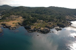
The mandate of the Marine Protected Areas includes the protection of fisheries resources, endangered species and habitats, unique habitats, and marine areas of high biodiversity. 19 The Honourable David Anderson announced that the site of one of the two pilot MPAs was going to be Race Rocks, an area that had previously been an ecological reserve, established in 1980 by the provincial government.20 It is an island off the extreme southern tip of Vancouver Island, 11 nautical miles from Victoria. As a pilot Marine Protected Area Race Rocks is providing the opportunity to learn and test different applications of MPA assessment, legal designation, and management as well as addressing the concerns of local First Nations, (namely Coast Salish bands).

Race Rocks has been an important part of Coast Salish First Nations for generations. The area is known in the Klallum language as , meaning ‘swift waters’. According to Anderson, the cultural values of the First Nations are consistent with the values behind MPAs. Their establishment will not affect First Nations opportunities to fish for food, social, or ceremonial purposes, and the development of Marine Protected Areas is consistent with the long term direction of future treaties between the First Nations and the two levels of government in BC. First Nations will be fully involved in the development of an effective decision making process for Marine Protected Areas in Canada.21

Lester B Pearson College, an international school that was involved in the creation of the Race Rocks ecological reserve, is also involved in the stewardship of the new Marine Protected Area. Pearson College carries out a schools program on the island for local elementary school groups. In the past, this has focused largely on aspects of marine biology, and environmental conservation. The program is now also being used to introduce students to the role of marine coastal ecosystems in the culture of First Nations, including ceremonial interaction with the ecosystem as well as traditional sources of food. In this way they are hoping to ensure the sustainability of resources by enabling students to recognize their role in the stewardship of marine resources.

The hallmark of the Marine Protected Areas are that they require the cooperation of many different groups. The process of setting up the pilot MPA has been a collaborative effort, involving Becher Bay First Nations, Pearson College, Navy representatives, environmental groups, Fisheries and Oceans, BC Parks, and the Ministry of Environment. Representatives from the Beecher Bay and the T’Souke Coast Salish groups are being consulted in order to determine traditional uses of the area and to ensure regular communication on ecological reserve management issues. It is one of the first projects to attempt this type of collaboration.

18Anderson (1996)

19www. racerocks.com – MPA
20See Appendix II- Speech by David Anderson

21Statement by David Anderson, Minister of Fisheries and Oceans, September 1st 1998.


The involvement of the First Nations in the creation of the MPA has led to the adoption of many of the principles found in the 13 moon system into the management plan. Much of the information from the traditional land use study of the Bamberton Town Development project is also being used as it was the first thorough documentation of the traditional uses of plants and wildlife in the area. The Bamberton project is seen as a model for the future involvement of First Nations in decision making and management processes.

On March 9th 2000, the Beecher Bay First Nations held a traditional burning ceremony near . Its intention was to bring together all the parties working on the project; to provide an opportunity for the non-natives involved to gain and idea of the respect that First Nations have for land resources and ancestors. It was open to all members of the Race Rocks Advisory Board. (those involved in setting up the pilot MPA) As well as representatives from the Federal Fisheries Department, Environment Canada, the Department of National Defense and a group of students and faculty from the nearby Lester B. Pearson College. Members of First Nations from Sooke, Esquimalt, Songhees, and Beecher Bay were present as well as several Coast Salish from the United States. During the ceremony young people served as ‘servers’; it was their role to show respect to the ancestors. Under the direction of the elders present 100 plates of food were burned. (Including salmon, bannock, desserts, juice etc.) According to observers the smoke went straight up, and then down and over the observers, a good sign, reflecting the support of the ancestors. Whenever major decisions are being made it is necessary, in Coast Salish culture, to ask for the advice and approval of the ancestors. This was needed before the creation of the Marine Protected area could proceed and was fulfilled by the burning ceremony. The importance and the need for the ceremony was explained by Tom Sampson:

” Before we can talk and make decisions about this Marine Protected Area Proposal, we must get to know each other on our terms.”-Tom Sampson, Elder of the Brentwood First Nations

As a result of the recent Delgamuukw decision, the relationship between the First Nations in British Columbia, the provincial and federal governments and the general public is in the process of changing. This change will also alter the role of First Nations in decision making processes as they gain more autonomy and work towards their goal of self determination. The Marine Protected Area initiative goes beyond Race Rocks and those directly associated with it. First Nations in BC are looking to (previously Race Rocks ecological reserve) as a model of what role First Nations will play in future processes and interactions with senior levels of government in Canada. As such , the creation of Marine Protected Areas ties together the past and the present. It reflects many of the traditional values of the Coast Salish and their connections to the environment, while leading to the formation of a possible model for First Nations involvement in Canadian politics and decision making in the future.


Bibliography
Barnett, Homer G., The Coast Salish of British Columbia, University Press, Oregon, 1955.

Bierwert, Crisca, Brushed by Cedar, Living by the river, Coast Salish figures of Power, University of Arizona Press, Tuscon, 1999.

Calxton, Earl, The Sannich Year, Sannich Indian School Board, District #63, Victoria, BC, 1993

Coates, Ken S. Summary Report: Social and Economic impacts of aboriginal land claim settlements: A case study analysis, Ministry of Aboriginal Affairs, 1995.

Fletcher, Garry L., The First Nations People and Race Rocks, Race Rocks Ecological Overview, Lester B. Pearson College, Victoria, 1999.

Heaman, Isabel, Summary of Delgamuukw. http://members.tripod.com/arcbc/delgamuu.htm

Paul, Philip Kevin, The Care-Takers: The re-emergence of the Sannich Indian Map, Report DFO-Misc- 1995.

Sharma, Parnesh, Aboriginal Fishing Rights, Laws Courts and Politics, Fernwood Publishing, Halifax, 1998.

Thom, Brian, Coast Salish Transformation Stories, Kinship Place and Aboriginal Rights and Title in Canada, Dept. of Anthropology, McGill University, 1998.

Thom, Brian, Connecting Humans to non-humans through kinship and place; draft 1997.

Thom, Brian, Concepts in Landuse, Stolo curriculum, 1995.

Thom, Brian, Co-management, Negotiation and Litigation: Questions of power in traditional use studies, McGill University, 1997.

Thom, Brian, Aboriginal rights and title in Canada after Delgamuukw, anthropological perspectives, McGill University, Jan. 1999.


A term paper by Sarah C. Fletcher, April 17, 2000presented as part of the coursework for :Anthropology 151-338B : Professor Lambert- McGill University , Montreal, Quebec, Canada


The Beecher Bay Burning Ceremony: 2000

From the minutes of the fourth meeting of the Race Rocks Advisory Board , February 23, 2000 FIRST NATIONS UPDATE :

  • Tom Sampson gave an update on his work with First Nations’ participation in the process. He indicated that there would be a traditional burning ceremony on March 9, 2000 by the Beecher Bay First Nation. The intent of the ceremony is to bring parties together to work on this project and provide an opportunity for non- natives to gain an idea of respect that First Nations have for the land, resources and their ancestors. The invitation is open to all members of the RRAB. The intent is to have all First Nations’ chiefs present from Sooke, Esquimalt, Songhees, and Beecher Bay. The ceremony will be held on Indian Reserve #2 at Rocky Point. Please let Marc Pakenham know about attendance and he will distribute a map to site.
  • Angus Matthews felt that this was a very generous offer by First Nations, it provides an opportunity for all of us to work together and it is not an offer that is given frequently.
  • Gord Hanson indicated that the MPA initiative goes beyond Race Rocks and suggests that First Nations people are looking at Race Rocks in terms of what role they will play in the future processes and their interaction with senior levels of government.

    WCVI07_1060

    Beecher Bay First Nations traditional burial site along the shoreline of Beecher bay

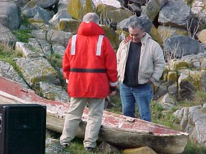
Responding to Tom Sampson’s invitation from the Beecher Bay Band, on March 9, we went in two vehicles through the DND property at Rocky Point on the South Side of Pedder Bay. I had asked for student volunteers from Lester Pearson College and 14 had signed on. The access to the part of the reserve where the ceremony was to be held was through the DND property. When the Beecher Bay reserve was created in the early 1950’s, IR #2 was established on the South side of an intervening seafront strip which is private property owned by another local family. DND property occupies the area to the East of these shoreline properties.

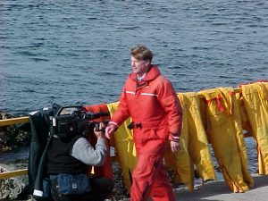
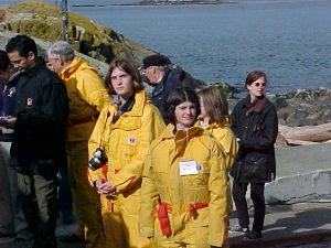
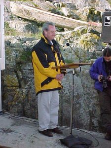
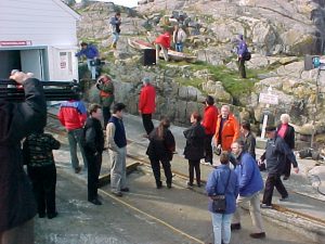
When we arrived, there were members of the Beecher Bay Band, and several representatives of other Bands, including several from the Lummi reserve in Washington State. We were welcomed by Tom Sampson who asked us to observe from an area back to the side of the long table and be quiet while the table was prepared. We talked to Lea Charles and her husband, the band chief Burt Charles. Lea said that the food consisted of salmon prepared in several ways, bannock, which had been baked that morning, and vegetables as well as desert food, such as chocolate. She told me they were up at 5:00 AM in order to bake the Bannock. She was worried by noon that it would not all be done, but they had just made it in time. It looked like a lot of work had been done by the local band in getting everything ready. From a standing table, covered with large bowls of food, several women dished out food onto 100 paper plates The plates were placed on two blankets on the ground. Beside each plate a glass of juice was prepared. The last process in preparation was attaching to each plate a small yellow post-it note bearing the name of an ancestor. Two elderly women sat off away from the food, preparing themselves mentally for the ceremony . All of the first nations people taking part in the ceremony had two dark red smudges of paint on their face. When all the plates had been placed on the ground, the leader from up island, ( the Kuper Island Band) who was conducting the ceremony talked to our assembled group, which included the members of the Race Rocks Advisory Committee; Mark Pakenham and Kelly Francis of Federal Fisheries Department, Dave Chater, Doug Biffard and Jim Morris of Provincial Parks, Jeannie Sparkes from Environment Canada and three representatives of the DND, Duane Freeman ,Lieutenant Commander Bill Laing , the base commander from the Department of National Defence and Howard Breen of the Georgia Strait Alliance, and Gordon Hansen. From Pearson College, Angus Matthews and Garry Fletcher from the committee, along with our Board member Dr. Joe Macinnis and Francoise with the students of Pearson College.

The ceremony leader addressed us saying that the logs for the fire had been laid out in the long row just above where the grave-yard was located. He said the logs should have been placed so that the servers would be facing the East however it was difficult to do that in this location, it seemed that by noting it and emphasizing the importance of things happening when one faces East , it was compensating for this slight deviation in tradition. Two long rows of logs – 20 meters in length were neatly laid making a frame in which crumpled paper and Cedar sticks were contained. The row was a meter in width forming a box for the combustible material inside. On top were laid cross pieces of Cedar to form a table top. He asked us to be very quiet and not to smoke during the ceremony as the spirits of the dead can come up and inflict paralysis as they try to take the cigarette. He also invited the young people to help as servers. This was very important as it was their role to serve their elders to show respect. When the students stood at the front they formed a row, and a server picked up the food and drink, one at a time giving it to the students who walked over with the food a few meters, passing it on to two other servers who then gave it to the two elderly ladies who raised it up in the air and then placed it on the cedar table. The ladies appeared to be acting as intermediaries with the spirits of the ancestors. The students then returned to the end of the line and repeated the process. The main servers were dressed in ordinary clothing, but just prior to starting the food transfer to the burning table, had the traditional ceremonial pink blanket placed over one shoulder and pinned across diagonally. The serving process took almost thirty minutes, after which the two women elders lit the fire along the full length of the table.

Everyone stood back a few meters and for 15 minutes or more the whole table and food burned . Bottles of orange drink bubbled up before the plastic melted. When the fire started going down, more sticks were piled on the top after they went along the edge with a bucket pouring water, probably to cool the outer log along the side, Then the two blankets were carefully folded and placed on top, again the fire burned.

As we sat watching the smoke went straight up in the air and drifted out to sea over the grave yard for the first 10 minutes. Then at a certain point it turned back and swept back down to the earth, enveloping everyone. Lea Charles later told us this was a good sign, and that the ancestors had touched our faces welcoming us to their land, and they now knew who we were. The fire burned vigorously and then subsided to smoking embers. Tom and the ceremony leader talked for a few minutes about what message to convey to us. The leader spoke, saying that the elders were pleased and that indeed they would be with the young servers for the rest of their lives whenever they needed help. There was a very positive feeling about the ceremony in those present. At this time the elders came around with a basin of water and we were all asked to wash our hands and faces, thus ending the ceremony.

Then as we had invited everyone back to Pearson College, an hour later, the students served all the visitors a chicken dinner in the dining Hall. Afterwards there were speeches by Tom Sampson and many of the invited guests from the other Bands. Many spoke in their own language, and were thanking the Beecher Bay group for inviting them. Lea and Burt Charles supervised the handing out of envelopes to each of the visiting groups. This seemed like a very important part of the day, perhaps a confirmation of the friendship of the different Bands. The burning ceremonies sometimes take place twice a year, and it seems that they travel for great distances to attend these occasions. They told us that recently up in Duncan there was a ceremony where 100 blankets were burned. The people wanted to burn clothes as offerings to the ancestors but they reasoned that they didn’t have the right sizes so blankets were deemed more appropriate. Some of the ancestors they were remembering were from the 1800’s, according to Lea Charles.

We all felt that this had been a very special experience in which we had been allowed to participate. Tom had emphasized that whenever major decisions were being made it was the custom of their people to ask the ancestors for advice. This ceremony had taken place on the point of land of their reserve closest to Race Rocks. He said that before they can talk and make decisions about important issues like this marine protected area proposal, we must get to know each other on their terms. This account of the process is not an official one, but rather it is my own interpretation of events. I feel that the story of this event must be passed on as the oral traditions of the First Nations have been passed on for centuries. Although no electronic media could be used to record the event, I have been given permission to record my impressions of the event on this website for educational purposes.

Garry Fletcher
Faculty Lester B. Pearson College
April 9, 2000

RRAB March 22, 2000 Agenda

Race Rocks Advisory Board Meeting- AGENDA
B.C. Parks , 800 Johnson St., Victoria, B.C.
Wednesday, March 22 2000 ; 10h00 — 16h00
Purpose: Fifth meeting of the Race Rocks Advisory Board.

Participants:
Cheryl Borris – Friends of Ecological Reserves
Erin Bradley — Dive Community
Howard Breen – Georgia Strait Alliance
Garry Fletcher – Lester B. Pearson College
Kelly Francis – Fisheries and Oceans Canada
Gordon Hanson – Coast Salish Sea Council
Lieutenant Commander Bill Laing – Department of National Defence (DND)
Dan Kukat — Sport Fish Advisory Board
Angus Matthews -Lester B. Pearson College
Sean Moore – Marina Operators
Jim Morris – BC Parks
Marc Pakenham – Fisheries and Oceans Canada
Tom Sampson – Coast Salish Sea Council
Keith Symington – Canadian Parks and Wilderness Society (CPAWS)
Brian Smiley — Fisheries and Oceans Canada
Dr. Anita Voss – science
Kevin Walker?- Northwest Whale Watchers Association

Observers:
Sean MacConnachie – Fisheries and Oceans Canada
Paul Preston – Fisheries and Oceans Canada
Jenny Sparkes – Parks Canada
Wendy Szanislow – Parks Canada

Agenda

  1. Purpose of Meeting — Kelly Francis
  2. Recommendations for interim management of Race Rocks MPA — facilitated by Judith Cullington
  3. Governance — Marc Pakenham
  4. Developing a Race Rocks Marine Protected Area budget
  5. Updates from meetings/consultations — Marc Pakenham / Jim Morris
  6. Other business

Return to RRAB Index

RRAB Meeting #5, March 22, 2000

RACE ROCKS ADVISORY BOARD MEETING # 5
DRAFT MINUTES
10h00 – 16h30, MARCH 22 2000
BC PARKS, 800 JOHNSON ST., VICTORIA


Participants:
Doug Biffard – BC Parks
Cheryl Borris – Friends of Ecological Reserves
Erin Bradley – Dive Community
Howard Breen – Georgia Strait Alliance
Kelly Francis – Fisheries and Oceans Canada
Gordon Hanson – Coast Salish Sea Council
Nancy Holman — Fisheries and Oceans Canada
Dan Kukat – Sports Fishery Advisory Board (SFAB)
Lieutenant Commander Bill Laing – Department of National Defence
Angus Matthews – Lester B. Pearson College
Jim Morris – BC Parks
Marc Pakenham – Fisheries and Oceans Canada
Tom Sampson – Coast Salish Sea Council
Jennie Sparkes – Parks Canada
Brian Smiley — Fisheries and Oceans Canada
Keith Symington – Canadian Parks and Wilderness Society
Dr. Anita Voss

Regrets:
Garry Fletcher – Lester B. Pearson College
Sean Moore – Local Marina Operators
Scott Wallace

Kevin Walker — Whale Watch Operators Association – North West

Observers:?Judith Cullington — Judith Cullington & Associates. Facilitator :Tiina Kurvits – Fisheries and Oceans Canada, National MPA Coordinator (Ottawa)

Kaaren Lewis – BC Ministry of Environment Lands and Parks, Manager of Planning

Sean MacConnachie – Fisheries and Oceans Canada

***************************************
INTRODUCTIONS & REVIEW OF MINUTES

  • The Race Rock Advisory Board (RRAB) reviewed and accepted the minutes from the previous meeting.
  • Kelly Francis introduced Tiina Kurvits from Fisheries and Oceans Canada in Ottawa.
  • Marc Pakenham introduced Judith Cullington who would be acting as a facilitator in the discussion regarding recommendations.

UPDATE ON ACTIVITIES

Burning ceremony:

  • Tom Sampson thanked the members of the RRAB for participating in the burning ceremony, which helped raise the importance of maintaining respect for the resources and people. Tom discussed the importance of moving forward with restoration and protection of the area and the impacts that today’s world is having on the resources and environment. He felt that the work we are doing here today would not only have an impact on the animals and environment but on all people and most importantly their children. First Nations are the first to feel the impact of changes in the environment. He re-iterated the words of Chief Seattle that the impact we have on the environment will come back and be placed upon ourselves.
  • Angus Matthews thanked Tom for the opportunity and described his experience and that of the students from the College who participated in the ceremony.

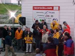
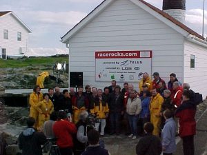
racerocks.com

  • Angus Matthews described the unveiling of www.racerocks.com. Two cameras are now online and can be viewed through Quicktime via the world wide web. Pearson College will be working with First Nations to further develop the First Nations component of the web site. Angus thanked the members of the RRAB who through their organizations helped support the launch of the web site.

Sports Fishery Advisory Board

  • Marc Pakenham thanked Dan Kukat for his work with SFAB and for the letter of support from them supporting the concept of a no-take MPA within the boundaries of the existing Ecological Reserve.
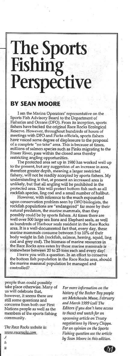
  • Dan Kukat indicated that his sub-committee of the SFAB had been working for the last three years to try to incorporate the view points and feeling of the over 100 000 potential anglers that could be affected by this process. He suggested that governments need to re-focus on the bigger picture of the entire environment. As an example he cited the recent case of the killer whale that was heavily contaminated with toxins. He stated that Fisheries and Oceans Canada requires more funding for field staff to address the existing negative impacts. With respect to Race Rocks it is important for his membership to have the halibut fishing spots excluded from the boundary. He will be meeting within two weeks with the SFAB and intends to table a motion to support this process so that it runs parallel to the sports fishing regulations. Dan indicated that it was important for SFAB executive that this outcome is not precedent setting and that each candidate MPA in the future be recognized as a unique area and situation. Other concerns raised by his constituents include the need for increased science and research for these areas. Finally it is important to recognize that SFAB represents predominantly occasional, recreational anglers that are fishing periodically and not necessarily commercial sports fishing operators.
  • Angus Matthews felt that it was important to recognize that the success of the MPA process at Race Rocks is based on the ongoing goodwill and cooperation of the primary users i.e. the sports fishers. He also indicated that this process can become more efficient and timely if community groups work and meet together and that the MPA process is an experiment for community groups working together for environmental protection.
  • Howard Breen agreed with the positive outcomes to-date and expressed hope that future projects will be as amiable.

RECOMMENDATIONS

  • Judith Cullington led the RRAB through the following list of recommendations.

1) Designation for Race Rocks as a MPA.

  • Tom Sampson raised the issue of treaty and implications to the process.
  • Brian Smiley raised the issue that this designation will be complimentary with the Ecological Reserve
  • Jim Morris suggested that a preface to the recommendations be included describing the existing Ecological Reserve and that MPA will not replace the Ecological Reserve. Marc Pakenham indicated that will be the case.
  • Dan Kukat suggested “…Oceans Act section 35 to compliment the existing Provincial Ecological Reserve.”
  • Consensus reached by the RRAB on recommendation.

2) Boundary recommendations for Race Rocks MPA.

  • Howard Breen indicated that the conservation community would like to have it noted that this size and type of boundary for future candidate MPA is not precedent setting.
  • Brian Smiley suggested that the recommendation as worded is correct but operationally is not necessarily reality as there are other areas within the 20 fathom line on the chart that are deeper than 20 fathoms within the proposed boundary.
  • Keith Symington indicated that despite this precedent setting event, this sort of boundary may not be useful for future candidates.
  • Consensus reached by the RRAB on recommendation.

7) Development of a traditional use study:

  • Tom Sampson agreed to recommendation if First Nations are involved in the development of the study and are supported with resources.
  • Jenny Sparkes inquired for greater clarity would the RRAB be developing this study or First Nations? Gordon Hansen indicated that he is currently working with Fisheries and Oceans Canada and Pearson College to develop context of study and possible outcomes including archaeological study and possible curriculum.
  • Angus Matthews suggested that the RRAB has to recognize Treaty rights somewhere the in the recommendations. Marc Pakenham indicated that Treaty rights are discussed in the pre-amble of the recommendations.
  • Dan Kukat inquired who was going to do this work and who is going to fund it? Angus Matthews indicated that Fisheries and Oceans Canada has provided the funds to the College to begin this project.
  • Tom Sampson felt that the MPA process was not tampering or delaying the Treaty process or vice versa but serving to further it.
  • Jim Morris inquired if there was a terms of reference for this project? Gordon Hansen suggested that First Nations will develop the terms of reference. Jim Morris didn’t see where BC Parks fits into the recommendation. Angus Matthews suggested that if BC Parks has funding that would be great but First Nations will be developing terms of reference and the college and government have to trust the capacity of the First Nation’s elders.
  • Brian Smiley suggested “develop terms of reference for and conduct traditional use study.”
  • Consensus reached by RRAB

3) Recommendations for vessel management guidelines & plan for Race Rocks.

  • Dan Kukat indicated that the best management practices developed by the whale watch operators association support this recommendation and possible suggested elements. He ideally would like to see reference to evolving operators’ association guidelines.
  • Kelly Francis indicated that the goal of today’s meeting was sign-off of recommendations & not necessarily the high level of detail required for the management plan
  • Erin Bradley indicated that the only difficulty from a diver’s perspective is the shoreline restriction. Shoreline restrictions have safety and logistic concerns for divers.
  • Jim Morris suggested change wording of recommendation to “will include” as opposed to “may”.
  • Howard Breen suggested that having only one set of industry guidelines to draw from could be problematic.
  • Brian Smiley suggested including “vessel management and boating guidelines”. Add plural to shoreline restriction.
  • Angus Matthews suggested using a series of voluntary guidelines be tried first. The last bullet acts as a safety valve. He suggests that the development of community voluntary guidelines will be required.
  • Roundtable discussion around voluntary guidelines.
  • Jenny Sparkes suggested that there does not need be a plan but rather a board to evaluate guidelines.
  • Kelly Francis suggested that guidelines would be modified as required.
  • Jim Morris suggested “vessel management guidelines be defined through consultation with various user groups”.
  • Marc Pakenham indicated that it is implicit in all recommendations that there is the need for education.
  • Consensus reached by RRAB

4) Recommendations for fishing activity

  • Gordon Hansen suggested changing “no-take” to a “no-take for a trial five-year period” or “and other conservation measures as recommended by the steering committee.”
  • Keith Symington indicated that he supports the idea of getting rid of the term no-take MPA.
  • Brian Smiley supports getting rid of no-take in regards to science and sampling.
  • Dan Kukat inquired if this MPA is an experiment? Jenny Sparkes responded that the creation of MPA is not an experiment but how First Nations interact and participate is the “experiment”. Gordon Hansen suggested that First Nations support conservation and suggest a 5-year period to research the effects of a MPA have on the surrounding area. Angus Matthews indicated what he understood to be as the “experiment” is having senior government recognize the role of First Nations in involvement of management at Race Rocks. The suggestion of the five-year window is to ensure that we review the goals and achievements of the MPA.
  • Howard Breen suggested that there are numerous First Nations affected by a possible designation. To this end Tom is seeking wording so that won’t prejudice other First Nations and their rights. Marc Pakenham suggested including a commitment to monitoring the effect on the resource with this conservation goal.
  • Howard Breen suggested changing “no-take” to “fully protected“.
  • Dan Kukat believes the intent is no-fishing for everybody. Existing fishery closures be expanded to a fully protected zone for the entire water column to the 20 fathom contour line
  • Keith Symington suggested “existing fishery closure be expanded within no-fishing zone with other conservation measures as recommended by the steering committee”.
  • Jim Morris indicated that under existing Ecological Reserve legislation Race Rocks Ecological Reserve is a no-take zone.
  • Brian Smiley suggested that fishing activity be monitored and reported upon routinely or in a timely fashion.
  • Suggestion to change title to “fishing and harvesting
  • Dan Kukat suggests recognizing no fishing zone to 20 fathoms as opposed to a metric measurement and MPA boundary. This wording is important point in terms of optics, credibility and recognition of sports fishers concerns about the area.
  • Final wording should be “Existing fishery and harvesting closures be expanded to a no-take zone within the 20 fathom contour line with other conservative measures as recommended by the steering committee”.
  • Consensus reached by RRAB

5) Recommendation for diving guidelines

  • Marc Pakenham indicated that Rosedale scuba diving has cited BC as one of the top ten diving cites in the World. In BC, Race Rocks is one of the best in the BC. Therefore Race Rocks is one of the best diving sites in the World.
  • Erin Bradley suggested integrating an ecological approach for divers into education package.
  • Howard Breen suggested changing bullet # 3 to “reefkeepers and other monitoring programs”.
  • Howard Breen referred to submersible activities at Hornby island and would like to see vessel management regime will address submersible activities
  • Brian Smiley suggested …education “and training”.
  • Jim Morris suggested reinforcing the no-take & no-harm concept as set out in the Ecological Reserve.
  • Include “Diving activities be reported and monitored routinely“.
  • Consensus reached by RRAB.

6) Recommendation for the educational activity & research at Race Rocks.

  • Jenny Sparkes suggested “develop spectrum of educational opportunities including internet”
  • Angus Matthews indicated that we need to clarify what is meant by managed by eco-warden. College is happy to monitor activities and participate in approval but does not want the job of regulating.
  • Keith Symington asked if research also includes links to other MPA/fishery goals. Develop learning and research opportunities where there is minimal impact on resource.
  • Jim Morris suggested having a long term plan for monitoring and research. Angus Matthews suggested that the permitting process could address competing needs.
  • Dan Kukat suggested that local marine training certification programs include a Race Rock education component.
  • Consensus reached by RRAB

8) Dredging and Dumping

  • Angus Matthews would like to see dumping include ballast water and grey water.
  • Light house outstation is currently dumping raw sewage and is therefore non-compliant – this will be addressed.
  • Bill Laing brought up that two stroke engines emit oil into the water. Marc Pakenham suggested that under current legislation we can address sewage but not oil from motors. Dan Kukat indicated that the technology required for his industry is not currently available in Canada.
  • Dan Kukat would like to see as a recommendation banning dumping of grey water.
  • Brian Smiley suggested changing “disposal” from “dumping”.
  • RRAB reached consensus

9) Exploration on non-natural resources

  • Howard Breen suggests “No additional pipelines or utility corridors“.
  • RRAB reached consensus

10) Protection of birds

  • Howard Breen inquired if there were any existing prohibitions during nesting season. Angus Matthews responded that there were self-imposed restrictions.
  • Brian Smiley suggested specifying appropriate conservation measures.
  • Dan Kukat suggested that conservation programs and measures exist in other forms and Race Rocks could be easily included in those processes (e.g. Christmas bird count).
  • Brian Smiley suggested changing title to “birds and bird habitat”.
  • Brian Smiley suggested changing to “appropriate protection area”.
  • Consensus reached by RRAB.

11) Protection of marine mammals

  • Change to “protection measures” from “conservation measures”.
  • Add bullet “Partnership with all groups for monitoring” (e.g. South Vancouver Island Whale Watchers Operations Association)
  • Jenny Sparkes suggested using eco-tourism operators as message delivery mechanism. She also suggested incorporating whale watchers operational guidelines into recommendations (develop or adapt those as required).
  • Brian Smiley suggested “develop and implement monitoring and research program“.
  • Howard Breen suggested that in all monitoring programs a review or analysis of compliance be performed.
  • Consensus reached

13) Compliance

  • Include reporting on compliance.
  • Instant reporting structure.
  • Face to face education and compliance.
  • Compliance/reporting for unorganized groups & individuals
  • Angus Matthews felt that regulatory enforcement & response are government responsibilities.
  • Angus Matthews indicated that compliance will be addressed if a human presence is maintained, e.g on-site staffing.
  • Included a recommendation for all levels of government to financially support compliance, research and education.
  • Jenny Sparkes suggested that the emphasis should be on non-regulatory approaches to voluntary compliance.
  • Howard Breen suggested that in regards to funding the First Nation guardian program may be a possible tool. He indicated that a baseline compliance database can be established on the web. Dan Kukat felt that this type of reporting mechanism may not be the most effective. Angus Matthews suggested adding a “reporting mechanism that reports to the steering committee.”
  • Dan Kukat indicated that the WWOANW totally support monitoring and compliance although once a year is not enough. He would like to see an instantaneous monitoring and compliance program be developed. He suggested the development of a compliance reporting mechanism for non-organized vessel users as well. Prefers the term best practices guidelines.
  • Consensus reached.

14) Aviation

  • Include “Helicopter by authorization only” .
  • Include “No over flights”.
  • Consensus reached

12) Governance

  • Jenny Sparkes asked if there would be a new / different advisory board. Kelly Francis responded that there would.
  • Howard Breen if new advisory board is going to require a new terms of reference , then the steering committee should have a terms of reference.
  • Cheryl Borris indicated that participation will be limited by resources. As a result government needs to ensure that capacity is maintained to ensure participation.
  • Howard Breen hopes that the goodwill of this initiative is carried over into other candidates to ensure that a network of protected areas is established.
  • Dan Kukat warned that if the advice of new advisory board is not followed, the process would be fall apart and participation and credibility would decrease.
  • Cheryl Borris reminded the RRAB that the friends of Ecological Reserve have given up their mandate of a bigger area and non- tourist area for the greater goal of establishment of a MPA.
  • Dan Kukat gave example of relationship in sports fishery where Fisheries and Oceans Canada sets vision and advisory boards implements policy.
  • Angus Matthews suggested that a steering committee has to act on a coast wide basis and is comprised of senior managers.
  • Change First Nations “representation” to First Nations “representative“.
  • RRAB reached consensus on the model.

15) Generic items

  • Overall use
  • Sustainability
  • Emergency response
    • Double hulled tankers
    • Low noise vessels
  • Doug Biffard suggested including First Nations name into the title of the MPA.
  • Angus Matthews suggested that the RRAB reconvene if the recommendations are not carried through.

Marc Pakenham will circulate revised recommendations for comments and revision before moving it up the line.

End of meeting 1620

Race Rocks Ecological Reserve – Marine Protected Area (RR ER-MPA) Draft Management Plan

This draft version has been replaced by a newer versionProceed to this link

 Race Rocks Ecological Reserve – Marine Protected Area
(RR ER-MPA) Draft Management Plan

Table of Contents
  • Map
  • Executive Summary
  • Acknowledgments
  • Introduction
  • Objectives, Background and Action?
  • Key Management Issues?
  • Appendix 1: Ecosystem Overview?

Map

Executive Summary

Race Rocks Ecological Reserve – Marine Protected Area will be managed to protect the rich intertidal communities and to encourage educational and research benefits while minimizing impacts.

The relationship with Lester B. Pearson College will be formalized to assist in the education, research and management of the ecological reserve – marine protected area.

The addition of Great Race Rock will be pursued to protect the integrity of the area and its values. If Great Race Rocks is acquired the lighthouse lands will be designated as a Protected Area under the Environment and Land Use Act. The former lighthouse buildings will be operated in conjunction with Lester B. Pearson College (under permit) and other partners as an education and research centre to complement the intent of the Race Rocks Ecological Reserve – Marine Protected Area.

To provide increased protection to resident groundfish populations, BC Parks will, in consultation with DFO and stakeholders and through direction provided by the emerging joint federal-provincial Marine Protected Areas Strategy, investigate the implications and feasibility of implementing full recreational harvesting closures in Race Rocks either under the federal Fisheries Act or designating the area as a Marine Protected Area under the Oceans Act.

 Acknowledgments

The plan was coordinated by Kris Kennett, BC Parks Planner. Garry Fletcher of Lester B. Pearson College developed the initial draft plan, and provided expert knowledge and information. Assistance and expertise was provided by various BC Parks staff including: David Chater, District Manager; Chris Kissinger, Resource Officer; Don McLaren, Area Supervisor; Mona Holley, Acting Wildlife Ecologist; Doug Biffard, Marine Ecologist; Ken Morrison, Conservation Planner and Jim Morris, District Planner and Fisheries and Oceans staff: Doug Andrie, Integrated Coastal Zone Management Coordinator; and, Marc Pakenham, Community Advisor.

Introduction

 The objective of the ecological reserve – marine protected area strategy in British Columbia is the conservation of representative and special natural ecosystems, plants and animal species, features and phenomena. Ecological reserves and marine protected areas contribute to the maintenance of biological diversity and the protection of genetic materials. They also offer opportunities for scientific research and educational activities. In many ecological reserve – marine protected areas, non-consumptive low-intensity uses such as nature appreciation, wildlife viewing, bird watching and photography are allowed and Race Rocks Ecological Reserve – marine protected area – Marine Protected Area features many of these activities.

Race Rocks Ecological Reserve – Marine Protected Area was created to protect a unique small rocky island system, intertidal areas and high current subtidal area in the eastern entrance of the Strait of Juan de Fuca. It is located off the southern tip of Vancouver Island, approximately 17 km. southwest of Victoria. It covers an area of 220 ha and includes nine islets, but does not include Great Race Rock. It was established in 1980 as a result of a proposal by the students and faculty of Lester B. Pearson College.

Purpose of the Race Rocks Ecological Reserve — Marine Protected Area Feasibility Study Plan

This plan defines management goals and objectives for Race Rocks Ecological Reserve – Marine Protected Area. It provides the strategies and guidance necessary to protect and manage the ecological reserve – marine protected area, particularly concerning the protection of natural values, recreation use, research and education uses. The management plan will be the working tool that will require periodic updating. Specific recommendations are documented for a multi-year management program.

Vision

Race Rocks Ecological Reserve — Marine Protected Area will continue to protect the high-energy marine system found in the eastern entrance of the Strait of Juan de Fuca. Research will assist in the management of the ecological reserve – marine protected area and contribute to the knowledge base of marine systems. The ecological reserve – marine protected area will provide opportunities to increase the awareness of students, visitors and the general public about marine systems and the ecological reserve – marine protected area program. Lester B. Pearson College and the surrounding community will play a large role in the education, research and management of this area. Non-consumptive low-intensity educational uses such as nature appreciation, wildlife viewing, bird watching and photography will continue.

OBJECTIVES

  1. To contribute to the protection of marine biodiversity, representative ecosystems and special natural features.
  2. To contribute to the conservation and protection of fishery resources and their habitats.
  3. To contribute to the protection of cultural heritage resources and encourage understanding and appreciation.
  4. To support recreation and tourism opportunities.
  5. To provide scientific research opportunities and support sharing of traditional knowledge.
  6. To enhance efforts for increased education and awareness.
  7. To develop partnerships for management and protection of the ecological reserve – marine protected including monitoring and reporting activities. 
  8. To develop working relationships and educational programs with First Nations

Objectives, Background and Action

 1. Objective:

To contribute to the protection of marine biodiversity, representative ecosystems and special natural features.

Background:

Establishing boundaries is a difficult task, given the problems associated with establishing ‘markers’ in a marine environment. The present boundaries were determined by the normal limits of SCUBA diving and based on the contours of the nautical charts of the time. This has created a situation where features are not captured and the boundary is not well-defined. In addition, metric charts are now the standard which makes the ‘fathom’ description more difficult to determine.

The ecological reserve is protected under the Ecological Reserve Act and the Ecological Reserve Regulations. In addition, the penalty provisions of the Park Act can now be used to assist in protecting the ecological reserve – marine protected area and its values. Organisms in the water column are not subject to provincial legislation, being under the jurisdiction of the federal government.

Fisheries and Oceans Canada can manage marine resources under the Fisheries Act and the new Oceans Act. The Oceans Act, enacted in January 1997, also gives DFO the authority to establish Marine Protected Areas (MPAs). Under this Act, MPAs can be established for a number of purposes, including conservation and protection of: commercial and non-commercial fisheries resourced; marine mammals and their habitats; endangered or threatened species and their habitats; unique habitats; and areas of high biodiversity or biological productivity. Race Rocks Ecological Reserve and its values, particularly the protection of resident groundfish populations, would benefit from the implementation of full harvesting closures under the Fisheries Act or designating it as a Marine Protected Area under the Oceans Act.

Great Race Rock is surrounded by the ecological reserve – marine protected area but is not part of it. It is the largest island in the group and supports a lighthouse station, which is federally administered. Recently, the federal government has been automating lighthouses and returning surplus Crown provincial land to the provincial government for others uses. BC Parks has the opportunity to add Great Race Rock to the ecological reserve – marine protected area.

Action:

In conjunction with DFO, investigate opportunities to expand the boundary from the existing 36.5 m (20 fathom) contour to the 50 m contour.

Investigate opportunities to establish global position system coordinates for identification of the ecological reserve – marine protected area.

Identify ecological reserve – marine protected area boundaries on marine charts and related marine guides and publications.

BC Parks will, through consultations with other agencies, such as DFO and stakeholders and through direction provided by the emerging joint federal-provincial Marine Protected Areas Strategy, investigate the implications and feasibility of implementing full recreational and commercial harvesting closures in Race Rocks either under the federal Fisheries Act or designating the area as a Marine Protected Area under the Oceans Act.

Develop a protocol agreement with DFO to ensure consistent management of the water column and the land base.

Pursue the addition of Great Race Rock to the ecological reserve – marine protected area.

  • Cooperate with Parks Canada and their national marine conservation area feasibility study.

2. Objective:

To contribute to the conservation and protection of fishery resources and their habitats.

Background:

 Race Rocks Ecological Reserve protects a provincially, if not nationally, significant high-current subtidal and intertidal ecosystem. The reserve has ecologically significant and unique assemblages of benthic and pelagic invertebrates. It protects several rare species, including the spiral white snail Opalia, and many rare hydroid species (such as Rhysia fletcheri), that represent unique Canadian or North American occurrences and provides haul outs and feeding areas for elephant seals, sea lions, breeding areas for harbour seals and nesting habitat and migrating resting areas for seabirds.

In 1991, DFO closed Race Rocks Ecological Reserve to commercial fin and shellfish harvesting for all species. Race Rocks is also closed to recreational harvest of shellfish, ling cod and rock fish but remains open for salmon and halibut. Fishing for salmon still occurs inside the ecological reserve – marine protected area boundaries, whereas halibut is largely found in the deeper, adjacent waters.

Oil spills next to the ecological reserve – marine protected area could potentially be devastating to the sensitive intertidal communities, marine mammal and bird populations. The ecological reserve – marine protected area probably has a relatively short time for self cleansing given its location in a high current zone with high energy exposure from both easterly and westerly winds in the Strait of Juan de Fuca. However, options for protection of this valuable ecosystem in the event of an oil spill should be investigated.

The lighthouse station on Great Race Rock poses two threats to the marine environment. First, sewage from the residences is being discharged directly into the water column. Although the extreme tidal flushing lessens the impact, this situation is not appropriate in an highly valued marine environment. Second, electricicty is provided by diesel generators, and diesel spills pose a hazard to the environment. Alternative technologies for sewage treatment and power generation, such as composting toilets and solar energy, should be investigated. Composting toilet has already been installed in assistant’s residence.

Visitors to the ecological reserve – marine protected area can severely impact the delicate underwater communities by anchoring, or disturb nesting sea birds or resting sea lions and seals by landing or passing too close to these small islets. Boats driven in the reserve at high speeds endanger the marine mammals.

Action:

Develop a marine management plan to ensure protection of intertidal and rare species and to ensure that elephant seals, harbour seals, California and Steller’s sea lions, and seabirds are not disturbed on their haulout and nesting sites.

In conjunction with Lester B. Pearson College and commercial tour operators, develop a code of conduct for visiting the ecological reserve – marine protected area to ensure protection of natural values and to maintain a high quality educational experience (including speed restrictions).

Discourage landings on islands through the provision of information and permit requirement.

Discourage anchoring in the ecological reserve – marine protected area through the provision of information.

In conjunction with Marine Protected Areas Strategy initiative, work with DFO in consulting all stakeholders to explore the implementation of full harvesting closures under either the Fisheries Act or the Oceans Act in order to assist in the protection of resident groundfish populations.

Ensure the recognition and clear information of the boundaries of the ecological reserve – marine protected area, speed limits and its protective status are clearly described in the BC Sports Fishing Regulations, on marine charts and guides.

In conjunction with the Oil Spill Recovery Information System (OSRIS), develop and register a strategy for protection of the ecological reserve – marine protected area in the event of an oil spill.

Work with the federal government to clean up and improve the site, including the removal of the present sewage disposal facilities and diesel tanks. Pursue opportunities for compensation. Investigate opportunities to utilize alternative technologies. Monitor technology that supports more intensive use remotely with less impact on the ecological values. Institute a monitoring program to determine marine and terrestrial site degradation or enhancement within the ecological reserve – marine protected area.

3. Objective:

To contribute to the protection of cultural heritage resources and encourage understanding and appreciation.

Background:

One of the main objectives of the ecological reserve – marine protected area program is to provide opportunities for scientific research. Race Rocks Ecological Reserve has been very successful at fulfilling this objective through the interests and actions of Lester B. Pearson College. The college undertakes and assists in most of the research conducted at Race Rocks. The students and faculty provide local knowledge, orientation services and willing assistants to other researchers. They also monitor permanent transects and conduct their own research as part of their course requirements.

BC Parks encourages research that contributes to the long-term protection and understanding of ecosystems. Research priorities reflect BC Parks’ mandate, with emphasis on conservation objectives, acute and chronic management problems, and rare and endangered species. To achieve this, research proposals are subjected to a systematic review process. The collected data are required to be made available and shared with the scientific community. As required by the Ecological Reserve Regulations, researchers must require a permit through BC Parks to legitimize their activities.

In the past, Lester B. Pearson College developed a good working relationship with the Coast Guard and the lighthouse keepers. The College was able to use some of the buildings to assist in their research. With the automation of lighthouses, Lester B. Pearson College has taken the opportunity of formalizing the use of the surplus buildings for a two-year period ending in 1999 and presently (since March 1997) employed the former light keepers to stay at Race Rocks. The College proposes to continue to utilize the facilities as an education and research centre.

Action:

With assistance from Lester B. Pearson College and other researchers, develop a long-term research and monitoring plan to minimize impact to ecological reserve – marine protected area values and maximize research opportunities and benefits.

Ensure all researchers have permits.

Operate buildings on Great Race Rock as a research and education centre, as funding permits. Work with community groups such as Lester B. Pearson College and other partners for the ongoing operation and funding for such as facility through a long term permit.

Develop a comprehensive permit with Lester B. Pearson College which define roles and responsibilities for education, research and management.

4.) To support tourism recreation and tourism ( this objuective was not completed inthe original)

5 Objective:

To provide scientific research opportunities and support sharing of traditional knowledge.

Background:

Education is another objective of ecological reserve – marine protected areas. Since the late 1970s, Lester B. Pearson College has been using the ecological reserve – marine protected area as an outdoor classroom and educational facility for students from both the college and local schools. In addition, groups like Friends of Ecological reserve, naturalists, and commercial operators visit the ecological reserve – marine protected area as part of their education programs.

Films and live televised programs such as the “Underwater Safari” series assist in developing an appreciation of the biodiversity with little impact on the ecological reserve – marine protected area. Approval for filming takes into account the purpose of the filming and the type of footage in relation to the purpose of the ecological reserve – marine protected area and the current inventory of ‘stock’ footage available.

The Internet is another means of education. In 1995, Lester B. Pearson College established files connected to their website with information on Race Rocks Ecological Reserve – marine protected area – Marine Protected Area, an ecological reserve – marine protected area publications list and intertidal photographic transects. Since that time the site has expanded to include more records of research, profiles of organisms, tidepools, as well as history. This has raised awareness globally and has resulted in students from other parts of the world undertaking comparative studies.

Race Rocks has a colorful marine history, with the ships that sunk as a result of the rocks and the building of the lighthouse. Little is known about First Nations historical interests and use of the ecological reserve – marine protected area. The college has established an archive on the internet of relevant historical information and images.

Action:

Undertake proactive measures to provide educational information to the public and visitors. Ensure accurate information in fishery regulations, provide information at points of entry (such as marinas); ensure the ecological reserve – marine protected area is mapped on marine charts and navigation guides.

Work with Lester B. Pearson College and other community groups to provide: low impact educational opportunities for schools and the community; offsite educational opportunities; and information on the Internet.

Continue to permit filming for only educational and research purposes. Develop stock footage to respond to standard filming requests.

Monitor the level of educational use and take management actions where necessary and in consultation with Lester B. Pearson College, commercial tour operators and others.

Develop, in consultation with Lester B. Pearson College and First Nations, educational information on ecosystems and the cultural and marine history of Race Rocks Ecological Reserve – Marine Protected Area.

Update existing Race Rocks Ecological Reserve – Marine Protected Area brochure to reflect management direction established in this plan.

 5. Objective:

To permit educational opportunities that have minimal impact to the ecological reserve – marine protected area and increase public awareness, understanding and appreciation for Race Rocks Ecological Reserve – Marine Protected Area and its values.

Background:

Ecological reserve – marine protected areas are established to support research and educational activities. Visitation to the waters surrounding Race Rocks Ecological Reserve – marine protected area – Marine Protected Area has been increasing, particularly those engaged in wild life viewing and diving. Uncontrolled, uninformed and excessive use could result in: behavioral changes or injury to marine mammals and seabirds; poaching of sealife; or physical injury or mortality from handling or improper dive techniques. Given the proximity of the ecological reserve – marine protected area to Victoria and the interest in these types of activities, commercial and recreation use will continue to grow.

Given the roles of ecological reserves – marine protected areas, uses that occur at Race Rocks should contribute to education or research objectives without negatively impacting the natural values. This may include commercial tours.

Action:

Subject to an impact assessment, only issue permits for commercial activities that are educational or research oriented.

Work with the volunteer warden, Lester B. Pearson College, to provide annual orientation session for commercial operators and tour guides. Continue to provide public information to increase awareness of the ecological reserve – marine protected area, the potential of ecological impact of various activities, and the need for caution in the ecological reserve – marine protected area. This would include: brochure; accurate information in BC Sports Fishing Regulations; information at points of entry; mapping on marine charts and navigational guides; internet/web site.

Work with commercial operators and researchers to develop a code of conduct within the ecological reserve – marine protected area to ensure protection of the natural values and to maintain a high quality educational experience. Develop a monitoring system with Lester B. Pearson College, site guardian, researchers and commercial tour operators to ensure appropriate behavior of diving and wild life viewing companies and other visitors.

Develop an outreach program and stewards program to assist with the management, and to develop respect for the ecological reserve – marine protected area and its values.

Discourage anchoring in the ecological reserve – marine protected area.

As per the Ecological reserve – marine protected area Regulations ensure that commercial operators in the ecological reserve – marine protected area have permits for their activities.

6. Objective:

To enhance efforts for increased education and awareness.

Background:

Commercial and sports fishing, nature tours, marine traffic, and explosives testing occur in the waters surrounding the ecological reserve – marine protected area. Presently, a part of Great Race Rock is administered by the federal government and partly by Lester B. Pearson College. Although most of the land base will be returned to the Province, the tower, which has been automated, will continue to be administered by the Canadian Coast Guard.

A number of federal and provincial initiatives for planning in the marine environment are either proposed or underway. These include the Pacific Marine Heritage Legacy, Marine Protected Areas Strategy and strategic planning for marine areas that is consistent with the Vancouver Island Land Use Plan.

Action:

Establish communications with CFB Esquimalt to determine the impact of nearby explosives testing on, the ecological reserve – marine protected area, and develop mitigative measures if necessary.

Work with DFO to lessen the impact of fishing, whale watching, seal and sea lion observing and bird watching.

Before Great Race Rock property reverts to the Province, work with federal government to clean up and improve site, including the removal of sewage disposal facilities and diesel tanks. Pursue opportunities for compensation. Investigate opportunities to utilize alternative technologies.

Develop protocol with Coast Guard for their continuing operation of the light tower, including helicopter landings, marine access, repairs.

Work with federal and provincial agencies in marine planning initiatives.

7. Objective:

To develop partnerships for management and protection of the ecological reserve – marine protected including monitoring and reporting activities.

Background:

Under the volunteer program, BC Parks has an ecological reserve – marine protected area warden program to provide on-site monitoring and reporting on ecological reserve – marine protected areas. Since the establishment of Race Rocks Ecological Reserve – Marine Protected Area, the Biology and Environmental Systems faculty and students at Lester B. Pearson College have taken on the role of warden. They were greatly assisted by the former lighthouse keepers stationed at Race Rocks who monitored activities in the ecological reserve – marine protected area and reported violations such as commercial fishing, shooting of sea lions and oiled birds on islands. Since the automation of the lighthouse, the college has an interim agreement with the Coast Guard to use the facilities for the next two years and they have generated private funding to keep the former lighthouse keeper in place as a guardian until March 1, 1998. The role of the site guardian is to support Pearson College’s activities on the island and alsoupport the College’s ecological reserve – marine protected area warden duties (e.g. provide information and report violations).

BC Parks is now developing a broader conservation stewardship initiative under the volunteer program. This program will encourage community involvement in the stewardship of parks and ecological reserve – marine protected areas. Given the interest in Race Rocks Ecological Reserve – marine protected area – Marine Protected Area and its proximity to an urban centre, there are opportunities to implement the program here. The integrity of the ecological reserve – marine protected area will be assisted by involving tour operators and other interests in the stewardship of Race Rocks.

Action:

  • Work with Lester B. Pearson College as host warden to assist in the management of the ecological reserve – marine protected area. Develop a protocol agreement to define relationship and outline roles and responsibilities for education, research and management, including operation of research facility on Great Race Rock.
  • In consultation with the volunteer warden, Lester B. Pearson College, develop opportunities for operators, naturalists and others to contribute to the stewardship of the ecological reserve – marine protected area.
  • Develop procedures to report violations in order to assist with enforcement.
  • Work with Lester B. Pearson College to provide a presence or guardian to assist in information distribution, education, monitoring and reporting of violations.
  • Work with DFO and the Coast Guard to enforce site-specific fisheries regulations and objectives.

8Objective:

To develop working relationships and educational programs with First Nations

Background:

First Nation interests and traditional uses of Race Rocks are not documented. A good working relationship between BC Parks and the First Nations people is needed to ensure BC Parks is fulfilling its fiduciary obligations and to develop a mutual understanding of the values of the ecological reserve – marine protected area and its ongoing protection.

Action:

Consult with representatives from the Beecher Bay, T’souke, Songhees and Esquimalt First Nations to understand the traditional uses of Race Rocks ecological reserve – marine protected area.

Ensure regular communication on ecological reserve – marine protected area management issues.

  • Investigate opportunities to undertake a traditional use and education study.
  • Establish joint management initiatives.

KEY MANAGEMENT ISSUES

Relationship with Other Land Use Planning

Ecological Reserve – Marine Protected Area Boundaries

Cooperation with the Federal Government

Cooperation with Lester B. Pearson College

Management of Research Activities and Facilities

Management of Education Activities

Management of Recreation and Commercial Activities

Conservation and Representation

Surrounding Land Use

Community Stewardship

Relationship with First Nations

KEY MANAGEMENT ISSUES

Relationship with Other Land Use Planning

Management planning processes provide a mechanism for public review and support for management strategies. In this respect, an ecological reserve – marine protected area management plan must be considered in terms of its relationship with other land use strategies.

In June 1994, the provincial government announced the Vancouver Island Land Use Plan. This plan recommended that strategic planning occur for marine areas. Marine planning units have now been identified and planning framework statements summarizing values and capabilities have been prepared for the next level of planning. Race Rocks and surrounding areas are included in this process.

The marine environment of the Pacific coast is not well represented in either federal or provincial protected areas systems. The federal and provincial governments are committed to establishing a system of marine protected areas and are developing a strategy to this end. A separate but related initiative is the Pacific Marine Heritage Legacy (PMHL), where the federal and provincial governments are working to form a network of coastal and marine protected areas along the southern Pacific coast. Race Rocks Ecological Reserve – Marine Protected Area is situated adjacent to a study area for a national marine conservation feasibility study which will be initiated in 1998-99 as part of the PMHL Program.

 Key Management Issues

Ecological Reserve – Marine Protected Area Boundaries

The ecological reserve – marine protected area includes an area of ocean, nine small islands and reefs bounded by the 36.6 metres contour, which is an outdated notation that does not follow natural features. Because of the presence of the Canadian Coast Guard light station, Great Race Rock has not been included in the ecological reserve – marine protected area. With the decommissioning of these stations, Great Race Rock is available to be added to the ecological reserve – marine protected area to enhance its integrity.

Cooperation with the Federal Government

Jurisdictional responsibilities for the management of the marine environment and marine resources are shared between the federal and provincial governments. For example DFP is responsible for organisms in the water column. The Coast Guard is presently reponsible for the management of Great Race Race Rock. The province has jurisdication over the other islands and the land under the water column. The provincial government is working with federal government agencies of DFO, Parks Canada and Environment Canada to develop and implement a marine protected areas strategy, and with Parks Canada to implement the PMHL program. The Canadian Forces Base (CFB) in Esquimalt tests explosives in the area, which may impact the ecological reserve – marine protected area’s values. Cooperation with the Coast Guard, DFO, Parks Canada and CFB Esquimalt is essential to ensure the best protection for the ecological reserve – marine protected area.

Cooperation with Lester B. Pearson College

Lester B. Pearson College was instrumental in the establishment of the ecological reserve – marine protected area. The faculty and students of the Biology and Environmental Systems program at Pearson College are long-time volunteer ecological reserve – marine protected area wardens. They are actively involved in research and education activities and provide an important monitoring function. Lester B. Pearson College has a temporary agreement with the Coast Guard to operate a research station at the lighthouse on Great Race Rock. Clarification of roles and responsibilities of both Lester B. Pearson College and BC Parks are needed to ensure successful management of the ecological reserve – marine protected area.

Management of Research Activities and Facilities

Race Rocks Ecological Reserve – Marine Protected Area provides outstanding marine research opportunities. Lester B. Pearson College has been the principal research agency and has developed a good database for the ecological reserve – marine protected area and its values. The College has pursued options to use the decommissioned lighthouse buildings as a research and education facility and guardian base.

Management of Education Activities

Given the proximity of an urban centre, Race Rocks Ecological Reserve – Marine Protected Area provides excellent educational opportunities. Lester B. Pearson College uses Race Rocks for their marine ecology program for college and local school students and naturalists. Tourism operators from Victoria offer educational nature tours as well. These activities must be managed to ensure protection of the values of the ecological reserve – marine protected area.

Management of Recreation and Commercial Activities

Commercial and non-commercial recreation activities such as wild life viewing, diving, boating and nature appreciation occur in the ecological reserve – marine protected area, both in the water and on land. These activities require cooperative management with the federal government, tour operators and recreational users to ensure that the values of the ecological reserve – marine protected area are maintained.

Background Summary

The Race Rocks Ecological Reserve – Marine Protected Area Background Report (Appendix 1) provides information on the ecological reserve – marine protected area to provide the basic information and assist in understanding the rationale behind the management plan.

Plan Implementation

This section compiles all the actions listed through this plan into three categories.

The implementation plan is divided into three components: ongoing management, priority one actions, and priority two actions.

Ongoing Management

Discourage anchoring and landings on islands in the ecological reserve – marine protected area through the provision of information.

Undertake proactive measures to increase awareness of the ecological reserve – marine protected area, the potential of ecological impact of various activities and the need for caution in the ecological reserve – marine protected area. This would include providing information such as the ecological reserve – marine protected area brochure at points of entry and ensuring accurate information and mapping in BC Sports Fishing Regulations, marine charts and navigational guide.

Only issue permits for activities that are educational or research oriented. Ensure all researchers and commercial operators have permits.

Work with Lester B. Pearson College and other community groups to provide: low impact educational opportunities for schools and the community; offsite educational opportunities; annual orientation session for commercial operators and tour guides; and information on the Internet.

Continue to permit filming for only educational and research purposes. Develop stock footage to respond to standard filming requests.

In consultation with Lester B. Pearson College as the ecological reserve – marine protected area warden, monitor the level of educational use and take management actions where necessary. This may include a site guardian to assist in information distribution, education, monitoring and reporting of violations to BC Parks.

Establish communications with CFB Esquimalt to limit testing near, and impact on, the ecological reserve – marine protected area.

  • Work with DFO and the Coast Guard to protect the values of the ecological reserve – marine protected area and to lessen the impact of fishing, whale watching and seal and sea lion observing.

Ensure regular communication with First Nations on ecological reserve – marine protected area management issues.

Priority One Actions

Develop a protocol agreement with DFO to ensure consistent management of the water column and the land base.

Pursue the addition of Great Race Rock to the ecological reserve – marine protected area. ( done in 2002)

Support the application of Park Act Regulations and penalties to ecological reserve – marine protected areas.

Cooperate with federal and intergovernmental initiatives such as Pacific Marine Heritage Legacy, Marine Protected Areas Strategy, Parks Canada’s national marine conservation area feasibility study, and other marine planning initiatives.

Work with operators and researchers to develop code of conduct within the ecological reserve – marine protected area to ensure protection of the natural values and to maintain a high quality educational experience.

Work with the federal government to clean up and improve site, including the sewage disposal facilities and diesel tanks. Pursue opportunities for compensation. Investigate opportunities to utilize alternative technologies.

With assistance from Lester B. Pearson College and other researchers, develop a long-term research and monitoring plan to minimize impact to ecological reserve – marine protected area values and maximize research opportunities and benefits.

  • Develop a protocol agreement with Lester B. Pearson College to define relationship and outline roles and responsibilities for education, research, and management issues, including operation of a research facility on Great Race Rocks. Develop a comprehensive research and park use permit with Lester B. Pearson College.

Operate buildings on Great Race Rock as research education centre, as funding permits. Work with community group such as Lester B. Pearson College for the ongoing operation and funding for such as facility through a long term permit.

Develop a monitoring system with Lester B. Pearson College, guardian, researchers and operators to ensure that appropriate behavior of diving and whale watching companies.

Develop protocol with Coast Guard for their continuing operation of the light tower, including helicopter landings, marine access, repairs.

Develop procedures to report violations in order to assist with enforcement.

Consult with representatives from the Beecher Bay and T’souke First Nations to determine their traditional use in the ecological reserve – marine protected area.

Priority Two Actions

Develop a marine management plan to ensure protection of intertidal and rare species and to ensure that elephant seals, harbour seals, California and northern sea lions, and seabirds are not disturbed on their haulout and nesting sites.

In conjunction with DFO, investigate opportunities to expand the boundary from the existing 36.5 m (20 fathom) contour to the 50 m contour.

Investigate opportunities to establish global position system coordinates for identification of the ecological reserve – marine protected area.

In conjunction with the MPA Strategy initiative, pursue the feasibility of establishing Race Rocks as a marine protected area under the Oceans Act.

In conjunction with OSRIS, develop and register a strategy for protection of the ecological reserve – marine protected area in the event of an oil spill.

Develop, in consultation with Lester B. Pearson College and First Nations, educational information on ecosystems, history and culture of Race Rocks Ecological Reserve – Marine Protected Area.

Develop outreach program and stewards program to assist with the management, and develop respect for the ecological reserve – marine protected area and its values.

  • In consultation with Lester B. Pearson College, develop opportunities for operators, naturalists and others to contribute to the stewardship of the ecological reserve – marine protected area.

Investigate opportunities to undertake a traditional use study.

Appendix 1: Ecosystem Overview

Introduction

The objective of the ecological reserve – marine protected area program is to preserve representative and special natural ecosystems, plants and animal species, features and phenomena. Ecological reserve – marine protected areas contribute to the maintenance of biological diversity and the protection of genetic materials. Scientific and educational activities are the principal reasons for ecological reserve – marine protected areas. Most ecological reserve – marine protected areas are open to the public for uses that are non-consumptive, educational, low-intensity such as natural appreciation, wildlife viewing, bird watching and photography.

Race Rocks Ecological Reserve – Marine Protected Area was created to protect an unique small rocky island system, intertidal and high current subtidal areas in the eastern entrance of the Strait of Juan de Fuca. It has ecologically significant and unique assemblages of benthic and pelagic invertebrates. In addition, it is a haul out and feeding areas for seals and sea lions and a nesting and staging area for seabirds.

Ecological Reserve – Marine Protected Area Description

Location and Access

Race Rocks Ecological Reserve – marine protected area – Marine Protected Area is located 17 km south west of Victoria at 123∞ 31.85’W latitude and 48∞ 17.95’N longitude. It is 1.5 km off the extreme southern tip of Vancouver Island at the eastern end of Strait of Juan de Fuca. Given the marine environment, access is limited. A Canadian Coast Guard helicopter pad is located on Great Race Rocks (which is excluded from the ecological reserve – marine protected area). Only seaworthy vessels are able to approach the ecological reserve – marine protected area, given the extreme sea conditions and lack of sheltered moorage.

Size and Boundaries

The ecological reserve – marine protected area is 220 ha to a depth of 20 fathoms (36.6 metres). It is almost entirely subtidal, although nine islets comprise less than 1 ha. The present boundaries were determined by the normal limits of SCUBA diving and the contour lines of nautical charts.

History of Ecological Reserve Establishment

Race Rocks Ecological Reserve – marine protected area – Marine Protected Area was first proposed by Lester B. Pearson College in 1979. Concerned about the effect of increasing visitation and harvesting, the marine biology teacher, Garry Fletcher, and his students sought legal protection. Their goal was to ensure the preservation of marine mammals, sea birds and underwater organisms for future generations. They were assisted by Brent Cooke of the Royal British Columbia Museum, Dr. Paul Breen of the Pacific Biological Station in Nanaimo, Dr. Derek Ellis of the University of Victoria and a host of other advisors. Garry and his students undertook 80 dives to collect data. They compiled background information to support ecological reserve – marine protected area designation including: observation records; species checklists; bottom profiles; tidal currents; salinity levels; and temperature variations. They also offered to undertake the responsibility for stewardship of the area as volunteer wardens. Their role wou be to provide information to divers and advised them of appropriate behavior. They would also continue to accumulate information and serve as assistants to researchers.

With the data collected by Lester B. Pearson College, the Race Rocks area fit the criteria for ecological reserve designation and was proclaimed under Order In Council no. 692, March 27, 1980.

Natural Features

Physical Features

The ecological reserve – marine protected area is almost entirely subtidal, but includes nine islets, comprising less than 1 ha in total. Intertidal and subtidal zones have substrates primarily of continuous rock and a rugged topography which includes cliffs, chasms, benches and surge channels. The location at the southern tip of Vancouver Island, plus the rugged shallow sea bottom, result in strong currents, eddies and turbulence.

Geology

The geology of Race Rocks is volcanic in origin, with the islets being offshore basalts. Granite and quartz intrusive, probably of the undeformed kind, are evident. Sediment basins can be found in subtidal areas.

Oceanography

The important oceanographic features which have a bearing on biodiversity are tides, currents, wave action, water temperature and turbidity.

Tidal currents are a major oceanographic feature of Juan de Fuca Strait. The ebb and flood tides and residual current have a major influence on the water structure. In addition, Race Rocks is a transition zone between the inner waters and the open ocean. For ebb tide that funnels water from the low-salinity, nutrient-rich waters of coastal rivers such as the Fraser and countless tidal marshes along the Strait of Georgia and Puget Sound through the narrow part of the Strait of Juan de Fuca. The flood tides, that bring in water from the nutrient-rich upwellings of the open Pacific Ocean. As tidal flow surges past the rugged topography of Race Rocks results in ‘racing’ current, eddies and turbulence. Currents flow with velocities of two to seven knots and change direction according to tide, wave and wind direction. The wave action is more pronounced at Race Rocks due to the exposure to the outer portion of the Strait of Juan de Fuca. The variability in undersea topography results in waves being reflect, diffracted and refracted in irregular patterns, resulting eddies and complex tides.

The water temperature is generally greater than 7∞ C with no distinct thermocline occurring. Mean surface temperatures are 7∞ C to 8∞ C in January, rising to 10∞ C to 11∞ C in August and September. In summer, the water is slightly cooler during flood than during the ebb tidal phase. Tidal flushing and turbulent currents reduce vertical layering of water masses. Surface salinity values average 31∞ /00 through the years and are characteristic of the waters in the Strait of Juan de Fuca.

Water clarity is seasonally dependent, being largely determined by the phytoplankton content of the water. In the winter, low phytoplankton populations result in good underwater visibility (sometimes greater than 15 metres) except after storms. In the summer , underwater visibility lowers with increasing phytoplankton. There is no significant turbidity due to freshwater run off.

Race Rocks is subjected to strong wave action during southeasterly and southwesterly gales which are characteristic of fall and winter. A prolonged westerly storm may produce swells 3 to 4.6 m high with 1 to 3.24 m high wind waves superimposed. Southwesterly gales produce smaller swells (2.5 to 3.7 m high) because of the limited fetch available across the Strait of Juan de Fuca. During calm periods between gales and the summer, a surge is produced by the low westerly swells (1 – 1.2 m) that are present through most of the year.

Climate

Race Rocks is in the rainshadow of the Olympic Mountains and the end of the wind funnel of the Strait of Juan de Fuca. Often, the ecological reserve – marine protected area experiences weather patterns quite different than southern Vancouver Island. It has an unusually high amount of sunshine the winter months, very seldom recording freezing temperatures. In summer, there is the occasional blanketing of fog.

The winds in Juan de Fuca Strait blow principally from the southeast and northwest. Outward blowing winds occur 50% of the time during the winter (October through March) while the inward blowing winds predominate during the summer (April through September).

Biotic Features

The rich variety and abundance of seashore life of the Pacific coast is due to the nutrient-rich waters, relatively uniform seasonal range of temperature and freedom from winter icing. Excellent light penetration results in the shallow clear waters teeming with plankton. Combined with the varied topography, the ecological reserve – marine protected area has exceptional variety and productivity of marine life and tremendous ecological diversity. Intertidal, shallow water, deep water and rocky substrate ecosystems support encrusting animals and plants capable of withstanding high velocity currents. In the lee of the island, quiet water flora and fauna are extremely abundant.

The marine communities here are unusually luxuriant and rich. The “coelenterate” fauna is perhaps the richest in the world and benthic fauna is abundant and diverse. Species such as Pink Coral, Gersemia rubiformis, and Basket Seastar, Gorgonocephalus eucnemis, that are usually found at much greater depths are found here at several metres. In addition, there is an unusual abundance of ubiquitous species such as Coralline Algae, Corallina sp., and Brooding Anemone, Epiactis prolifera.

Given the nutrients, some organisms grow to a large size. For example, Giant Barnacle, Balanus nubilus, reaches sizes in excess of four inches and the Thatched Barnacle, Semibalanus cariosus, achieves a prickly texture. The occurrence of disjunct echinoderm species such as the seastar Ceramaster articus, numerous specimens of the Cup Coral, Balanophyllia elegans, the Northern Abalone, Haliotis kamtschatkana, and the Butterfly or Umbrella Crab, Cryptolithoides sp., contribute to the unusual character of the subtidal communities.

The ecological reserve – marine protected area contains an abundance of plumose and brooding anemones, Epiactis prolifera, and large numbers of sponges and ascidians. At least 65 species of hydroids, giant barnacles, a variety of colonial tunicates, three species of sea urchins, sea cucumbers, and basket stars adorn the underwater cliffs. Bright pink hydrocoral, soft pink coral, bryozoans and long-lived species of mussels are found here. Other molluscs include chitons, limpets, snails, scallops, and pacific octopus. The rare spiral white snail, Opalia sp., occurs in one limited area. The ecological reserve – marine protected area protects thriving populations of intertidal species that have been severely impacted by sports and commercial harvesting elsewhere. These include three species of sea urchins, goose-neck barnacles and the mussel, Mytilus californianus.

Twenty-two species of algae have been recorded, including extensive stands of Bull Kelp, Nereocystis luetkeana,. In the intertidal zone, over 15 species of red, brown and green algae exhibit striking algal zonation patterns, distinctive to the Pacific coast. Several species of red algae, Halosaccion glandiforme, Endocladia muricata and Porphyra sp., occupy relatively high levels on the intertidal shoreline. Porphyra sp. are particularly abundant in the early spring at higher intertidal levels. Microscopic flagellated euglenoids, Pyramonas, live in the high rock pools, giving them a bright green color. The rock walls of tide pools and the shallow subtidal areas are encrusted with the Encrusting Pink Algae, Lithothamnion sp., and large populations of coralline algae. Dead Man’s Fingers, Codium fragile, rare to this area, is found in two small isolated areas of the intertidal zone on the main island. Over 20 species live subtidally and a dense canopy of bull kelp rings all the islands and extends underwater to 12 metres.

The Surfgrass, Phyllospadix scouleri, is abundant in a narrow band near zero tide level and in the deeper tidepools on the western side of the main island.

Marine Mammals

Over fifteen hundred California Sea Lions, Zalophus californianus, and Steller or Northern Sea Lion, Eumetopias jubatus, haul out on the islets south of Great Race Rocks between months of September and May. In the spring, they tend to move out the area and head north to breed on the Scott and Queen Charlotte Islands. In recent years, 35 to 70 Northern lions and up to 800 California sea lions have used Race Rocks as a winter haul-out.

Several hundred Harbour Seals, Phoca vitulian, inhabit Southwest and North Race Rocks year round, bearing their young in June. Six to eight Northern Elephant Seals, Mirouaga angustirostris, have started to frequent the reserve. Up to 60 transient and resident Killer Whales, Orcinus orca, frequent the waters foraging on the sea lions and seals. A family of River Otters, Lontra canadensis, has also been living in the ecological reserve – marine protected area. Other marine mammals that are occasionally observed in the waters of the ecological reserve – marine protected area are Northern Fur Seal, Callorhinus ursinus, Dall’s Porpoises, Phocoenoides dalli, Gray Whales, Eschrichtius robustus, and False Killer Whales, Pseudorca crassidens.

Sea Birds

Race Rocks serves as a nesting colony and a migration resting area. Glaucous-winged Gulls, Larus glaucescens, and Pelagic Cormorants, Phalacrocorax pelagicus, are the most abundant nesting birds in the summer months. Approximately 235 pairs of cormorants nest on the cliffs of Great Race Rock and on the southern outer island. One hundred and eighty pairs of gulls nest in the high spray zone around the perimeter of the main island and on the small outer islands. Eighty pairs of Pigeon Guillemots, Cepphus columba, nest in rock crevasses on the central island and up to 10 pairs of Black Oyster Catchers, Haemotopus bachmani, nest on the islands. Bald Eagles, Haliaeetus leucocephalus, frequent the area, with groups of 50 birds being sighted on the rocks in winter months. Harlequin Ducks, Histrionicus histrionicus, Surfbird, Aphriza virgata, Rock Sandpipers, Calidris ptilocnemis, and Black Turnstons, Arenaria melanocephala, can be observed occasionally, particularly in the winter. Brandt’s Cormorants, Phalacrocorax penicillatus, and Glaucous-winged Gulls, Larus glaucescens, are the most abundant birds in the fall and winter. Common Murres, Uria aalge, Tufted Puffins, Fratercula cirrhata, Rhinoceros Auklets, Cerochinca monocerata, Ancient Murrelets, Synthliboramphus antiquus, and Marbled Murrelets, Brachyramphus marmoratus,are occasional visitors. Lester B. Pearson College staff reported counting thirteen brown pelicans also on Race Rocks.

The islets of Race Rocks function as suitable alternate habitat for various sea birds that have been forced out of other areas due to environmental disturbances. For example, in the fall of 1974, unusually severe weather conditions off the Queen Charlotte Islands forced the ancient murrelet to frequent Race Rocks.

Fish

Decorated Warbonnets, Chirolophis decoratus, Red Irish Lords, Hemilepidotus hemilepidotus, sculpin, Kelp Greenling, Hexagrammos decagrammus, Ling Cod, Ophiodon elongatus, China Rockfish, Sebastes nebulosus, Tiger or Black Banded Rockfish, Sebastes nigrocinctus, and Copper Rockfish, Sebastes caurinus, swim in ecological reserve – marine protected area waters. Wolf Eels, (Anarhichthyes ocellatus, also inhabit the rock cervices. Salmon species pass through the area including: Pink Salmon, Oncorhynchus gorbuscha; Chum Salmon, O. keta; Sockeye Salmon, O. nerka; Coho Salmon, O. Kisutch; Chinook Salmon, O. tshawytscha.

Historical and Cultural Features

This small group of islets were known to the early sailors as the “dangerous group” . They were subsequently renamed “Race Rocks” by officers of the Hudson’s Bay Company upon the recommendation of Captain Kellet who previously noted the dangers created by the rip tides and current which raced around the islands.

Given that the rocks and reefs of Race Rocks were a danger for converging shipping traffic from Seattle, Vancouver and Victoria, the second oldest lighthouse on the southwest coast lighthouse was built on Great Race Rock. It was constructed of four-foot, cut and fitted granite blocks brought around Cape Horn from England in 1858, build in 1860 and lit on February 7, 1861. It stands 39 metres (105 feet) above the ground. The tower was automated in 1996 and no longer requires light keeper staff.

Despite the Race Rocks lighthouse and another at Fisgard at Esquimalt Harbour, by 1936 at least thirty five vessels had met with disaster in the immediate vicinity of Victoria. The “Nanette” (1860), the “Lookout” (1872), the “Sechelt” (1911), “Rosedale”, “James Griffith”, “Albion Star”, and the “Siberian Prince” are only a few of the ships which were wrecked on or near Race Rocks. Within the ecological reserve – marine protected area lie at least two shipwrecks, the “Nanette” and the “Fanny”, a sailing ship which was built in Quebec.

In 1950, the lighthouse keeper disappeared in Race Passage while trying to row to the mainland for supplies. In 1960, the Department of National Defense installed a bronze plaque on the lighthouse tower to commemorate the centennial of the lighting of this important aid to navigation.

Tenures, Occupancy Rights and Jurisdictions

Water column is in federal jurisdiction and the land, including the sea bottom, is provincial jurisdiction. Great Race Rock is excluded from the ecological reserve – marine protected area and, until recently, was administered by the federal government. With the automation of light houses, most of the island is now being transferred back to the Province. Lester B. Pearson College has a two-year agreement with the Canadian Coast Guard to occupy the site and run a research station from the outbuildings. The College has been successful in generating funding to maintain the buildings and to keep on the lighthouse keeper as a guardian until 1998. The College has applied for a license of occupation with BC Lands to continue their activities there.

The lighthouse has been designated a heritage site under the Heritage Conservation Act. With recent changes to the Heritage Conservation Act, wrecks more than two years old are protected from unauthorized removal of artifacts.

Resource Use Adjacent to Ecological reserve – marine protected area

Fishing

This part of the coast is one of the most productive recreational salmon sport fishing water in British Columbia and in the past sports fishing has been a popular activity in ecological reserve – marine protected area waters. In 1990, the Department of Fisheries and Oceans closed the waters surrounding the ecological reserve – marine protected area to the commercial harvest of fin and shellfish and to recreational harvest of shellfish, ling cod and rockfish. Recreational fishing of salmon and halibut can still occur. Fishers have reported that the ecological reserve – marine protected area is not a good fishing area for salmon and that the halibut recreation fishery occurs in deeper water beyond the bounds of the ecological reserve – marine protected area.

Military

The Naval Base in Esquimalt use the area for testing of weapons. Underwater explosions may be negatively impacting marine mammals in and around the ecological reserve – marine protected area.

Marine traffic

Oil tankers from Alaska, freighters from Europe and Japan with industrial goods ranging from cars to forest products pass by the ecological reserve – marine protected area. Ships used to come within half a mile of the rocks but since designation of the Traffic Separation Lanes, they pass further away. Smaller vessels come close or pass through Race Passage, mainly tenders and fishing boats from Vancouver and Victoria on their way to or from the salmons and herrings grounds in the Pacific. On weekends, particularly in the summer, the surrounding waters are covered with sports fishers and small boats.

Activities

Research

Much of the research activity in the ecological reserve – marine protected area has been undertaken or assisted by Lester B. College, for two reasons. First, the college is close by, located in nearby Pedder Bay. Secondly, the marine ecology instructor, Garry Fletcher, has used the area for educational purposes with his students undertaking many research projects and has an interest in researching the area. The light station complex on Great Race Rock provides a base and sanctuary for the researchers.

Since the establishment of the ecological reserve – marine protected area, the science students, members of the diving service and faculty of Lester B. Pearson College have continuously monitored underwater and intertidal life. They now monitor tidepools and 13 under water reference stations and have installed intertidal and subtidal reference pegs. Students have done original research on the following topics: distribution of barnacles in the intertidal zones in the different exposures; population density study on sea urchins; intertidal anemone Anthopleura elegantisima; limpets; marine mammals acoustic monitoring; Euglenoid; incidence of Imposex in carnivorous snails such as the spindle whelk (Serlesia dira); internal parasites of the Hairy Shore Crab (Hemigraspus oregonensis) and Purple Shore Crab (H. nudas); colonization in a heavy current channel; marine red algae Halosaccion glandiforme populations; and research on biotic association of Giant Barnacles with hydroid species.

The students of Lester B. Pearson College assisted Dr. Anita Brinkmann-Voss (under the auspices of the Royal Ontaria Museum) to identify 65 species of hydroids. Many of these had never been found in North America and is totally changing the classification of these animals, with a new genus and possibly even a new family. The Royal British Columbia Museum has done research on nesting seabirds. Other researchers have studied transient Orca whales, seals and sea lions. Research on northern abalone (Haliotis kamschatkana) as an indicator species for ‘No Take’ marine protected areas was completed in 1997 by Scott Wallace.

Daily water temperature since 1927 and salinity records since 1936 of the surrounding waters have been taken by the staff of the light station. Water currents were monitored by instruments from the Institute of Ocean Sciences with assistance of Lester B. Pearson College in the early 1980s. The present Race Passage Current tables are a result of that research.

Education

Since the late 1970s, Lester B. Pearson College has been using the ecological reserve – marine protected area as an education facility for courses on biology and environmental systems. In addition, they lead school tours in the spring and fall. Up to 150 grade seven students from local schools either visit Great Race Rock for ecology work in the spring. The objectives of this school program are: to gain a first hand experience on the complex marine systems; to instill a respect for marine life and concern for its conservation; and, to develop an appreciation for ecological reserve – marine protected areas. The children often get a tour of the light station, and are introduced to intertidal and subtidal marine life.

Education has been enhanced through live telecasts in the Underwater Safari series, which continue to be broadcast. This experiment in real-time video access for one week in 1992 showed the potential for using technology to provide access electronically to thousands of viewers without impacting the integrity of this sensitive ecosystem. This has raised awareness globally on the “Adopt an Ecosystem” approach.

The Internet is another means of education. In 1995, Lester B. Pearson College established a world wide web page with information on Race Rocks Ecological Reserve – Marine Protected Area and their activities there. This has raised awareness globally.

Other Activities

Generally, there are three categories of visitors to the ecological reserve – marine protected area: 1) boaters who are primarily observing the marine life around the rocks, particularly marine mammals; 2) boaters who come ashore, usually to visit the lighthouse facilities; 3) divers who dive either from shore or from boats. Visitation to the ecological reserve – marine protected area has been increasing, particularly those engaged in whale watching and diving. Concerns are being raised about the affects on visitation on the whales and their foraging activities. Uncontrolled, and unrestrained pursuit of the whales could interfere with behaviors and ability of the whales to feed in this area.

Dive tours are also increasing. Uncontrolled use of the ecological reserve – marine protected area could result in increasing in poaching of sea life, physical injury and mortality from handling and improper dive techniques. These could lead to impacts on the underwater life, for which the ecological reserve – marine protected area is to protect.

Management Considerations

Management of Recreation and Commercial Activities

Activities such as whale watching, commercial diving, boating and nature appreciation occurs in the ecological reserve – marine protected area, both in the water and on land. Activities, their types, and levels of use require management to ensure that values of the ecological reserve – marine protected area are maintained.

Management of Research Activities and Facilities

Race Rocks is well-known and well-used for research purposes, as a result of the efforts of Lester B. Pearson College. The college undertakes and assists with most of the research .

Cooperation with the Federal Government

The ecological reserve – marine protected area legislation pertains only to the foreshore and the land under the water column. The water column, which is an important component of the ecological reserve – marine protected area, actually under Federal jurisdiction.

Cooperation with Lester B. Pearson College

Lester B. Pearson College plays a large role in the management and the research undertaken in the research. Garry Fletcher and his students have been the wardens of the ecological reserve – marine protected area since its creation. They work closely with school groups, naturalist groups, divers and other researchers who visit the ecological reserve – marine protected area, providing information on appropriate conduct and guiding services. With their plans to set up and staff a research centre on Great Race Rock, they could provide an even greater monitoring role.

Ecological reserve – marine protected area Boundary

The 220 hectares of the ecological reserve – marine protected area include an area of ocean, nine small islands and reefs bounded by the 36.6 metres contour. This boundary is difficult to mark and enforce.

Management of Educational Activities

Lester B. Pearson College uses Race Rocks Ecological Reserve – Marine Protected Area for their marine ecology program involving college, local school students, and naturalists. Tourism operators from Victoria also offer natural history tours of the area.

Management of Ecological reserve – marine protected area Values

Sewage disposal on Great Race Rocks, fishing in the ecological reserve – marine protected area for salmon and halibut, military testing and the potential for oil spills are issues that exist on this site.

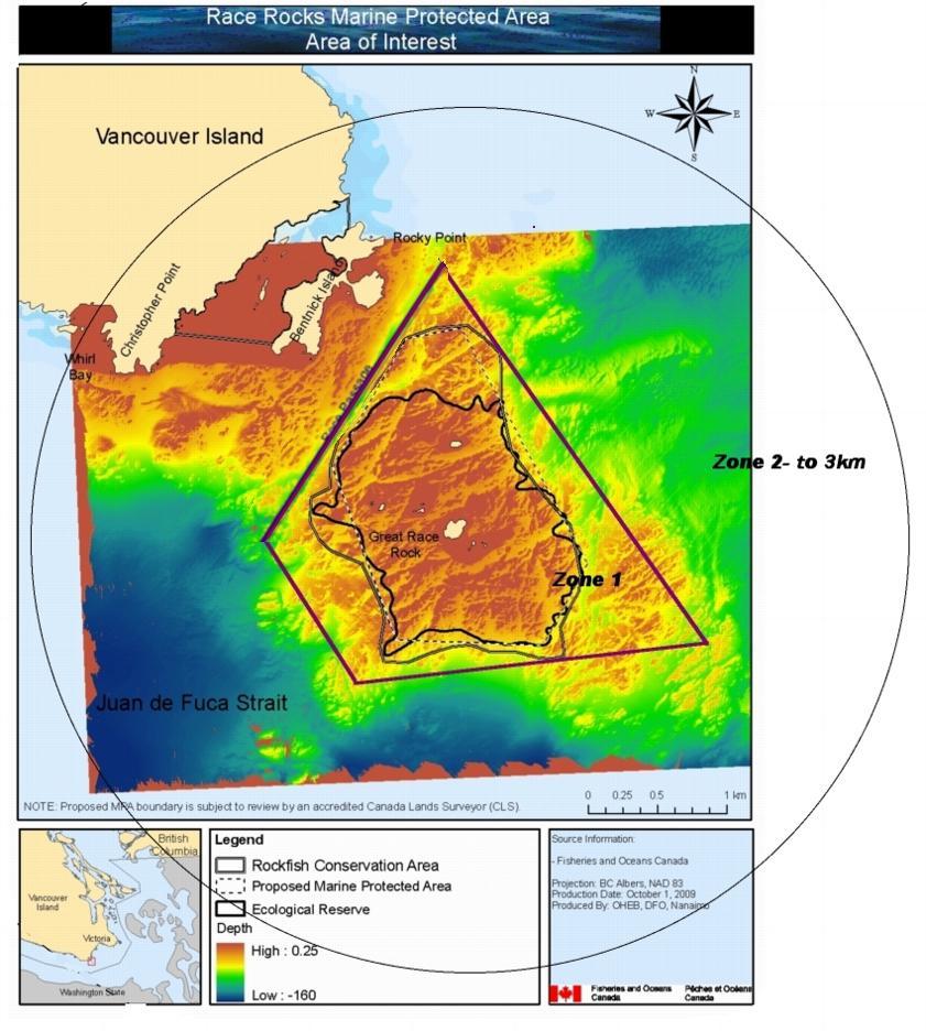


Official Launching of the Millennium Project for Race Rocks

On March 11. 2000 a special gathering ceremony was held at Race Rocks Ecological reserve to recognize the federal governments contribution to the Race Rocks Millennium project, and to ‘officially open the project.

Radios and Microwave Dishes are Installed at the Observatory and at Race Rocks

News update Feb 23-24 

Radio on the Rock….by Peter Seem (PC)
The 35 meter antenna for the microwave reception from Race Rocks which was contributed by Telus is installed behind the observatory at Pearson College.This tower was a decommissioned one Telus donated to the project from another part of BC.

The other part of the installation was at Race Rocks Ecological reserve where the  microwave antenna and transmitting infrastructure equipment were transported and installed in the Lighthouse toweron Great Race Rocks.

PRESERVING A HERITAGE SITE
The Telus crew, along with the help of Pearson’s electrician, Don Nixon, and Dion Jakobsen from Commlink, were presented with a unique problem when they went out to the island. The lighthouse, on which the island-side antenna and transmitter are to be installed, is a Heritage Site. As such, they needed to find a way to install all of the new electrical and data-carrying wires from the base of the tower to up above the light compartment without drilling new holes or cutting into the rock.

Arriving at Race Rocks with the new microwave dish

After looking at a diagram of the tower and examining the structure, they were able to manoeuvre relatively inflexible cable up through existing conduits and ventilation shafts. The transmitter was fixed underneath the stair-ladder, and the dish was attached to the metal cage of the lighthouse and lined up with the dish at the observatory.
Thanks to PC student Peter Seem for this writeup.

racerocks.com Project Update Feb 13, 2000

The week of February 6 through 13, 2000 has plotted more progress for the racerocks.com project.

With only 27 days remaining until the system is scheduled to go on line, daily progress is required so we will meet the project deadlines.

On Monday, Coast Guard officials granted permission for us to temporarily install a 24 inch radio antenna atop the historic Race Rocks lighthouse tower. Required for the transmission of our Race Rocks video
and data signal, the antenna will be fastened by Coast Guard technicians to the ladder structure above the main light room on the tower. We are very grateful to Coast Guard officials Fred Stepchuck and Noelani Taylor for reviewing our request so efficiently.

Wednesday morning Lyle Kosola, the radio engineer from Comlink caught the 7:00 am BC Ferry from the mainland to Vancouver Island along with Telus antenna and microwave specialists Al Mireau, Dave Farley and Rob Robinson. These top Telus staff members pulled together to make the radio link happen. While Chris Blondeau took Lyle and Dave to Race Rocks Al and Rob drove to the top of the hill near Pearson College’s observatory. As the island crew laboured up the spiral staircase in the 140 year old light tower Dave set about the tough task of hand climbing a 200 plus year old Douglas Fir tree. At the 60 foot mark Dave thankfully and somewhat breathlessly reported seeing the top two stripes of the black and white lighthouse. With a strobe light held just in front of a mirror Dave was finally seen in his tree by Chris Blondeau from atop the lighthouse. With two towering trees framing the radio path like goal posts on a ridge Lyle collected the information he would need to determine the tower height required to make all this work. The swell from Tuesday’s storm was still throwing waves at the Race Rocks jetty despite the pleasant day causing the Pearson College workboat Second Nature to plunge on her spring lines so it was decided to evacuate the island crew as quickly as possible. At the antenna location Al determined the best lay out for the tower and Lyle scouted locations for the radio equipment and wiring. A very good day filled with promise.

On Thursday Lyle completed his calculations and determined that the tower height could be reduced to 60′ provided we shot the radio right through the middle of the Douglas Fir “goalposts” on the Rocky Point ridge. Its worth a try. The shorter tower (as opposed to the 100′ considered) will have much less aesthetic impact at the college site, protect a clear sky view for the College’s telescope and, we hope, save Telus a bit of money. The antenna tower was a late addition to the Telus contribution.

Friday was a very positive day for the development of the project. Work on wiring Great Race Island for the network that system designer Ken Dunham has prescribed is 75% installed. Al Mireau from Telus reports that antenna installation will begin on Tuesday February 15. Our ever watchful professional worry specialist Aengus MacIntosh will review the critical time paths at this stage. Unlike the picture 10 days ago this looks like it can actually happen! We have a few wrinkles in our server delivery plans. We meet with Ian Scott our guardian angel at Telus to devise final plans for delivery of the signal to the internet. Ian as always has some creative solutions. We also have a good conversation with Richard Catinus our contact at Apple. We are very keen on using Apple’s remarkable QuickTime software to stream our video on the net. This will of course also commit us to Apple’s computer equipment. Garry Fletcher has lusted for Apple’s new G4 computer. We are very close to a decision. Mid afternoon we meet with John Nightingale, Director of the Vancouver Aquarium Marine Science Centre and his senior science and external relations staff. Their enthusiastic support backed by a significant financial contribution is greatly appreciated. At the end of a network planning discussion with Ken Dunham it suddenly dawns on me that we have spoken with every one of our sponsors and suppliers today and they are all doing their very best for us.

Saturday, members of the public and various interested groups joined DFO and BC Parks staff to review the status of the Race Rocks Marine Protected Area plans. Marc Pakenham the DFO coordinator has lead an exhaustive series of community consultations on the plan along with Jim Morris from BC Parks. Brian Smiley, a DFO scientist gave a compelling presentation about the ecological values of Race Rocks. There appears to be real enthusiasm for the protection of the Race Rocks area and many creative ideas of how the opportunities for public access and educational uses could be accommodated were suggested. The last public presentation on the MPA plan will be at the Olympic View Golf Club on Wednesday February 16, 2000 at 19:00 hrs.

PROCEED TO NEXT UPDATE- FEB 22/2000
Thank you for your interest.
Angus Matthews

RRAB Meeting # 3 January, 2000

RACE ROCKS ADVISORY BOARD MEETING # 3
DRAFT MINUTES
12h00 — 16h00, JANUARY 26, 2000
LESTER B. PEARSON COLLEGE, VICTORIA


Regrets: Duane Freeman — Department of National Defence

Observers: Judith Burke — South Islands Aquatic Stewardship Society

***************************************
INTRODUCTION

  • Nancy Holman DFO Communications and Judith Burke from South Islands Aquatic Society were introduced. Judith will be assisting 2WE Associates with the public meetings.

TERMS OF REFERENCE REVIEW

  • Roundtable discussion and revision of Terms of Reference.

ACTION ITEM: Marc Pakenham to circulate revised Terms of Reference.

BOUNDARIES

  • Marc Pakenham described the results of various information sessions and outcomes to date including: Sports Fishing Advisory Board’s endorsement of the bathymetric model; the diving community’s support of the bathymetric model with an extension to the 50 metre depth contour. The greatest amount of support was for the angularized version (Option 2.)
  • Keith Symington inquired where would 50 metre contour be on the map. Marc Pakenham indicated that he would produce another map showing the 50-metre contour line.
  • Marc Pakenham discussed the option of cutting off the western fingers and extending northern boundaries of the ER.
  • Keith Symington suggested that we need to discuss what is important at the end of the day (e.g. the establishment of the first MPA in Canada).
  • Garry Fletcher suggested that northern point of Option 2 does not need to go further than northern boundary of the ER. Race Passage falls well below the “protection unit” and protection of that area would not provide any added value to the core area.
  • Angus Matthews indicated that the major users of Race Rocks from an operational perspective are one — the sports fishing community, two — the eco-tourism community and three – the dive community. We need to focus on those that are going to be using the area. The existing problems with Option 2 are: 1) the northern point in Race Passage, and 2) western fingers are prime halibut areas.
  • Sean Moore indicated that he needs to have information to hand out regarding boundaries. His experience indicates that the numbers of people that fish in area has been dropping since the inception of the ER and that many people know and recognize the existing footprint.
  • Sean Moore indicated that SFAB totally supports no-take of resident species but is still looking for fishing opportunities for transient species.
  • Howard Breen agreed with Angus Matthews’ remark that boundaries are a “maker or breaker” issue. What is important is getting task completed. He suggested that existing boundaries won’t reach conservation goal, but future network of MPAs will add to biomass for all users.
  • Kelly Francis re-iterated that during consultation or information sessions we are referring to Race Rocks and not all future MPAs. This process may be used as a template but the outcomes may not necessarily be the same.
  • Cheryl Borris felt that the College is the primary constituent at Race Rocks and not fish harvesters. The ER is the land and the seabed and the MPA is water column. There are separate goals for each, but we need to keep them joined. The issue of the MPA is whether it is going to be a no-take or not. First Nations have suggested that they would suspend harvesting for 5 years. Is SFAB willing to do that?
  • Tom Sampson expressed his concern that if this process was to establish a protected area than it should be protected in its entirety. He felt that a larger area would be better because there are other areas for all fishermen to go to. He suggested that First Nations would be looking to look at this project for 4 to 5 years to see if MPAs work. He indicated that the RRAB is too concerned with excluding people out of the area and out of the process, and the focus should be on the fact that we are already out of and not recognizing the natural process.
  • Keith Symington indicated that to facilitate completion of the process he would rather support going back to Option 1 with a no-take provision and that changing the ER boundaries would be viewed negatively by the conservation community.
  • Garry Fletcher indicated that the 20-fathom line boundary of the ER was not based on science but on limit of scuba diving. In 1990, fisheries regulations were put in place to address impact on the ecosystem from harvesting. The RRAB has to come to terms with the fact that this area is not a scientifically defensible in terms of conservation and protection but that there is an urgency to move forward. Future MPAs may need a 20-year study to determine where to put boundaries, but until that time use existing boundaries i.e.. the Ecological Reserve.
  • Jim Morris indicated that the problems lie with compliance, enforcement and education. He suggested a 5-year study plan to examine options of a larger area.
  • Howard Breen suggested that we need a mechanism to ensure that users know when they are in or out of the ER/MPA. The RRAB should not be hung up on boundaries – education /enforcement is the greater issue.
  • Angus Matthews suggested that the essence of problem is compliance and education and that it is very hard to inform people of fishing rules when the rules are not straightforward. He felt that it was critical to collect data as to why people are at Race Rocks and what they are doing.
  • Angus Matthews suggested that with the addition of a radar system they would be able to overlay boundaries on radar screen. He also indicated that they may be able to use strobe lights to signal people when they are in or out of the boundaries
  • Jenny Sparkes suggested that until the objectives of the MPA are defined it is not possible to make a decision on boundaries.
  • Anita Voss inquired when would the boundary questions be decided. Kelly Francis indicated that we have to finish public consultations before boundary decision can be made.
  • Cheryl Borris suggested that maybe step one is to accept the existing ER boundaries as the MPA for now and plan for an incremental approach to addressing changes.

DRAFT MANAGEMENT PLAN

  • Marc Pakenham distributed a copy of an example of a provincial management plan and asked for the RRAB to review it.
  • Marc Pakenham indicated that the current draft management plan does not discuss governance or fiscal/financial implications and discussed ideas of an annual report as a reporting tool.
  • Jim Morris described the province’s requirement for a certain format and management plan specifically for the ER.
  • Angus Matthews indicated that the governments have to work together in the development of a unified management plan. Keith Symington and Tom Sampson both agreed to this point.
  • Cheryl Borris inquired if the Province had a problem going forward with a joint plan.
  • Jim Morris indicated that the only problem is question of format. He indicated that he would go back to his managers to let them to know that the RRAB wants a joint plan.
  • Howard Breen indicated that the one of the reason he was here is to ensure that the governments work together on this pilot.

SCIENCE MEMBERSHIP

  • Marc Pakenham thanked Dr. Voss for her attendance and participation. He informed the board that Scott Wallace has been unable to participate to-date because of workload and remote location. Marc asked for suggestions for another Science representative.
  • Keith Symington suggested Bill Austin from the Cowichan Marine Centre.
  • Gary Fletcher suggested someone from the University of Victoria would be preferable, as they would be able to generate future interest for graduate students.
  • Anita Voss suggested that Bill Cosgrove or Phil Lambert from the Royal BC Museum might be good candidate.

  • Gary Fletcher suggested that Norm Healy from Royal Roads may be interested.

PRESENTATION

  • Gary Fletcher gave a progress report on the www.racerocks.com project.

PUBLIC PRESENTATIONS

  • Marc Pakenham discussed the DND site tour and thanked Bill Laing for hosting the event.
  • Marc Pakenham informed the board of the latest information sessions including the session with dive community who expressed interested in a volunteer warden program. The dive community may develop a code of conduct for divers in the ER/MPA as well as regulations regarding speed limits. Erin Bradley suggested that it was a very useful discussion about compliance and volunteer policing of the area by the people who are using the area.
  • Howard Breen inquired if there was any expression of interest from the divers about sinking a wreck in the MPA. Marc Pakenham indicated there was not.
  • Angus Matthews indicated that there were opportunities for local divers to participate in research at Race Rocks that require a relatively low science background (e.g. through Reefkeepers).
  • Jim Morris indicated he was enthusiastic with the meeting with local divers. He felt that divers do not want anchorage in MPA and may want to include an environmental component in their training.
  • Marc Pakenham discussed the presentation to the Metchosin Regional District and indicated that they will be sending a motion of support for the project.
  • Marc Pakenham discussed the upcoming public consultation sessions and the possible contracting of 2WE Consultants. The target date for these sessions is the second to third week of February.
  • Angus Matthews inquired as to what sort of forum would be used to inform the public of the sessions. Marc Pakenham and Nancy Holman suggested that it would be a combination of radio, and daily and weekly newspapers. Angus Matthews suggested using a Western Community site as well as in Victoria.
  • Angus Matthews suggested also advertising the information on the Internet and that the presentation could use an open house type format.
  • Howard Breen inquired what would be the end date for information sessions. Angus Matthews suggested that it should coincide with last public presentation.
  • After a roundtable discussion around time and location Marc Pakenham indicated that February the 12th from 0930-1530 in Victoria and the 16th in Metchosin from 1930-2130 would be planned for.

OTHER BUSINESS

  • Marc Pakenham discussed the opportunity to use a video teleconference facility to communicate with New Zealand sports fishers and their experience with the establishment of MPAs. Rupert Gale suggested although that was an interesting idea he cautioned that the issues are different in New Zealand than here in terms of target species and the establishment of MPAs.

Next meeting date: Feb 23 2000 1200-1600

Location: 1st Floor Parks Board Room, 800 Johnson St. Victoria

Return to RRAB Index