Executive Summary
Race Rocks was designated an Ecological Reserve in 1980 by the BC Government. In September 1998, Race Rocks (XwaYeN) was proposed as a Pilot MPA (Area of Interest) by DFO. In 2004 Race Rocks became a Rockfish Conservation Area (RCA) to protect inshore rockfish and lingcod and their habitat from recreational and commercial fishing pressures.
A Marine Protected Area (MPA) under the Oceans Act is a are geographically defined areas in the marine environment dedicated and managed for the long-term conservation of nature. Fisheries and Oceans Canada (DFO) designates marine protected areas under the HYPERLINK “http://laws.justice.gc.ca/en/O-2.4/text.html” Oceans Act in order to protect and conserve:
Commercial and non-commercial fishery resources, including marine mammals, and their habitats;
Endangered or threatened marine species, and their habitats;
Marine areas of high biodiversity or biological productivity; and
Unique habitats;
Any other marine resource or habitat as is necessary to fulfill the Minister’s mandate (of Scientific Research).
There is considerable scientific evidence that marine protected areas and networks provide a number of ecological benefits, including the enhanced recruitment of fish species, including those of commercial value, through the protection of spawning areas, larval sources, habitats and migration routes. In addition, benefits of marine protected areas and networks extend beyond the ecological as there are often social, cultural and economic benefits to establishing and managing marine protected areas. On ?????, the Race Rocks (XwaYeN) Pilot MPA received formal designation as an Oceans Act marine protected area. As a result of this designation, the waters surrounding Race Rocks are now a federal MPA.
Introduction
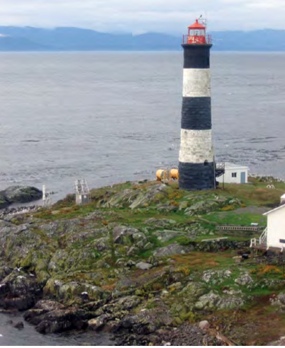
Race Rocks (XwaYeN), located 17 km southwest of Victoria in the Strait of Juan de Fuca, consists of nine islets, including the large main island, Great Race. Named for its strong tidal currents and rocky reefs, the waters surrounding Race Rocks (XwaYeN) are a showcase for Pacific marine life. This marine life is the result of ideal oceanographic conditions, supplying the Race Rocks (XwaYeN) area with a generous stream of nutrients
and high levels of dissolved oxygen. These factors contribute to the creation of an ecosystem of high biodiversity and biological productivity.
In 1980, the province of British Columbia, under the authority of the provincial Ecological Reserves Act, established the Race Rocks Ecological Reserve. This provided protection of the terrestrial natural and cultural heritage values (nine islets) and of the ocean seabed (to the 20 fathoms/36.6 metre contour line). Ocean dumping, dredging and the extraction of non-renewable resources are not permitted within the boundaries of the Ecological Reserve. However, the Ecological Reserve cannot provide for the conservation and protection of the water column or for the living resources inhabiting the coastal waters surrounding Race Rocks (XwaYeN) as these resources are under the jurisdiction of Fisheries and Oceans Canada (DFO).
The federal government, through the authority of the Oceans Act (1997), has established an Oceans Strategy, which is based on the principles of sustainable development, integrated management and the precautionary approach. Part II of the Oceans Act also provides authority for the development of tools necessary to carry out the Oceans Strategy, tools such as the establishment of Marine Protected Areas. This federal authority will complement the previously established protection afforded the area by the Ecological Reserve, by affording protection and conservation measures to the living marine resources.
Under Section 35 of the Oceans Act, the Governor in Council is authorized to designate, by regulation, Marine Protected Areas (MPA) for any of the following reasons:
the conservation and protection of commercial and non-commercial fishery resources, including marine mammals and their habitats;
the conservation and protection of endangered or threatened species and their habitats;
the conservation and protection of unique habitats;
the conservation and protection of marine areas of high biodiversity or biological productivity; and
the conservation and protection of any other marine resource or habitat as is necessary to fulfill the mandate of the Minister of Fisheries and Oceans.
In 1998, the Minister of Fisheries and Oceans announced Race Rocks (XwaYeN) as one of four pilot Marine Protected Area (MPA) initiatives on Canada’s Pacific Coast. Race Rocks (XwaYeN) meets the criteria set out in paragraphs 35(1) (a), (b) and (d) above. Establishing a MPA within the Race Rocks (XwaYeN) area will provide for a more comprehensive level of conservation and protection for the ecosystem than can be achieved by an Ecological Reserve on its own. Designating a MPA within the area encompassing the Ecological Reserve will facilitate the integration of conservation, protection and management initiatives under the respective authorities of the two governments.
Since 1977, faculty, students and staff at Pearson College have been involved with Race Rocks (XwaYeN). The college is committed to explore and expand its research and education opportunities available at Race Rocks (XwaYeN) as well as maintain a long term presence as the custodian of the Ecological Reserve. Any and all research or educational activities to take place in the Race Rocks (XwaYeN) ecological reserve requires a permit issued by BC Parks. Pearson College acts on behalf of the province of BC, as custodians of the Ecological Reserve, administering research permits and monitoring access to Rack Rocks (XwaYeN). Research conducted on Race Rocks (XwaYeN) is detailed on the Race Rocks (XwaYeN) website ( HYPERLINK “http://www.racerocks.com/racerock/research/researchexternal.htm” http://www.racerocks.com/racerock/research/researchexternal.htm).
The area has cultural significance to local First Nations. The XwaYeN (Race Rocks) area is claimed traditional territory for at least four Coast Salish First Nations people; Beecher Bay First Nation, T’Sou-ke Nation, Songhees Nation and Esquimalt Nation. The term “XwaYeN” is from the Klallem language for the place called Race Rocks. XwaYeN (Race Rocks) is believed to be the gateway to the Salish Sea and is seen as an icon of the region, ecosystem and traditional territories of the Salish people.
Race Rocks (XwaYeN) provides opportunities for recreational activities as well as public awareness and education on its unique ecological features. With its close proximity to urban areas, Race Rocks (XwaYeN) is independently accessed by the public for boating, fishing, diving and wildlife viewing. Race Rocks (XwaYeN) has gained worldwide attention by divers for its marine diversity as well as its walls, pinnacles, crevices and high currents. While divers enjoy the underwater ecosystem, tourists and researchers to the area have engaged in marine wildlife viewing, typically between the months of April to October. The important tidal upwelling due to the unique bathymetric features at Race Rocks (XwaYeN), acts as a haven for a significant assortment of flora and fauna.
Purpose and Scope
The purpose of this Management Plan is to outline Fisheries and Oceans Canada’s (DFO’s) plan to manage activities in the Race Rocks (XwaYeN) MPA. This Management Plan is guided by legislative and Regulatory context, and forms a framework to put the legislation and Regulations into practice.
Legislative Authority for the Race Rocks (XwaYeN) MPA
Canada’s Oceans Act (1996) (Box 1), provides the legal basis for the Federal Government to lead and facilitate the designation of a Marine Protected Area (MPA) to protect commercial and non-commercial species, including marine mammals and their habitats, areas of high biodiversity and productivity, endangered and threatened species and unique areas. The Act contains provisions for the designation of MPAs and prescribing measures, including:
Zoning of MPAs
Prohibiting classes of activities within MPAs, and
Any other matter consistent with the purpose of the designation.
In 1999, DFO released a Marine Protected Areas Policy, outlining Canada’s commitment to developing a network of marine protected areas. The 2005 Federal Marine Protected Areas Strategy was developed to implement a federal network of marine protected areas that are managed within an integrated oceans management framework. The strategy calls for collaboration in managing and monitoring these areas, and for increasing awareness, understanding and participation of Canadians in marine protected areas. The Oceans Act provides for the conservation and protection of unique habitats and marine areas of high biodiversity and production.
Race Rocks was designated an Ecological Reserve in 1980 by the Government of British Columbia under the authority of the Ecological Reserves Act. Under the Ecological Reserve designation, only non-consumptive use is permitted; the area was closed to both commercial and recreational fisheries by Fisheries and Oceans Canada (DFO). In September 1998, Race Rocks was proposed as a Pilot MPA (Area of Interest) by DFO. It is important to note, that the selection of Race Rocks (XwaYeN) as a proposed MPA preceded the current framework for selecting Areas of Interest (AOI), which requires areas to be identified as either ecologically and biologically significant areas (EBSA) or areas that contain ecologically significant species (ESS). Under the Oceans Act, Race Rocks (XwaYeN), meets the criteria set out in paragraphs 35(1)(a), (b) and (d) (inserted box below).
In 2004, Race Rocks became a Rockfish Conservation Area (RCA), and part of the network that consists of 164 sites coast-wide. RCAs are designated to protect inshore rockfish and lingcod, and their habitat, from recreational and commercial fishing pressures. The RCA designation prohibits any fishing activities (both recreational and commercial) that would harm rockfish stocks. Race Rocks was selected as a RCA because the island and surrounding seabed were already listed as an Ecological Reserve and the complex geography of the area provides ideal habitat for inshore rockfish.
Linkages with other Legislation and Authorities
Federal Legislation and Authorities
Fisheries Act (DFO)
The Fisheries Act provides DFO the authority to manage freshwater and marine fisheries throughout Canada, including providing for licensing and enforcement and provisions for closing areas to fishing, prohibiting the harmful alteration, disruption or destruction of fish habitat or the deposit of substances deleterious to fish. Violation of the Fisheries Act may carry significant fines and/or imprisonment upon conviction.
Canada Shipping Act / Navigable Waters Protection Act (TC)
Transport Canada, along with the Canadian Coast Guard, is responsible for administering the provisions of the Canada Shipping Act and the Navigable Waters Protection Act which includes regulation of navigation, as well as ship source pollution prevention, including control of ballast water. Transport Canada works with industry and the public to regulate, promote and enforce safe, secure, efficient and sustainable marine practices. The Department oversees the safety, security and marine infrastructure of small vessels, large commercial vessels and pleasure craft; regulates the safe transport of dangerous goods by water; helps protect the marine environment; and fosters marine transportation efficiency through the establishment of a marine marketplace framework. Race Rocks (XwaYeN) is located in close proximity to a major shipping lane for vessels destined to Vancouver or Seattle, both of which are busy seaports. Industry vessels are expected to comply with all relevant legislation and shipping best practices.
Species at Risk Act (EC/DFO/PC)
In 2003, the Species at Risk Act (SARA) was enacted by the federal government to protect species at risk and their critical habitat. SARA is jointly administered by DFO, EC and Parks Canada Agency; the Minister of DFO is responsible for aquatic species at risk; EC is the federal lead for coastal migratory bird species at risk. The Act protects species identified as endangered or threatened through prohibitions against harming, harassing, capturing, taking or killing an individual, and against destroying its residence or critical habitat. The Act also requires the development of recovery and management plans. These documents outline short-term and long-term goals for protecting and recovering species at risk. Race Rocks is home to two species that have been listed under SARA: 1) Northern Abalone (Haliotis kamtschatkana) (Threatened),
Canadian Environmental Protection Act (NEB)
Legislated in 1999, the Canadian Environmental Protection Act (CEPA) aims to prevent pollution and to protect the environment, including the marine environment, and human health by preventing and managing risks posed by toxic and other harmful substances. The Act provides for establishment of national guidelines for monitoring dredged and excavated material at ocean disposal sites, interim marine and estuarine water quality guidelines, water quality guidelines for the protection of aquatic life, disposal at sea and control of land-based sources of pollution, offshore oil and gas, and toxic substances.
Canadian Environmental Assessment Act (CEAA)
The Canadian Environmental Assessment Agency (CEAA), reporting to the Minister of Environment, require environmental considerations, alongside social and economic considerations, are taken into account in all federal decisions respecting policies, plans, programs and projects in a manner that supports balanced, integrated decision-making and progress toward sustainable development. The Agency also supports oceans-sector-related research projects such as integrated assessment of ecosystem impacts due to climate change in coastal communities and evaluating biodiversity in marine environmental assessments.
Provincial Legislation and Authorities
Ecological Reserves Act
In 1980, the province of British Columbia, under the authority of the provincial Ecological Reserves Act, established the Race Rocks Ecological Reserve. This provided protection of the terrestrial natural and cultural heritage values (nine islets) and of the ocean seabed (to the 20 fathoms/36.6 metre contour line). Ocean dumping, dredging and the extraction of non-renewable resources are not permitted within the boundaries of the Ecological Reserve. However, the Ecological Reserve cannot provide for the conservation and protection of the water column or for the living resources inhabiting the coastal waters surrounding Race Rocks (XwaYeN).
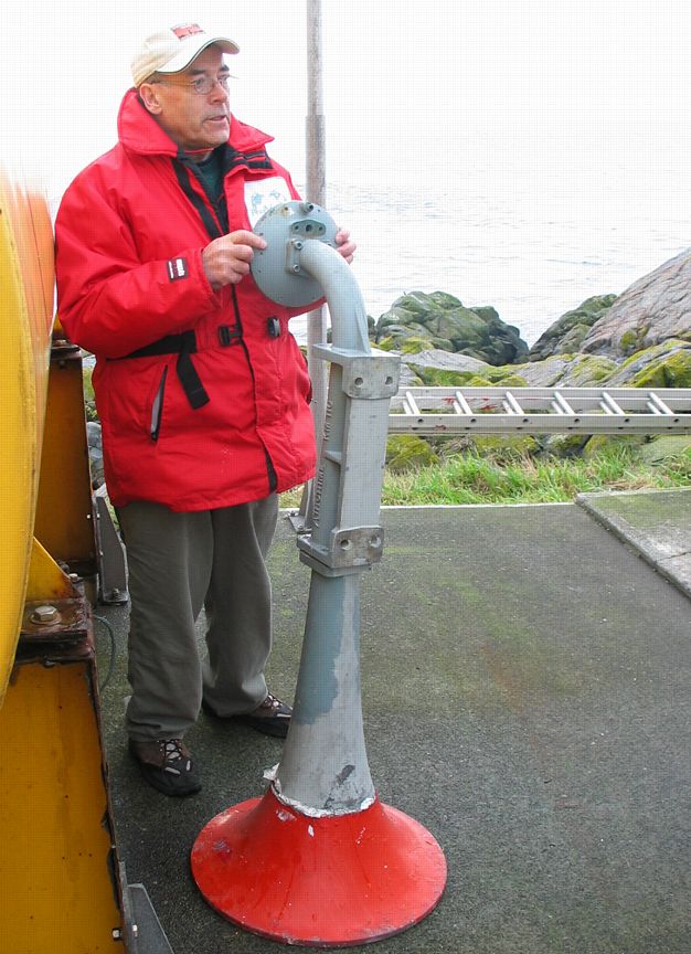
BC Parks leases to the Canadian Coast Guard, a division of the Department of Fisheries and Oceans, the envelope of land around the light tower, which also includes the vertical solar panels and fog horn.
Local Authorities
The Race Rocks MPA is within the Capital Regional District, with the District of Metchosin having boundaries that are just inland from Race Rocks. In the District of Metchosin, through its Official Community Plan, the community has identified much of the mainland shore area as sensitive shore line areas and protected it under special municipal zoning. Issues associated with the Community Charter and the Official Community Planning and construction of buildings or business ventures on the islands may involve input from the local government. In addition, in Metchosin’s OCP the Whirl Bay, Rocky Point and Bentinck Island Group are listed as potential or future park areas.
Additional Federal, Provincial or Territorial Authorities
Department of National Defence (DND)
The Department of National Defence has a major presence in the oceans sector and contributes to the government’s maritime sovereignty objective through its maritime forces and institutions across the country. DND has a lead role with respect to national security issues in Canada’s ocean areas.
Background
General Location and MPA Boundaries
The Race Rocks (XwaYeN) Marine Protected Area (MPA) is 268.5 hectares in size and encompasses the majority of seamounts surrounding Great Race (largest of the islets) (Figure ?). The Race Rocks MPA will include the marine waters within an approximation of the 36.5 meter depth contour surrounding but not including the nine islets. The internal boundary is limited to the seaward side of the low tide contour for each of the islets. The sea floor is not included as it is within the authority of the province of British Columbia and is managed under the Ecological Reserve Act. There is no zoning within the Race Rocks MPA.
Figure ?: Race Rocks (XwaYeN) Marine Protected Area with boundary coordinates.
Recent Conservation Initiatives
1980
Province of British Columbia (under the Ecological Reserves Act), established the Race Rocks Ecological Reserve.
1990
Seasonal fisheries closures under the Fisheries Act, restricting all commercial fishing of finfish and shellfish in the area
1991
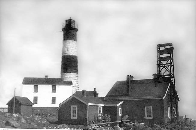
Race Rocks Lighthouse became a Recognized Federal Heritage Building
1997
Canada’s Oceans Act came into force, including the establishment of the Oceans Management Strategy (OMS).
1998
Minister of Fisheries and Oceans announces four “pilot” MPA initiatives including Race Rocks.
1998
Canada/BC MPA strategy implemented.
1999
Northern abalone (Halliotis kamischatkana) designated as a threatened marine species by the Committee on the Status of Endangered Wildlife in Canada (COSEWIC); waters surrounding Race Rocks are an important nursery and recruitment area for this species.
1999 (Dec)
Establishment of the Race Rocks Advisory Board (RRAB).
1999
DFO released a Marine Protected Areas Policy
2000
(March 22)
RRAB made recommendations including a governance model, voluntary compliance/best practices guidelines and for Race Rocks be a joint federal/provincial MPA named X’waYeN (Race Rocks)
2000
(Sept. 14)
Minister of Fisheries and Oceans and the BC Minister of Environment Lands and Parks announced endorsement of Race Rocks to become Canada’s first Oceans Act MPA.
2000
(Oct. 28)
Draft designation regulation for Race Rocks pre-published in Part1 of the Canada Gazette.
(during 60 day public comment period)
Chiefs of three of the Race Rocks FN intervened, expressing their opposition to the MPA designation.
2002
Canada Gazette regulatory package expired
However, the Ecological Reserve cannot provide for the conservation and protection of the water column or for the living resources inhabiting the coastal waters surrounding Race Rocks (XwaYeN).
The Oceans Strategy isbased on the principles of sustainable development, integrated management and the precautionary approach. This policy, established under the auspices of the Oceans Act also provides authority for the development of tools necessary to carry out the Oceans Strategy, tools such as the establishment of Marine Protected Areas. This federal authority complements the previously established protection afforded by the Ecological Reserve, by affording protection and conservation measures to the living marine resources.
By establishing a MPA within the Race Rocks (XwaYeN) area, a more comprehensive level of conservation and protection for the ecosystem can be achieved than by an Ecological Reserve on its own. The designation of this MPA encompassing the Ecological Reserve facilitates the integration and increases the synergy of conservation, protection and management initiatives under the respective authorities of the two governments.
Additional protection measures have taken place in and around the Race Rocks (XwaYeN) area including seasonal fisheries closures under the Fisheries Act, restricting all commercial fishing of finfish and shellfish in the area since 1990. Recreational harvesting of salmon and halibut and harvesting of non-commercial species continue, but much of that activity has been curtailed after the designation of a Rockfish Conservation Area (RCA) around Race Rocks (XwaYeN) in 2004. The prohibition of living marine resource harvesting along with an Oceans Act MPA designation provides a longer-term commitment to the conservation and protection of the Race Rocks (XwaYeN) ecosystem.
The Race Rocks Advisory Board (RRAB) was established to assist DFO and BC Parks with consultations and the development of consensus-based recommendations for designation and management of the MPA. The Race Rocks Public Advisory Board (RRPAB) is composed of community representatives and Race Rocks stakeholders including Pearson College (who presently funds and provides the Ecoguardian at Great Race), private businesses, recreational users, the education sector, research interests, the Ecological Reserve Volunteer Warden and several conservation/environmental protection groups.
MPA Establishment Process
2004
Designation of a Rockfish Conservation Area (RCA) around Race Rocks
2005
Federal Marine Protected Areas Strategy developed.
2009
Establishment of Race Rocks Public Advisory Board (RRPAB)
2010
DFO and First Nations (T’Sou-ke Nation, Songhees Nation and Beecher Bay First Nation) signing of Memorandum of Understanding (MOU)
Ecological Overview and Assessment
In 2001, a comprehensive assessment of the physical and biological systems of Race Rocks (XwaYeN) was completed by Wright and Pringle (2001). The 2001 report provides an extensive ecological overview describing the geological, physical oceanographic and biological components of Race Rocks (XwaYeN) and the surrounding waters of the Strait of Juan de Fuca at the time. Natural history observations and some traditional knowledge were also included. An updated EOAR was produced in 2010, to supplement the existing ecological overview by summarising new information collected in the Race Rocks (XwaYeN) area since 2001 and describe any changes to trends in species distributions and oceanographic conditions.
Economic, Social and Cultural Overview and Assessment
An economic, social and cultural overview assessment was conducted to review human activities that were undertaken in the proposed MPA or that are likely to be undertaken in the established MPA in the future. Human activities that take place in close proximity to the MPA and may influence activities within the MPA were also investigated. In general, the marine ecosystem within this area is known for its exceptional diversity which is of importance to commercial and recreational fisheries in adjacent areas. Activities were organized into three specific categories; 1) commercial activities, 2) neighbouring marine traffic, and 3) non-commercial activities.
Commercial activities include commercial shipping, Coast Guard, Canadian Military, fisheries and aquaculture. Increased inbound and outbound deep sea traffic is related to freight demands at the ports served as well as investments of the ports to increase their efficiency and expand their capacity. Most of the business for the Canadian Coast guard in the Race Rocks area is serving marine wildlife viewing, sport fishing and diving vessels which is closely related to population growth in the CRD and areas resulting in increased demand for coast guard services. DND’s military buffer zone, partially overlapped with the Race Rocks (XwaYeN) MPA, is anticipated to continue the activities of training, demolition and ammunition depot.
Tourism and recreation, primarily ocean-based outdoor activities include boating, angling, wildlife viewing, kayaking and diving. In January of 2009, Tourism BC concluded that BC was considered the most appealing ocean destination in North America which clearly indicates the potential demand for ocean activities on the BC coast among resident and visitor markets.
Pearson College, an educational institution manages the Race Rocks Ecological Reserve under an agreement with BC and focuses on community outreach programming. Research and education activities, subject to review and approval by the Race Rocks Operating Committee (BC Parks and Pearson College), require a permit and all research materials and results must be made available as public information.
There are two alternative energy projects associated with Race Rocks, including the solar panel project and the tidal energy project
Management Framework
In 1997, the Oceans Act provided Fisheries and Oceans Canada with a leading and coordinating role in the development of a cooperative and collaborative approach to a network of federal marine protected areas in Canada. In 2005, the Government of Canada launched a comprehensive Oceans Action Plan (OAP) to coordinate and implement oceans activities, and to sustainably develop and manage our oceans. The implementation of Canada’s Oceans Strategy, having the overarching goal to “ensure healthy, safe and prosperous oceans for the benefit of current and future generations of Canadians”. Under the Health of the Oceans pillar of the OAP, several activities are identified including the development of a Federal Marine Protected Areas Strategy. The Federal Marine Protected Areas Strategy defines a marine protected areas network as: “a set of complementary and ecologically linked marine protected areas, consisting of a broad spectrum of marine protected areas, established and managed within a sustainable ocean management planning framework and linked to transboundary, global and terrestrial protected area networks”.
The resultant conservation and management objectives provide guidance for the effective implementation of the Regulations and will assist in management of activities within the MPA.
(Placeholder for National Framework for Canada’s Network of MPAs and Canada-BC MPA Network Strategy)
Guiding Principles
GUIDING PRINCIPLE
DESCRIPTION
Integrated Management (IM)
A collaborative, flexible and transparent planning and management process recognizing shared responsibility of governments, Aboriginal groups, coastal communities, industry and others to support the sustainability of our marine resources.
Ecosystem Approach
Recognition of the complexity of ecosystems and the interconnections and energy flows among their component parts.
Precautionary Principle
Decisions and actions on conservation measures can and will be taken in the absence of scientific certainty.
Respecting Aboriginal Peoples
In addition to constitutionally protected Aboriginal and treaty rights as well as land claims agreements, the federal government is committed to working with affected Aboriginal Peoples to collaboratively plan, establish and manage marine protected areas.
Knowledge Based
The integration and use of both scientific and Traditional Ecological Knowledge (TEK), which includes Aboriginal, local and historical sources of information, can contribute significantly to the identification, development and management of an effective federal marine protected areas network.
Consultation and Collaboration
Mechanisms for gathering of information, increasing public awareness, conducting research, and ensuring participation of those with an interest or role to play in marine protected areas planning and management will be established to improve collaboration and cooperation amongst partners.
Public Awareness, Education and Stewardship
Engaging Canadians in the development of marine protected areas and their network include ocean stewardship activities that contribute to capacity building, increasing public awareness and understanding of ocean conservation issues as well as the development of constituencies that support the marine protected areas network.
Management Effectiveness
The evaluation of the outcomes of a particular marine protected area measured against specific objectives.
Adaptive Management
Evaluation of management effectiveness and applying new science knowledge to adjust management regimes in order to continue meeting marine protected area objectives.
Conservation Objectives
Conservation objectives are statements, expressed in broad terms, which describe aspirations for the ecological feature(s) of the MPA. To ensure that the MPA Regulations and management measures are effective, there must be a standard against which they can be evaluated. The conservation objective, developed by DFO with input from the RRPAB, provides that standard.
To protect and conserve an area of high biological productivity and biodiversity, providing habitat for fish and marine mammals, including threatened and endangered species.
MPA Management Objectives
Management principles and objectives identify priorities for management that support the achievement of the conservation objective.
Impacts from human activities in the area will not compromise the conservation of biodiversity and ecosystem function of the Race Rocks Marine Protected Area.
Build a knowledge base to define and understand biodiversity and ecosystem function, using best science and TEK/LEK.
Monitor biodiversity and ecosystem function.
Monitor and evaluate management effectiveness to ensure management is contributing toward achievement of overarching Conservation Objective.
Management Strategies
(Note the following is a list of the TYPE of management strategies that will be considered to meet the conservation objectives)
Principles developed in Canada’s National Policy and Operational Framework for Integrated Management and the Oceans Act were the basis for determining the development of strategies for the Race Rocks MPA
Assess, identify and mitigate impacts of human activities on:
populations and ecosystem dynamics
unique and vulnerable species and habitats, including migratory species
to the physical and chemical qualities of surrounding waters and sediments
Review existing Best Management Practices and guidelines to integrate them into MPA approvals as appropriate.
Apply adaptive management of human activities based on assessments and mitigation measures identified.
Identify priority habitats and species for recovery and restoration
Recommend mechanisms for recovery and restoration of degraded habitats and species of concern
Identify knowledge gaps and establish research priorities and protocols
Support and undertake inventories, surveys to contribute to monitoring to systematically expand the understanding of the ecosystem based on established research priorities
Establish ecological benchmarks and thresholds for assessing changes in population, community and ecosystem dynamics, including impacts of human activities
Document First Nations traditional knowledge, local ecological knowledge and scientific knowledge
Utilize existing or develop information sharing protocols between agencies, user groups and other organizations
Develop relationships with the research community working on relevant issues
Build awareness in Stakeholder communities as well as other regulators to achieve compliance with the Race Rocks (XwaYeN) MPA conservation objectives.
Educate and inform stakeholders of existing regulations and policies relevant to the Race Rocks (XwaYeN) Marine Protected Area (e.g. Ballast Water Control and Management Regulations)
Identify and utilize opportunities for public engagement
Partner with user groups to reach visiting public and international tourist in order to convey messaging of conservation and protection
Apply BMPs, guidelines and mitigation measures appropriate to minimize impact of awareness related activities
Management Measures / Output
Management measures are the practical tools and procedures to be used by DFO to achieve conservation and management objectives and help gauge the effectiveness of the MPA.
Compatible Activities:
First Nations harvest of fish. Honouring constitutionally protected rights. Agreements being pursued with First Nations include fisheries management related work and communications, with respect to Race Rocks.
Wildlife viewing in the waters surrounding Race Rocks (XwaYeN) as well as on the islets themselves following the guidelines produced for observing marine wildlife, “BeWhaleWise” (2009), stating boaters should slow down to speeds less than 7 knots when within 400 metres of a whale, keep clear of the whales path and do not position the vessel closer than 100 metres to any whale ( HYPERLINK “http://www.BeWhaleWise.org” www.BeWhaleWise.org). These guidelines also apply when observing pinnipeds and birds on land. These guidelines were developed to minimize <>human impacts to marine wildlife while allowing for viewing opportunities.
Private recreational boating, subject to adherence to guidelines
SCUBA diving, when undertaken with minimal impact to marine life. PADI project AWARE (2007) has developed guidelines for divers to protect the underwater environment while diving. Low impact diving would involve not collecting any living or dead organisms, ensuring that the diver’s buoyancy level is appropriate so as not to disturb the seafloor, not feeding or disturbing marine wildlife, and ensuring that dive vessels do not set an anchor line onto the substrate.
Research activities that contribute to the scientific knowledge of biodiversity and ecosystem function are compatible with the conservation objectives of this area. All parties interested in conducting scientific research within the Race Rocks (XwaYeN) ecological reserve require a BC Ecological Reserve permit and clearance from the Province of BC (administered by Pearson College).
Scientific monitoring and surveillance activities carried out to monitor marine life as well as those activities directed towards conservation and protection. Along the south coast of BC, overflights for pinniped stock assessment and creel surveys take place. This work is, at times necessary to achieve the conservation objectives of the MPA and to measure changes to the ecosystem and its functions.
Educational activities, subject to guidelines as appropriate, relating to school group tours (akin to ecotourism) and student led research projects (akin to Scientific Research), subject to activity approvals.
Incompatible Activities/ Threats
Commercial and recreational fishing and other resource extraction activities.
Harassment of wildlife through wildlife viewing.
The island of Great Race and the seabed nearby contain a number of manmade structures. These structures were built before the establishment of the MPA. These include the historic lighthouse, housing and power generation facilities on Great Race as well as the turbine and infrastructure used by the tidal current project to generate environmentally sustainable electricity. Further development within the MPA boundary is not compatible with the conservation objectives for the MPA.
Governance
DFO has the primary responsibility for the protection and management of the Race Rocks MPA. However, the Race Rocks MPA overlaps with the existing Ecological Reserve (ER) and as such, requires the coordination of a number of government agencies to implement relevant legislation and guidelines.
Collaborative Governance
The Oceans, Habitat and Enhancement Branch (OHEB) is the lead organization within DFO for the management of Race Rocks. However, a collaborative approach to managing the activities in the MPA will be required. A tripartite coordination between federal government, provincial government and First nations is coordinated under committees such as the Oceans Coordination Committee (OCC), Marine Protected Area Implementation Team (MPAIT), Regional Committee on Oceans Management (RCOM), Pacific Inter-Departmental Oceans Committee (PIOC) and the Government-First Nations Management Board (GFNMB). In addition, other government departments and agencies, MPA users and other individuals with an interest in the MPA play important roles in meeting the objectives for the MPA and implementing the management plan.
MPA Advisory Board
Government-First Nations Management Board (GFNMB)
(SEE CONSULTATIONS DOC)
Roles and Responsibilities
This section provides an overview of the activities related to the administration of the MPA and identifies roles and responsibilities of DFO, other government departments, and……… Government and non-government organizations play a role in managing the Race Rocks MPA and ensuring it is protected for future generations (SEE FIGURE IN GULLYMP pg 57 – circles). There are roles and responsibilities related to legal requirement for both government departments and users of the area. However, others with an interest in the MPA can play a role through providing advice on management, research guidelines, undertaking outreach, or participating in stewardship activities in the MPA. (Table?) The ongoing participation and involvement of a variety of federal and provincial government bodies, industry and public interests is essential to the protection of the Race Rocks ecosystem.
Fisheries and Oceans Canada
DFO is the lead authority for oceans management in Canada and coordinates federal programs, policies and management strategies related to Race Rocks. As the lead authority for the Race Rocks MPA, DFO has the primary responsibility for its protection and management. The Oceans, Habitat and Enhancement Branch (OHEB) is the lead organisation within DFO Pacific Region. Using an integrated management approach, OHEB will serve an overall facilitation and coordination function for implementation of the management plan and management of the Race Rocks MPA.
Section 32 of the Oceans Act provides the Minister of Fisheries and Oceans with the authority to establish, designate or recognise advisory bodies. The post-designation Race Rocks MPA Advisory Board, comprised of key partners and stakeholders with interests in the management of the MPA) has been formed. The role of this MPA Advisory Board is:
Advise on management plan development;
Participate in monitoring programs, review of protocols and data collection (i.e. where local/coastal communities and oceans users have pertinent expertise, such as providing experiential, local and traditional ecological knowledge of the MPA ecosystem);
Provide advice on adapting the management plan and monitoring strategy, where necessary;
Share progress reports with broader stakeholder community;
Review annual work plans and performance reports; and
Help promote compliance through awareness raising with interest groups.
Department of National Defence
The Department of National Defence’s (DND) military buffer zone for the WQ (Whiskey Quebec) military training area is partially located in the waters of the proposed Race Rocks (XwaYeN) MPA. While training activities do not take place within the Race Rocks (XwaYeN) MPA boundary, Bentinck Island, located approximately 2 km away, is a blasting training site in the use of explosives for the Canadian Forces Base (CFB) Esquimalt.
Province of British Columbia
For over 30 years, BC Parks has been engaged with the protection of Race Rocks through the establishment of Race Rocks as an Ecological Reserve (ER). While the ER includes the islets and sea floor, it does not include the federally controlled water column.
collaborative management between MPA and ER
highlight linkages
First Nations
The area has cultural significance to local First Nations. The XwaYeN (Race Rocks) area is claimed traditional territory for at least four Coast Salish First Nations people; Beecher Bay First Nation, T’Sou-ke Nation, Songhees Nation and Esquimalt Nation. The term “XwaYen” is from the Klallem language for the place called Race Rocks. The nutrient rich waters of this area provided a wide diversity of food fishing opportunities year round. XwaYeN (Race Rocks) is believed to be the gateway to the Salish Sea and is seen as an icon of the region, ecosystem and traditional territories of the Salish people.
Pearson College Any and all research or educational activities to take place in the Race Rocks (XwaYeN) ecological reserve require a permit issued by BC Parks. Pearson College acts on behalf of the province of BC, as custodians of the ecological reserve, administering research permits and monitoring access to Rack Rocks (XwaYeN).
Monitoring and Reporting on Management Effectiveness
Research and Monitoring Strategy
Research and monitoring activities carried out as part of SARA action plans will be beneficial for increasing the understanding of the Race Rocks ecosystem. Conversely, research and surveillance activities carried out to manage the MPA may also be beneficial for assessing compliance with SARA and promoting the recovery of particular at-risk species.
Race Rocks (XwaYeN) has been used as a field site for scientific research and education by Pearson College as well as other researchers. Currently, all parties interested in conducting scientific research within the Race Rocks (XwaYeN) ecological reserve require a BC Ecological Reserve permit and clearance from the Province of BC (administered by Pearson College). The role played by the Eco-Guardian at Race Rocks provides a great opportunity for partnering to help achieve monitoring goals. Research activities that contribute to the scientific knowledge of biodiversity and ecosystem function are compatible with the conservation objectives of this area, subject to activity plan approval.
Public Awareness, Education and Stewardship
To meet the MPA Management Objectives as described in section 3.3 (3. a-c), Race Rocks (XwaYeN) will provide opportunities for recreational activities as well as public awareness and education on its unique ecological features. This section describes the overall approach to providing information on the Race Rocks MPA to affected user groups and all Canadians.
With its close proximity to urban areas, Race Rocks is accessible to many people, providing a unique opportunity to showcase a coastal marine protected area, increasing public awareness and providing educational opportunities.
For the MPA to be successfully managed, it is important that the public, particularly affected user groups, area aware of the MPA designation and Regulations. Outreach and education activities will be directed to improve compliance with the Race Rocks Regulations.
To contribute to the successful implementation of a network of MPAs in Canada, those involved with the establishment of MPAs in other parts of the country should be aware of the process taken with Race Rocks and the challenges that were faced. The lessons learned from the designation of the Race Rocks MPA will be documented and shared with colleagues and the public.
ACTIVITIES
OUTREACH MATERIALS
CURRICULUM MATERIALS
MATERIALS FOR THE GENERAL PUBLIC
NATIONAL AND INTERNATIONAL AWARENESS
RaceRocks.com
Pearson College, in addressing the concern about environmental impacts from site visits during the 1980s and 1990s, launched a website in 2000 to support non-commercial education through live streaming video.
Tourism and Recreation
With its close proximity to urban areas, Race Rocks (XwaYeN) is independently accessed by the public for boating, diving and wildlife viewing. Boaters may use the waters surrounding Race Rocks (XwaYeN) as a thoroughfare to other areas, shelter from the elements, as a reference point for navigation, or a general point of interest.
Race Rocks (XwaYeN) has been recognized as an important sport fishing destination since western settlement with anglers seeking Pacific salmon, halibut, lingcod, rockfish, prawns and crabs.
Since 1900, Race Rocks (XwaYeN) has gained worldwide attention by divers for its marine diversity as well as its walls, pinnacles, crevices and high currents. While divers enjoy the underwater ecosystem, tourists and researchers to the area have engaged in marine wildlife viewing, typically between the months of April to October. The important tidal upwelling due to the unique bathymetric features at Race Rocks (XwaYeN), acts as a haven for a significant assortment of flora and fauna (Figure 5).
Management Plan Review
The current management plan is intended to guide management of the Race Rocks MPA from (year) to (year). EXAMPLE ONLY
Surveillance, Enforcement and Compliance
Surveillance, Enforcement and Compliance planning for Race Rocks (XwaYen) MPA will be developed consistent with DFOs National Oceans Act Marine Protected Area Compliance and Enforcement Policy currently being developed. A coordinated approach between DFO and BC Parks to compliance and enforcement is required for the MPA given its existing Ecological Reserve status.
Specific Roles and Responsibilities
As the lead federal authority for the MPA, DFO will have overall responsibility for ensuring that the Regulations and conservation measures are respected and enforced, while other agencies also have accountabilities under their own mandates in the area (Province of BC). DFO’s role is undertaken through the Department’s legislated enforcement mandate and responsibilities under the Oceans Act, the Fisheries Act, the Species at Risk Act and other federal legislation covering fisheries conservation, environmental protection, habitat protection and marine safety. DFO also provides a leadership and coordination role for broader inter-agency surveillance, monitoring and enforcement activities in support of the MPA. Under this coordinated approach, the primary means of the Departmental enforcement presence will be through an already existing surveillance program.
In addition, BC Parks has a management contract with Pearson College of the Pacific to provide a 24 hour a day resident EcoGuardian at the Ecological Reserve. Wherever possible, DFO should strive to work cooperatively with BC Parks and the designated EcoGuardian to achieve surveillance and compliance objectives.
DFO fishery officers will work together with other law enforcement personnel (or enforcement officers so designated by the Minister according to section 39 of the Oceans Act) to ensure that the proposed management actions and regulations for the area are respected. Enforcement of the regulations and subsequent offences will be dealt with under sections 37 and 38 of the Oceans Act.
Submission and Evaluation of Activity Plans (Example ONLY)
Scientific Monitoring and Research
DFO wishes to encourage research at the Race Rocks MPA while meeting its conservation objectives. Research in the Race Rocks MPA has a dual identity: first, as a human use with potential impacts which management measures seek to address; and second, as a generator of data, knowledge and information valuable for the adaptive management of the MPA. A research strategy will be developed to include monitoring protocols and be regularly updated.
Surveillance, Enforcement and Compliance
Enforcement officers are charged with enforcing all of the provisions out the Oceans Act, including all MPA Regulations. Violations of the MPA Regulations carry penalties under the Oceans Act, while contraventions of licences and consent issued for foreign vessel access can result in charges under the Fisheries Act and under the Coasting Trade Act. Upon conviction, the courts may impose fines and prison terms for offences under each of these Acts.
The following is a list of responses available to deal with alleged violations of provisions of MPA Regulations of the Oceans Act:
Warnings;
Orders recommended by the Minister of Fisheries and Oceans, and
Injunctions;
Alternative measures to prosecution; and
Prosecutions.
The primary means of surveillance and enforcement in the MPA is through DFO’s Conservation and Protection Program. In addition to its general MPA enforcement activities, DFO is responsible for fisheries enforcement matters related to the MPA. Fisheries violations can result in charges under both the Fisheries Act and the Oceans Act as Fishery Officers are designated as enforcement officers under both pieces of legislation.
The enforcement provisions of the Species at Risk Act may also be used in support of the MPA when dealing with listed species. Fishery Officers are designated as enforcement officers for the Species at Risk Act and violations may result in charges under this legislation, as appropriate.
REFERENCES AND RELATED MATERIAL
Ballast Water Control and Management Regulations. Canada Gazette Part 1, Vol. 139, No. 24, June 11, 2005. Available online: “http://www.canadagazette.gc.ca/archives/p1/2005/2005-06-11/pdf/g1-13924.pdf” <
Canada’s Federal Marine Protected Areas Strategy, Government of Canada. 2005.
Oceans Act Marine Protected Area Regulations, Compliance and Enforcement Policy – May 2010 Draft
Race Rocks Area of Interest Regulatory Intent Statement. Working copy of the Draft Regulatory Intent for Race Rocks MPA, August 2010.
Socio-Economic Base Case Update for Race Rocks Proposed Marine Protected Area. Prepared for DFO – Habitat Management Division, March 31, 2009 by R. Sunderman, Peak Solutions Consulting Inc.
The Role of the Canadian Government in the Oceans Sector. Fisheries and Oceans Canada.2009.
Wiring Diagrams to Illustrate the Oceans Act MPA Designation Process and Management Responsiblities. Prepared by the Department of Fisheries and Oceans, Oceans Sector for the Race Rocks Public Advisory Board, May 18, 2010.
PAGE 22
Doug Biffard: Is this an accurate reflection of the authority of BC Parks and the roles and responsibilities of Pearson as custodians?
Needs reference
