This file presents several possible configurations of new boundaries for the proposed MPA. It is important to recognize that this is only a proposal from one participant in how boundaries may be modified in the future as new research becomes available:
G. Fletcher, November 20, 2009,
We are proposing that a reconsideration of the boundaries of the MPA be placed on the table for future deliberations. It should be noted that as more research becomes available helping to fill the gaps in knowledge about population distributions in the area, there may be a need to change the boundaries. It is mentioned in several of the references on MPA creation that this is often done to keep up with current scientific knowledge. This is intended to address the issue of the Ecosystem-based approach which is strongly reflected in the Oceans Act of 1998.
Below are three possible variations on the theme of alternate boundaries. The images are followed by a the rationale for consideration of boundary changes.
 |
 |
 |
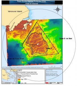
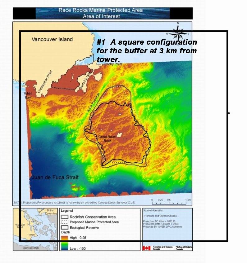
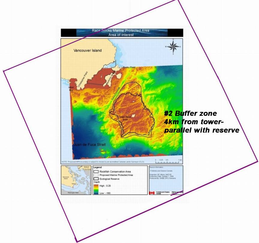
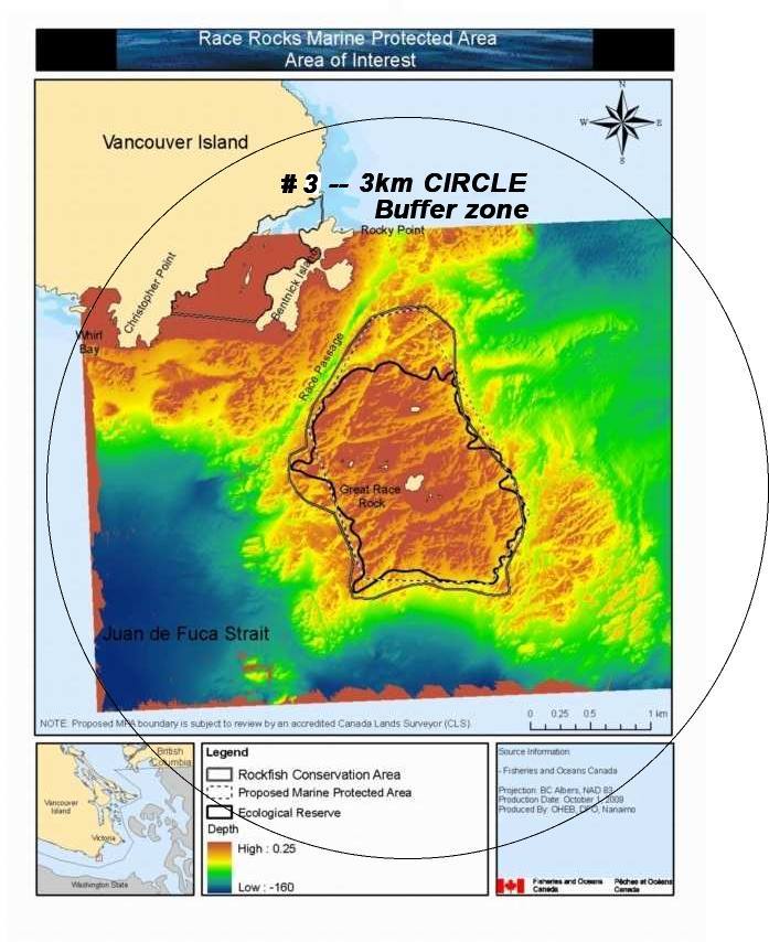
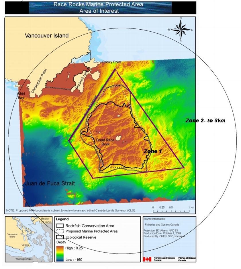
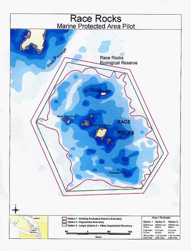
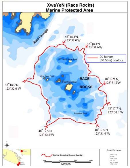
| OPTION 1. A parallel sided shape to encompass most of the distinct reef of the archipelago. The boundary for a buffer zone being at 3 km. |
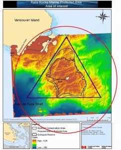
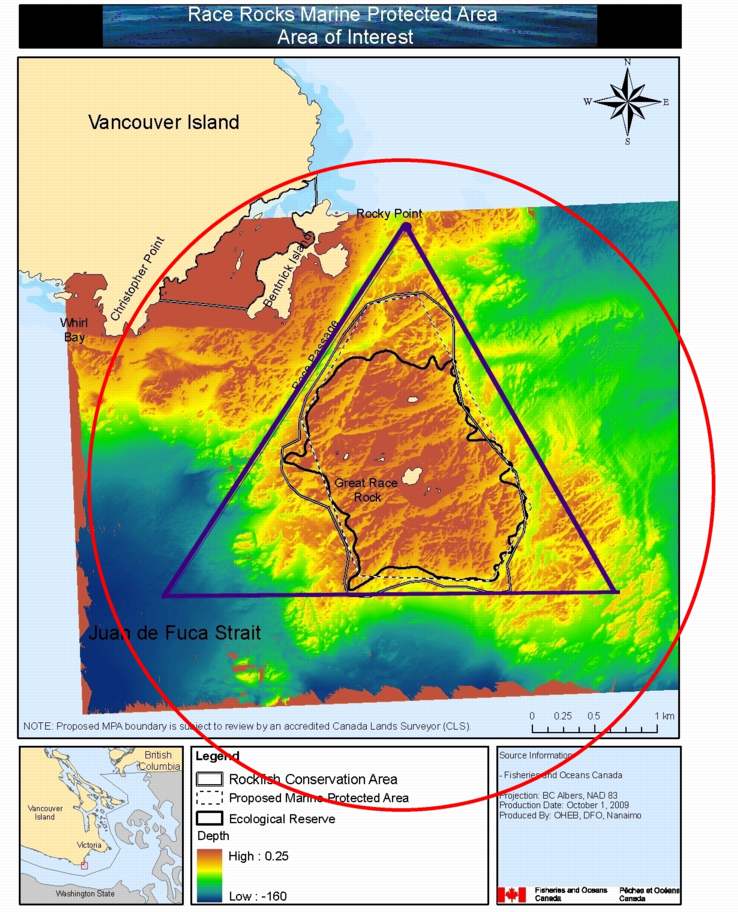
OPTION 2. A triangle covering most of the reef but including a section of the blue 100 meters depth. This may be useful for future population transects through the complete depth profile. |
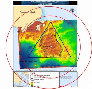
OPTION 3:
A multiple zoned buffer which may see different designations of use.
|
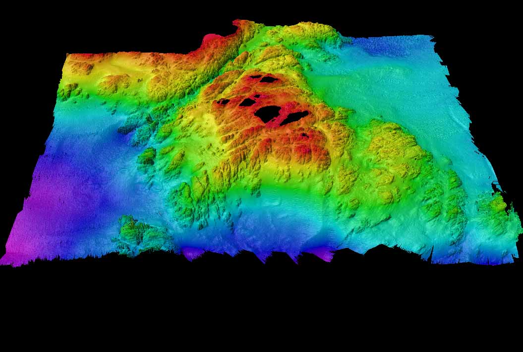
There is a possibility that when they have undergone further research, specific zones currently outside of the protected area boundary, may lead to some unique habitat and ecosystem structure. Below are two such candidate areas:
 |
 |
 |
| Two areas of interest in particular are the large sand dune-like area at over 100 meters depth which lie at either end of the Race Passage Canyon. Although there is no evidence currently on what type of ecosystem exists in that area, we should be prepared to have a flexible approach to boundaries in the future, as these land forms and their habitats could be quite unique. |
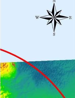
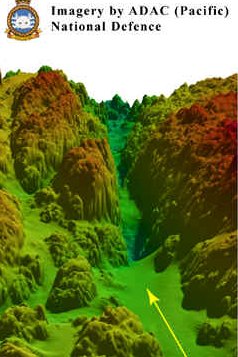
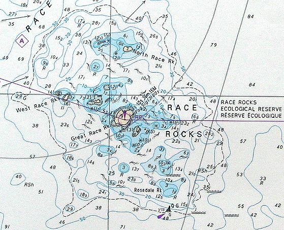
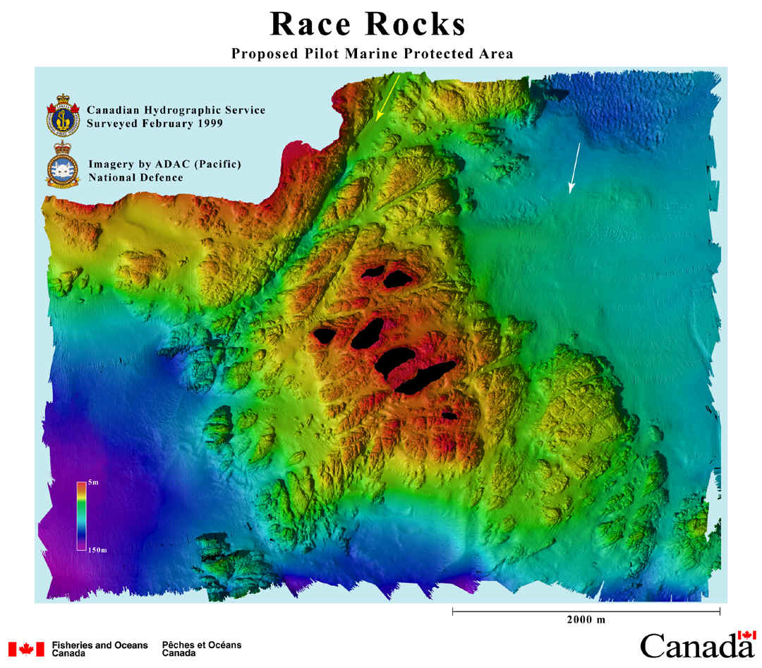
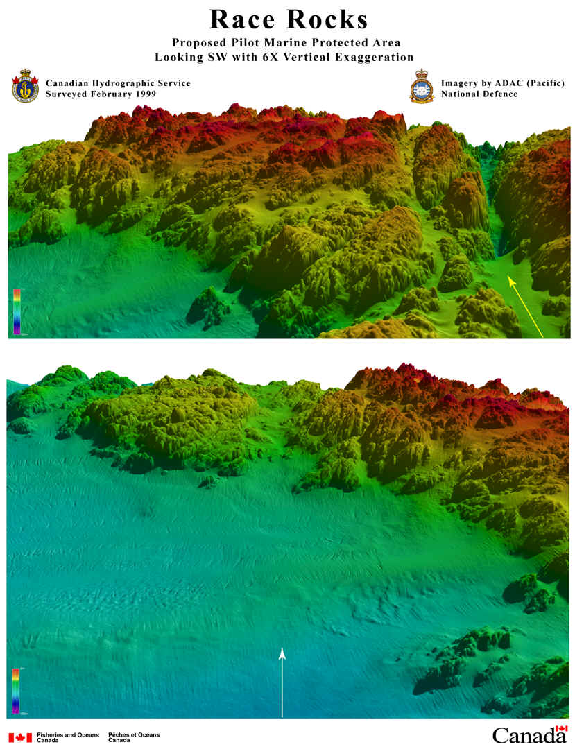
In this side profile of the Race Passage area, along the direction of the yellow line, is a geological fault separating Race Rocks from Vancouver Island.
|
The canyon, results in vertical topography along with the resulting ecosystems that are probably unique to the reserve. It may be advisable to protect at least the reef-side wall of this feature if research justified it. |
Descriptions of the activities permitted and prohibited
in each of the zones of Option 1:
ZONE 1
In Option 1, a basic trapezoid defines the boundaries of the Marine Protected area within which all species ecosystems and their complete habitat are protected. This designation accomplishes objectives which are within the interests of all the stakeholders.1. The complete underwater “reef” of Race Rocks is protected, ensuring that the habitat of key species is not compromised.
2. Speed limits of all vessels transiting or entering the MPA must be reduced to eliminate wash from wakes.
3. Commercial operations would be required to be registered with DFO as is proposed in the Draft proposal for marine mammals.
4. Approach to marine mammals and seabirds is limited to 100 metres and entrance to the area is prohibited except for service vessels when whales are present. In this zone marine vessels must avoid surface concentrations of foraging seabirds and mammals.
5. Recreational fishing would only be permitted outside of this zone.
ZONE 2This is a buffer zone in which no commercial fishing, extractive operations or marine dumping can occur. Bilge pumping is prohibited and In addition there will be no overflights by aircraft except where required by emergency operations or by Coast Guard at times acceptable to not interfere with breeding seasons. Cruise ships may not transit inside this 3 Km zone.See this file for more information and suggestions on BUFFER ZONES
| RATIONALE FOR THIS BOUNDARY PROPOSAL |
| 1. Protection of Fish resources only in the Race Rocks MPA is inadequate and contrary to the purpose of an MPA ” To protect marine species and habitats.” It will be very short- sighted to rush through the MPA process without making a serious effort to do what is best and ecologically sustainable for the long term future. |
| 2. In this way, the complete underwater “reef” of Race Rocks is protected, ensuring that the habitat of key species is not compromised, and that optimal conditions are provided for regeneration of species which will repopulate adjacent areas. Species such as Octopus lay eggs at depth and then migrate up the reef when mature. It is essential to take into consideration the 3 dimensional aspect of the habitat of marine species if we are to achieve near-complete habitat protection. |
| 3. The original purpose of the MPA creation at Race Rocks was to eliminate the jurisdictional problems of administering the marine protected area so that the ecosystem would gain better protection in law. Simplifying the boundaries make it more obvious to users of the resources in the area. |
| 4. Fisheries enhancement in adjacent areas will be much stronger if this complete reef refugia is available. Research in many parts of the world has clearly demonstrated this.This reference provides many examples of the research throughout the world on MPA benefits to fisheries enhancement, and biodiversity . |
5. The version of the MPA boundaries proposed in September by DFO might result in the following unresolved problems:
- Marine birds and their foraging habitat in the waters around Race Rocks, and the nesting habitat of four species of seabirds: black oyster catcher, pigeon guillemot, glaucous -winged gull and pelagic cormorant on Race Rocks are not protected by this act because they are covered by different legislation, some provincial, some federal.
- Intertidal life on the 9+ Race Rocks islands is protected by Ecological reserve status only, and that designation is only a designation by an order in council by the BC legislature, which could be rescinded .
- No buffer zone to prohibit such activities as ocean dumping, bilge discharge or ocean mining exists, leaving Race Rocks subject to possible future problems.
- No buffer zone for commercial harvesting is in place, allowing food resources of the ecological reserve species to be compromised.
- A Marine Protected Area designation does not necessarily assume it is a no-take area for any kind of harvesting, leaving the resources of the area open to exploitation, and the Rockfish Closure, also a temporary designation, the only protection for fishery resources.
- Three species of marine mammals, Elephant seals, harbour seals and river otters currently use the Race Rocks islands as a breeding and pupping colony. Two other species, northern and Californian sealions use it as a seasonal haulout. Other legislation is still required to protect those species when they are on land.
|


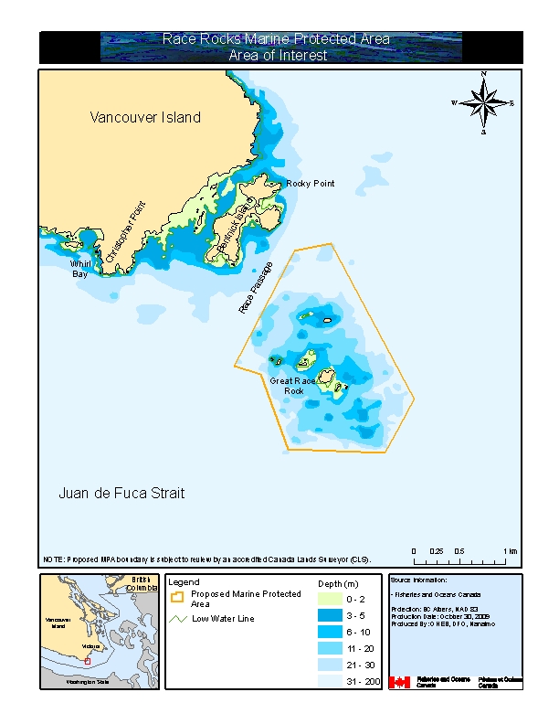 Proposed boundary areas
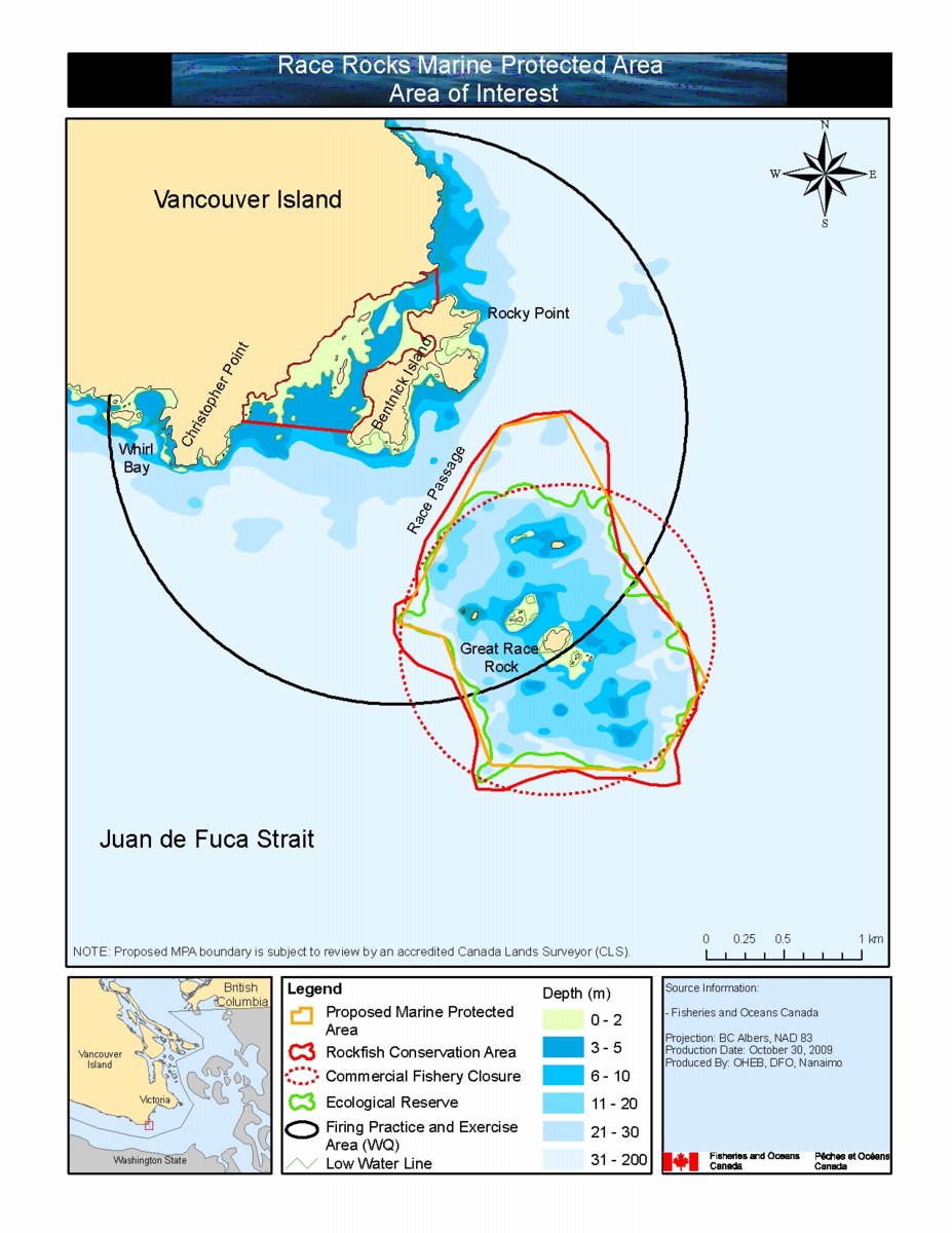 Proposed boundary areas detail