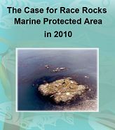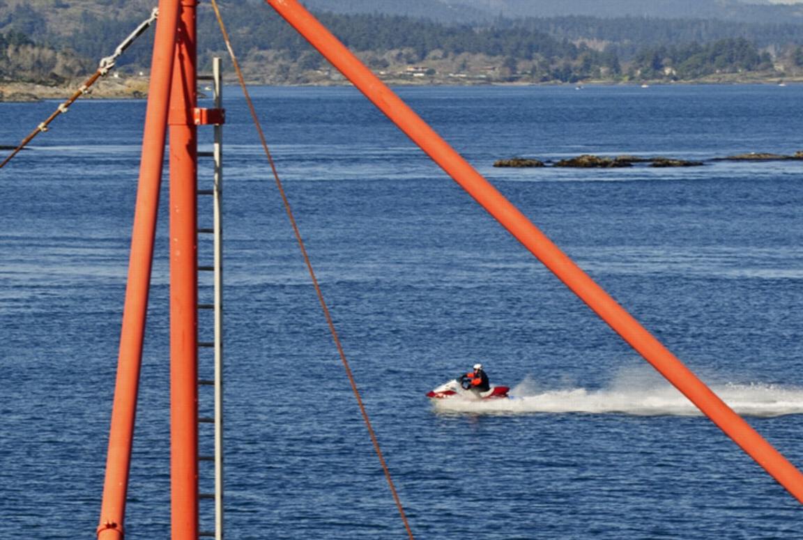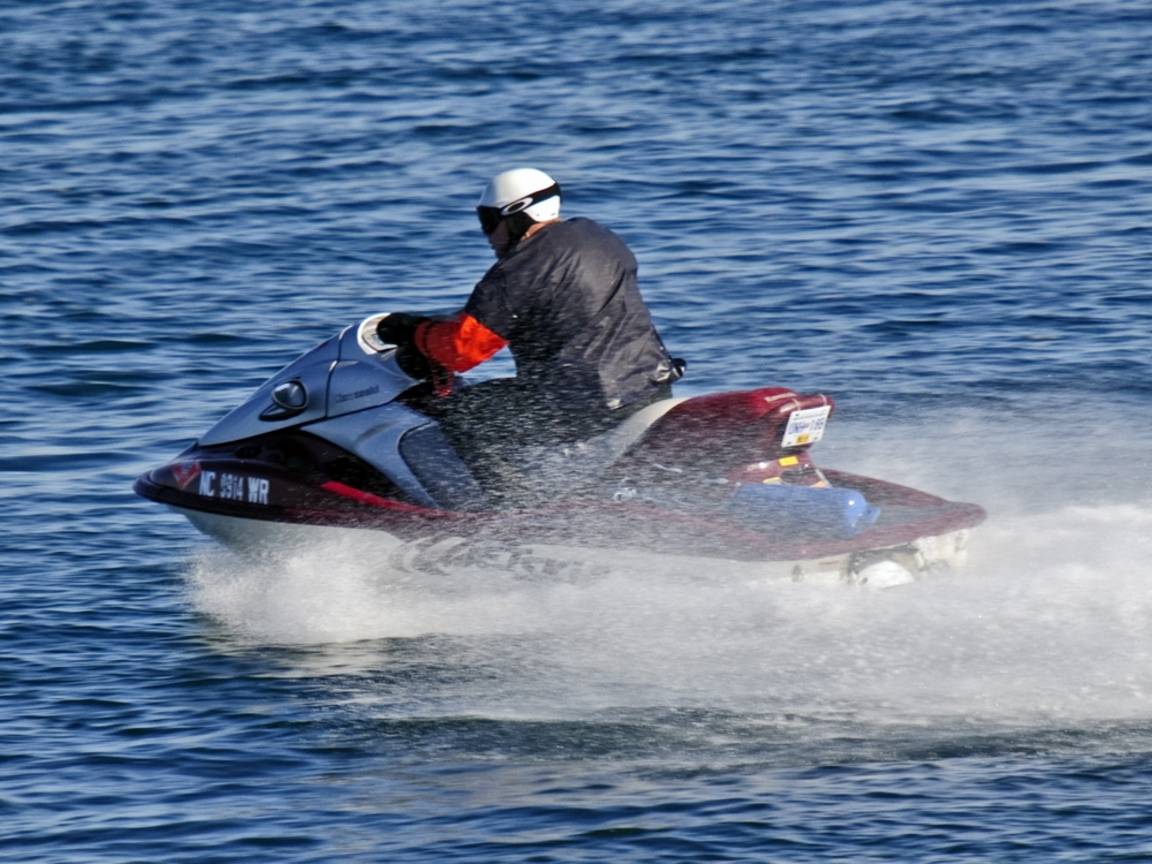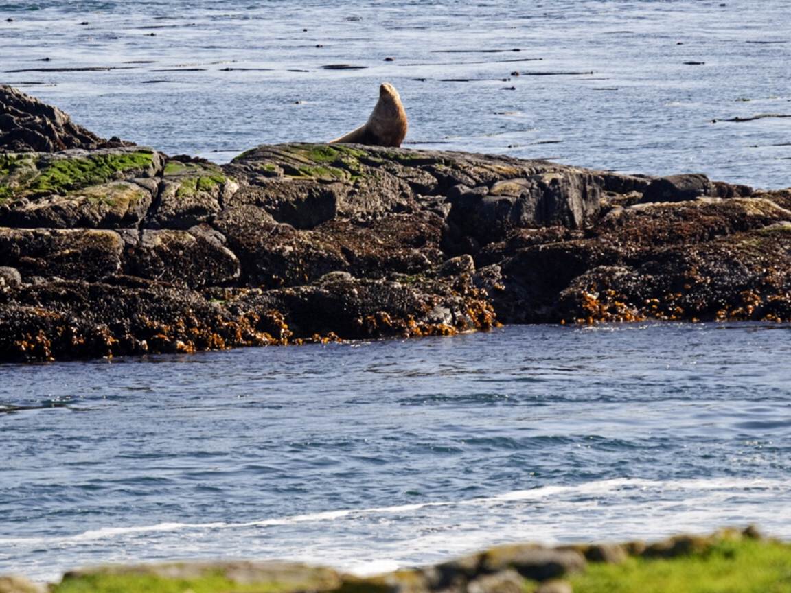
It is important for our deliberations on the MPA to have information available on research that has been done on the benefits to the ecosystem and to fisheries enhancement when MPAs are established. Also the value of the establishment of a buffer zone for maintaining the ecological integrity of a reserve is discussed. This would reduce the likelihood of accidental incursions and would simplify enforcement activities,.
The following references provide information from the research experience gained from a number of international examples
1.The Science of Marine Reserves: PISCO 2007
This is probably the best resource available on the research that has been done on benefits of marine reserves on the web. It can be downloaded in its entirety.
http://www.piscoweb.org/publications/outreach-materials/science-of-marine-reserves
In 2007, PISCO updated The Science of Marine Reserves, an educational booklet originally published in 2002. The booklet is now presented in three versions: a U.S. version in English and Spanish, an international version in English, and a Latin American and Caribbean version in English and Spanish. The booklets are accompanied by a 15-minute video first released in 2002.
These resources provide the latest scientific information about reserves in an understandable and accessible format. They are designed to be used by natural resource managers, government officials, scientists, and the interested public.
2.Big Profit From Nature Protection:
On the BBC website from November 13, 2009
http://news.bbc.co.uk/2/hi/science/nature/8357723.stm
“Money invested in protecting nature can bring huge financial returns, according to a major investigation into the costs and benefits of the natural world.”
“The new analysis takes the economists to the undersea realms of fisheries and coral reefs.
Conservation groups have repeatedly called for a vast expansion in protection for marine ecosystems, both to conserve biodiversity and as a longer-term boost to fisheries yields.
Mr Sukhdev said there was a powerful economic case for this as well.
“If we were to expand marine protection from less than 1% to 30%, say, what would that cost?
“Establishing reserves, policing them and so on, would cost about $40-50bn per year – and the annual benefit would be about $4-5 trillion.”
The benefits would come from increasing fish catches and tourism revenue and – in the case of reefs – protecting shorelines from the destructive force of storms.”
3. Marine Protected Areas Finding a Balance between Conservation and Fisheries Management.
Woods Hole Oceanographic Institution
http://www.fathom.com/course/21701790/session3.html
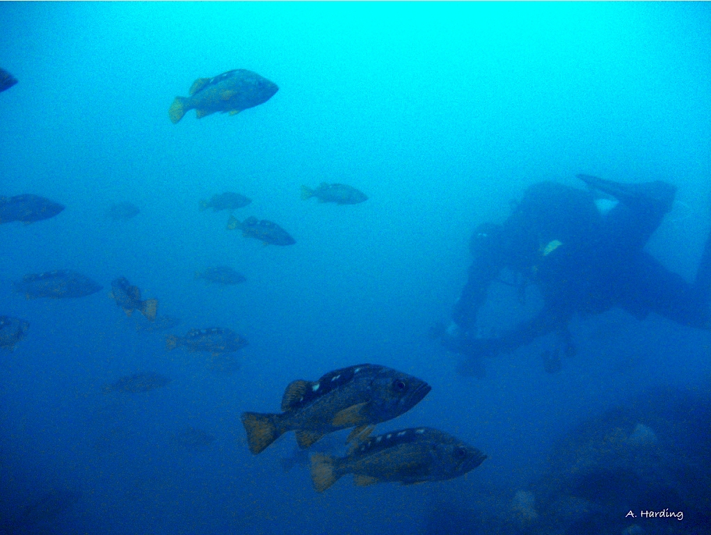
Another contribution scientists have made is in identifying the value of protecting fish so that they grow large and reproduce. In the early 1990s scientists compared the fecundity and egg production of a 60-centimeter red snapper with that of a 40-centimeter red snapper. Despite the fact that the older, larger fish is only one-third greater in length than the younger fish, this increase in length translates into a twelve-fold increase in biomass. Moreover, the larger fish produces the same number of eggs as 212 of the 40-centimeter fish. This difference emphasizes how the relationship between fecundity (the number of eggs produced by a female) and fish size increases disproportionately as older fish allocate more energy to reproduction while young fish allocate more energy to growth. This means that a larger average size of fish in a population can have profound effects on the reproductive potential of that population and its ability to renew depleted populations.
4.Economics of Marine Protected Areas
FCRR 2001, Vol. 9(8)
Sumaila, U. and Alder, J. (eds). 2001.Economics of Marine Protected Areas.
A Conference held at the UBC Fisheries Centre, July 2000
http://www2.fisheries.com/archive/publications/reports/report9_8.php
“Abstract
This Report documents most of the presentations given at an international conference on the Economics of Maine Protected Areas (MPAs) on July 6 to 7, 2000 at the UBC Fisheries Centre. MPAs are areas in a marine habitat that are closed either partially or completely to fishing. They have recently been promoted as complements to traditional fisheries management in the literature. The conference sought to provide a forum for academics, government and private sector actors to present, share ideas, information and models for assessing the benefits of MPAs. The focus of the conference was on the analysis and modelling of economic and social aspects of MPAs. As the papers in this volume show, the presentations were multidisciplinary in scope, covering the state of the art in the analysis of the use of MPAs as management tools for sustainable fisheries.
Results reported at the conference include:
• protecting one of the subpopulations in a stochastic model reduces the sum of squared deviations of catches and effort while the average catch increases;
• to assess the potential benefits of MPAs to fisheries one needs to factor in possible benefits arising from improvements in habitat within reserves, and the lower management costs that MPA implementation could lead to;
• the success of MPAs hinges on the development of economic alternatives for former users of the areas protected;
• if the current fisheries management system is inefficient and no improvement is expected, it is very hard to provide an economic reason for introducing MPAs;
• incorrectly sized or located MPAs may increase the risk of depletion;
• small MPAs with artificial reefs achieve little to avert collapse of fisheries or shift towards catches of low trophic level species;
• accounting for the non-consumptive economic value of fish abundance and size may have a large impact on the economic viability of ecologically functional MPAs;
• in the presence of a limited entry license system, reserve creation can produce a win-win situation where aggregate biomass and the common license price increase;
• MPAs can have differential impacts on the various players involved in a fishery;
• the possibility of spatial heterogeneity in fish stocks implies that an MPA can impact on biodiversity in potentially undesirable ways;
• MPAs can help hedge against uncertainty, especially in cooperatively managed fisheries;
• the precautionary approach in fisheries management implies that economic loss due to the implementation of MPAs will have to be very large to make the establishment of MPAs economically unwise.”
5. International History Of Marine Protected Areas
http://books.nap.edu/openbook.php?record_id=9994&page=145
“The concept of protecting marine areas from fishing and other human activities is not new. In the nonmarket economies of island nations in Oceania (Polynesia, Melanesia, and Micronesia), measures to regulate and manage fisheries have been in use for centuries. These include the closing of fishing or crabbing areas, sometimes for ritual reasons but also for conservation when the ruler decided an area had been overfished or needed protection because it served as a breeding ground for fish that would supply the surrounding reefs (Johannes, 1978). In the broader, global context of conventional fisheries management, Beverton and Holt (1957) provided the first formal description of the use of closed areas in fisheries management. This work was in part inspired by the increase in fish stocks observed in the North Sea after World War II when the fishing grounds were inaccessible because of the presence of mine fields. Since then, fishery managers have used closed areas to allow recovery of overfished stocks, to shelter young fish in nursery grounds, to protect spawning and migrating fish in vulnerable habitats, and to deny access to areas where fish or shellfish are contaminated by pollutants or toxins (Rounsefell, 1975; Iverson, 1996).
Marine Reserves and Protected Areas Provide a Strategy for Ecosystem-Based Management
A growing body of literature documents the effectiveness of marine reserves for conserving habitats, fostering the recovery of overexploited species, and maintaining marine communities. There is a rising demand for ecosystem-based approaches to marine management that consider the system as a whole rather than as separable pieces of an interlocking puzzle. Congress recognized this in the 1996 reauthorization of the Magnuson-Stevens Fishery Conservation and Management Act (NOAA, 1996a) –”
6. Protecting the Spawning and Nursery Habitats of Fish: The Use of
MPAs to Safeguard Critical Life-History Stages for Marine Life
This article shows how commercially important fish species reproduce in spawning aggregation areas which can have a spill-over effect resulting in fishing enhancement in adjacent areas.
7. MPA NEWS search:
http://www.googlesyndicatedsearch.com/u/mpanews?site=search&hl=en&lr=&safe=off&hq=inurl%
3Adepts.washington.edu%2Fmpanews&q=benefits+to+fisheries+of+MPA&btnG=Google+Search
Article #5 is one of many articles in the MPA NEWS out of University of Washington. A search on their site for benefits of marine Protected areas provides this list of references:
8. Towards Networks of Marine Protected Areas: IUCN and WCPA: The MPA Plan of Action for IUCN’s World Commission on Protected Areas
http://www.protectplanetocean.org/resources/docs/PlanofAction.pdf
“This Plan of Action recognizes that MPAs are a tool, not an end in themselves. They are essential in order to protect marine biodiversity and achieve sustainable fisheries. They provide insurance against the common global problem of failure of conventional fisheries management based on control of fishing effort and/or take. The contrasting combination of the physical connectivity of seawater combined with the increasingly known genetic isolation of marine species means that networks of MPAs are vital tools to support marine ecosystem health. Networks of MPAs, within single ecosystems but spanning entire seas and ocean realms (such as the High Seas), are necessary to ensure that biological connections are maintained between interdependent MPAs. A common example is where larvae from one MPA support populations of one or more species within other MPAs. A comprehensive, adequate and representative system
of MPA networks can provide protection for all major ecosystem components in conjunction
with their characteristic habitats and species at an appropriate scale within and across each bioregion. It should have the required level of management to ensure ecological viability and integrity, address the full range of human activities, and be sufficiently duplicative so that a single event, such as an oil spill, would not eradicate that diversity.”
9. Protected Areas, How marine Protected Areas Help Eliminate Poverty
http://www.nature.org/initiatives/protectedareas/howwework/art23185.html
A good example from Fiji of how MPAs can contribute to the social and economic well being of coastal areas in the developing world. Also see the video
10. Marine Protected Areas for the Temperate and Boreal Northwest Atlantic: The Potential for Sustainable Fisheries and Conservation of Biodiversity
Northeastern Naturalist, Vol. 7, No. 4, Symposium Proceedings: History, Status, and Future of the New England Offshore Fishery (2000), pp. 419-434 (article consists of 16 pages)
• Published by: Humboldt Field Research Institute
http://www.jstor.org/stable/3858522
“Abstract
Year-round no-take marine protected areas (MPAs) can enhance conservation of exploited species and biodiversity overall. MPAs have the potential to sustain living marine resources and their support systems at genetic, population-community, ecosystem, and landscape levels. From a fisheries perspective they can protect spawning and nursery areas of key species, maintain age structure (retain older, proportionately more fecund individuals), protect key habitats, and reduce bycatch. MPAs are used sporadically in management of fisheries and are generally based on predicted responses for populations of exploited taxa. However, identification of representative, rare, and high diversity areas of temperate and boreal marine systems, especially on outer continental shelves, is still in its infancy. There is information available from both the scientific literature and from fishers on the life history and behavior of economically important species, on species assemblage patterns, and on physical structure of the marine environment. Such information could be used as a starting point for identifying areas of particular importance to populations or communities of fishes and for the conservation of diversity at the regional scale. Identification of such areas could serve as a basis to design an experimental network of MPAs. Such MPAs, designated for the purpose of maintaining or developing sustainable fisheries, must explicitly be designed within an experimental context, maintaining flexibility for changes in regulations as new information becomes available. Monitoring change in exploited and non-target populations (intra- and inter-guild), habitat complexity indices, and diversity of sentinel taxa (for assessing maintenance of diversity) will be needed to provide feedback to assess the efficacy of MPAs and to recommend changes in the regulatory framework.”
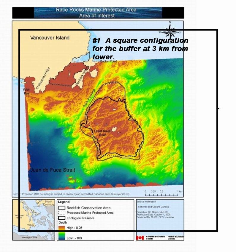
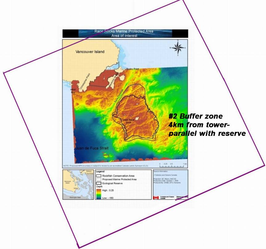
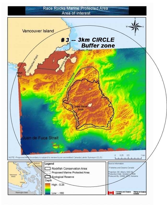
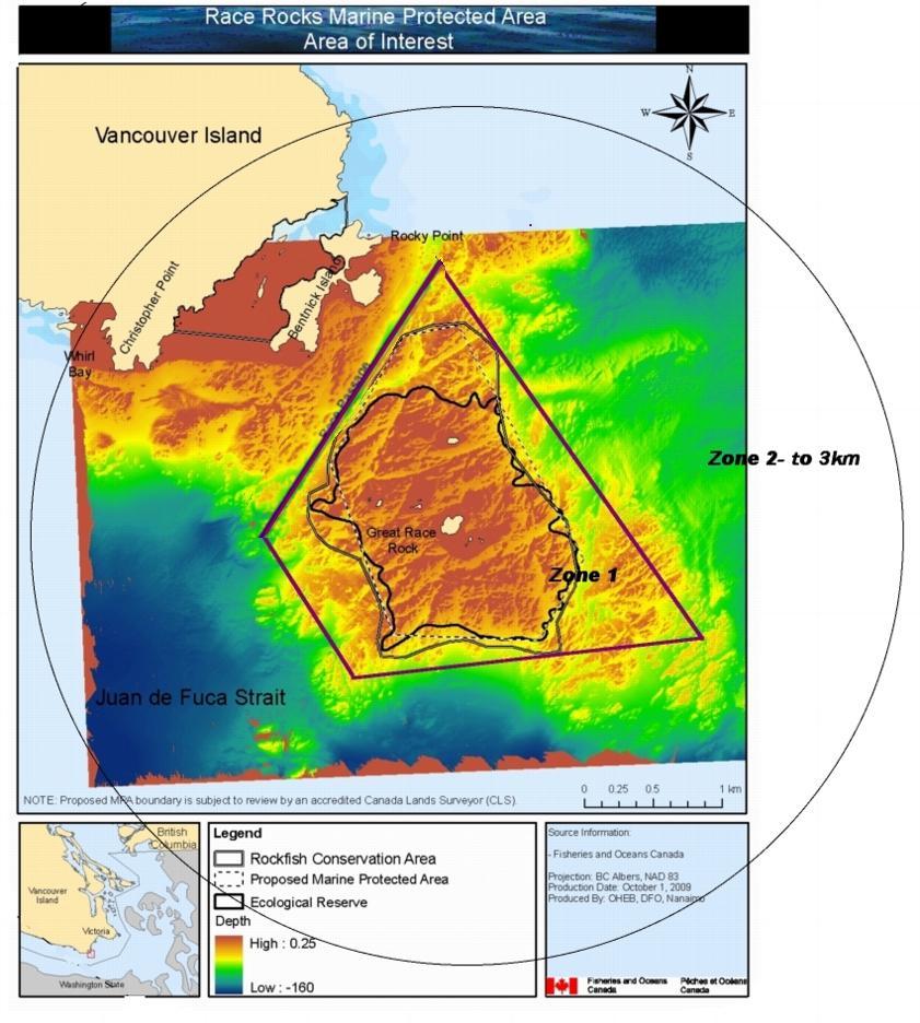
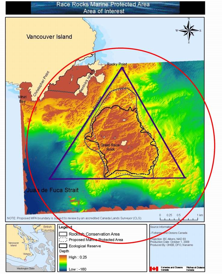
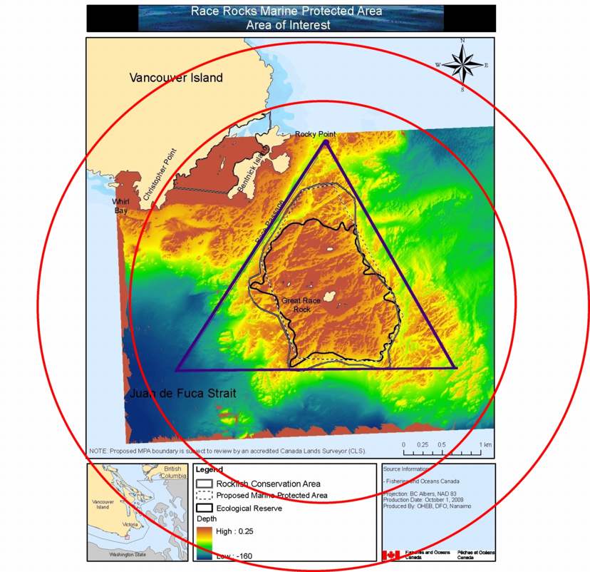
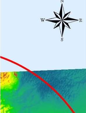

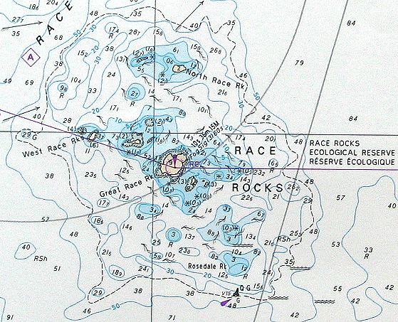
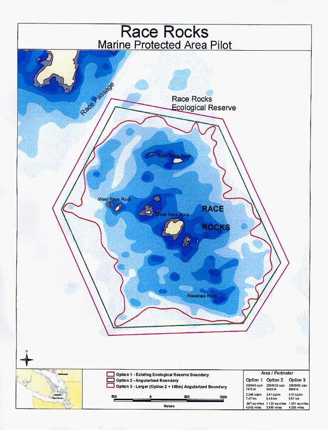
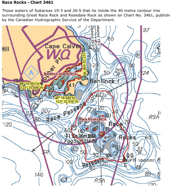
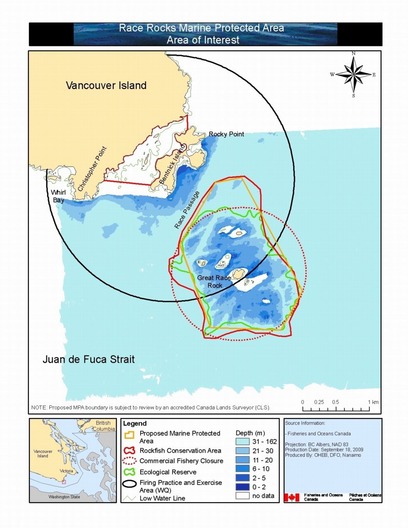
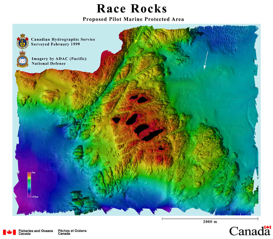
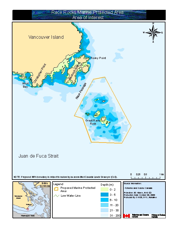 Proposed boundary areas
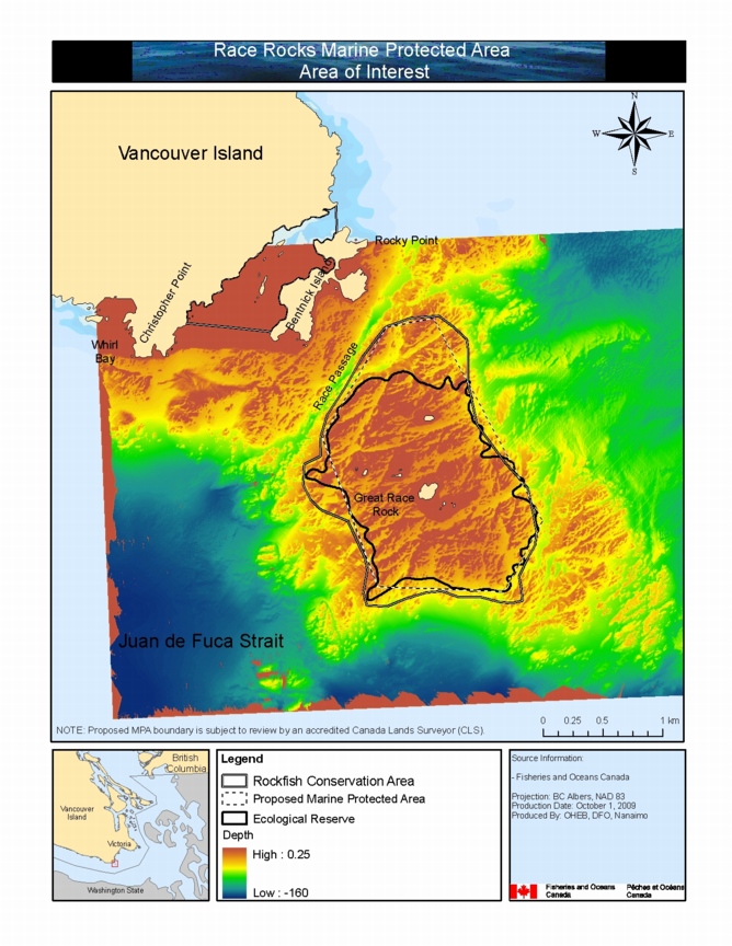
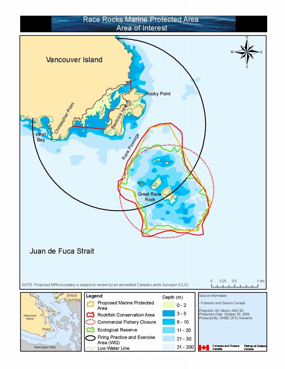 Proposed boundary areas detail