racerocks.com Project Update, Feb 6 2000

We have made very significant advances towards our goal of initiating Phase 1 on March 11, 2000. This is especially true in the week of January 31, 2000 thanks to an extraordinary effort from our lead partners at Telus and LGS.

NEWS FROM LGS
LGS Project Manager Aengus McIntosh has proven himself to be a stern task master and gifted conductor as he coordinates the various aspects of the project. We have ordered the radio equipment needed to beam the heavy bandwidth of streaming video from Race Rocks to Pearson College and our entry point into “mainland” fiber and the internet. With advice from the specialists at Telus we have selected Tsunami Radio, 5.8 GHz spread spectrum 4Mb equipment to deliver the signal from Race Rocks. This equipment has been ordered from Glentel in Edmonton. Web specialist Scott Nicholl at LGS is working with Garry Fletcher and his students from Pearson College to develop the new racerocks.com web page for the March 11 launch. Scott has sourced our first camera, a SiteZap from Reardon Technology which is on the way to us from California. Aengus McIntosh continues to track our activities to make sure we apply foresight in our design, maximize the value of our purchases and work together to meet the complex and interconnected deadlines.

TELUS TO THE RESCUE
At Telus, effective support from Ian Scott, has mobilized a dedicated group of specialists in various Telus departments. Telus provided the solution to our biggest challenge when they agreed to provide the tower required to mount the radio antenna at the Pearson College end of our radio link. This was a turning point for the whole project and we are all very grateful to Telus. Staff in their Advanced Communication division are working on the issues around delivering the streaming video out of Pearson College and onto the Internet through the Telus server farm. Tim will have more details on this in the near future.

AT PEARSON COLLEGE
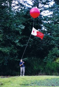
With a red balloon tethered high above the College’s observatory it is obvious something is happening. Garry Fletcher and a group of students in the know are aware of the work being done by Tom Bates of Telus to find the site for a radio link to the Pearson College campus. Less obvious are the preliminary web activities and documenting of the project that Garry’s students are working on. As the educational leader | and Director of the project, Garry is researching the various needs and options of the project design. We are very grateful to Tom Sampson for his advice on First Nation’s aspects of the educational program. Throughout this time the public consultations onthe establishment of the Race Rocks Marine Protected Area are also proceeding. Garry and several students are very much involved in this process as well. Garry also finds time to teach as well!

MORE RESOURCES
We welcome more supporters to the project. Ken Dunham, a Pearson College graduate and the principal of Symmetrical Systems Consulting is a born again partner in the project. It was Ken Dunham and Garry Fletcher that first developed the idea of a virtual Race Rocks web site in 1996 (when the costs were prohibitive). Ken is donating his network design expertise to design and build the local area network on Great Race Island and across the campus of Pearson College to Telus fiber. It is amazing how much today’s design looks like Ken’s 1996 radical version! Vancouver Aquarium and Marine Science Centre have confirmed significant financial support for the project and we look forward to the benefits of the Centre’s extensive experience in delivering marine education programs as we move into subsequent phases of the project.

MILLENNIUM BUREAU
The Federal Millennium Partnership Bureau has made this project possible. We have been in extensive communication with Bureau staff in recent weeks and they have been of great assistance in developing our contract and accounting systems. Though detailed and precise the systems are efficiently expedited. The good news is that at this point we are exactly on budget.

On a personal note… it is a great experience to work on this project. I have never worked with a group of such eager problem solvers. Thank you to all those mentioned here and to the many others working on specific elements of racerocks.com who will I am sure be recognised as their particular component comes on line.

UPCOMING EVENTS
If you are interested in the Race Rocks Marine Protected Area plan you are welcome to attend a Department of Fisheries and Oceans and BC Parks open house on the plan at Royal Roads on Saturday February 12, 2000 from 9:00 to 15:00hrs or at the Olympic View Golf Club on Wednesday February 16, 2000 from 19:00 to 21:30hrs. Garry and some of our students will be there to discuss the issues and present information about Race Rocks from our existing web site at http://www.racerocks.com

please e-mail Marc Pakenham at DFO if you plan to attend.

Angus Matthews

PROCEED TO NEXT UPDATE- FEB 13/2000

Millenium Partners, LGS and Telus visit Race Rocks with Pearson College

Photos by Victor Rakou, PC student (Russia) —–Text by Peter Seem, PC student ( US)

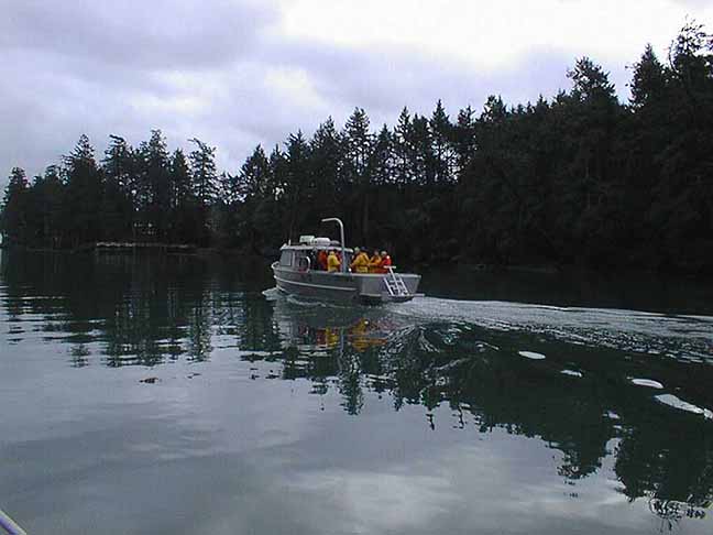
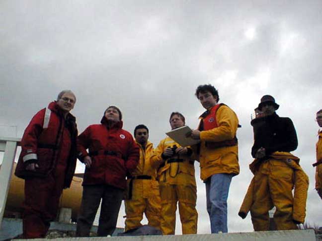
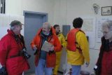
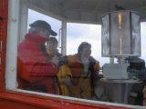
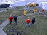
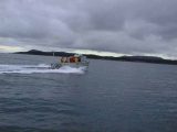
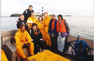
On January 14th, 2000, Tom Bates, Paul Longley, and a Telus representative, along with Angus Macintosh and Scott Nichol, from LGS, came out to Pearson College. After a whirlwind tour of campus from Garry Fletcher, Biology and Marine Science teacher, and Angus Matthews, administration and finance director,  the group headed out to Race Rocks along with several Pearson Students.The group’s main goal for the day was to find sites for the radio or microwave transceivers that would transmit data between the college and Race Rocks.

The transmission of data will be Telus’ contribution to the project. Paul Longley, from pre-sales technical support, and Tom Bates, with microwave engineering, were there to lend their expertise.   LGS’ Aengus Macintosh was acting as project manager, and Scott Nichol was recording the work for the web page the IT firm would be helping to create.

Other options, the tops of local mountains, would require running a ground cable from the site to the college, which would be both time consuming and costly. Clearly, the best option present was to aim for a site just behind Pearson College’s observatory, which was relatively clear of trees and already connected to the internet by a high speed line.

While the group also needed to deal with finding sites and running power to all of the equipment on Race Rocks, their primary concern was the data transmission. In order to get undisturbed transmission they needed a clear line of sight between two stable sites. Any trees, foliage, or other obstructions, or small movements at either end, would break up the transmission. Indeed, even being too close to the water would generate refraction that could disturb data flow.The best solution found was to start from the highest point on Race Rocks, and aim up. From the top of the lighthouse, with the aid of a sighting scope, they took stock of the options: William Head, the closest point to the island, was deemed too low to the water to allow for a clean shot.


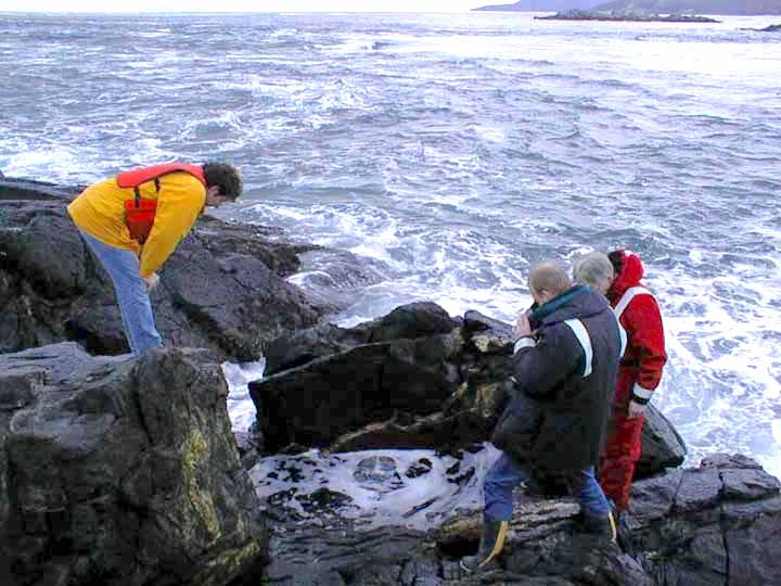
examining the tide pool on the west side

Garry took the group over to the tidepool that has been constructed on the West side of the island.
Plans were to install one small camera underwater in this pool to provide a window to view the emerging life and the frequent surge action .

This tidepool was rearranged and no longer functioning after the hurricane of 2006. Fortunately the underwater camera had not been installed!

=============================================

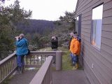
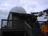
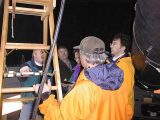
The observatory could be seen from the top of the lighthouse through a gap in the trees. The next question that had to be dealt with was whether any of the taller trees in between would provide an obstruction, and need to be topped. The prospect of gaining permission from the DND to take the tops off of one or two old growth trees on their property was frowned on because of the delays that would undoubtedly ensue. To get an answer, the team decided to take a look at the situation from the other end. A boat ride later, things weren’t much clearer. From within the dome of the observatory, it was very difficult to catch site of Race Rocks, or more importantly, the lighthouse. Despite Garry’s excited, “I see red! ” the mood was skeptical. Stripped black and white, with a red cap, the lighthouse should have stood out, if it was visible. The difficulty catching sight of it suggested that they would either need to be higher up or that a clean shot wasn’t going to be possible.

No one was willing to go ahead with any other part of the project, trying to secure donors and expensive equipment, without being sure that this most fundamental requirement could be met. It was resolved that they would try a test the next day to find out just how high an observatory side tower would need to be, if indeed it was possible at all.

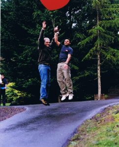
On January 15th, at noon at Pearson College there happened a strange sight. A giant red helium balloon flew high over the college, dancing in the breeze on a long tether tied to a banister at the observatory. While one part of the group headed out to Race Rocks, the other sent up the helium filled balloon.The helium filled balloon. Over radio from the lighthouse, they directed the balloon to be raised higher until they could see it, unmistakably and comfortably above any surrounding trees. The length of the tether, still well within the achievable height for a tower, was proof that a clear line for transmission had been found.

The project is ready to move into actually constructing the tower, setting up the transmission equipment, and obtaining the cameras and sensors. They hope to have transmission established and two cameras up and running by March 11, 2000.

PROCEED TO NEXT UPDATE- FEB 6/2000

LGS Project Management of the Millennium Project

This Project Management was a donation of the LGS group the following .PDF files represent the valuable contribution that this group contributed to ensuring the successful completion of the Project.


1. Project Definition Statement
ganttreportfeb112000

2. January 6, 2000 Gantt Report
PDS01

3. LGS Project Management Methodology
PDS02

4.January 11 Gantt Report
PDS03

ACOUSTICAL BATHYMETRY OF RACE ROCKS

ACOUSTICAL BATHYMETRY OF RACE ROCKS

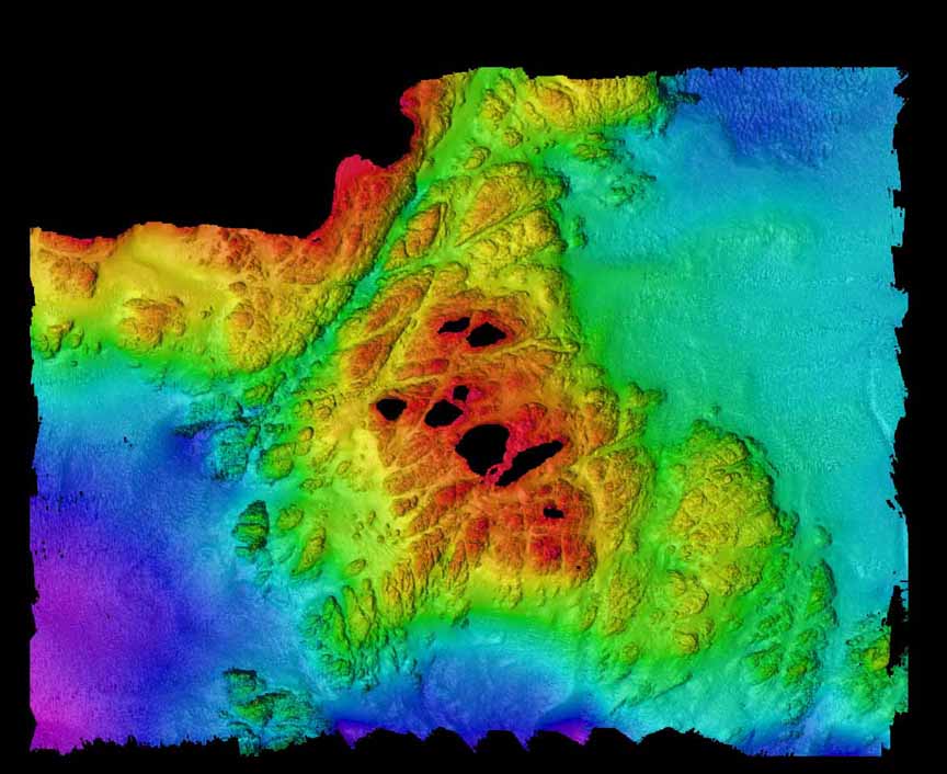
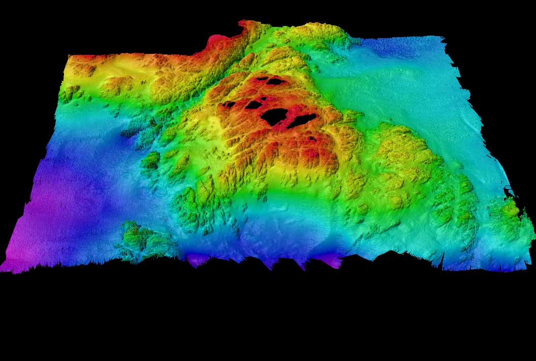
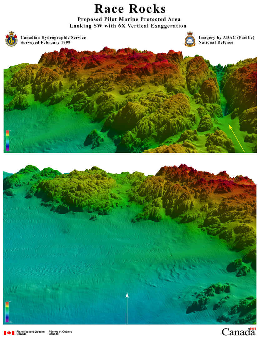
In February 1999 the hydrographic survey boat from The Institute of Ocean Sciences in Sidney, B.C. has done an acoustical bathymetry program which has mapped the seafloor around Race Rocks to a depth of 100 meters. The project is under the direction of James Galloway. This project will eventually involve two other components as well, grab samples at 40 locations underwater and underwater towed video to a depth of 20 meters. More detail will follow on this page as the project progresses, but the initial two images of bathymetry from different perspectives are presented here.
Our thanks to the following who have made this project possible and have shared their results immediately with us.Doug Cartwright Hydrographer
Canadian Hydrographic Service
Pacific Region
Also thanks to Lt.Mike Brissette at DND for final stages of work on these images.and to James L Galloway , PEng
Canadian Hydrographic Service, Head, Sonar Systems Institute of Ocean Sciences
9860 West Saanich Road
Sidney BC

Note: In this view, the black area is either where land is located, or it represents the margins of the survey .
(2d capture of entire area from south – 1 x magnification ). Bentick Island appears at the top of the picture. Great Race Rocks, where the light station is located is the large island in the center of the picture. Shoreline margins are not yet accurate. The present boundaries of the Ecological reserve are more or less the outer limits of the red area at 36 meters.
. The second image is a view from the South looking Northward. Colors toward the blue scale are representing depths of almost 100 meters.
( 3d capture of entire area from south : 1x magnification -3 x vertical exaggeration)
We hope to add further interpretation to the pictures , but at this stage they represent a significant step as the first layer of information on the seabed.

These projections represent three dimensional views looking toward Race Rocks from the North West underwater direction.

BCTEL takes a trip with Pearson College to Race Rocks

rrbctelOn January 13, 1998, BCTEL** (Discovery Learning) representatives took a trip to Race Rocks Ecological Reserve with Pearson College faculty member Garry Fletcher and some of his students. They had invited them to see first hand many of the Pearson College marine science educational projects that are highlighted on the College’s web page. BCTEL (Discovery Learning) provides the College with internet support, making this unique marine science project globally accessible. Following the Race Rocks visit, BCTEL presented the students with a $5,000 cash gift for the College’s annual fund.

**now Telus

MEASUREMENT OF SURFACE AREA USING “NIH IMAGE”

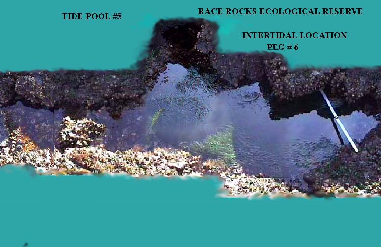
The image that you have available must be either a .Tiff or a .Pict . You may download the full screen version of this image, pool5.jpg and then convert it to one of those formats using graphics converter or Photoshop or any suitable image handling program.The image of the tide pool shown here has a 1 meter ruler in it . An object of known length must be present in the picture in order to do measurements.


1. Open NIH image using the small black microscope icon. (If you do not have NIH Image installed on your computer you may download it here. download NIH Image ( available in Mac or PC )

2. Open the image “pool5.pict” that you have made by downloading the “pool5.jpg”.

3. From the TOOLS pop-up menu in NIH Image, select the SELECT LINES tool ( the dotted line fifth from the top of the right hand column).

4. Click and drag the select lines tool over the one meter image in the picture.

5. Click on the top Menu bar item ANALYZE, then move down to SET SCALE

6. In the SET SCALE box, set the units to centimeters. Set the KNOWN DISTANCE to 100., press “OK

7. Select the region to measure using the freehand selection tool, ( fourth down on the Tools bar– heart shaped dotted line.)

8. Outline the area to be measured by tracing the perimeter of it with this tool.

9. CLICK on ANALYZE– OPTIONS – in the tool bar.

10 .Click in the boxes for Perimeter and Area. ( Other options may be tried after this basic step has been mastered.)

11. Click on ANALYZEMEASURE –ANALYZE–SHOW RESULTS . Now you should see the calculated area and perimeter in the results box.


Further information on page 6 of the “NIH Image” direction manual

BBC interview on the future use of technology to bring Race Rocks to the internet

In November of 1997, BBC reporter Hugh Warrick accompanied Garry Fletcher to Race Rocks and did an interview on the future plans for using technology to make available the resources of Race Rocks to all through the internet.

As is said in the interview : “Typical of ecotourism you could love an area to death”—  the solution of using the right kind of technology to broadcast on the internet is discussed and even robotically controlled video cameras on the internet are mentioned. Later in the early part of 2000 that was to become a reality .
for mp3:


BBC interview on a Proposal for Virtual Race Rocks

In November of 1997, I was interviewed by Hugh Warrick of the BBC on a plan to set up a network on RaceRocks to be able to have live streaming video on the internet, Here is the audio clip of that interview

BBC Interview at Race Rocks in November of 1997 on Technology for Sustainability at Race Rocks

A Proposal for Race Rocks Ecological Reserve. : Technology for Sustainability

A Proposal for RACE ROCKS ECOLOGICAL RESERVE: Technology  for Sustainability


CONTENTS:


STEWARDSHIP OF A PRICELESS RESOURCE: A window into a unique remote natural world exists on the south western tip of Canada.The Race Rocks archipelago of 9 small islands and a central island dominated by a 137 year old lighthouse was made an ecological reserve in 1980. Under the stewardship of staff and students of Lester B. Pearson College of the Pacific it was designated to serve as an area for research and education as well as preservation of a rare assemblage of marine organisms. Almost 20 years later, Pearson College has taken on responsibility for managing the islands and the reserve, and providing for continued staffing on the now automated light station.

Central to this proposal is the concept that the International students on scholarship from 83 countries at Lester B. Pearson College will benefit greatly by the ability to continue to use Race Rocks as an educational resource. Moreover they will be able to be involved in operating this project as a model for ecological stewardship that they will be able to take back with them and apply to sensitive areas in their own countries. The potential for a global network of such education and research areas has exciting possibilities.

BUILD IT AND THEY WILL COME– ELECTRONICALLY! With our new responsibilities come a determination to make this unique resource available to the world while at the same time preserving its fragile wild ecosystems. In October of 1992 we had the experience of assisting with the broadcast from Race Rocks of 24 programs in the Underwater Safari television series. We reached by satellite, microwave and cable technology the classrooms and science centers across the nation. Now we have decided to use internet communication technologies to accomplish this task on a wider global scale and a regular basis. The following proposal puts forth some of the wide range of possibilities that could help us to succeed inthis challenging task over the next few years.

THE INTERNET AS A DELIVERY SYSTEM: Central to this plan is internet connectivity from the island of Great Race Rocks via appropriate microwave and/or Satellite technology. This prototype could be a valuable experiment in the provision of educational research images,sound and video to educational institutions around the world. Moreover it would be a valuable model for others to use in the stewardship process with unique and endangered environments.

TIDEPOOL MONITORING: N.J. Berril, one of the fathers of marine science in Canada said “If you look into a tidepool and comprehend what you see, you are observing the universe”. We have found in the biology and environmental systems classes at the college,that the tidepools at Race Rocks are a valuable asset for modeling ecosystems. There are a number of these pools of varying sizes and proximity to the water on the South West corner of the island. The physical factors of these pools such as salinity and temperature, fluctuate widely each day. Being able to monitor these changes continuously will lead to a better understanding of the dynamics of the systems. We can envisage electronic monitors that could be installed in certain tidepools that could lead to unique opportunities for students and researchers to pursue studies. It would also be possible to offer a visual image of these pools with the installation of a video imaging system underwater in a pool.

ROBOTIC VIDEO FROM THE LIGHT TOWER: With a series of robotic video cameras installed on the light tower and at other locations around the island, we could attain the possibility of an unrestricted panoramic view of the reserve. These cameras could be controlled by the operator on internet, and the following applications could result:
a) monitoring the marine mammal colonies. Year round there are always some marine mammals in the reserve. The elephant seal population has recently increased , with a possibility that they may form a new breeding colony.
b) Harbour seals are year round residents. Images of delivery of seal pups on the rocky shore right below the tower, and nursing mothers in the shallow water would afford a great advantage for the study of seal behavior.
c) The hundreds of California and Northern Sea lions that frequent the area from fall to spring would be a constant source of interest for internet visitors who could direct robotic cameras to zoom in on the constant activity in the haul out colonies. Feeding in the nearby waters that attracts flocks of birds could also be seen.
d) Orca whales frequent the area and would be visible from cameras scanning the surrounding ocean .
e) Four species of Marine birds: Pelagic Cormorants, Black Oystercatchers, Pigeon Guillemots and Glaucous Winged Gulls nest on the central island of Great Race Rocks. Video coverage of all stages of foraging , courtship and nesting behavior would be possible. Bird predation by frequently visiting bald eagles and falcons could be followed also. In addition , throughout the winter months overwintering populations of sea birds may be observed on the islands.
f) Security of the reserve could be enhanced greatly by cameras with robotic control. Both open ocean and Intertidal resources are at risk.
g) Continual observation of sea conditions would be possible for the environment weather service.

OCEANOGRAPHIC MEASUREMENTS: Daily measurements of salinity, (since 1936 ) and temperature ( since 1927) have proven invaluable for oceanographic research. We propose to add to this, sea state, and tide and current readings , all available in real time ,as well as in long term records.

UNDERWATER VIDEO RETRIEVAL SYSTEM: The staff and students of the Diving Service at Lester Pearson College have since 1980 been assisting other researchers in the reserve and doing regular monitoring of some of the basic features of the reserve. We have the capability to establish an electronic data bank, accessible by internet , of some of the footage of the organisms underwater at Race Rocks. This will serve as a valuable resource for those studying biodiversity and behavior of marine life. This footage could be updated frequently by our divers asthey do surveys in the reserve. Seasonal changes could be accounted for and a series of baseline ecosystem images could be established .

DEEP UNDERWATER ACCESS: In areas of the reserve too deep for regular diving, footage could be obtained from remotely operated vehicles. When linked to image maps of the reserve this footage could reveal a fascinating account of the underwater ecosystems. Arrangements through existing groups including the military who operate these vehicles should be possible to arrange.

HYDROPHONE RECORDING: Several years ago we participated with whale researchers in helping to install a hydrophone in the water off race rocks. This experience pointed to the possibility of having real time audio available from the underwater world of the islands.Killer whale vocalizations, as well as the murmur of other sounds of fish and invertebrates underwater could be a valuable addition to the web site.

ATMOSPHERIC DATA GATHERING: For many years, the light station served as a meteorological station.. Wind speeds are still transmitted to the weather forecasting services. Real time recording of a number of physical factors could be obtainable by internet. UV radiation,temperature, humidity, sunlight, precipitation and wind speeds could all be included in an array of data.

THE ALTERNATE ENERGY AND WASTE DISPOSAL TECHNOLOGIES: Recently the light and foghorn underwent conversion to Solar energy. We aim to seek an array of solar and wind technologies to be installed to make the island totally energy self sufficient. These energy generators could be monitored on a comparison basis so that a constant set of data on relative efficiencies was available to the internet site. There also exists the possibility of energy from the constant currents running past the island. This would not be an easy task but would be something to investigate for the long term. In addition, a number of technologies could be employed to provide for complete waste recovery in the sewer system of the station so that it no longer discharges into the ecological reserve.


Garry Fletcher: Pearson College faculty member in biology, environmental systems and the CoastWatch program.

November 4, 1997


Return to Contents |


Underwater Safari- October 1992

In October of 1992, the diving students of Pearson College were able to help with the underwater filming for the Canadian Underwater Safari production. This series of 24 one hour television programs was broadcast live to schools and museum audiences across Canada and the US on the Anik E2 Satellite. Since that time the programs have been broadcast across the world. We have made available at this location some of the unique underwater footage which was taken by the photographer Darryl Bainbridge. The project was an experiment in using technology along with many volunteer hours to help to bring the fragile ecology of this unique area to the world. Our thanks to B.C.Parks for the intial funding to launch the production. The Royal B.C. Museum and its staff , Shaw Cable, BC Systems, BC Tel and many volunteers who provided assistance with this project.

 This video is of Pearson College student Jason Reid ( PC yr. 18) discovering a wolf eel Anarrhichthys ocellatus while the program was broadcasting live. Cameraman Darryl Bainbridge followed the huge fish for some time and caught it feeding on a green sea urchin.

OTHER REFERENCES TO THIS PROGRAM ARE IN THESE POSTS: 

 https://www.racerocks.ca/tag/underwater-safari/

Living on a shelf off the North side of Great Rocks is a Wolf Eel often seen by divers. This very gentle fish cooperated with us for one session allowing some very interesting poses. On this dive, Jason Reid (LBPC year 18) encounters the wolf eel


The fish shows patience while looking for its favourite food

Jason offers the wolf eel a green urchin

as it eats, clouds of urchin roe puff out of he urchin

Swimming away with his “catch”

A harbour seal was inquisitive with the divers

A gentle nose to nose with a diver


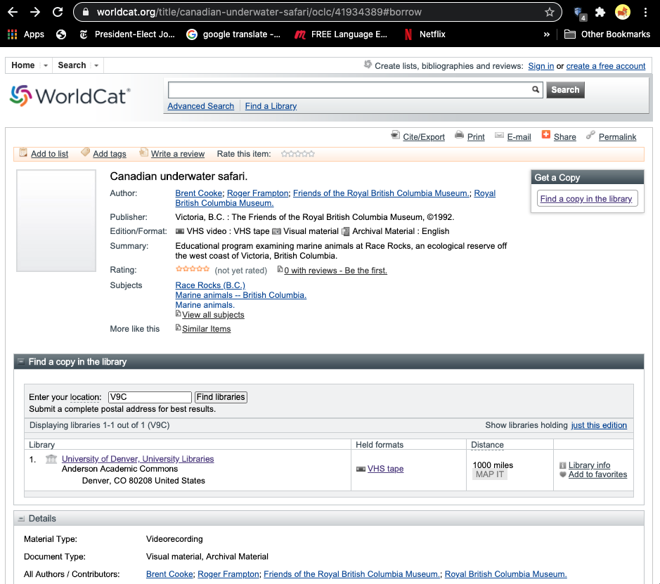
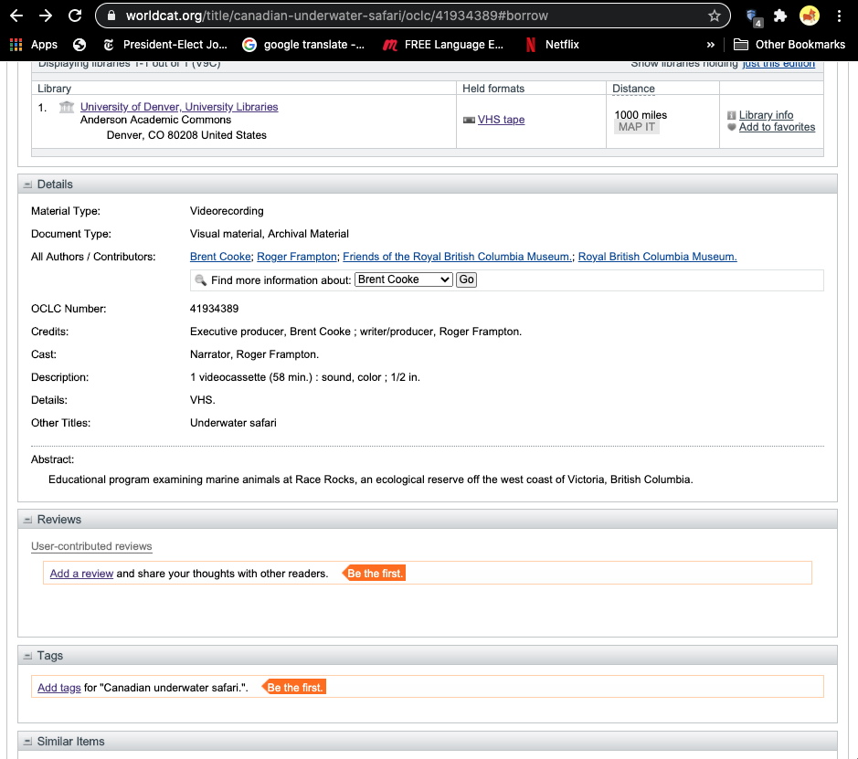
There was a video published by the Friends of the Royal British Columbia Museum and authored by Brent Cooke and Roger  Frampton on the Underwater Safari program: the following gives information on it.

https://www.worldcat.org/title/canadian-underwater-safari/oclc/41934389#borrow