| TOPOGRAPHY of SUBTIDAL RACE ROCKS |
Topography of Subtidal Race Rocks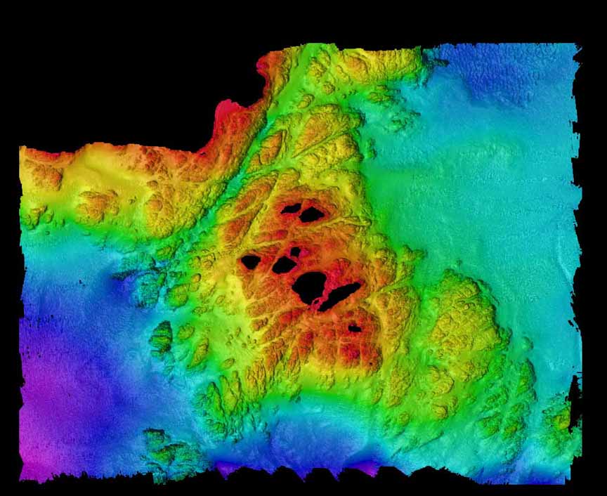
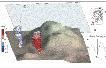
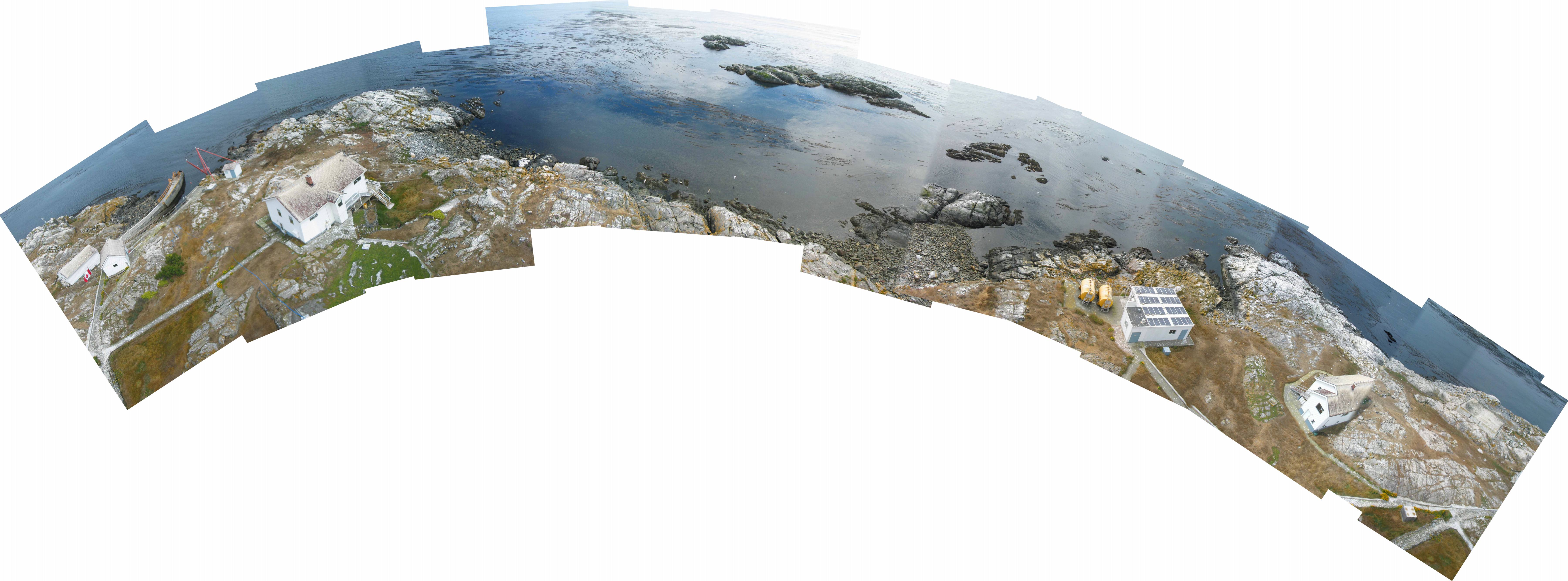
| Only by looking beneath the waves can we really get a full picture of the extent of the topography of the Race Rocks Archipelago. | We were fortunate in 1999 to have a comprehensive study and mapping project done by the Canadian Hydrographic Service. They used multi- beam sonar to plot the bottom profile down to 150 metres. |
| With the results of this imaging process we are now able to appreciate the extensive powers of the glaciers as they moulded the terrain at the Southern tip of Vancouver Island. Now, the only surface features that attest to this force are the glacial scouring on the rocks and the erratics, (rocks of basalt or conglomerate) left by the last glacier to pass over Race Rocks and the adjacent shorelines of Vancouver Island. |
| The Abiotic effect on Organisms of the Surface Topography of Race Rocks |
| Go to this Google Map of the Surface topography of Race Rocks to see how the abiotic factors of geology and topography affect the distribution of organisms at Race Rocks |
AND THE GEOLOGY IS EVER-CHANGING
This large boulder at one end of the artificial tidepool moved 2 metres during the Hurricane of Dec 15, 2006. See this file for before and after pictures.
THE QUARTZ INTRUSIONS:
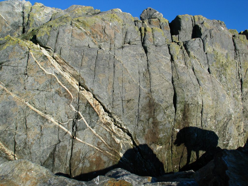
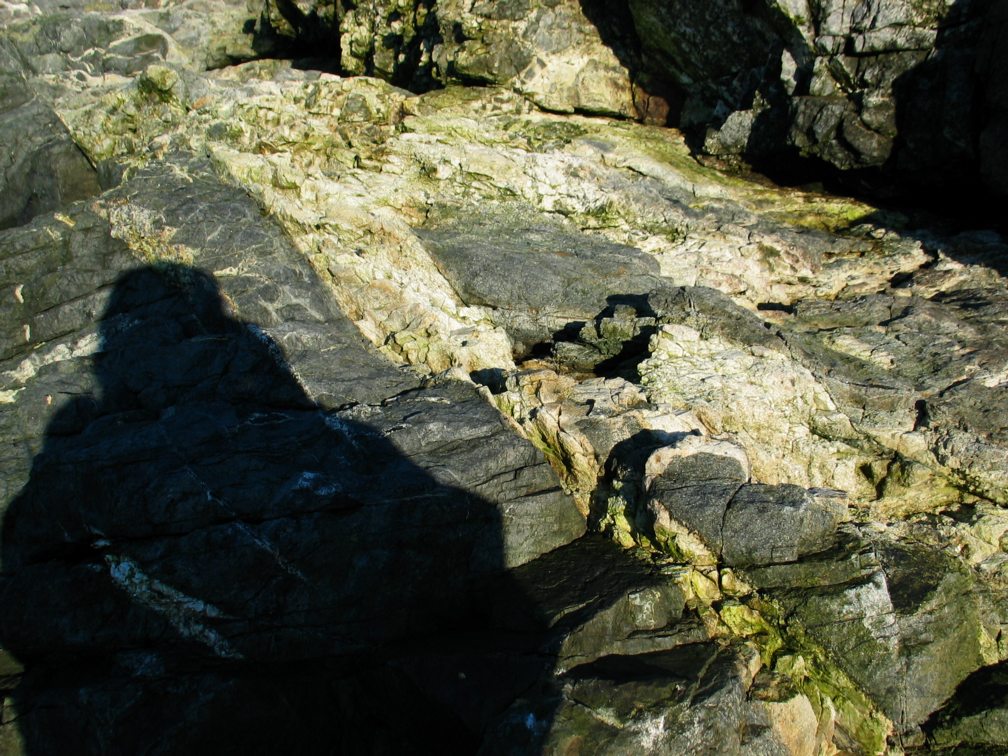
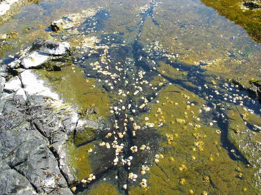
We have very little formal information on the Geology of Race Rocks, but no doubt it has an important role to play in the distribution of organisms. Most of the foundation rock at Race Rocks is a black coloured basalt. It was formed underneath a volcanic range which has since been scoured away by glaciers. One obvious example to which we often refer students on field labs is the interesting rock structure of the bottom of tidepool number 4 on the west intertidal 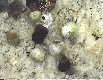 shelf of Great Race Rock. On the this side of the island, many seams of white rock occur as intrusions into cracks of the previously hardened basaltic background rock.
On the bottom of this shallow pool is a seam of quartz with some obvious crystalline structure.. In the tidepool we find a pure white variant of the usually black coloured Littorine snail, Littorina sitkana( periwinkle) We speculate on the existence of this color variant being due to the quartz background which makes it well camouflaged in the pool and thus able to avoid the predation of shorebirds. In the picture several white and several black variants of this species are shown against the quartz background.
In 1998, a Pearson College student, Giovanni Rosso, conducted research on this color variation and produced a paper on shell colour variations at Race Rocks. In his abstract he summarizes:
“As with most intertidal gastropods, Littorina sitkana shows remarkable variations in shell color. This occurs both in microhabitats which are exposed or sheltered from wave action. There seemed to be a close link between the shell coloration of the periwinkle and the color of the background substrate. Field work was carried out on the Race Rocks Marine Protected Area in order to investigate patterns of color polymorphism. Evidence from previous studies was used to support interpretations and understand certain behaviors.
The results showed that in the study site there was a very strong relation between the shades of the shells and the colors of the rocks. Light colored shells stayed on light shaded rocks and vice versa. An interesting pattern was noticed with the white morphs. These were rare along the coast (only 2%), but were present in relatively high numbers in tidepools of white quartz. From previous experience (Ron J.Etter,1988), these morphs seem to have developed as evolutionary response a higher resistance to physiological stress from drastic temperature changes between tides. Some results showed that the white morph is present in an unexpectedly high percentage at the juvenile stage, but then their number decreases dramatically.”
-
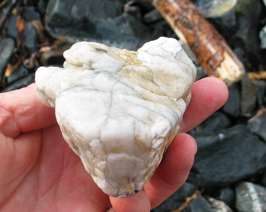
- Quartz veins in the bedrock on the west side of the island.
-
- Sheets of quartz where the rock has fractured. ( West shore)
-
- tidepool number 4 referred to below.
APPEARANCE of CONGLOMERATE SUBTIDALLY.
An interesting discovery was made in 2005 on the preliminary dives to examine the substrate where the tidal current generator was going to be installed, The bottom at location 1, just North of the docks at Race Rocks, yielded a conglomerate type of rock surface at 15 meter depth in the channel . We were surprised at this as we had never come across this formation before, certainly it doesn’t appear to exist on the rocky islets, above water on the archipelago. Dr. Chris Yorath who has recently published a new version of “The Geology of Southern Vancouver Island” has supplied the following information which may explain this finding:
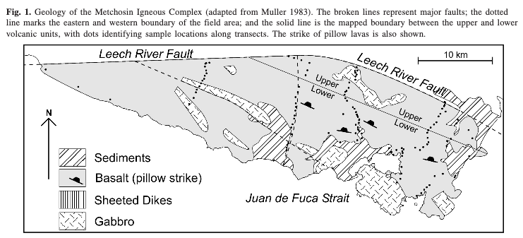
1. Race Rocks are part of the Metchosin Igneous Complex and is part of the Crescent Terrain (25 million years old).
2. Conglomerate rock overlays the igneous rocks although it has been eroded away in many places.
3. The source of the “boulders” within the conglomerate is often from within the Metchosin Complex but there may also be sources from other parts of Vancouver Island.
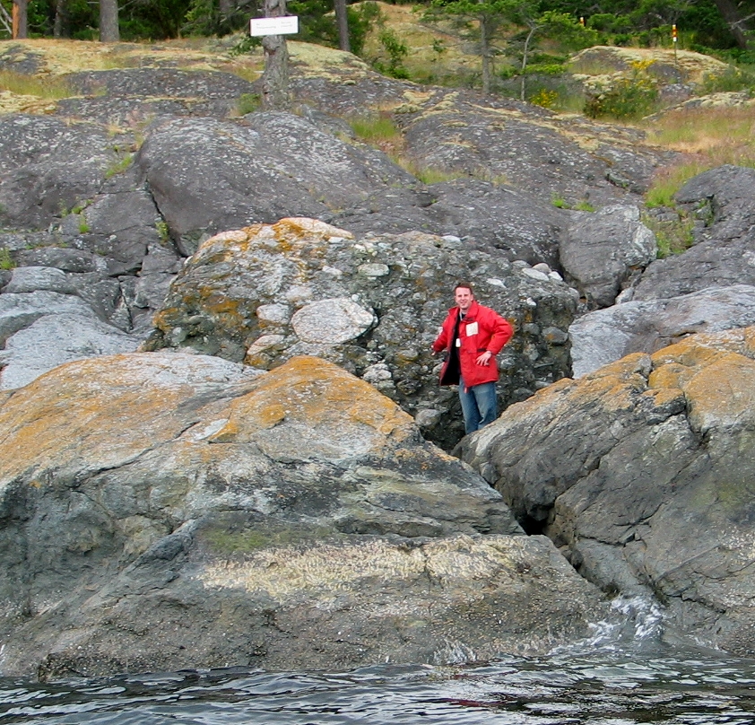
This large glacial erratic boulder made of conglomerate rests on the shoreline 50 metres east of Fossil Point. in nearby Pedder Bay.
4. The conglomerate is called Sooke Conglomerate and can be found in East Sooke Park (between Aldridge Point and Creke Point).
EARTHQUAKES
| The 1872 Earthquake as recorded at Race Rocks by Mr .Argyle the Lightkeeper from: The 1872 North Cascades Earthquake British Columbia Reporting Localities. |
The 1872 North Cascades Earthquake British Columbia Reporting Localities.
The Metchosin volcanics are particularly unusual in that they are not only an emergent sequence with ocean-floor affinity (Muller.). but as we will demonstrate, they are also an example of low-titanium normal mid-oceanic ridge basaIts (low-Ti MORB-N).
METCHOSIN VOLCANIC: A LOW-TITANIUM EMERGENT SEAMOUNT
AT THE BASE OF THE CRESCENT TERRANE” (92~)
By Andree de Rosen-Spence and A.J. Sinclair
The University of British Columbia
 Accretion-related metamorphism of the Metchosin Igneous Complex, southern Vancouver Island, British Columbia Sean Timpa, Kathryn M. Gillis, and Dante Canil