Prionitis lanceolata- red algae

Phylum: Rhodophyta

Class: Rhodophyceae

Order: Cryptonemiales

Family: Cryptonemiaceae

Prionitis lanceolata (Harvey)

Description: This plant is erect, up to 30 cm. tall, reddish brown in colour, growing in clusters, and attached to the substrate by small discoid holdfast.  The erect portion is narrowly stipitate below, tapering above to a flattened lanceolate portion.  The apices of the branches taper gradually to a point.  Numerous proliferous flattened short pinnately arranged branchlets occur along the margins of the main axes
Habitat:  On rocks in the lower intertidal and upper subtidal zones.

Pacific Coast Distribution:  Alaska to Mexico

Adapted from: Robert Scagel, 1972

Research suggestion: Look for galls on this algae: Reference.

Surge Channel and Surge as an Abiotic factor

On a field trip to Race Rocks with the Biology class in the spring 2003, we took some time to observe and video the surge channel out on the south-west tip of Great Race Rock. It was a calm day which had been preceded by a few days with storms out in the Pacific Ocean. The energy imparted to the water column was just now reaching Great Race and the water was breaking on the west shore. The effect of “Surge” as an abiotic factor is not often considered in affecting the intertidal zonation of organisms on rocky coastlines in marine biological research. See this file on this abiotic factor.


It is our firm belief that here, the level up the shoreline in the intertidal zone where many invertebrates and algae can survive is elevated. These intertidal organisms are able to keep moistened longer, ambient temperatures are depressed from evaporation and and they even have longer availability to food resources being carried in the surging water. This is most obvious with the Goose Neck barnacle population and the intertidal anemone distribution along this shore. Additionally the tidepools up the channel are flooded more frequently, resulting in lower temperatures and more stabilized salinity conditions. It should be emphasized that this is not directly “wind-driven” water movement. As one can see in the video, the surrounding sea is calm, with little wind that day.

Tidal Cycle at Race Rocks Video

 This clip was produced on 8.11.2002. As Race Rocks Marine Protected Area is a place where large (3 meter) tidal range occurs, it is a good location to observe the raising and lowering of the water . A rock in Race Passage near the West shore of Great Race Rock was chosen and a camera was installed in front of the window of the research room in the Marine Science Centre. Video clips were taken for 15 seconds every hour of daylight, high tide occurred during noontime. The second part of the clip shows the tide going in fast motion, a day at the rock passes in 25 seconds.” Jeremias Prassti, ( PC yr 28)

From Victoria Tide tables for this date.. 8.11.2002. :

time… tidal height (ft)………….(meters)
0910 …………………..8.9……………..2.7
1100………………….. 8.5……………..2.6
1445………………….. 9.2……………..2.8
2345………………….. 1.0………………0.3

PROJECT IDEA:
1. On graph paper, using the data above, plot the tidal variation for the day. Then pause the video on each of the levels, measure the height of an exposed piece of the rock and then plot it on the graph. In this way you should be able to determine the elevation of the top of the rock.

2. Link to the physical factor page for Race Rocks – Go to the Tidal calculator links available and compare the shape of the graph for November 8, 2002 with the graph you have made here

Pollicipes polymerus: Goose-neck Barnacle- The Race Rocks taxonomy


This low tide view on the south- west corner of Great Race shows the close competition between the California mussels and the goosenecks.
LOCATION:
The gooseneck barnacle, is found in abundance in the intertidal at Race Rocks. Globally. it is found from the southern region of Alaska to Baja, California. It is attached to rocks at the high intertidal zone and all organisms in a particular area will be oriented towards the same direction. It normally occurs on wave-beaten rocks. These barnacles have undergone extensive harvesting on the shorelines of the North Pacific, in particular around urban areas. Typically our record of conservation has been poor and continued harvesting results in very little stock recruitment and consequently a diminishing stock of this species. People of Western European origin frequently have a desire to eat this species, as it tastes very much like crab.

These clumps of gooseneck barnacles line the surge channel, if you see the video on the surge channel page , you can understand how they are exposed to a food source of plankton by the surge action even when they are above the tidal level. 


DESCRIPTION:

It has a fleshy stalk which attaches it to rocks or floating objects. The long neck is about up to 10cm. compared to the shell which is 5 cm. long. It has a leathery appearance with small bumps. The body consists of the peduncle and capitulum. The peduncle is the attachment organ but also contains ovaries and some muscles. It is covered with tiny ossicles on short fleshy stalk. the capitulum consists of most of the animal, including all appendages except the first antennae, The capitulum is ventral.

Domain Eukarya
Kingdom Animalia
Phylum Arthropoda
Class Cirripedia
Order Thoracica
Family Scalpellidae
Genus Pollicipes
Species polymerus
Common Name:Gooseneck Barnacle

REPRODUCTION AND FEEDING:

The organism is a hermaphrodite but they rarely undergo self fertilizaton. Cross fertilization is more common. Fertiliztion is external and it occurs in the mantle cavity. Gooseneck barnacles are filter feeders. They feed on smaller crustaceans and plankton. They do this by projecting their feathery feet called cirri to trap organisms. The cirri also act as lungs for gaseous exchange. Their main predators are the glaucous winged gull and the sea stars.

HISTORY:

Their name, gooseneck barnacle arose from the middle ages where they were thought to be developing geese which dropped off to become adult geese. As such geese were considered as fish and could be eaten on days meat was considered a taboo. Check out the patterns on the neck of the Brant Goose.

Other Members of the Phylum Arthropoda at Race Rocks 
taxonomyiconReturn to the Race Rocks Taxonomy
and Image File
pearsonlogo2_f2The Race Rocks taxonomy is a collaborative venture originally started with the Biology and Environmental Systems students of Lester Pearson College UWC. It now also has contributions added by Faculty, Staff, Volunteers and Observers on the remote control webcams.     October 2002- Garry Fletcher

Intertidal Invertebrates on the West shore of Great Race Rocks

westshoreThe intertidal zone on the West side of Great Race Rocks as viewed and photographed on June 12, 1999 at a minus 0.1 tide. The predominant macroalgae is Hedophylum sp. although immature bull kelp (Nereocystis luetkeana) is also anchored in this zone close to the shore. westisleThe small island on the North West corner is completely exposed at low tide but submerged at high tide. It contains a rich assortment of hydroids as well as other invertebrates where Dr. Anita Brinckmann-Voss has collected specimens at the zero tidal level.


Small pink dots of a Melobesia mediocris, a calcareous pink encrusting algae which grows as an epiphyte on the leaves of surf grass.phyllospadix

pinkgreenJust below the green fringe of surf grass, Phyllospadix scouleri, pink hydrocorals and other hydroid survive the current and wave swept zone.

abietinariaanthopThe hydroid Aglaophemia latirostris with an Intertidal Anemone. 


3anthopleuraOther Cnidarians such as the green anemone, Anthopleura xanthogrammica, are found in the low intertidal area. These large anemone with symbiotic algae are also found in the surge channel on the south-west corner. The knife placed in the picture for scale measures 10cm in length.

redblueurchGiant red urchins Strongylocentrotus franciscanis live here at the upper limits of their range and the purple urchin,  Strongylocentrotus purpuratus also inhabits a narrow band in this area.

handnubilusA giant barnacle, Balanus nubilus plays host to a colony of Symplectoscyphus turgidus  (formerly  Sertularella turgida) . Hydrocoral, (Allopora sp.encrusts much of the substrate

gfcave2Two of the small caves at this level yield a variety of invertebrates. The ceilings of these caves usually support a variety of hydroids

rrpeg7caveThe floor of this cave on the south-west corner is covered with the red encrusting sponge,  Ophlitaspongia

purpleurchinHere on the small island, the purple urchins reside in a crevasse next to the mussle Mytilus californianus.


Tidepool work -Environmental Systems 1999

Why do Transects ? overview and techniques

THE OVERVIEW:

Images of transects applied to biological systems provide educators and students an opportunity to explore a wide diversity of systems and habitats. Traditionally, transects have been used in ecological studies to understand populations and community associations within selected habitats. The same concepts may be used to investigate any number of other biological systems ranging from individual organisms, or parts of organisms, to global ecosystems.
The transect provides a tool to focus attention on specific, selected systems and the effects of abiotic and biotic parameters affecting those biological units in the system. Qualitative and quantitative analyses by students at many levels, utilizing the resources of the world wide web, will provide the ability to study not only the specific transect site, but to link those studies with related research and information. It is our expectation that this exercise will not only provide an opportunity for an actual educational experience but will form the initial stimulus for contributions on new sites by other individuals and groups on a world wide basis. This would transfer the collaborative classroom exercise to a research activity reflecting the collaborative nature of international science.Educators and students are encouraged to use, among others, the BioQUEST philosophy of collaborative learning to develop additional exercises that support the use of transects as a tool for biological investigations and learning.

Collaborative Curriculum Lead-In:

Using the internet with biological transects can enhance knowledge and appreciation of important relationships in established biological systems. It is an ideal technique to foster and promote collaboration among students of a class, or between students from different geographic areas, the states or provinces, and countries. Teachers at all levels (K- 16) can take advantage of this medium to introduce students to the WWW as an information-providing tool, and as a research tool (example: NIH Image). Furthermore, they are encouraged to get their students to provide other examples of transects so that a transect data base on the web can be expanded. It could eventually include a wide variety of biological systems whether from a microscopic view point or a satellite perspective.

TECHNIQUES:

The basic premise of the initial transect presentations on this web site is of transects established linearly across a biological site (often through an environmental gradient). The measuring device used depends on the size of the site and the logistical constraints in putting it into place. It is envisioned that eventually transects ranging in size from a microscopic level to a satellite image level will appear here.

Note: to be useful for this project, all images contributed must have a reference measurement scale visible or the scale must be known so that it could be inserted into the pictures. Photos also need to be of good quality. It is also possible that accurate drawings could provide the image for a transect.

BIOLOGICAL SYSTEMS

Transects may be used in any biological system that is appropriate to the educational and scientific mission. What is presented here are suggestions for choosing habitats; the list is not all-inclusive, but hopefully a stimulus for further selection and development of sites. Most of our natural ecosystems in the world are being affected by the onset of Climate Change. If we are to know what the components of a natural ecosystem are , we need to document them before irreversible change occurs,  

EXTERNAL SITES:

1. AQUATIC HABITATS:

a. Marine

  • Water column (vertical and horizontal transects; use of satellite imagery)
  • Rocky Intertidal
  • Mud Flats
  • Sandy Beaches
  • Subtidal
  • Cobble and Shingle Beaches
  • Tide Pools
  • Coral Reefs
  • Thermal vent communities
  • Ice Flow Communities

b. Estuarine

  • Water column
  • Mangrove communities
  • Mud and sand flats
  • Salt marshes
  • Lagoons
  • Docks and pilings

c. Fouling (Settlement) communities

d. Freshwater

  • Lakes and ponds
  • Ephemeral pools
  • Rivers, streams and creeks
  • Marshes

2. TERRESTRIAL HABITATS:

  • Forest and woodland
  • Grassland
  • Savannah
  • Chapparal
  • Deserts
  • Urban lot
  • Agricultural fields
  • Tundra

INTERNAL [LABORATORY BASED] SITES:

1. Microscopic communities: use of bacteria, protists, invertebrates, algae

  • Petri dish populations
  • Tissue culture populations
  • Glass slide populations

2. Macroscopic habitats

  • Aquaria – marine, estuarine and freshwater
  • Terraria – desert to moist 

We hope that this page will soon expand to include a wide range of images of very different transects. Some of the transects we would like to see contributed are :

    • A transect through a bog ecosystem.
    • A transect through an alpine ecosystem from the foot of a melting glacier.
    • A transect through the shoreline of a drying salt pan as one sees in Saskatchewan or other locations on the North American Plains.
    • Aerial transects from the tundra showing distribution of Caribou herds and vegetation .
    • Aerial transects through the savannahs of Africa showing animal distribution patterns .
    • Coral Reef and Mangrove Forest transects.
    • Vertical Transects in Forest Ecosystems.
    • Microscopic Transects.

    HOW DOES ONE PREPARE IMAGES TO BE ANALYZED?
    ECOLOGICAL NICHE MODELING: This file gives detailed instructions on the method used to download pictures for processing, measuring, and further work. It also contains details for an exercise on the 3D modelling of ecological niches of organisms.

ORIGINAL AUTHORS:

This program was developed at the 1995 BioQUEST Summer Workshop on Collaborative Learning, Peer Review, and Persuasion in Biology Education at Beloit College, WI. USA
The authors of the program were :

  • Lynette Padmore, Florida A & M University, Tallahassee, Florida
  • John Moon, Harding College, Searcy, Arkansas
  • Ned Lyke, California State University, Hayward, Hayward, California
  • Gabriele Wienhausen, University of California, San Diego, La Jolla, California
  • Garry Fletcher, Lester B. Pearson College, Victoria, B.C. Canada

Peg 5 sample transects
See Transect A0050101

See Transect A0050102
See Transect A0050103
_____________________________________________________________

Return to the Contents page for Environmental modelling with Transects..

Transects for Environmental Monitoring at Race Rocks

CONTENTS: This section on Transects is composed of Several Parts:

1. This Page with background and some ideas.

2. Why do Transects.. overview and Techniques. 

3. For a more in depth exercise on the Ecological Niche of organisms see this file:  Ecological niche, The Empirical Model


4.See the following completed photographic transects:
See Transect A0050101
See Transect A0050102
See Transect A0050103

BACKGROUND
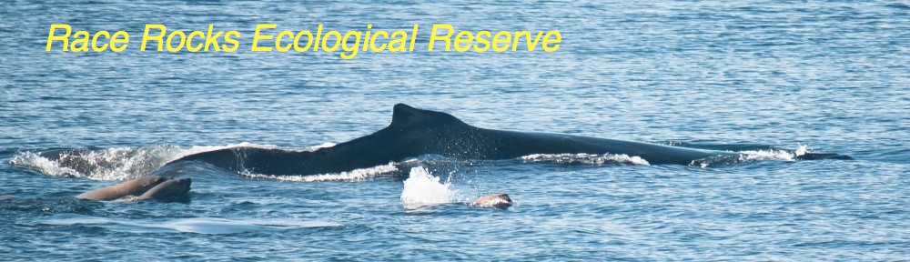
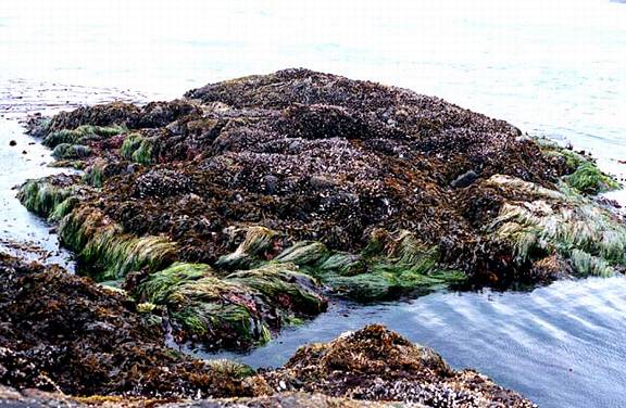
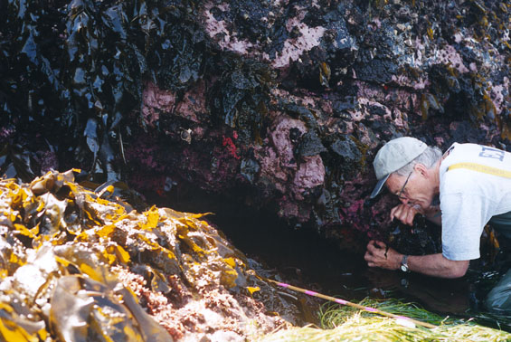
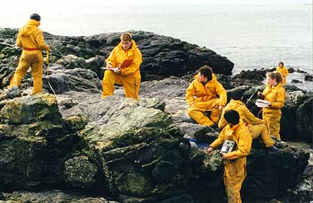
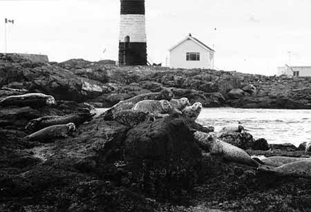
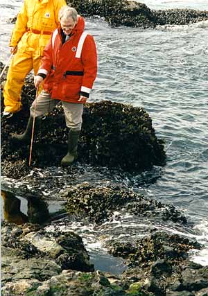
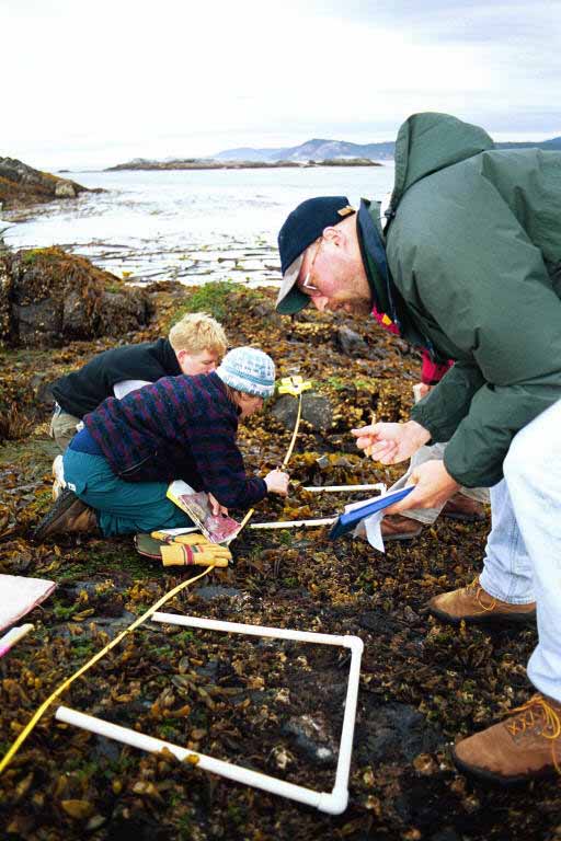
The students and faculty of Lester B. Pearson College which is a member of the United World Colleges have used the ecological reserve and now the MPA of Race Rocks for studies of marine ecosystems, both sub-tidally and inter-tidally since1978. During that time a number of exercises have been developed to use in teaching ecological concepts in the International Baccalaureate Environmental Systems and Biology classes.

Transect Peg Locations on Race Rocks 

Carmen’s Lab on Transects – kite Diagrams

1998 Class Photos and – Transects of Peg #`15

1999- Royal Roads Environmental management students visit Race Rocks

Underwater Transect at Race Rocks -Video

While using basic research techniques it has been possible to start to build up a library of information that can be more useful for determination of the effects of long term climatic changes or changes induced by humans, (anthropogenic). In addition this record may provide ideas to encourage others to apply the techniques to other ecosystems.

This program was developed at the 1995 BioQUEST Summer Workshop on Collaborative Learning, Peer Review, and Persuasion in Biology Education at Beloit College, WI. USA

See the following completed photographic transects:
See Transect A0050101
See Transect A0050102
See Transect A0050103

NUMBERING SYSTEM
A numbering system had to be developed that reflected the concept that this was only one of many that could be referenced from this site if individuals from around the world were willing to collaborate with us in building the project.

LOCATION….PEG NUMBER…TRANSECT NUMBER….QUADRAT NUMBER..

A0……..05…………01…………01………

Where:

A0 refers to the first site to be added to this WWW site
05 refers to the peg location ( we have 15 such locations permanently identified at the Race Rocks Ecological Reserve.)
01 refers to the first transect entered from this location.
01 refers to the first quadrat picture that you can access on this photographic strip.
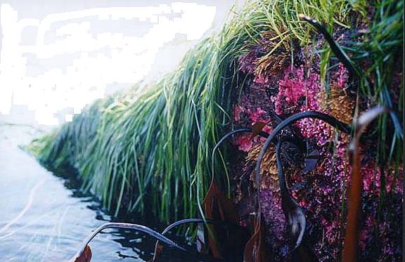
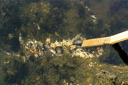
TIDAL LEVELS
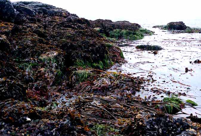
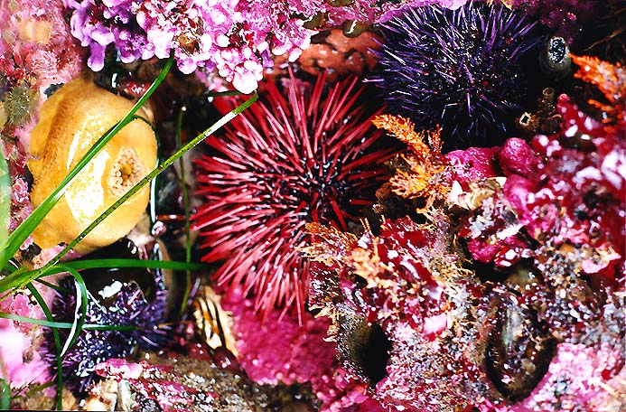
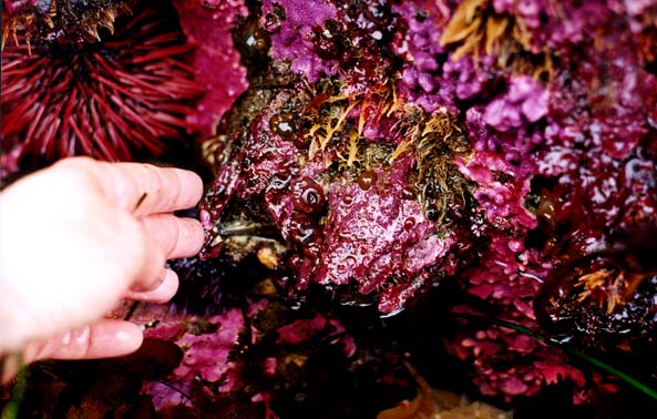
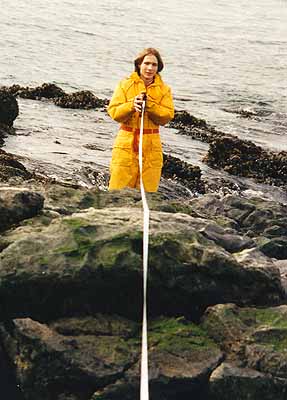
Since the location of organisms in the intertidal zone is partially determined by tidal levels, that is one of the essential measurements given with our transect images. It is important to understand that the levels given here are based on the Canadian tide tables

Victoria Tide TablesThese are not calculated the same way as tables from the United States. To convert the elevations given here to conform to the US pattern in which 0.0 equals mean lower low water, subtract 0.8 meters from these Canadian readings.You may find further explanation on the operation of Tides in any marine biology or Oceanography text. One that may be useful is:
Seashore Life of the Northern Pacific Coast– by Eugene Kozloff, page 7-9.

For TIDAL Heights of Other LOCATIONS, use this link

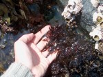
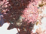
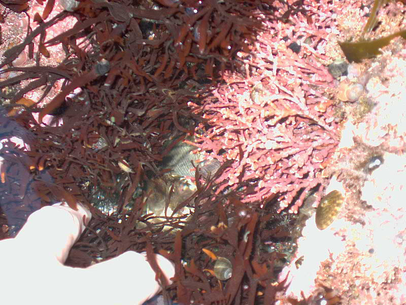
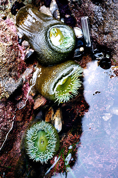
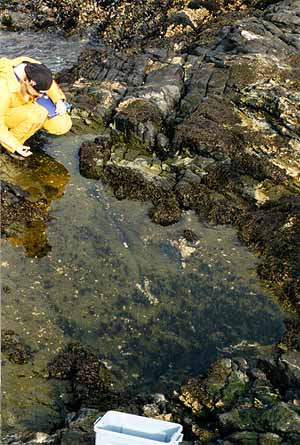
SOME  IDEAS FOR USE OF THESE TRANSECT PHOTOS

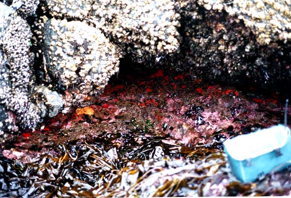
  • Quantify the distribution of organisms
  • Relate the distribution to the intertidal elevation
  • Find out how to capture these images
  • Use other technology to analyze the photos
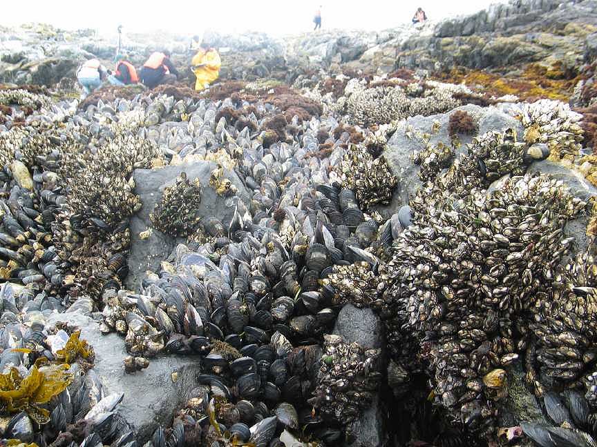
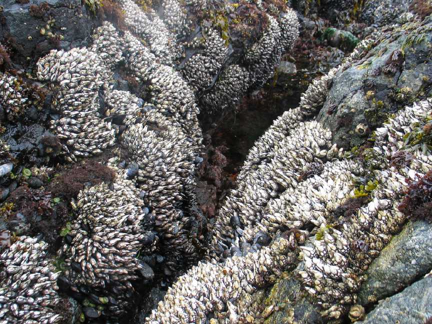
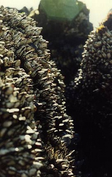
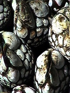
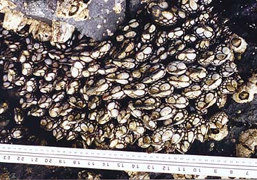
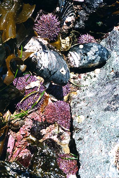
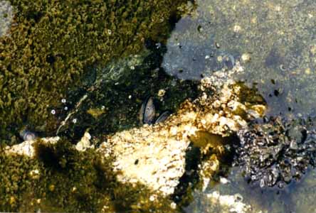
  • Study the mussels in greater depth
  • Study other organisms from the transects in greater depth.
  • Students in environmental systems will use this as a source to prepare for investigations in the intertidal zone when we have the opportunity to do a field lab at the ecological reserve. The photo strips also could be used by those living far from an ocean shore to study the relationship between abiotic or physical factors and organism distribution. Also by noting the location of certain species, for instance the mussels, M. californianus and then seeing where they would fit on a tidal level chart for the area (using the Victoria Tide Tables), students could calculate the length of times for submergence and emergence of the species in a week, a month, or a year. In addition they could compare the conditions in the winter months, with the extreme low tides occurring in the night with the conditions in the summer months when the low tides occur every two weeks in the daytime. Students should be encouraged to discuss the results of their investigations and pose further questions about conditions in the intertidal zone.

See Transect A0050101
See Transect A0050102
See Transect A0050103

THIS IS JUST A START!
By looking here you might get a few ideas of how you can do some interesting investigations using these pictures. But don’t stop there, we would like you to collaborate with us by adding ideas and new transects to our list. It would be excellent if someone living on another ocean shore with different intertidal zonation patterns could supply a similar set of photographs for comparison.Go back to techniques for directions on how to contribute