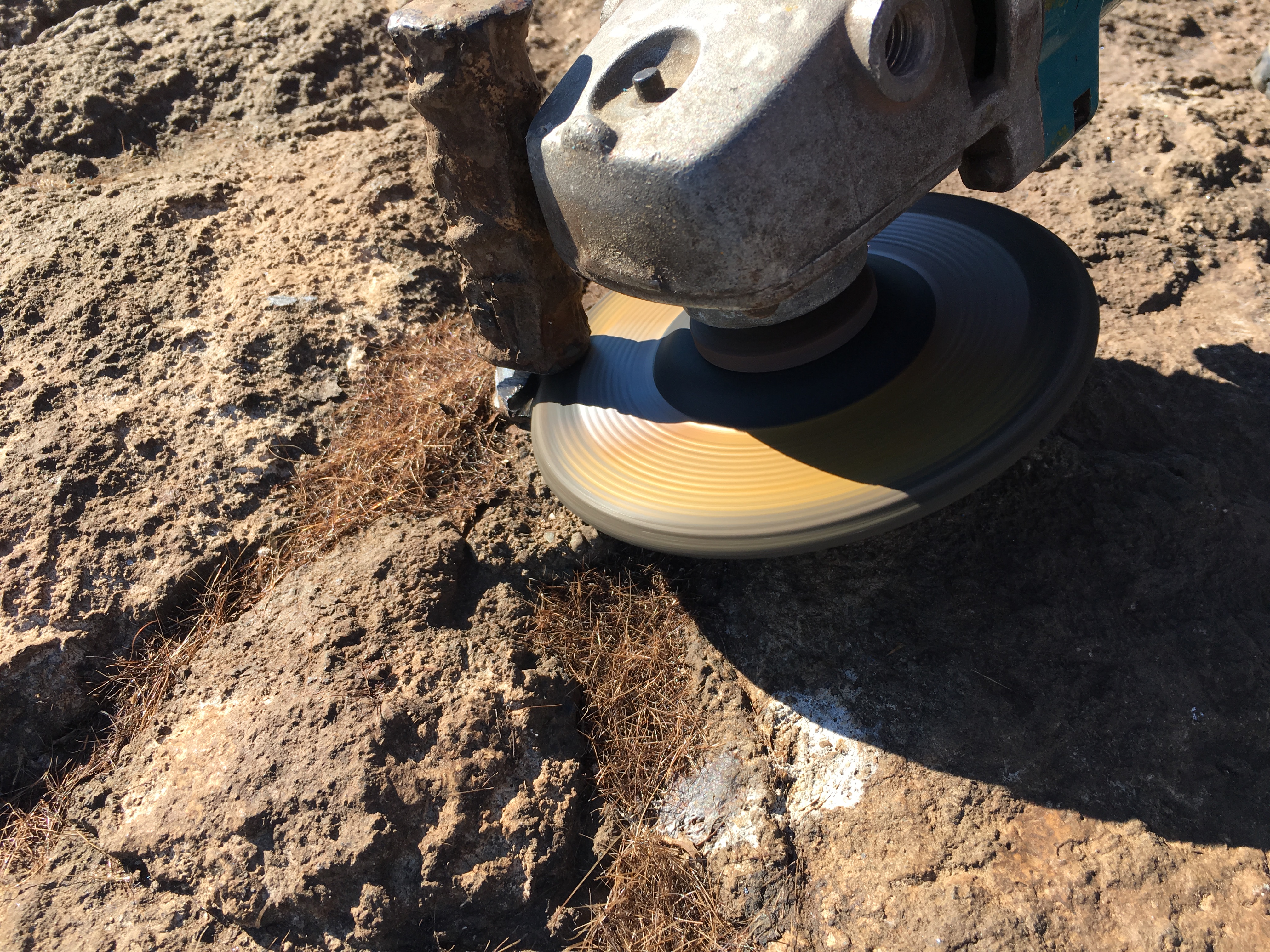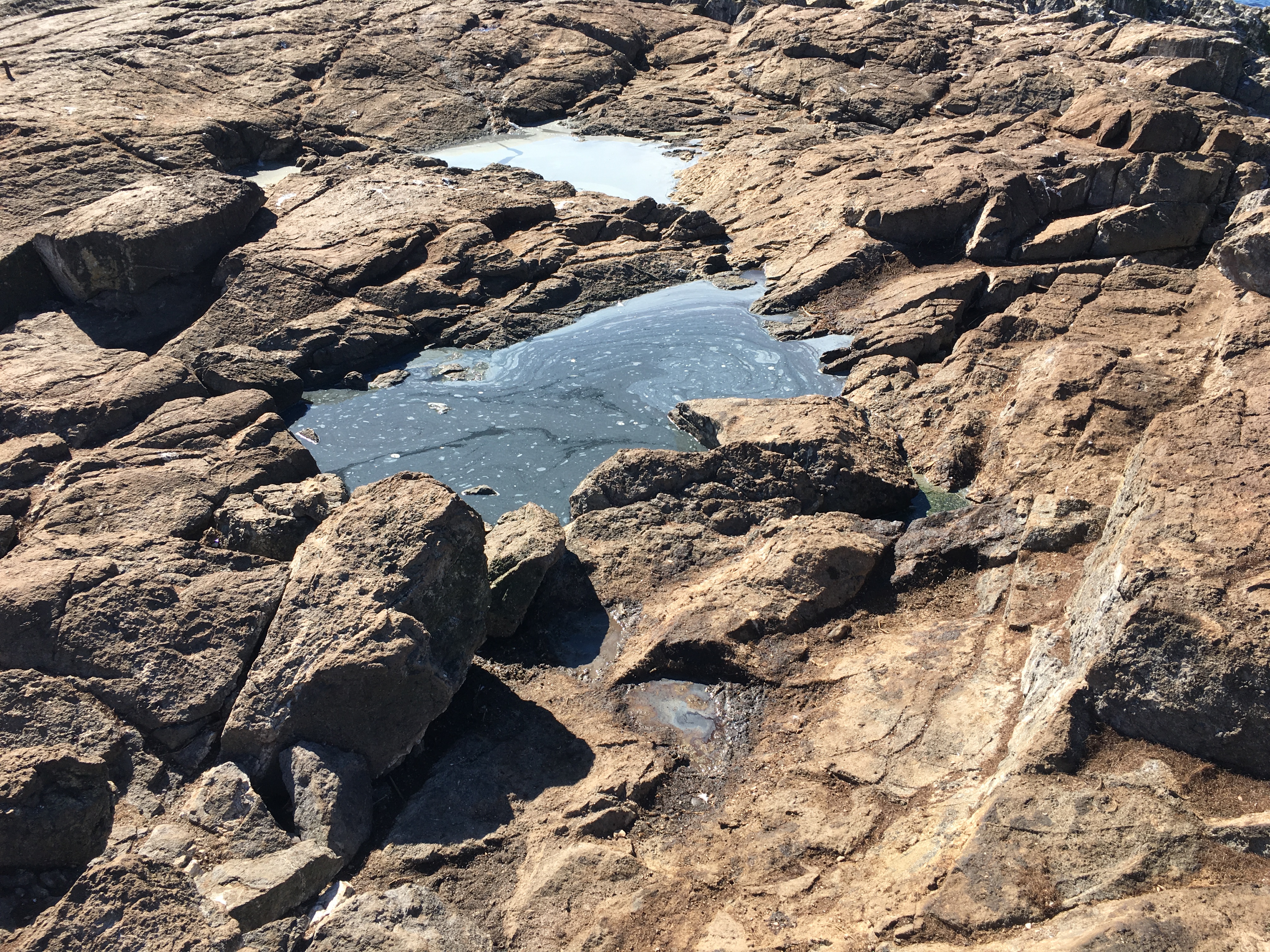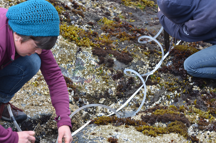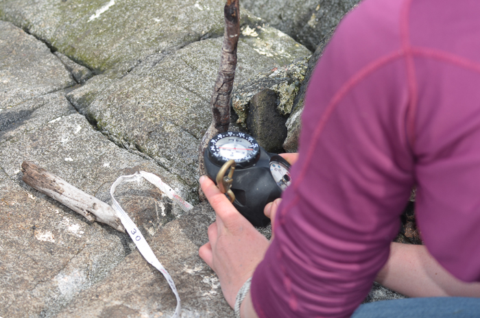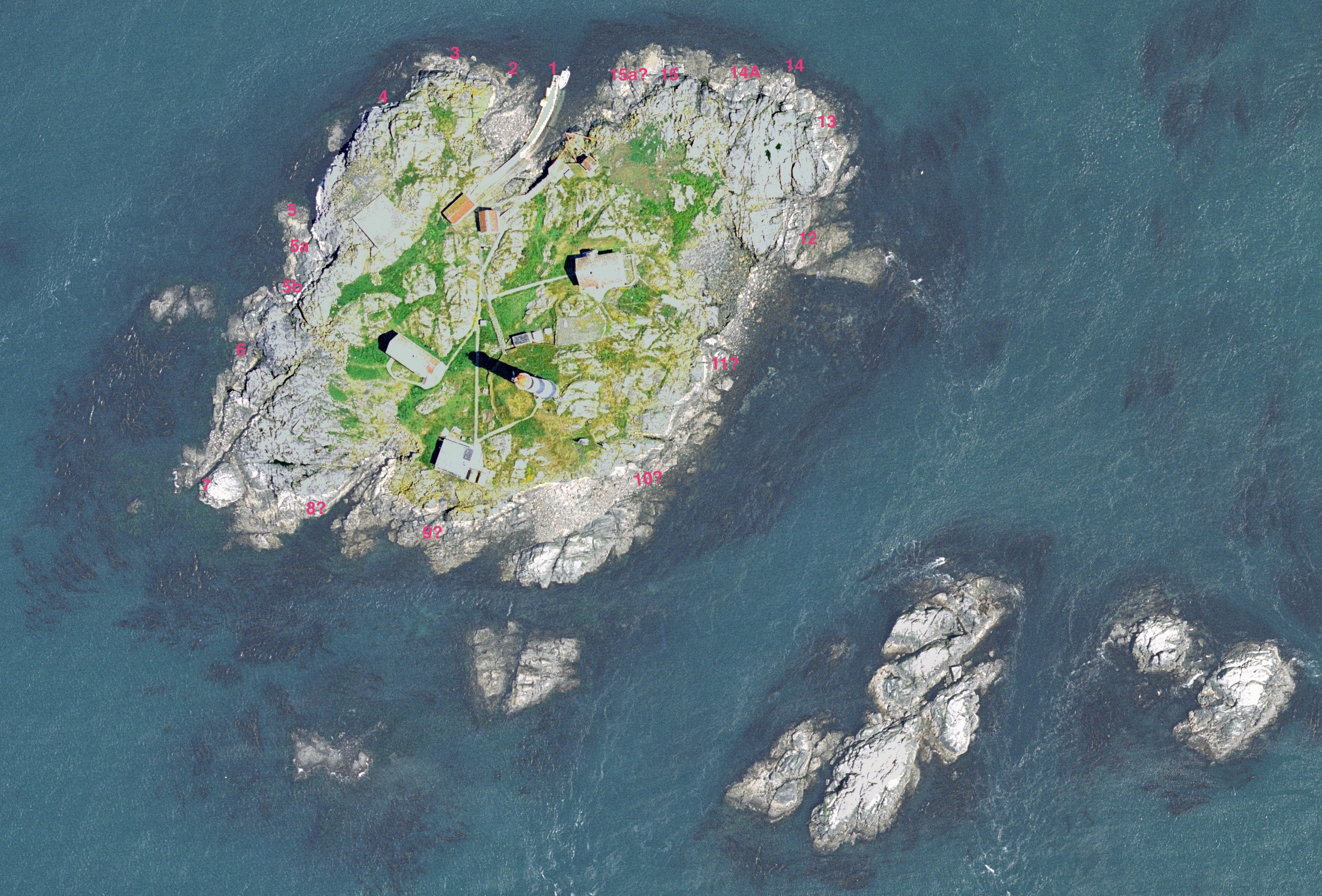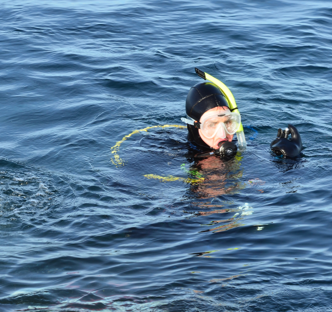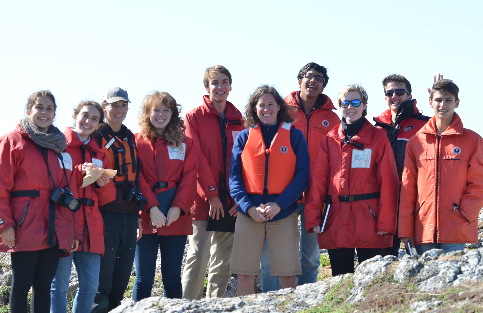
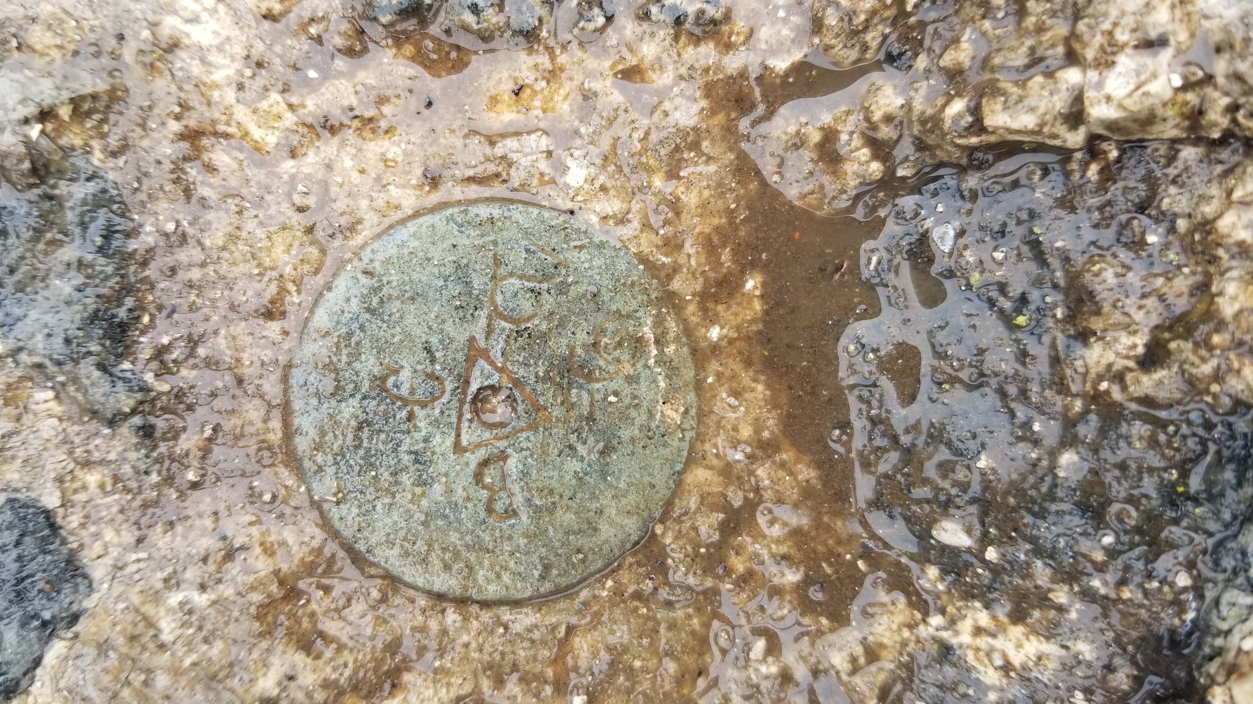
I accompanied Lucinda Leonard and two students from UVIc Megan Caston and Yijie Zhu – they are both working towards Masters degrees in Geophysics, working on earthquakes and faults to Race Rocks along with 6 students from Pearson College for the installation of two GPS stations. Many years ago , perhaps as early as 1991, this plug had been installed a meter in front of the Camera 5 location , and it had not been rechecked since. Laas was able to get this picture of it to verify that it was still there .
-
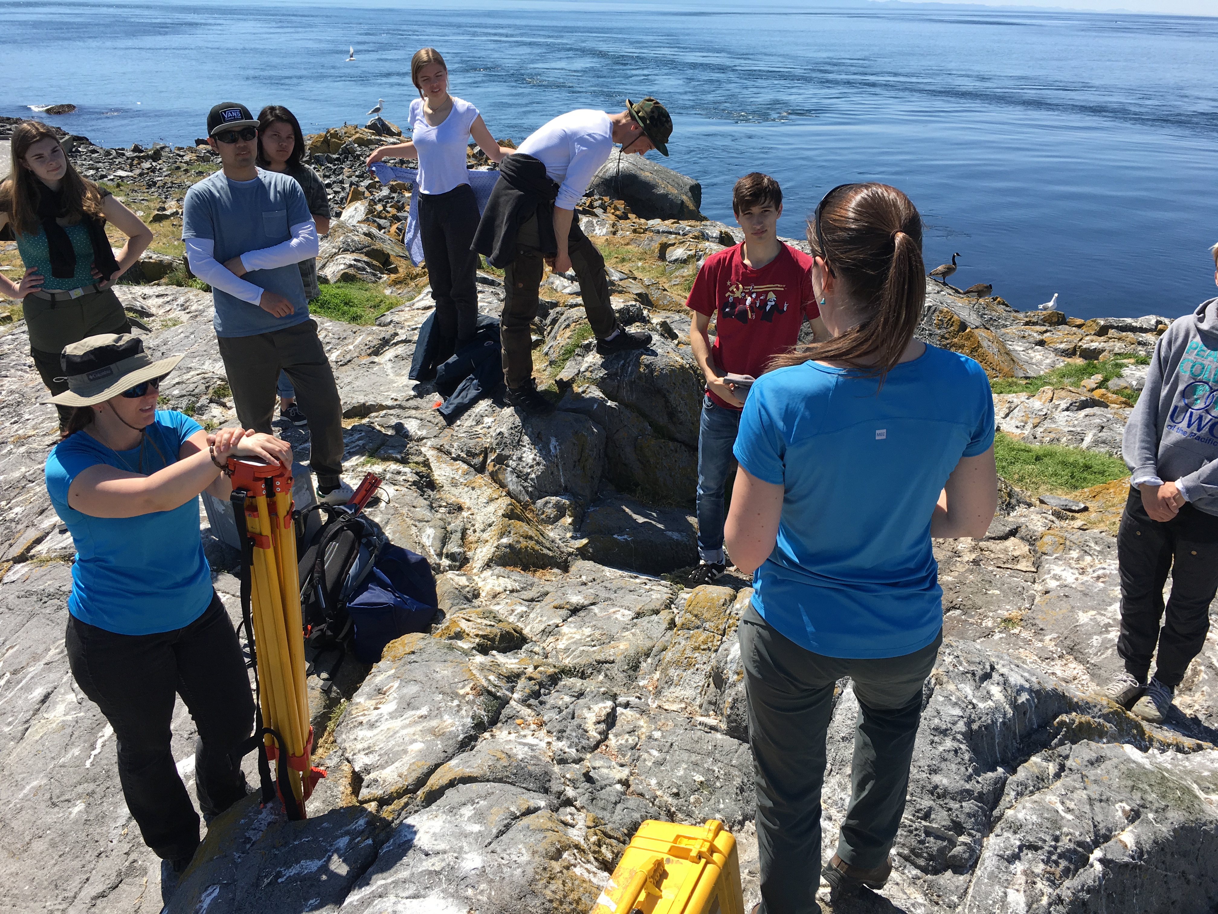
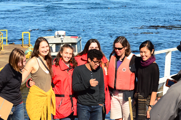
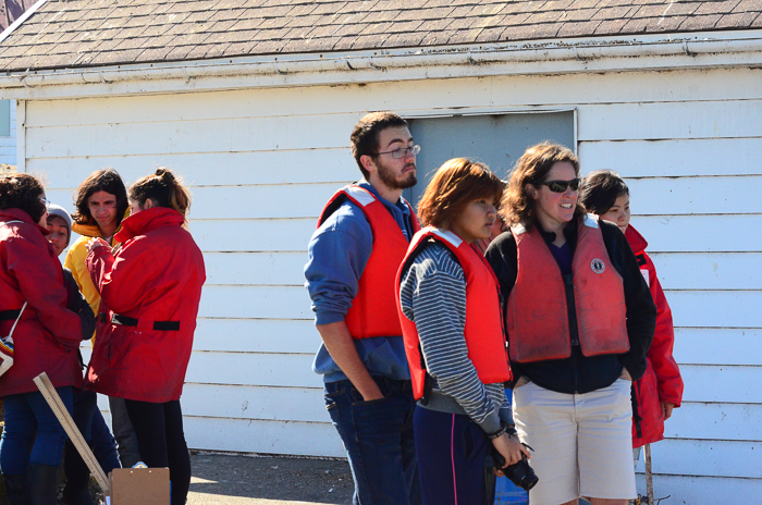
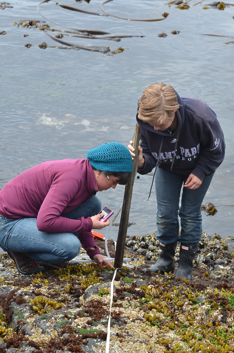
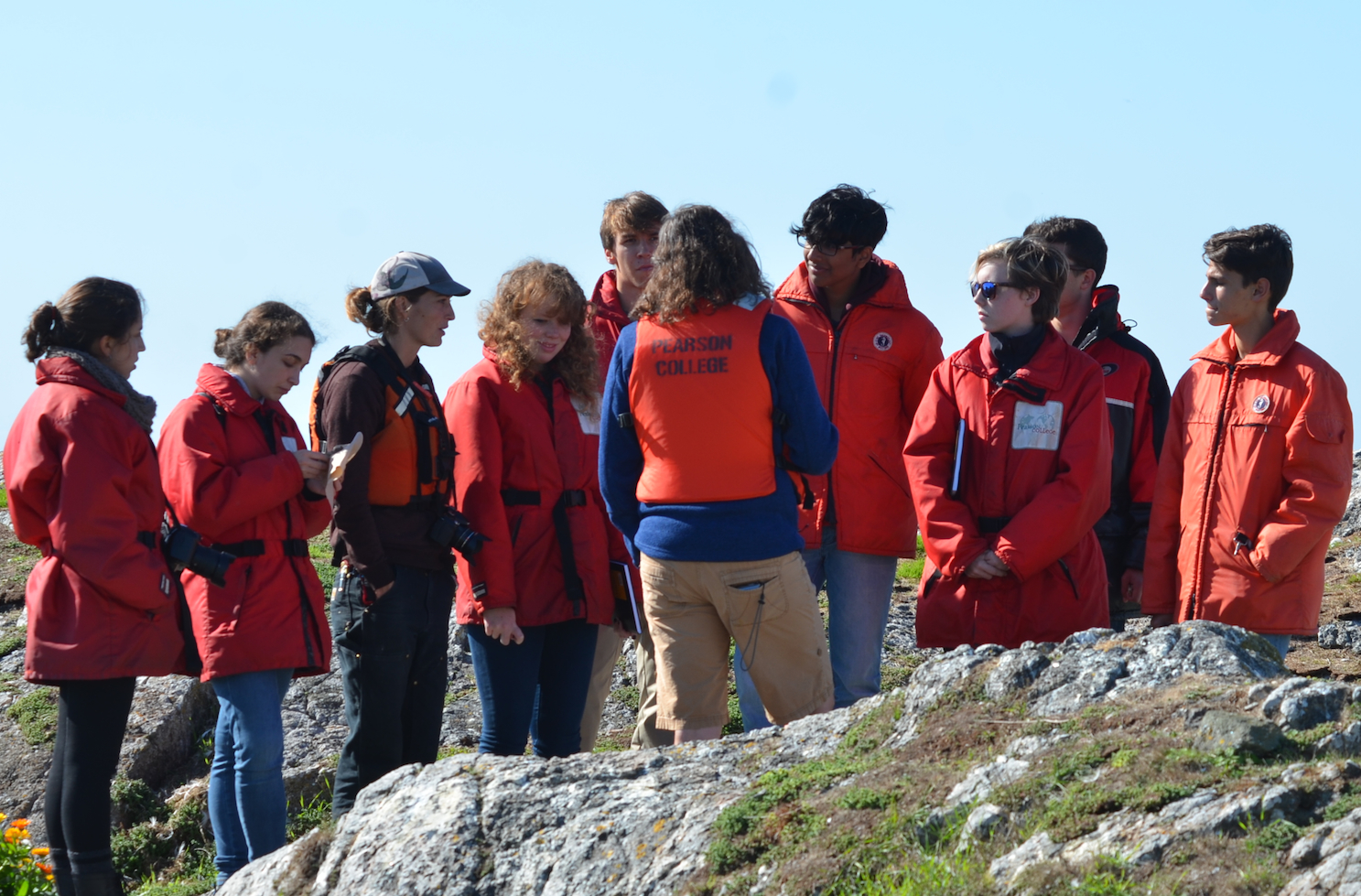
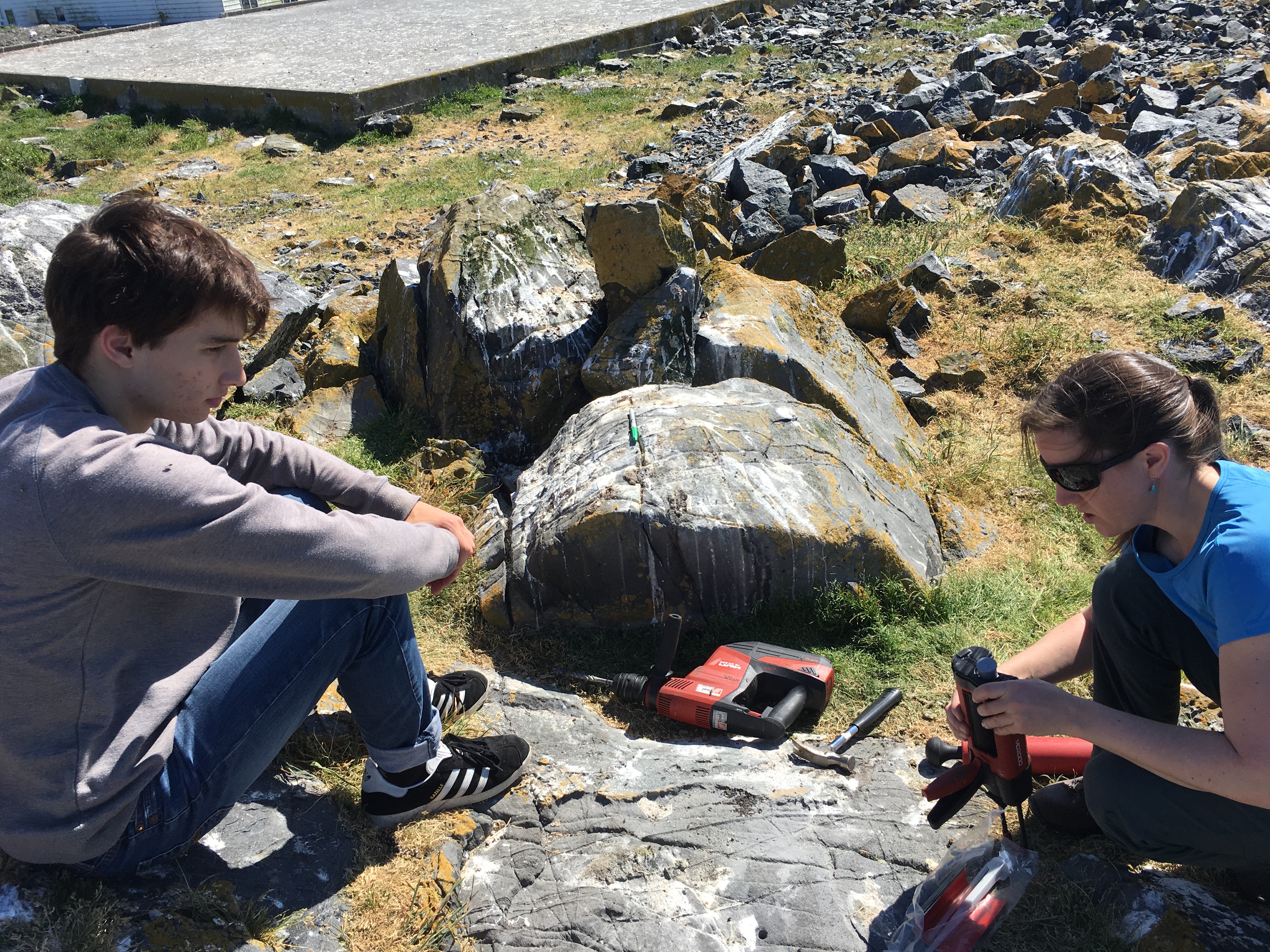
- Lucinda explaining the project to the Pearson College marine Science students
-
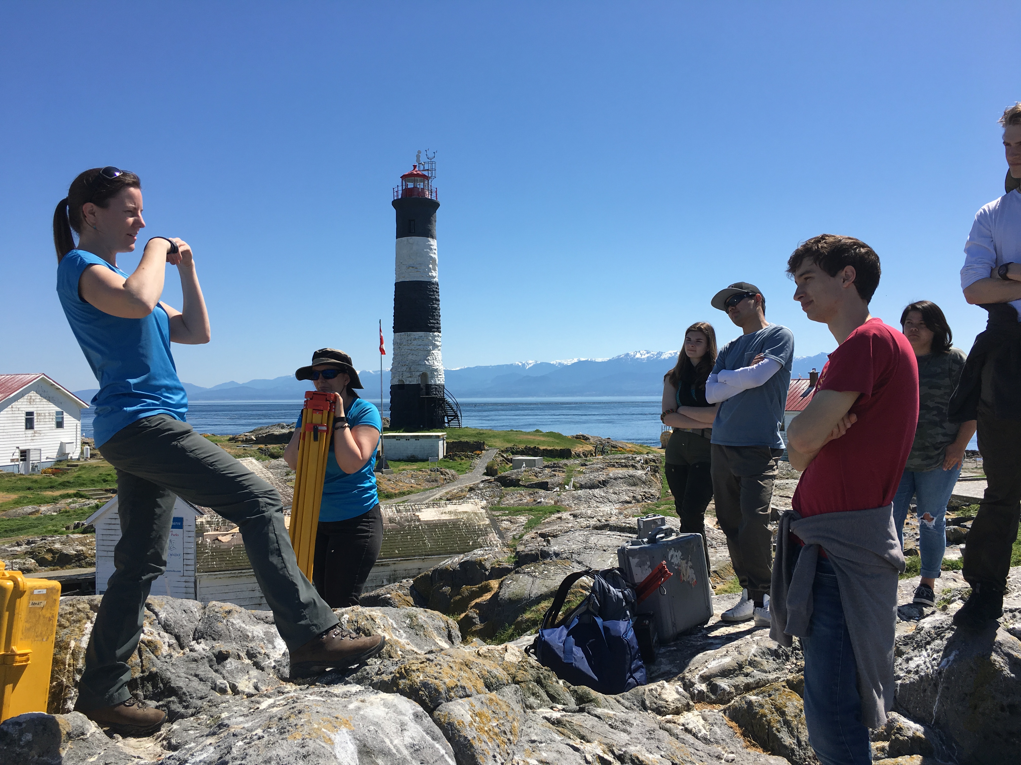
- Pearson College students
-
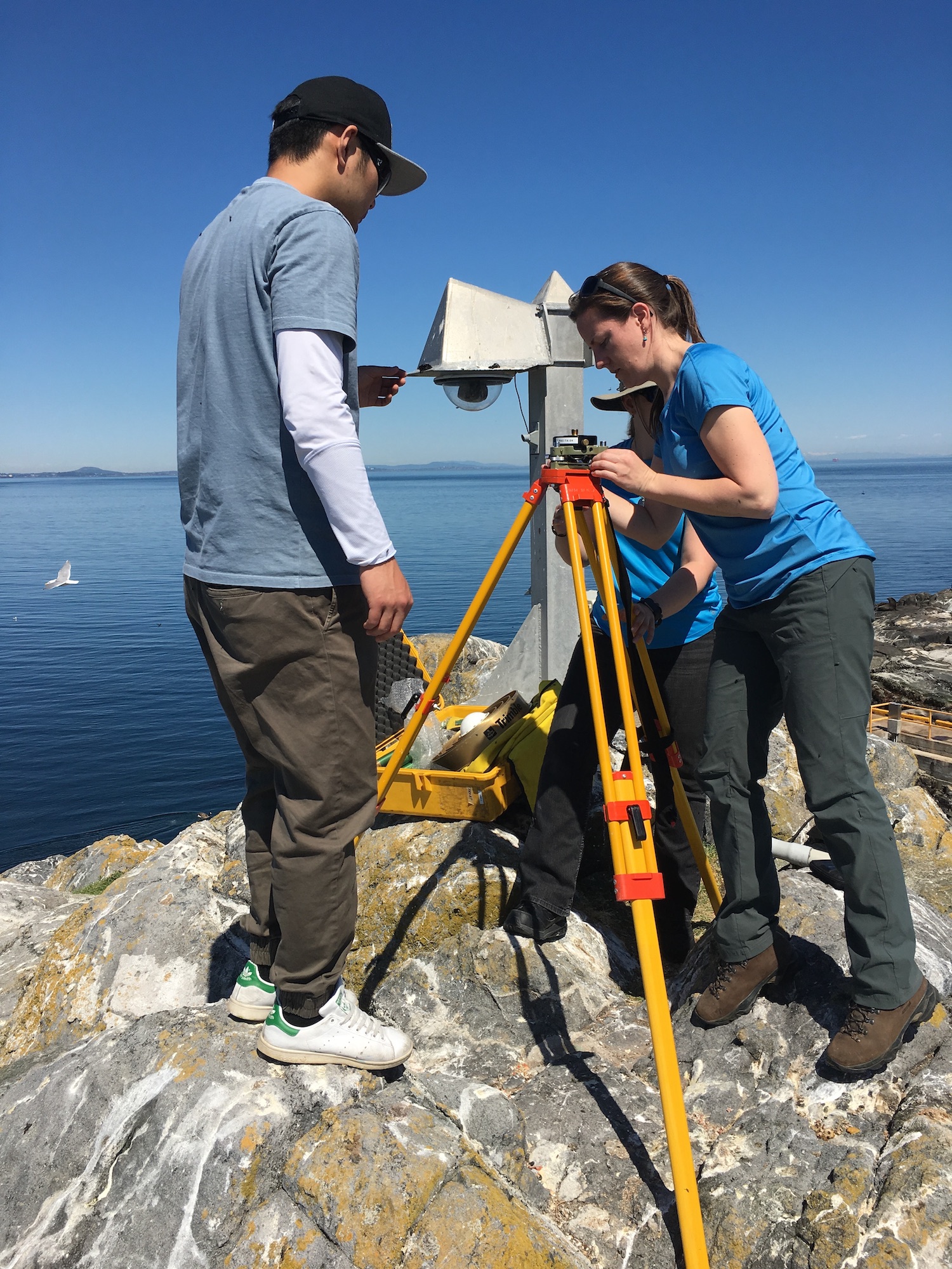
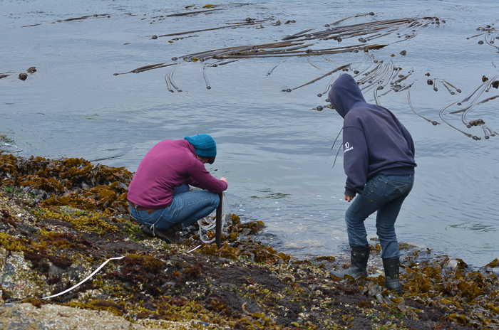
- A tripod fixes the sensor over the marker
-
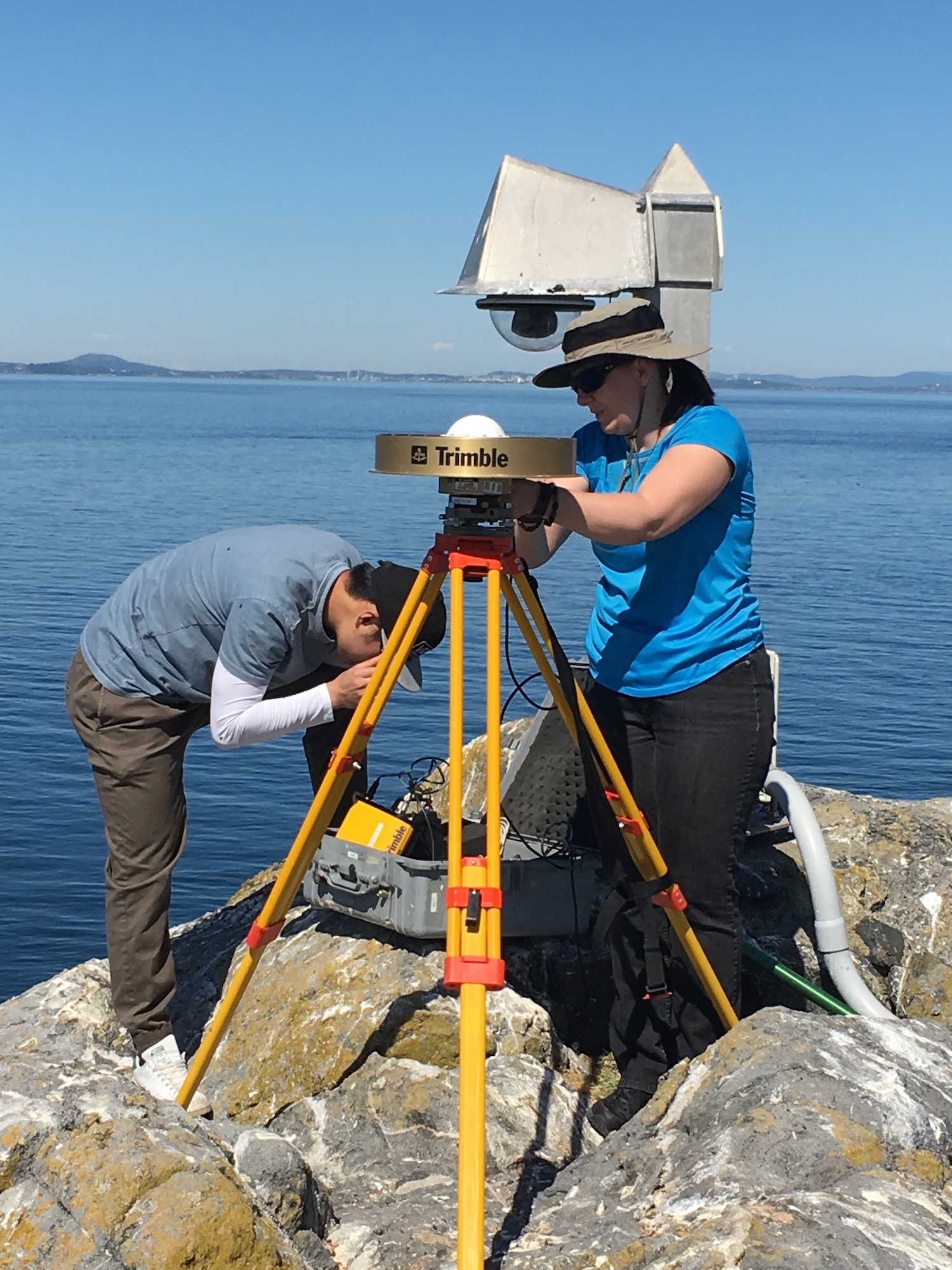
- UVic students Megan and Yijie
-
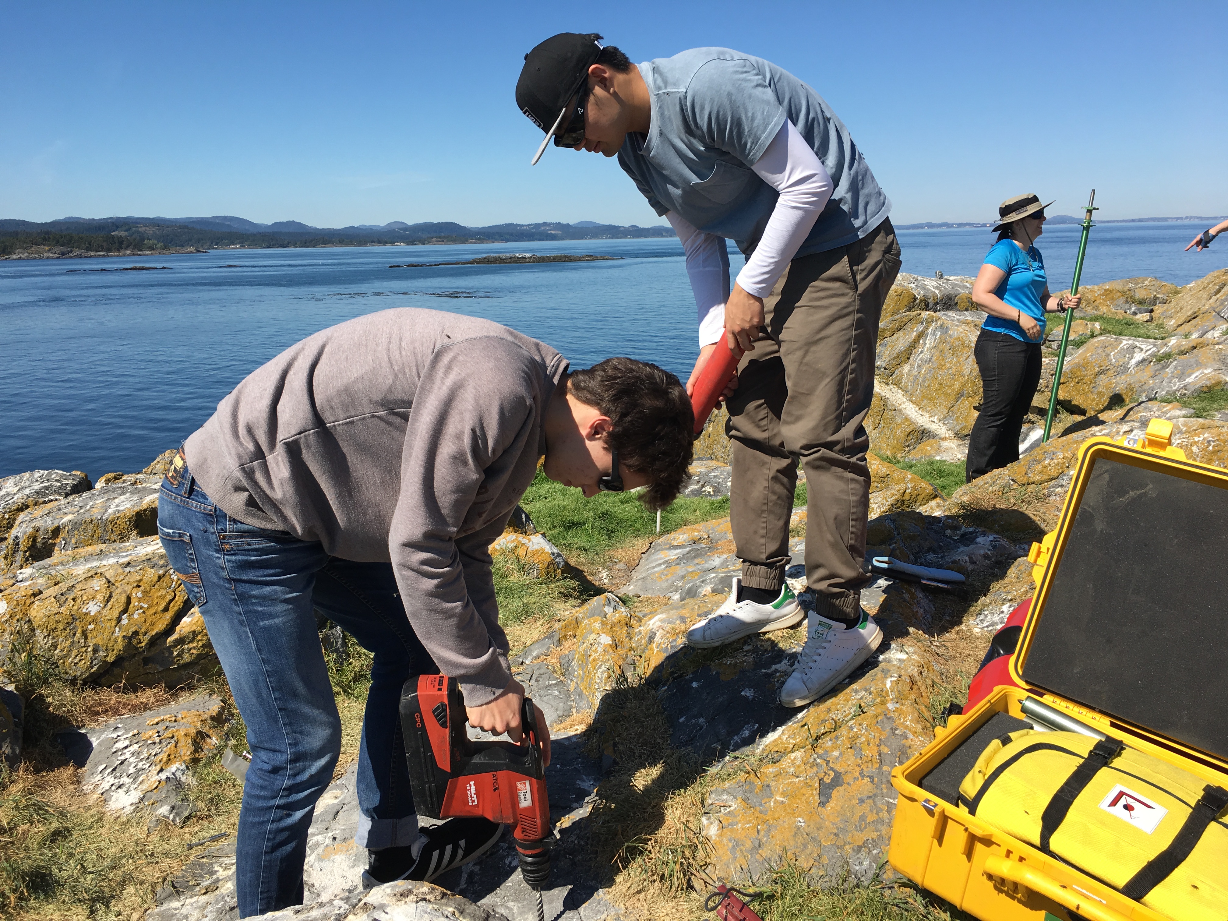
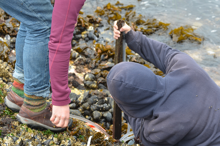
- Pearson College student drilling hole for tripod anchor in new location 5 meters west of the old one.
The following is the research proposal by Lucinda Leonard, Assistant Professor (Geophysics) School of Earth and Ocean Sciences, University of Victoria PO Box 1700 STN CSC, Victoria, British Columbia, Canada V8W 2Y2
GPS Survey for Earthquake Hazard Assessment on Southern Vancouver Island
Participants: Lucinda Leonard, Assistant Professor, School of Earth and Ocean Sciences, University of Victoria
Julie Elliott, Assistant Professor, Purdue University
Yan Jiang, Research Scientist, Natural Resources Canada, and Adjunct Professor, University of Victoria 2-3 students will also take part in the fieldwork.
Objectives:
(1) To quantify seismic hazard of crustal faults on southern Vancouver Island. (2) To improve understanding of crustal deformation in subduction zone forearcs.
Scope of fieldwork:
The research project will establish and survey a relatively dense network of high-precision Global Positioning System (GPS) sites across fault zones on southeastern Vancouver Island that may host significant earthquakes. The 2018 survey will involve temporary instrument deployments at a number of pre-existing survey markers as well as new markers emplaced in bedrock. We anticipate future deployments every 1-2 years over the next 5-10 years.
Rationale:
Southeastern Vancouver Island is a region of high seismic hazard due to its location above the Cascadia subduction zone – the region is susceptible to damage from: earthquakes on the Cascadia megathrust fault offshore (magnitude ~9; similar to the devastating 2011 tsunamigenic Japan earthquake), deep earthquakes beneath the Salish Sea and Puget Sound (up to magnitude ~7; e.g., 2001 earthquake in Nisqually, Washington, that caused minor damage in Victoria), and earthquakes on poorly-understood shallow crustal faults (up to magnitude ~7.5; similar to the 2011 damaging earthquake in Christchurch, New Zealand). Crustal earthquakes, although smaller in magnitude than megathrust events, may produce strong shaking in urban areas due to their shallow source and possible close proximity. Modelling of a scenario crustal earthquake beneath the City of Victoria estimates extensive damage to 64% of building stock, 75% of the water pipeline system, and 90% of the sewer pipeline system in the city (VC Structural Dynamics Ltd., 2016).
Crustal faults remain poorly understood in the region, although recent progress includes the identification of surface-rupturing Holocene earthquakes on the Leech River fault (Morell et al., 2017) and its likely offshore equivalent, the Devil’s Mountain fault (Barrie and Greene, 2018). Fault mapping and trenching are important to determine the maximum magnitude of past and future earthquakes on individual fault strands, but these methods cannot provide accurate estimates of slip rates on fault zones, as required for input into seismic hazard assessments. GPS surveying can be used to track the relative motion of survey markers over time; a sufficiently dense GPS network can be further used to identify the location of active faults and to quantify their slip rates (e.g., Marechal et al., 2015). The existing network of continuous GPS stations on southeastern Vancouver Island is inadequate for this purpose, e.g., there are only three stations within 20 km of the active Leech River fault zone. Campaign-style deployments, repeated every 1-2 years over a time-span of 5-10 years, will provide the greater density of survey locations needed to assess strain build-up on fault zones. Several sites were established in 1991 and re-surveyed in 1996 (Henton, 2000; Mazzotti et al. 2003) – we propose to re-occupy these sites, where possible, and to establish a denser network of campaign GPS sites for temporary deployments (2-4 days at each site).
1
Methodology
Site locations:
Site requirements: accurate GPS positioning (to within 1 mm) requires the GPS antenna to have a good view of the sky in order to maximize the satellite signals received. It also requires a marker to be emplaced in a stable substrate, ideally bedrock. Thus bedrock hilltops provide optimum site locations. In this region, many optimal locations are located within parks.
Proposed deployments include 5 pre-existing sites, in addition to ~16 new sites, at an average of ~3 km spacing perpendicular to the Leech River fault zone and adjacent faults offshore (Figure 1; Table 1). The greater number of sites to the north of the fault zone reflects greater accessibility over a larger land area in this region.
Figure 1. Proposed locations of campaign GPS sites. Also shown are the locations of continuous GPS sites, pre-existing campaign GPS sites, and mapped faults.
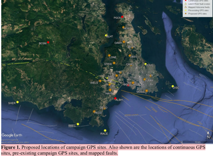
Table 1. Locations of existing and proposed GPS campaign sites available by contacting the research proponenet
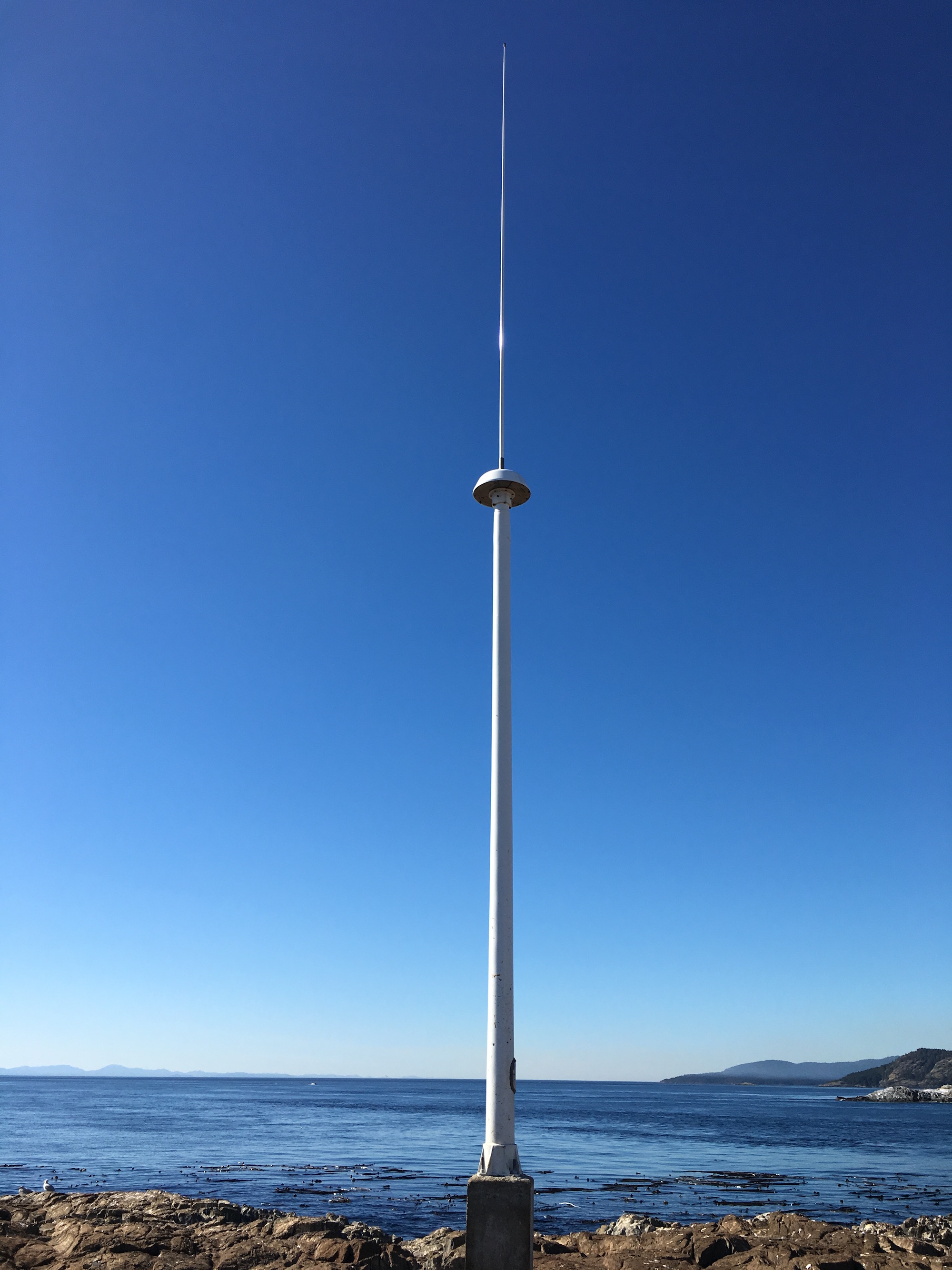
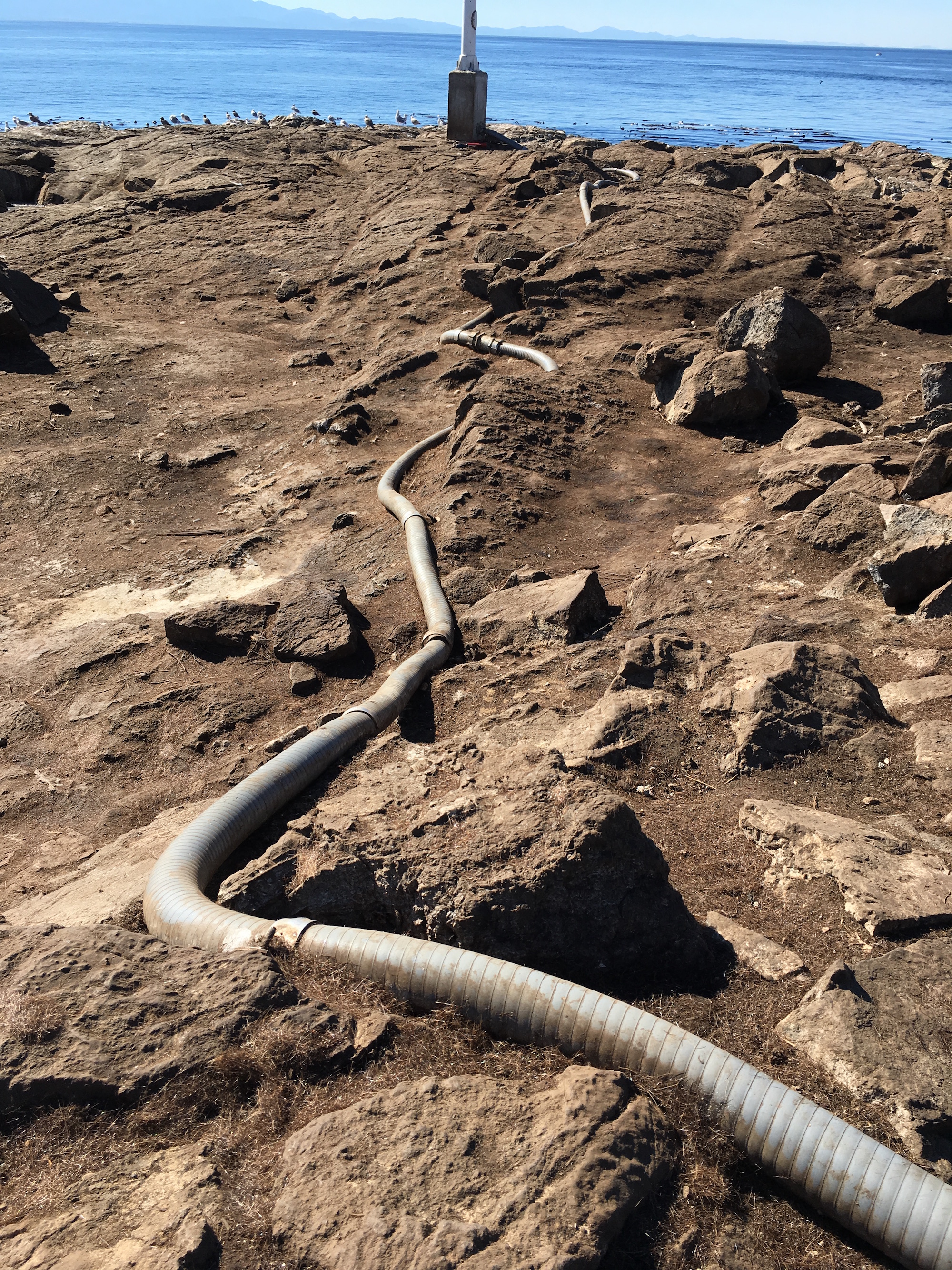
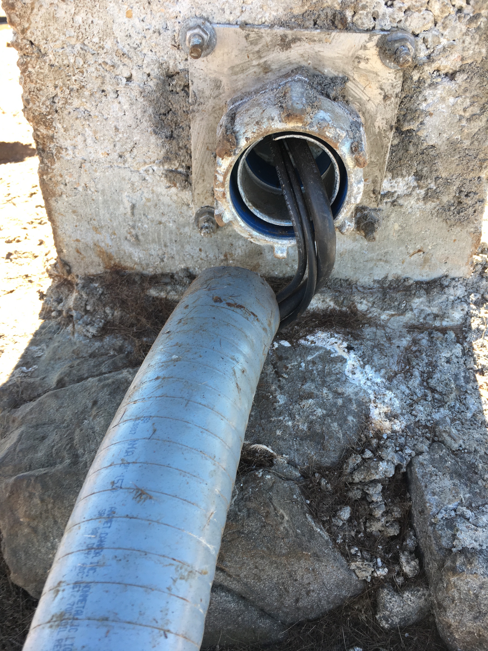
For a continuous period of 2-4 days at each site (maximum of once per year), a 1.7-m high mast with GPS antenna will be set up over an existing or new marker in the bedrock at each site, attached by cable to a receiver in a locked box on the ground. During deployment, the mast will be secured to the anchors using chains (Fig. 2a). At sites not conducive to the mast set-up, a tripod (Fig. 2b) or spike mount (Fig. 2c) will be used instead. New sites will be established by using epoxy to fix stainless steel marker pins into the bedrock. These will penetrate 6 inches into the rock, with a diameter of 0.5 inches, to lie flush with the ground surface. For mast sites, three stainless steel anchor bolts will also be bolted into the rock to a depth of ~2 inches, each attached to a 2-inch diameter stainless steel ring flush to the ground, at a distance of ~0.5 m from the central marker.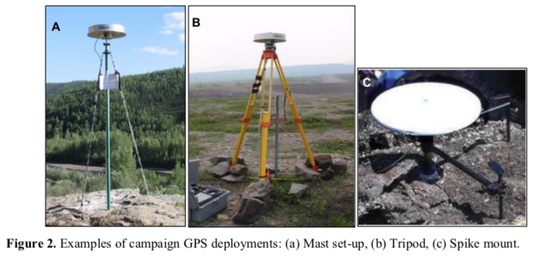
Approximate schedule for 2018 fieldwork:
The fieldwork will be carried out in August 2018, with each site being surveyed for 2-4 days. The proposed schedule is shown in Table 2 below, although actual dates may differ.
Table 2. Approximate schedule for fieldwork in August 2018 Approx. Dates Tasks
Aug 1 Aug 2 Aug 3 Aug 4 Aug 5 Aug 6 Aug 7 Aug 10
Aug 11 Aug 12 Aug 13 Aug 14 Aug 15 Aug 16 Aug 17 Aug 18
Team 1: Deploy PBHY, HIGH, SHER
Team 1: Deploy MLHT, TOLM, check others, babysit TOLM
Team 1: Stay at TOLM, check others
Team 1: Babysit TOLM, Demob PBHY, HIGH, TOLM (after 5 pm) Team 1: Demob MLHT, Deploy HAVN
Team 1: Check HAVN
Team 1: Demob HAVN after 5 pm
Team 1: Paperwork; deploy BEAR, STEW
Team 2: Deploy BBEC, DEVO, MILL
Team 1: Deploy OAKH, DOUG, check BEAR, STEW, babysit DOUG Team 2: Deploy PEDD, check BBEC,DEVO, MILL
Team 1: Babysit DOUG, check STEW, OAKH, BEAR
Team 2: Check DEVO, PEDD, BBEC, MILL
Team 1: Demob STEW, BEAR, Babysit DOUG then demob after 5 pm Team 2: Demob BBEC, DEVO, MILL
Team 1: Demob OAKH, Deploy THET, DISC (by boat)
Team 2: Demob PEDD, deploy LONE, CAMO
Team 1: Deploy WELS, MOSS, SUMM
Team 2: Deploy OBSV, check LONE, CAMO
Team 1: Check WELS, THET, MOSS, SUMM
Team 2: Check LONE, CAMO, OBSV
Team 1: Demob DISC (boat), THET
Team 2: Demob LONE, CAMO
Team 1/2: Demobilize WELS, MOSS, SUMM, OBSV
4
Plans for on-site security, site control and general safety?
The deployment of passive GPS equipment poses little risk to the public. Flagging will be placed on the equipment to mitigate any potential tripping hazards. Signs will be posted at all sites, with the following text (correct dates to be inserted): “Surveying for earthquake hazard study in progress from August 3-6 – please do not disturb. For more information, please contact Lucinda Leonard, School of Earth and Ocean Sciences, University of Victoria: 778-676-9621 or lleonard@uvic.ca”. At locations that are popular with the public, sites will be manned during daylight hours. Sites that see less pedestrian traffic will be visited 1-2 times per day during the deployment.
Data processing and analysis:
Geodetic data will be processed using standard routines to determine precise daily average locations for each site. Positional time series will be analyzed to provide site motions (direction and rate of motion) in a North America reference frame. Analysis of relative motion between sites will enable determination of strain across fault zones and improve seismic hazard assessment for southern Vancouver Island.
References:
Barrie, V., and H. G. Greene (2018), The Devils Mountain Fault zone: an active Cascadia upper plate zone of deformation, Pacific Northwest of North America, Sedimentary Geology, v. 364, p. 228-241, doi: 10.1016/j.sedgeo.2017.12.018.
Henton, J.A. (2000), GPS studies of crustal deformation in the northern Cascadia subduction zone. Ph.D. thesis, Univ. Victoria, Victoria B.C., Canada, 169p.
Marechal, A., S. Mazzotti, J.L. Elliott, J.T. Freymueller, and M. Schmidt (2015), Indentor-corner tectonics in the Yakutat-St. Elias collision constrained by GPS, Journal of Geophysical Research, v. 120, p. 3897-3908, doi: 10.1002/2014JB011842.
Mazzotti, S., H. Dragert, J. Henton, M. Schmidt, R. Hyndman, T. James, Y. Lu, and M. Craymer (2003), Current tectonics of northern Cascadia from a decade of GPS measurements. J. Geophys. Res. 108(B12):2554.
Morell, K. D., C. Regalla, L. J. Leonard, C. Amos, and V. Levson (2017), Quaternary rupture of a crustal fault beneath Victoria, British Columbia, Canada, GSA Today, v. 27, no. 3.
VC Structural Dynamics Ltd. (2016), Citywide seismic vulnerability assessment of the City of Victoria, Report prepared for the corporation of the City of Victoria, Victoria, BC, Canada, 43p, available online at: http://www.victoria.ca/assets/Departments/Emergency~Preparedness/Documents/Citywide- Seismic-Vulnerabilities-Assessment.pdf
See the follow-up when the instrument was removed on the May 15 log